Through a haze of cloud, milky sunshine
washes the plains of the high Thames. It is an early October
morning, and the reason it is early is that from here on, out the back doors
of Oxford, the riverlands grow so remote that getting in and out becomes a
four- or five-stage operation, of almost as many hours, on increasingly patchy
public transport.
 |
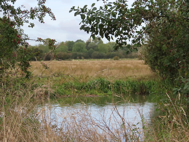
| The ancient common of Port
Meadow, stretching far up the west flank of Oxford. |
 |
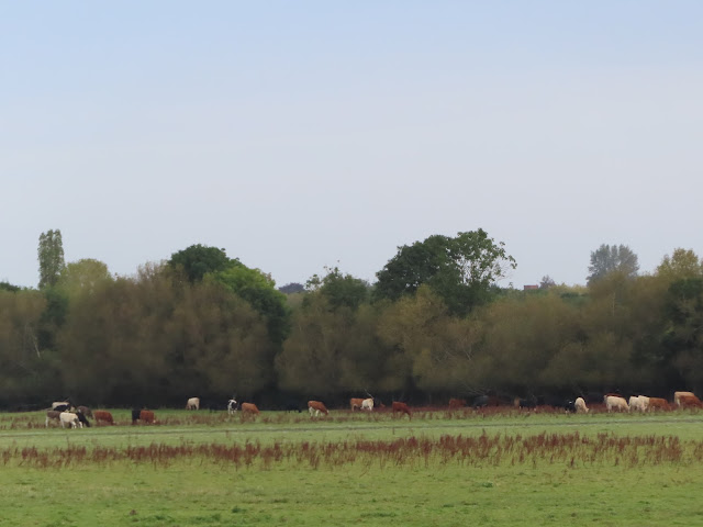
| More cows graze by the river
close to the northernmost point in its course. If you like cows you’re in the
right place with this one. |
Gone are the towns and cities, the castles
and palaces, the towers of exclusion which lord over the middle Thames. Here there
is green as far as the eye can see, with only a smattering of small craft – tugs,
canoes, and the iconic narrowboats – puttering from lock to lock. This expedition,
having shoved through the English capital with its industrial relics, political
struggles and crowded illusions of modernity, then through the long parade of past
and present privilege-nests that hold the middle river, has at last broken out
to the high countryside, the remnants of the English bush, where the infant
river emerges from its cradle.
Peace at last then? Not quite. The
picture-postcard daydream of the upper Thames, in which it trickles serene
through grassy meadows and hamlets of beige Cotswold stone, belies a volatile
flow loaded with pent-up grievance. Concertinaed through bunched-up meanders
and straining in the fetters of its locks, the young river here is as liable as
any reach downstream to drown these low-lying plains in remorseless floods. And
as the water, so too the humans who have written their stories in it – for even
out here, stories of strife and struggle whisper from the reeds.
 |
| The ruins of the Godstow nunnery,
on the outskirts of Oxford, is one of that city’s more mythically-charged
installations. |
 |
| The goal of this section is
the New Bridge, which typical of English naming conventions is the
oldest bridge on the Thames. It is there that the river meets a tributary whose
name reaches right into this country’s present moral calamity. You’ll have
heard of it: the Windrush. |
With the end in sight, it’s time to
step this expedition up a gear. The remaining sections, starting with this one,
are all twenty-kilometre hard slogs over open country. Anyone thinking of tackling
this for themselves should plan with full respect for weather and seasonal
conditions, in particular rainfall, flooding, and hours of daylight, as well as
preparing good footwear, sensible clothing, and well-organised travel and/or
local accommodation arrangements. Sufficient food and drink, especially water,
are vital; there are occasional pubs on or near the river, but also long
stretches in between with absolutely nothing.
As we shall see, you’ll also find
plenty of large animals in these parts. Be nice to them. Brexit wasn’t their
fault.
 |
| Upstream from Osney Bridge in
west Oxford: the upper limit for large watercraft and effective gateway to the Upper
Thames. |
 |
Notice the increase in scale since the previous section.
|
Start: Osney Bridge (nearest station: Oxford)
End: Newbridge (no settlement, just a
bridge with a pub at each end; about five buses a day stop by the Rose
Revived pub on a Witney-Abingdon route)
Length: 21.7km/13.5miles
Location: Oxfordshire – City of
Oxford, Vale of White Horse, West Oxfordshire
Topics: Port Meadow, Godstow,
miles and miles of cow meadows and sheep meadows (Wytham Foothills, Farmoor
Reservoir, Bablock Hythe and Northmoor Meadows), Newbridge and the River
Windrush
Port Meadow
The river keeps its distance from central
Oxford, but its course
down the western flank of the university city is nonetheless close to its heart,
both in the high imagination of its myths and literature and more practically
in its daily jogs and strolls. More bucolic than the southward reaches and not
so integrated into its suburbs and its rowing, these northward banks draw
plenty of locals and their dogs out for morning exercise.
 |
| The riverside houses of Osney
adjoin the water here, with their little gardens’ back doors opening straight
onto the towpath. The west bank is occupied by a large set of allotments, which
the river’s ducks seem eager to get into. |
 |
| A reminder of the branching
maze of channels into which the river splits around Oxford. This one wasn’t
even the main flow, having been cut out by the monks of Osney Abbey to power their mills.
The cut under the footbridge at right (east) links to the Castle Mill Stream
and the start of the surviving part of the Oxford Canal, which runs all the way
up to Warwick Province. To the left (west) the river’s old main course – now
the Bulstake Stream – heads off down a weir-controlled open-air swimming pool
that was closed in the 1990s. The water level gauge is a reminder that these
flows are at times far more dangerous than they look here. |
 |
| The link to the Castle Mill
Stream is known locally as the Sheepwash Channel, another echo perhaps
of the Oxen-ford’s rustic origins. |
 |
| Through the foliage to the
east is the tower of St. Barnabas’s Church, built in 1869 to cater for what was
then growing into the impoverished working-class Jericho district. Its industrial
labourers were crammed into poor-quality housing with no effective drainage or
sanitation, exposing them to terrible risks from floods and water-borne
diseases. |
The towpath then crosses to a sliver
of an island barely three or four metres in width – essentially a raised track,
between the river to the west and the tiny Fiddler’s Stream to the east.
This Fiddler’s Island might look a charming place for a stroll, but its
severe vulnerability to flooding is obvious immediately.
 |
| Pretty, isn’t it? But signs
warn that deaths have occurred during floods here and strongly advise people
not to attempt to walk this path when it’s inundated. |
 |
| The Fiddler’s Stream is
clogged with duckweed, making it popular with hungry waterfowl. |
 |
| Evidence of rather ferocious
tree management across to the west. |
 |
| Your boat needs a low profile
like this to make it up here past Osney Bridge. |
The island ends at a large boatyard,
right where the river and Castle Mill Stream first diverge. Here too is the
bottom corner of the vast Port Meadow, a 400-acre expanse of common
grazing land.
 |
| This rusty footbridge allows
Oxford’s escapees to get across to run around on the Port Meadow. But the
towpath, which the boatyard reminds us was originally built for hard work on
the river, trails on to the tip of Fiddler’s Island. |
 |
| Here too are flashes of the
otherworlds haunting Oxford. From this boat a tiger and unidentified two-headed
entity keep a wary watch on wayfarers. |
 |
| The north end of Fiddler’s
Island, where the Medley Footbridge, built in 1865 and also known as the Rainbow
Bridge, crosses west. Medley appears to be the name of a small farming
hamlet that used to stand on that bank. |
 |
| Bossoms Boatyard is a
significant local institution. Run by the Bossom family from its opening in the
1830s until 1945, it claims to have been a pioneer of fibreglass hulls and
still operates one of the few boat-building and repair stations to be found on these
far reaches. Next door to it is the Medley Sailing Club, the highest such club
on the Thames. |
 |
| A first sighting of Port
Meadow, stretching broad and flat all the way up to Wolvercote in the
distance. |
Port Meadow is ancient. According to
legend (and to at least some extent historical record), this grazing field has
remained unploughed, unbuilt on and largely unchanged for more than four
thousand years. The archaeological remnants it harbours stretch from recent
horse-racing bridges and civil war fortifications right back to Iron Age
settlement traces and Bronze Age burial mounds – a record of the many shifts in
management and usage systems through which, apparently, the meadow has
persisted as a common pasture.
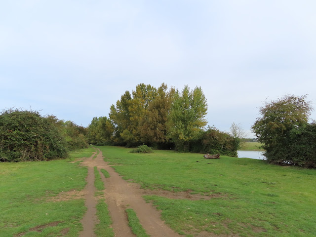
 |
| It’s the first of many
pastures on the menu today. |
 |
| An alternative approach to
grazing? Or a metaphor for this country’s troubled relationship with the truth? |
 |
| Just up the road to the west
is the tiny hamlet of Binsey. Once considerably larger, it is known for its St.
Margaret’s Church’s legendary healing well, said to have been called up by Frideswide, Oxford’s patron saint. Long a pilgrimage site, it gained
international fame when it inspired Lewis Carroll’s ‘treacle well’ in Alice’s
Adventures in Wonderland. ‘Treacle’ was a medicinal term in the day of the
Frideswide legend but by Carroll’s time had come to mean the syrupy by-products
of sugar refining. |
 |
| Binsey also used to have a
ford in this area, close to its still-active pub, The Perch. It was one
of several farming villages that relied on and claimed rights to Port Meadow. |
The survival of any common,
especially one so large as Port Meadow, is of note in a country thoroughly
transformed by its violent Enclosure of them, from which process it has
inherited its present abusive land practices. It is tempting to attribute Port
Meadow’s survival to the power of the Oxford ‘freemen’ (i.e. that tiny minority
of its feudal population who were rich and male), into whose formal ownership
it had fallen by the time of the 1086 Domesday survey and under whose gaze the
peasant serfs of surrounding villages like Binsey, Medley and Wolvercote grazed
their animals here too.
Yet we should recall that with the
rise of Oxford University, the mere mortals of that city, even the privileged
officials among them, were not so powerful. In fact Port Meadow seems to have
become a perennial object of contestation between a thousand years of competing
interests. These included the ‘freemen’ and city authorities, the village
commoners, the Godstow nuns and the rising wool industry, as well as later industrial-age
comers such as the railway-builders, allotment-planters and flying clubs.
 |
| And there it looked like a
nice simple field without a trouble in the world. |
Far from a pastoral paradise, Port
Meadow must at times have been a merciless battle-pit for lawyers, bailiffs and
pitchfork-toting peasants as they had it out over rents, fines and licence
fees, fought off each other’s Enclosure claims, and seized each other’s horses,
geese and cattle. Ironically it seems to have been this perpetual struggle,
rather than any semblance of long-term cooperative project they could be
congratulated for, that guaranteed Port Meadow’s survival as a common. That is
to say, no invested party could make any permanent change to it without
incurring the prohibitively expensive wrath of everyone else.
 |
| The western bank seems less
vicious by comparison. Perhaps the Mario and Luigi impression of this pair of
trees has helped keep the peace. |
 |
| Yet no patch of English soil
is without a heritage of greedy violence it seems. The Binsey Poplars, a row of
poplar trees, stood around here till they were summarily felled in the 1870s to
feed the railway boom. Their destruction inspired a poem of lamentation by Gerald
Manley Hopkins, and
efforts to re-plant them have since drawn a great deal of management work to
this bank. |
 |
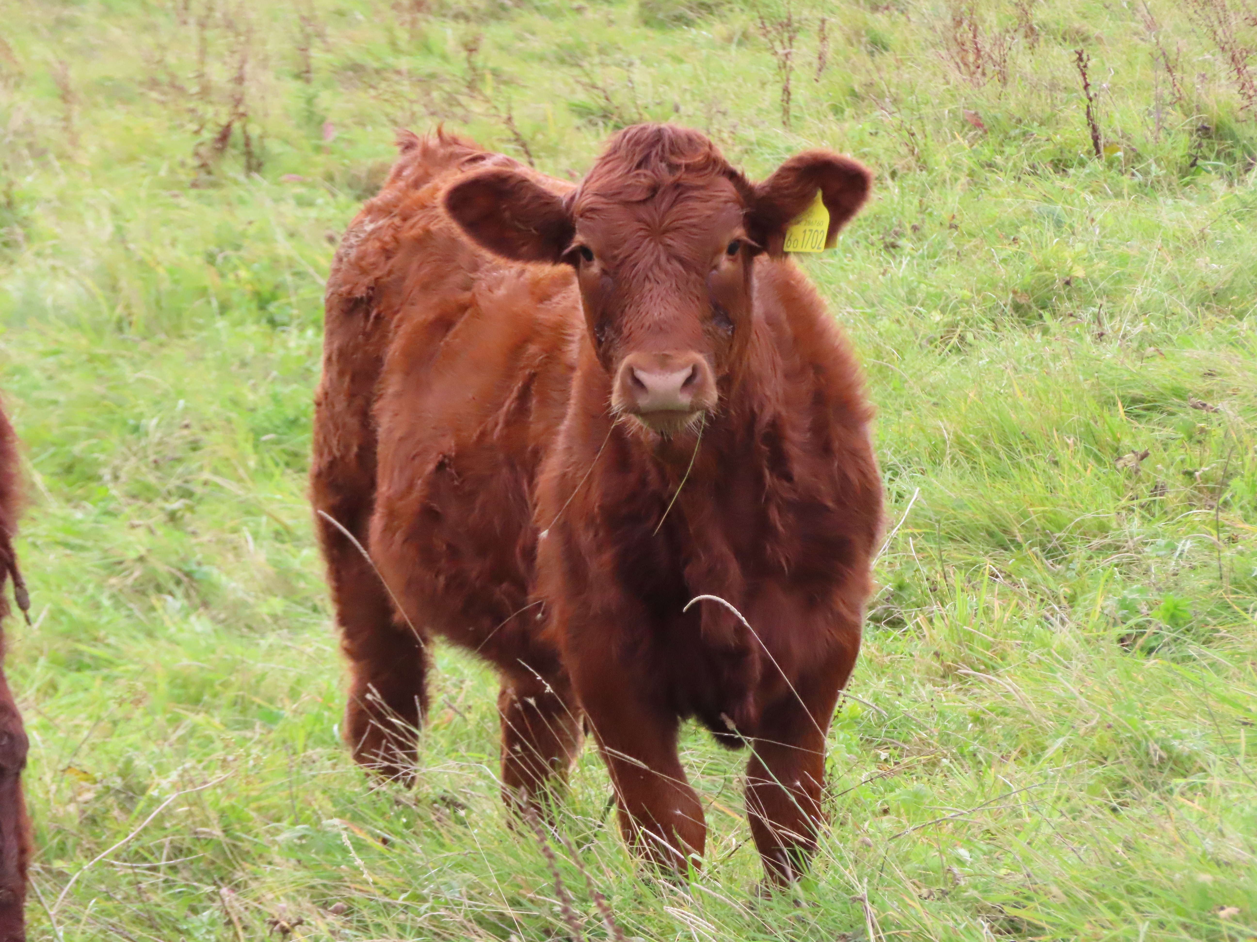
| It also has its own bovine
population. They graze right up to the river and will stand there exchanging remarks
about you as you walk past. Show them lots of respect, especially if you see
calves. |
 |
| On the north side of Port
Meadow is Wolvercote. An ancient farming village mentioned in the Domesday
survey as Ulfgarcote (‘Woolgar’s cottage’), it fiercely protected its
rights to the common against the Oxford heavies, but was eventually absorbed by
that city’s growth over the last two centuries and is now part of its inner belt of village-suburbs. |
 |
| Nowadays Port Meadow is a
popular recreational space, especially when it freezes over in winter and gets
used for ice skating. Its long absence of building, ploughing, and chemical
fertilisers or pesticides has also made it a site of scientific interest given
its richness in rare plants and birds. |
 |
| Meanwhile the ‘freemen’ of
Oxford and ‘commoners’ of Wolvercote still graze their horses and cattle on it,
and still get involved in disputes when they feel their interests are
threatened. One of Port Meadow’s latest dramas concerns a bitter row over the
Castle Mill student housing development on its southern rim, which has ruined
its view of the Oxford skyline. |
Godstow
Near the top of the Port Meadow a
backwater arrives that was long drawn on by Wolvercote as a mill stream. At
this junction the main river flows through Godstow Lock, the first in
today’s sequence of upper-river locks and also the highest of all Thames locks
to use electro-hydraulic operation. In other words, if you’re travelling up
this way by boat, you have to physically open and shut all the locks from here
on (or hope there’s a nice lock-keeper on duty to do it for you).
 |
| If you know anyone in or near
Oxford who recently lost their keys, let them know that they’re on this bit of
wood somewhere in this random field near Port Meadow. |
 |
| The approach to Godstow Lock,
with the Wolvercote Mill Stream curving away at right past the Hinksey Sculling
School. |
 |
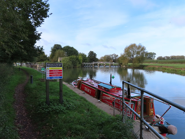
| Godstow Lock was built in 1790,
replacing a flash weir, and rebuilt in 1924. |
 |
| The lock-keeper’s cottage. |
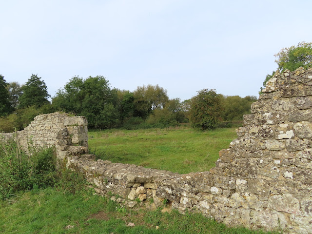
Through a gate at the far end of the
lock, this corner’s operative structure – or what’s left of it – sits
straightforwardly next to the river.
 |
| Like many other monasteries
the Godstow nunnery grew into a large and wealthy complex. It acquired rich
landholdings all across the country and drew donations from powerful sponsors, likely
connected to the many women from nobility backgrounds who came to study here. This
best-preserved part of the main structure appears to have been its chapel. |
Clearly the place had clout and
profile, but perhaps because the English don’t like it when women have those
things, they took to attaching regular scandals to Godstow’s name in the
following centuries. Perhaps the most sensational concerned a certain
individual among the community (the extent of her membership as either nun or
student is unclear) whose name was Rosamund Clifford: a young noble from
the Welsh frontiers, best known as king Henry II’s favourite long-term lover.
 |
| Godstow’s ruined inner court. Rosamund
Clifford was buried in the complex when she died around 1176, still only in her
twenties. The circumstances of her passing are unknown; the story that she was
poisoned out of jealousy by Henry II’s queen, the formidable Eleanor of
Aquitaine, is unverifiable, and the embellishments that stuck to that legend over
time suggests it owes more to English misogynistic sensationalism than to actual
events. Even in death however Clifford’s legend continued, with her grave
becoming a pilgrimage site, then getting shunted outside by a disapproving
bishop, which gave rise to rumours that her ghost haunted the abbey in
objection to this ill-treatment. What’s more reliably on record is that as
Clifford’s resting place, Godstow received substantial gifts of money and
resources from her beloved Henry II. |
The scandalism went on through to the
fifteenth century, by when Godstow seems to have swirled with stories of
dismayed inspectors, quarrelsome legal proceedings, extravagant lifestyles, and
the ever-recurring rumours of ‘ill-discipline’. Most of these seem to have
concerned the community’s contact with the secular outside world, especially
students coming up from Oxford. The hyperbolic tenor of some of these
reports leads one to think the nuns might as well have been abducting and
trapping them in their beds, when not overwhelming them with raucous drinking
and feasting. Perhaps the accusations really reflected the more
common story of powerful men in the church establishment resenting the idea of
a community of women making their own decisions, and so doing everything in
their power to hobble, constrain or otherwise interfere in the running of their
community.
There was less ambiguity about the
fall of Godstow, which took place, as at most other monasteries, in the late
1530s following sustained pressure from Thomas Cromwell and his commissioners
on behalf of Henry VIII. The last abbess, Katherine Bulkeley, surrendered the
nunnery after a principled stand in negotiations – and more caustically, a
personal stand against the official sent to receive that surrender, the Oxford
priest Dr. John London. Each accused the other of threats and assault, and in
the end the abbess secured a small victory in persuading Cromwell to remove Dr.
London so she could give up Godstow to a more amenable commissioner.
 |
| After its fall the nuns were
pensioned off and much of the complex was destroyed, including Rosamund
Clifford’s grave. Henry VIII passed what was left to his physician George Owen,
who built a mansion out of the ruins in which his family lived for the next
hundred years. |
In a further familiar trend, the
final end to habitation in Godstow came in the Civil Wars. The house was
garrisoned by the Royalists to defend their Oxford headquarters, gunpowered and
occupied by the Parliamentary army, and its stones scavenged thereafter for
local building projects. What remains is now a scheduled monument under the protection
of Oxford University.
 |
| Across a bridge from the ruins
is the nunnery’s former hospice, which found new life after its destruction as
the famous The Trout inn. This pub’s physical and cultural proximity to
Oxford, Godstow and the Thames have given it a profound and far-reaching mythic
profile. |
 |
| These letters – mostly
initials or acronyms by the look of it – have been carved into the ruined
walls. Oxford students? Troublemaking tourists? Any ghosts that linger around
here can’t be happy with those responsible and probably know where they live. |
 |
| Beneath the overarching narratives
are always lots of smaller-scale personal experiences that equally form part of
the story. Usually their profile remains small, but here’s a rare case of one
getting publicly commemorated on-site. |
 |
| Godstow Bridge, which links
the ruins and the pub, dates back at least as far as the Civil War when the
Royalists attempted to hold it against the Parliamentary army. The appearance
of the nearby Oxford Bypass bridge in 1961 has left this protected structure a
lot quieter than it used to be. |
There is something almost
supernaturally daring about how Godstow’s ruins just sit by the river here,
with next to no protection or explanation in spite of the hostility it once
received or the hard-nosed interests still lurking nearby. Perhaps it’s
unsurprising then that the nunnery has gone on to lead quite an afterlife in
Oxford’s imagination. Both the ruins and The Trout inn featured heavily
in the lives of its literary heavyweights such as C. S. Lewis and J. R. R.
Tolkien; in that of Lewis Carroll before them, whose river trip that spawned Alice’s
Adventures in Wonderland is said to have come here; and also in the Inspector
Morse series of novels and TV dramas. One of Godstow’s most fully-defined
mythic outings, as well as one of its most recent, is in Philip Pullman’s
ongoing The Book of Dust trilogy, the sequel to His Dark Materials,
in whose parallel-universe Oxford the monastery with its industrious and
strong-willed nuns still exists (known there as the Priory of St. Rosamund –
now who might that be?); while The Trout, where one of the main
characters works, plays host to shady political intrigues prior to (what else?)
a great flood and darkly mythic river journey.
 |
| If not for Henry VIII there
might have been teas and cakes on offer to walkers here today. He should feel
bad about what he did. |
King’s Lock
Godstow is where the Oxford
conurbation ends. From here we’re into the hinterland. The casual pedestrians
and dog-walkers fall off, leaving the green swathes devoid of human presence
save for the occasional narrowboat or more committed hiker.
 |
| Just past Godstow is the 1961
bridge for the Oxford Ring Road, here part of the A34. In keeping
with the otherworldly resonances of this place, it was given the breathtakingly
imaginative name of Thames Bridge. The old City of Oxford boundary
marker in the foreground indicates that travellers venture beyond at their own
risk. |
 |
| A lost piece of either the
agricultural revolution or World War I has fallen through a time-rift and
landed under the bridge. |
 |
| Floofs. |
 |
| And from here on the river is
basically like this. |
 |
| And this. |
The river’s headwaters fall from the
west, but immediately above Oxford it swings into its first great loop which
constitutes most of this section. Looking west from here, you can see the
probable reason.
 |
| Wytham Hill, rising in the
near distance. |
The heavily-wooded Wytham Hill
is the northwestern-most piece of raised ground in the central Oxford Plain,
and forms a part of that cluster which breaks the young river into a web of
marshy, flood-prone channels as it wrestles its way through. It circumvents
this limestone lump by circling north round its base, where those thick woods
come right up to the waterside.
After negotiating the hill, the river
arrives here at King’s Lock. This is the northernmost point in its entire
course.
 |
| The builders of King’s Lock
cut through this corner of the river, creating a triangular island. The
Wolvercote Mill Stream diverges here too, on its northern side past this weir.
An artificial cut along that stream connects it – and thus the river – to the
Oxford Canal, and seems to be the preferred link for boaters moving between them. |
 |
| King’s Lock was one of the
Thames’ final pound locks, built only in 1928, but it was preceded here by at
least seven hundred years of flash locks, weirs, and fishing traps. It has the
shortest fall of any lock on the river, and is the first, heading upstream,
that must be operated manually – that is, by heaving your body against those
wooden bars. |
 |
| The lock-keeper’s cottages
begin to exhibit the colourations of Cotswold limestone. |
 |
| King’s Lock is also unusual in
having this little low-carbon visitor centre attached. Its information boards
describe its experiments in environmentally-sustainable, energy-efficient
construction techniques to meet the challenges of a busy lock service in the
cold and remote open countryside. |
Wytham Foothills
If you were wondering which king this
lock was named for, it in fact has nothing to do with kings. The name comes
from Middle English kine, meaning cattle (as seen earlier in Wallingford’s kinecroft) – an animal whose ancestral
importance in this area, as reflected too in Ox-ford’s name, has not
entirely departed it yet.
 |
| West past King’s Lock – really
the Cattle Lock, then – Wytham Hill slopes down to the river. |
 |
| Across the river this distant church
spire offers the only glimpse of Cassington. It’s a small village with a
familiar story of Norman manor lords, a period under the influence of the
Godstow abbey, eventual Enclosure, and brief connection to the canals and
railways. |
 |
| The only settlement in the top
of this bend is this farm compound. It appears to house the John Krebs Field
Station, a research outpost of the Oxford University Department of Zoology. |
Before we can meet the true masters
of this terrain we must reckon with the Seacourt Stream. This is the
western-most of Oxford’s maze of channels, which leaves the main river here and
flows south, through the rustic village of Wytham, then Binsey with its
‘treacle well’. After that it joins the Bulstake and Hinksey streams.
 |
| The confluence with the
Seacourt Stream. It gets its name from the lost village of Seacourt, which used
to stand near its southern exit. The village of Wytham on the other hand still
exists, and offers the main entry to the hill and woods. |
 |
| This red narrowboat might be
familiar from Godstow Lock. In fact we would cross paths all day, with it
puttering ahead on the open river only to be caught up with as it waited to get
through lock after lock. |
Across the Seacourt Stream, a light
electric fence separates the field from the riverside. And in that field...
 |
| Nuuo. |
 |
| Here they are. |
All these fields are flood-meadows
that spend a great deal of the year underwater. This poorly suits them to grow
crops, so instead they’re mostly used as grazing pastures with a herb-rich fare
much enjoyed by these fine fellows.
The fence keeps them in, but that
doesn’t stop them coming right up to the edge to inspect you.
 |
| Like this. |
 |
| And this. |
 |
| Double trouble. |
It is important to show these the
proper respect. None of the cows on this section showed the slightest sign of
aggression, but occasionally – if, say, they’re protecting small calves, or surprised,
or provoked, or aggravated by the English political situation – they are known to attack passers-by and are quite capable of dealing serious injury or death if they feel so inclined.
Always observe how an individual or
group is behaving and avoid entering a field with them if you feel concerned. If
you do find yourself menacingly stalked, charged, or otherwise approached, it’s
generally advised to walk away calmly. Never run (they’re faster), or panic
(their charges are often warning bluffs that stop before they reach you).
 |
| Once past the nuuo the thick
woods of Wytham Hill loom close. |
Here another tributary river, the Evenlode,
arrives. Under that mysterious name it flows from the eastern Cotswolds in
Gloucester province, from where it passes the remnants of the equally
mysterious Wychwood, then the massive Blenheim Palace of Churchill fame, before
reaching the Thames here beneath Cassington.
 |
| The helpfully-labelled confluence
with the Evenlode. It is virtually unnavigable and has had serious problems
with sewage discharge and agricultural runoff. |
 |
| It’s plain from this range
that the Wytham Woods are not messing around. |
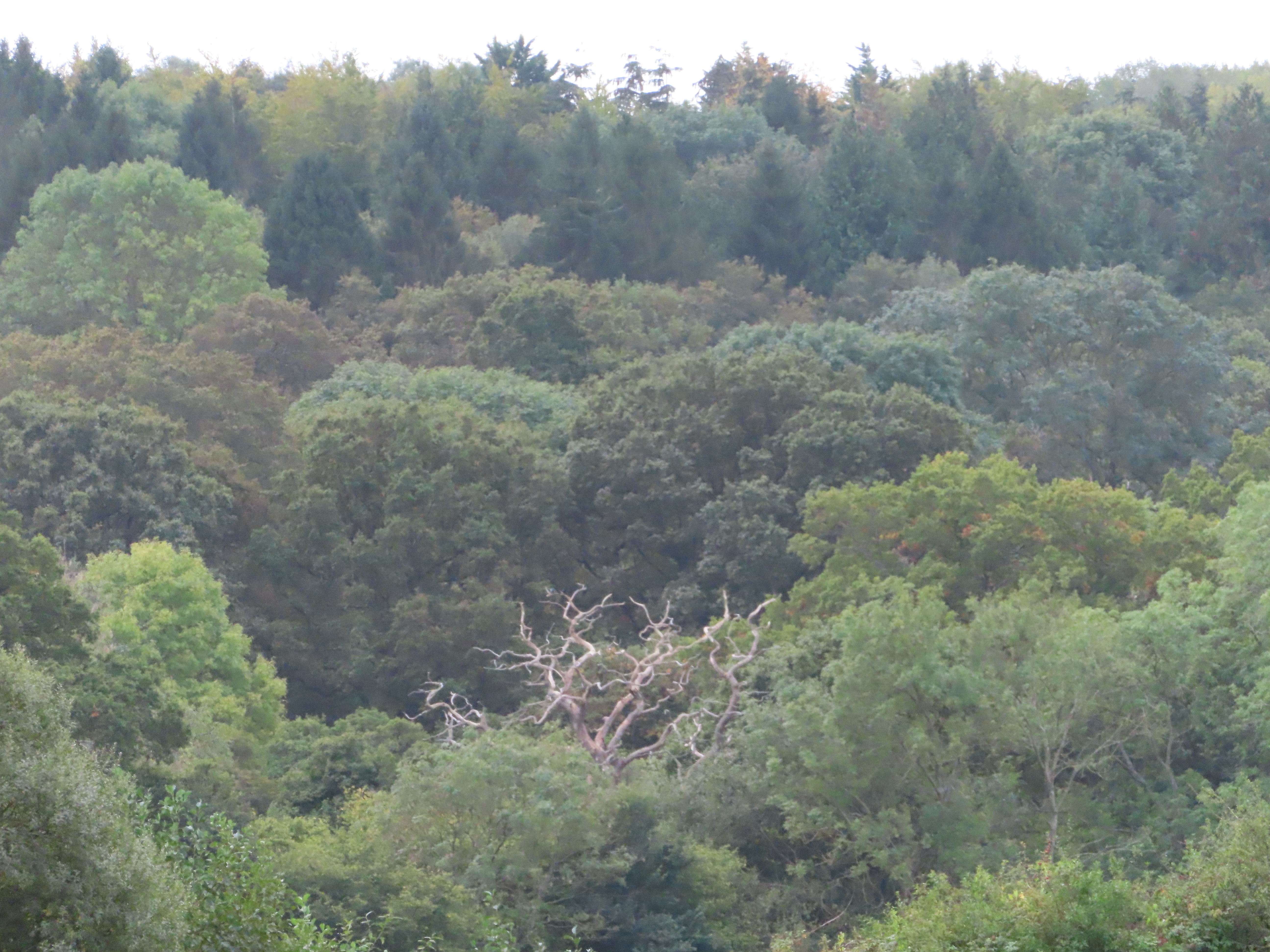
This is where the woods of Wytham
Hill roll down to the riverbank. By all accounts this is no ordinary woodland.
Formerly part of the Abingdon Abbey estate, then held by the powerful
German-Jewish Schumacher family, by the time Wytham Great Wood was
bequeathed to Oxford University in the 1940s it still harboured an ancient and
extraordinary diversity of plant and animal life whose oldest sections are
thought to date back to the last ice age. Under the University it has since
become one of the most thoroughly-researched woodlands in the world, whose
yield of decades of copious data has been instrumental to ecological and
climate science.
 |
| From this side it presents
something of a darkly forbidding air. The clouds of cawing ravens circling
above its thick tree cover suggest strange rituals as old as some of the
ecology in question. Apparently it’s very nice though. You can enter the main
woods for free but need to apply for a permit from the University. |
 |
| Further pastures stretch away
on the north bank. They’re not as isolated as they look; beyond those trees is
the A40, the traditional trunk road between London and south Wales. |
A change of scenery follows as the
woods enswathe the riverbank.
 |
| Wytham Woods also feature in
the Inspector Morse series as a convenient place to hide bodies. Watch
where you walk in here. |
 |
| Somewhere around here, easily
missable behind the tree cover, is the mouth of an old canal built around 1800
that runs in parallel to the Evenlode up to Cassington. Known as the Cassington
Cut, it was added to give better barge access to Cassington’s mill and wharf,
but the railways drove it out of use by the 1870s and it was gradually forgotten. |
The woods open up toward the
northwest corner of the loop, where the river draws closest to the largest settlement
in this area: Eynsham. It’s set back about a kilometre from the river,
with access not helped by the busy B4044 road onto which the foliage which
overhangs its tiny pavement does its best to push you. A visit is therefore a
little out of contention given the distance still left to cover today, but Eynsham’s
link to the river is well-signified by its lock, pub, and bridge at its connected
hamlet of Swinford.
 |
| The river splits briefly around
an island, with Eynsham Lock in the artificial south channel (left) and its
weir in the main flow (right). Say hello to ‘Tug No.2’ again, whose captain was
here spotted disembarking to resupply. |
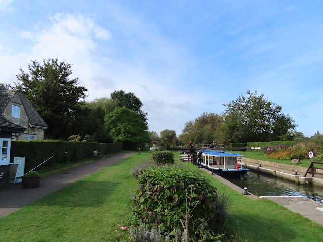 |
| Eynsham Lock was another
latecomer, replacing more rudimentary weirs and flash locks in 1928. |
Eynsham is an ancient market village,
almost a town, with an astronomical-for-these-parts population of over 5,000. Said
to have emerged in Roman or sub-Roman times, it grew up in the Anglo-Saxon
period (whence its likely name origin, ‘Ægen’s enclosure’) owing to its
control of this important Swine-ford – i.e. a place where it was
relatively safe for pigs to cross amidst these unpredictable currents on the
Mercia-Wessex frontier.
Around 1005 Eynsham got its own
Benedictine abbey. It answered initially to Dorchester but flourished in its own right as
it grew over the centuries till its eventual demise – yet again – at the hands
of Henry VIII in 1538. This one was demolished quickly to stop the monks coming
back, and its ruins cannibalised to build new houses; many of its stones can
still be found in the village’s cottages today.
 |
| On the road between the river
and village is The Talbot pub, one of a handful that serves walkers and
boaters along these reaches. |
 |
| Swinford Bridge, a Georgian
limestone construction from the 1770s. |
The Swine-ford itself seems to
have taken the form of a ferry for most of this period, but in the eighteenth
century this bridge was built to replace it. It is distinct in being the only
bridge besides Whitchurch Bridge to charge tolls to vehicle traffic
to this day (though pedestrians and cyclists cross for free since 1835). This
has apparently caused much contention: its private owners get to enjoy the
tax-free fleecing of local motorists, who often find themselves stuck in
congestion thanks to its toll queues and potholes. Attempts to get the 5p toll
abolished or bring the bridge into public ownership have so far come to
nothing.
 |
| On the other hand, the
COVID-19 pandemic appears to have achieved what the English’s long-suffering efforts
at democracy could not. At present the toll booth is unoccupied and cars drive across
with impunity. |
 |
| They’ll probably bring the
toll back as soon as they get the chance. The bridge was last sold in 2009, at
auction for over £1.08 million, and in the best traditions of English
transparency the present owners of this key piece of infrastructure have been
kept secret. It’d be a shame if anything happened – say, a collapse, or an
accident involving a huge lorry, or a brawl over tolls – that required public
accountability, no? |
 |
| Anyway, nice bridge. |
And with that we are clear of human
society and its instinct to casually oppress everything it touches, and now get
to proceed through some attractive landscapes down the west slopes of Wytham
Hill.
 |
| It can look pleasant out here. |
 |
| So here’s something to ruin
it. The west bank here (opposite) falls under the parliamentary constituency of
Witney, West Oxfordshire’s largest town. If the name sounds familiar it’s
probably because it was the seat of David Cameron, the former Prime Minister
and Conservative Party leader who set off the Brexit referendum for no reason,
lost it, then walked off into the cover of his super-rich lifestyle to leave
everyone else to eat the consequences. (On a related note, those pigs that crossed at Swinford – never mind.) |
 |
| It’s not these plants’ fault.
They wouldn’t have plunged a country into an abuse-pit of division and
disintegration while calling it democracy. |
 |
| Here we are. This is more like
it. |
Now this time there’s no fence, and
the bovine community ranges hungrily right up to the river. Fortunately they’re
in peaceful if circumspective mood today, and will stand there watching you as
you cross their territory.
 |
| There’s no going around these
ones. You’ll just have to hope they’re not inclined to demand tribute.
Especially the chonky one at left. |
 |
| Wytham Hill is less wooded on
this side and looks nice in the afternoon sun. Notice there’s another herd of
Holsteins in the hillside field. |
 |
| The view back towards Swinford
Bridge, with one or two other walkers negotiating their way through the sovereign
herd. |
There’s another large boatyard ahead
here to help river-adventurers not get stranded after dark in the bovine
kingdoms. Oxford Cruisers Ltd. occupies a meander at the western end of the
village of Farmoor – a twentieth-century roadside settlement that takes
its name from an old common, now submerged beneath the reservoir ahead.
 |
| The skies here suffer the
occasional rude intrusion of military aircraft, likely flying out of the major
Brize Norton RAF airbase upriver. |
 |
| The family-run Oxford Cruisers
appears to specialise in the repair and restoration of narrowboats. |
Here the wayfarer faces what at first
appears the unwelcome return of a menace that should have stayed behind on the
middle river: a string of residential properties which have seized the
riverbank for their private gardens, forcing an inland detour. Fortunately however
these ones appear forgivable. What actually seems to have happened is that their
claims did in fact stop at the towpath, only for it to crumble away over the
years due to erosion.
 |
| The detour is at any rate a
short one, up the side of the Oxford-Eynsham road. |
 |
| In the hatch must be a ladder
down to an interdimensional space, from where you can reach a parallel
Oxfordshire where the cows are in charge of government. Maybe one of them experienced
a political scandal for questionable actions involving its udder and David
Cameron. |
Bablock Hythe and Northmoor
A trail between the houses leads back
to the towpath, which comes in short order to Pinkhill Lock. Built by
the Thames Navigation Commission in 1791 and named for a local farm, this one
is quite a bit older than those immediately downstream and cuts through the
neck of a large meander.
 |
| For all the isolation of these
high reaches, or perhaps because of it, a great deal of work seems to have gone
into the equipping and presentation of the locks here. Pinkhill Lock was
notable on this journey as the first one which gave rise to a spontaneous
conversation with a lock-keeper. Help him close the gate and he will offer
advice about the Bablock Hythe ferry, whose disappearance presents the defining
problem of the reach ahead. |
From here the towpath continues some
three kilometres down the east bank, past the Farmoor Reservoir, till it
reaches Bablock Hythe, where travellers and barge-workers historically crossed
by ferry. So why is it rumoured that the ferry no longer exists? To reach Bablock Hythe to examine this mystery, and furthermore to avoid
getting stuck on this side when the towpath switches bank, it is now necessary
to cross the lock-gates and take an extended detour through the western
pastures.
 |
| For a little further the river
comes and goes as the path cuts across a string of wooded meanders. |
 |
| If you get a Game Over by
being arrested and jailed by the cows then this is where you emerge when you
re-load your last save. |
 |
| The western bank appears to
fall under a rather woollier authority. |
This detour means we do not get a
view of the dominant landscape feature on this reach. Farmoor Reservoir,
the largest body of open water in Oxford Province, was dug out in two stages in
the 1960s and 70s and provides this region with its primary supply of drinking
water. It is also used for sports – fishing, sailing, windsurfing – and is very
popular with birdwatchers; its proximity to the Wytham Woods, along with other
local woodland and wetland reserves, draws in a wide range of seasonally-migrating
bird species.
 |
| Most of the islands and
east-bank peninsulas in the meanders here are nature reserves with
bird-watching hides installed. |
 |
| There used to be a footbridge
around here too. Skinner’s Bridge was said to have been attached to a
picturesque old weir and inn, likely descended from a mill, run by an old
landlord called Joe Skinner. By the twentieth century the buildings had all
disappeared, and the bridge appears to have burnt down in the 1940s. |
 |
| A distant glimpse of the
Farmoor Reservoir embankment. |
Here we must seek the river’s pardon
in leaving it for a time, in order to circumvent the Bablock Hythe Caravan Park
which sprawls with grasping incorrectness up the riverbank ahead. The diversion
takes us into the sphere of influence of Stanton Harcourt – or
specifically, the fields after fields of sheep that together are many times
larger than the village itself.
 |
| Stanton Harcourt itself is a
way up the road to the west here; this is the tower of its St. Michael’s
Church. Stanton means ‘farmstead by the stones’, and likely refers to a
nearby Neolithic stone circle now known as the Devil’s Quoits, sadly too
far to reach on this journey. Harcourt is another ownership-tag on the
part of the Norman nobility, added by the same family that later produced the
Simon Harcourt who forced a whole village to move so he
could build his riverside mansion. |
 |
| The village is too far to visit
on foot if we want to safely complete today’s stretch before the sun goes down.
So instead we get another bunch of pastures, this time with regular fleecy
company. |
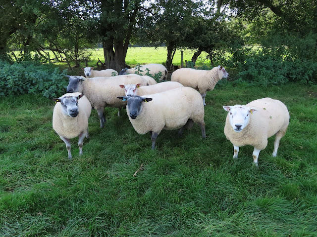
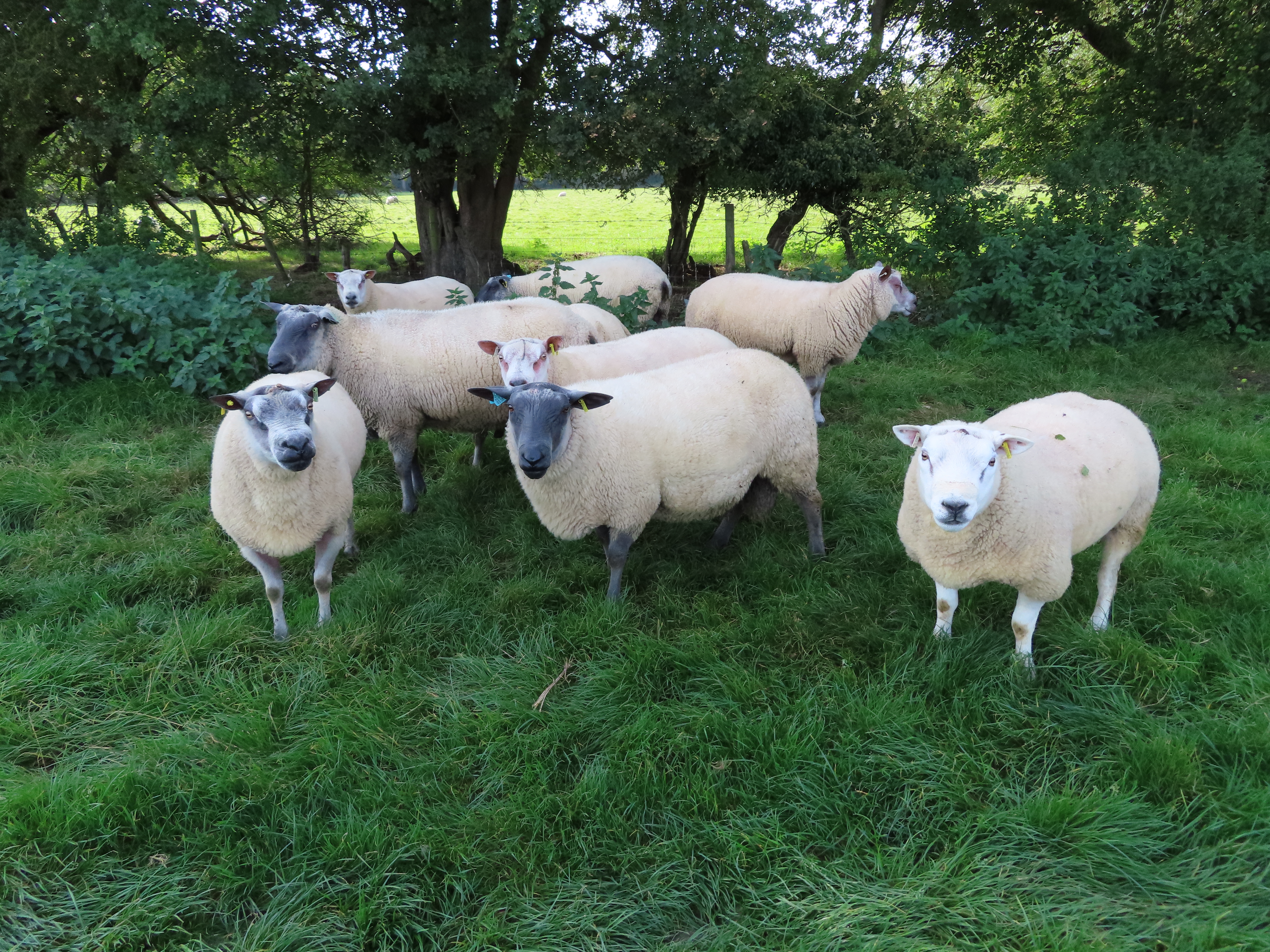
These fields are full of sheep. They
are a lot more skittish than the earlier cattle and tend to scoot away as soon
as they notice you coming, although a small minority will stand there
staring at you.
 |
| This individual is the lone
exception, and will give you a neeh before taking tentative steps in your
direction. |
 |
| They run off as soon as you
touch the gate. It’s best to show them respect too, by treading gently and
letting them know in a soft voice that you’re not here to make trouble for
them. |
 |
| It’s chilly out here now, but still
gets quite warm when the sun breaks through. Flexible clothing is sensible when
walking in this season. |
Let’s have a closer look.
 |
| Neeh. |
 |
| More rectangularity. |
 |
| As far as detours go, these
fluffy friends make this one not too bad. |
Make it across six or seven fields’
worth of sheep territory and you reach a tarmac lane: the main access road to
the river at Bablock Hythe.
 |
| The Bablock Hythe road.
Another spontaneous encounter with the locals took place here, this time with an
elderly fellow on a mobility scooter. He introduced himself by the nickname
everyone around here apparently calls him – ‘Jolly’ – and had apparently lived
in these parts since the 1940s, rarely travelling beyond. He too had much to
say on the disappearance of the fabled Bablock Hythe ferry. |
 |
| The most visible manifestation
of Bablock Hythe today is this sizeable caravan park. |
 |
| ‘Polite’ in English culture
means ‘people at the bottom of power hierarchies are to be punished for each
failure to say please or thank you, while people who own property
are entitled to speak however the fuck they want’. |
Bablock Hythe is a tiny hamlet,
composed mainly of The Ferryman Inn and now vastly overshadowed
by the holiday caravan park that’s taken up residence along its road and
riverside. This place’s importance was in its ferry, both practical and mythic (as of course all ferries are); all the more so for being some
thousand years old as well as supposedly the Thames’s first cable ferry,
drawn across the water along a large rope or chain.
 |
| The Bablock Hythe ferry as it
appears in an 1859 woodcut. It was a substantial vessel, much relied-upon by
these pasturelands’ farmers to take their large animals across. By the late
twentieth century it could even take cars, up to three at a time according to
Mr. ‘Jolly’. |
 |
| The Ferryman Inn, known
in these parts for its not-at-all-pub-like exterior, replaced an older inn
called The Chequers during the twentieth century and is said to have
operated the ferry till its disappearance. |
So what happened to it?
In what seems a sadly typical
reflection of English modernity, after a millennium of service the ferry closed
down in hazy circumstances during the post-World War II decades. Efforts were
apparently made to revive it, with The Ferryman Inn running a new
passenger boat towards the close of the century, but that too has now vanished.
Some say it was washed ashore by floods and too damaged to resume service;
others suggest that someone stole it. Signs persist of strong local interest in
getting the ferry restored, but obtaining the funding to do so looks ever less
likely in the shadows of violent austerity and COVID-19.
Till they do so, the weighty whispers
of Bablock Hythe are left largely to a fading imagination. It’s an annoyance
for walkers, cyclists and local residents, who are forced to go all the way
down to Swinford or just as far up to Newbridge in order to cross. But perhaps
its real casualty is the centuries of cultural heritage invested in this site,
as another repository of Thames memories sinks into the mire of an age that
seems to regard such things as expendable.
 |
| The site of the Bablock Hythe
ferry. It would surely cost no more than a few thousand pounds to get it back
up and running, no? Would that not be a drop in the ocean for this country’s
multi-millionaire landowners, such as, say, a certain former MP for the
constituency this riverbank is in? |
 |
| The next meadow along appears
to have been privatised by the caravan park for the leisure of its customers. |
 |
| They’re quite a long way out
here, still reliant on instruments you’d usually have to go to a museum to
see. |
Northmoor Meadows
The last four or so kilometres for
today cross the pastures of Northmoor, another tiny farming village
whose name means what it sounds (in reference to Southmoor on the other
side). These fields occupy this final corner of the great Wytham bend, beyond
which sits the historic Newbridge crossing.
 |
| Look who’s reappeared. |
 |
| It’s narrow enough to swim
across now. Still, don’t underestimate it. You’d see its true character if the
locks in these parts stopped working. |
 |
| Some thick woods known as the
Eaton Plantation coat the east bank on the approach to the final curve. Eaton
is a tiny hamlet beyond them whose manor has traditionally been held by
Oxford’s St. John’s College, which used it as a refuge in times of
plague. |
 |
| Possibly the wood’s tallest
resident. |
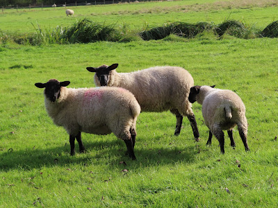
These fields too are sheep pastures. These
ones’ inhabitants appear recently sheared.
 |
| These sheep look considerably
more naked than their fellows in the fields downstream. |
 |
| The riverside fence here is poorly-maintained,
and one sheep got into a bit of a panic as it got its leg stuck in the fallen
string while trying to run off. Fortunately it got free. In case the
responsible farmer is wondering, I kicked the loose fencing into the bush to
stop it happening again. |
 |
| The sun sets over Northmoor
Lock after a long day of trekking through the pasturelands. |
Northmoor Lock was built in 1896 by the Thames
Conservancy, successor to the Thames Navigation Commission. One of the river’s
remotest locks of all, it is distinguished by its weir, thought to be one of
the last paddle-and-rymer weirs (requiring manual operation using paddles) in
the world. These are considered dangerous under present-day legislation, with
most surviving examples on the Thames removed in recent years.
 |
| Northmoor Lock. It was here
that the crew of ‘Tug No.2’ finally realised with great mirth that we’d been
inadvertently following each other all day. |
 |
| The lock-keeper’s cottage,
largely unchanged since it was built. |
On the final stretch a short sequence
of residences take their late-day revenge with private-property claims to the
riverbank opposite. But they’re considerably humbler than those we put up with
in the middle river, and wisely do nothing to obstruct this final progress up
the north side.
 |
| The typical character of the
last length of river to Newbridge. |
 |
| Less unaffordably ostentatious
mansion, more holiday cottage, one might think. |
 |
| The most showy of those
houses... |
 |
| ...and its boathouse, whose
slanted posture suggests it’s trying to exist in mismatching
timelines simultaneously. |
 |
| Northmoor Lock replaced a set
of flash locks and weirs nearby. One of them stood here by the name of Hart’s
Weir, hence this Hart’s Weir Footbridge. The bridge was built in
1879, a year before the weir was removed. |
And at last, the fences and thickets
close in on the approach to a key strategic crossing.
 |
| Look at that. Just when we’d
thought they’d stopped. Newbridge is strategic, yes, but steady on. |
 |
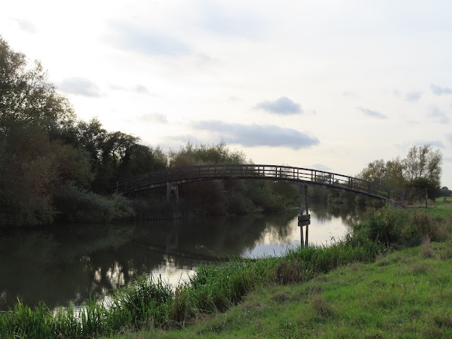
| The New Bridge appears,
by whose pubs the river-travellers have pulled in their boats for the night. |
 |
| The final approach passes
through the gardens of The Rose Revived, one of the two pubs that face
each other across the bridge. |
Newbridge
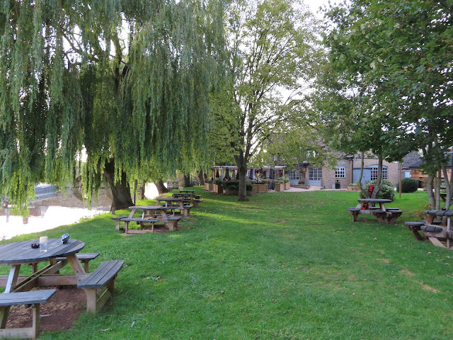
This doesn’t really qualify as a
settlement. Newbridge is literally a bridge with a pub at each end – The
Rose Revived on the north side, The Maybush on the south – standing
together out in the open countryside. That said, it’s a hearty sight at the end
of eight hours’ slogging through said countryside, and does moreover hold a few
features of great significance.
The most obvious is the bridge
itself. Despite its name, the New Bridge, which carries the A415
Abingdon-Witney road, is the oldest surviving bridge on the Thames. (It
competes for this status with Radcot Bridge upriver, which pre-dates it but got
wrecked in multiple conflicts and required extensive rebuilding). This bridge
has stood continuously since the early thirteenth century, when it is thought
to have been one of a set of bridges in this area built by
Norman monks on the
orders of King John. The likely context was the growth
of the Cotswold wool trade at that time, with its rising demand for access to
southern markets.
 |
| Supposedly it was a new
bridge in that context, i.e. built after the others in that set. Its
distinct honey-grey stone (on which more in a moment), pointy archways, and
projecting piers offering both structural strength and shelter for crossers,
make it a highly treasured piece of local heritage. |
For all its isolation, Newbridge sits
at a strategically important location equidistant from the urban nuclei of
Oxford, Abingdon and Witney. This got it threatened during the Civil Wars, in
particular in 1644 when the Parliamentary army got into a skirmish with
Royalist defenders as they attempted to cross to encircle the king’s Oxford
headquarters. They did not succeed – it was too soon – and it was this,
supposedly, that put them in such a bad mood as to take it out on Abingdon’s market
cross as they retreated there.
The bridge itself survived however,
and has continued to do so through all the trials of industrialisation, the car
and road revolution, and the contempt for heritage of a market fundamentalist
age. It has perhaps come closest to trouble in the last couple of decades as
its eight-hundred-year-old arches and elm-beam foundations noticeably struggle
to cope with present-day traffic loads, regulated as they are by traffic lights
and an eighteen-tonne weight limit. A new (that is, Newer) bridge close by
looks the likeliest of answers, yet for the moment local opposition and a lack
of funds seem to have put the matter on hold.
 |
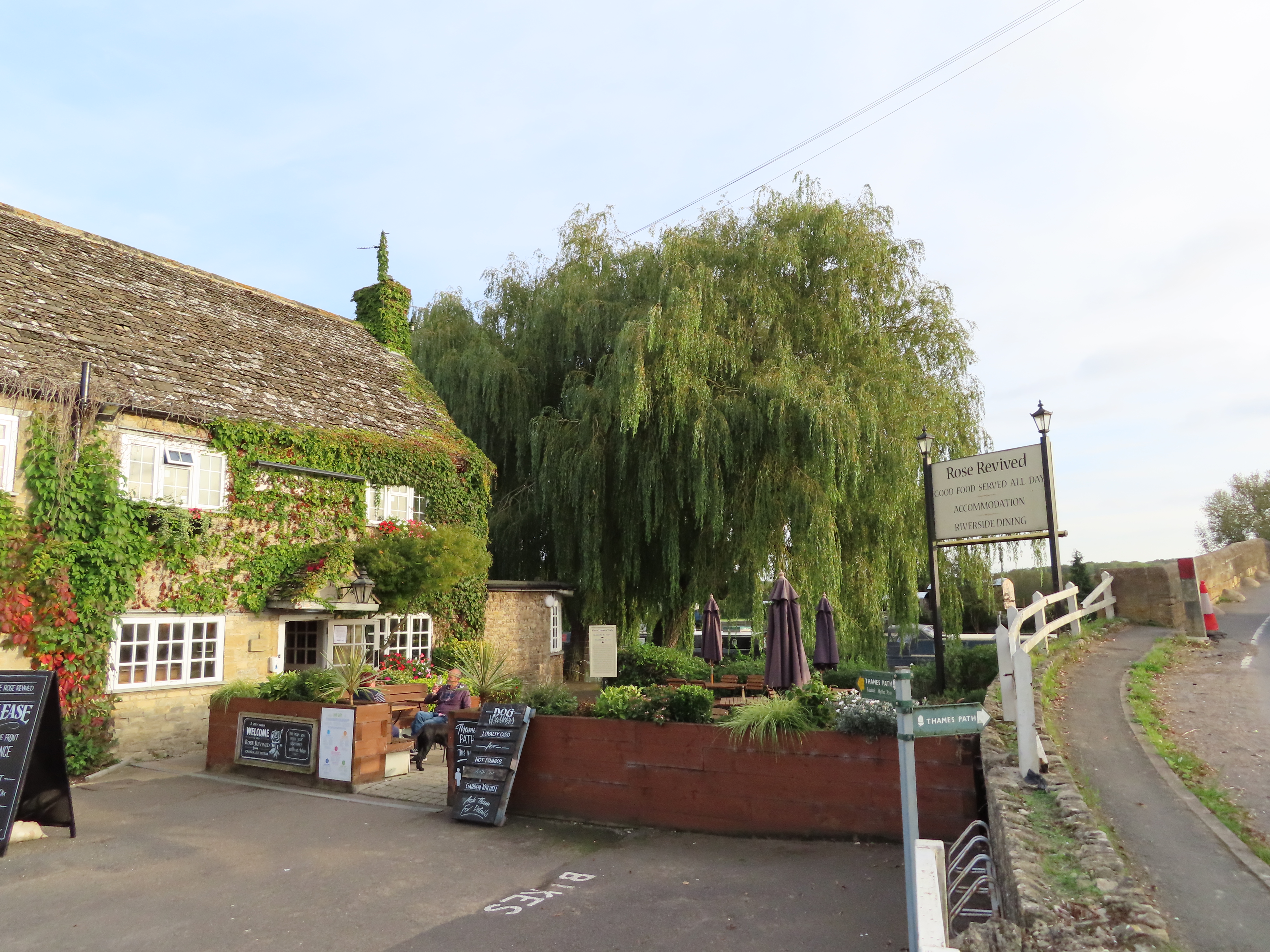
| The Rose Revived at the
north end of the bridge is possibly about as old as the bridge itself, although
its name seems to have changed several times. A legend, likely apocryphal, has
Oliver Cromwell drinking here during the Civil War and placing a drooping rose
from his attire into his ale tankard, which, it is said, revived and so gave
the pub its name. In the centuries since then it’s also been known as the Fayre
Inn, The Rose and Crown, and simply The Rose. |
 |
| At the south end stands The
Maybush, rumoured to occupy the house where the hermit charged by the monks
to care for the bridge once lived. Both pubs were severely damaged during the devastating
floods of summer 2007 but have since been repaired. |
Why here then? What was the
underlying significance of this site? As always it is the water that must have
the final word, and that word is one which as of now should send caterpillars
of shame down every English spine.
 |
| Windrush. |
The tranquil Windrush, with a
name thought to come from the ancient Celtic for ‘white fen’, rises in the East
Gloucestershire Cotswolds and glides a gentle path down through West
Oxfordshire, via Witney, to arrive at the Thames here. It is up this waterway
that stands the famed ancient quarries of Taynton, whose Cotswold limestone it
brought forth to build this New Bridge as well as the grandiose
dreamscape of the Oxford colleges.
Yet the Windrush is best known for
another signature it left in this country’s history. After the German cruise
ship MV Monte Rosa was repurposed as a transport and prison ship by the
Nazis, it was seized by the British in northern Germany in the closing months
of World War II. Following the pattern of giving captured ships the names of
rivers, it was this here tributary that rebirthed that vessel under the new
name of HMT Empire Windrush. Three years later, in 1948, it would
sail into Tilbury harbour on its most famous journey: that which brought
several hundred migrants from the then-British colony of Jamaica, who along
with other colonial ‘subjects’ had all just been granted British citizenship. Many were responding to British adverts in Jamaican newspapers to
come and work in the ‘mother country’ as it staggered from the bombed-out
wreckage of the war.
These passengers were the first in a
generation of Caribbean immigrants who took up the call to come here, helped this country rebuild, made critical contributions from public transport
to the fledgling National Health Service (NHS) in a time of labour shortage,
and together with those who arrived after them earned an esteemed place in
national memory under the name of the ship on which they first arrived, and by
extension the river for which it was named: the Windrush Generation.
But of course, everyone knows the hellish
descent of this story. These people received racist hostility from the start,
not least from a government whose extension of citizenship to the colonies had
been aimed at light-skinned people from, say, Canada or Australia – and who
when they realised also included dark-skinned people, turned heaven and earth
upside down to stop more coming. Decades of violence, prejudice and
discrimination followed, much of it orchestrated by racist (when not explicitly
neo-fascist) politicians and popular movements. And in the 2010s their successors
in the Conservative Party government completed a horrific revenge by illegally
deporting hundreds of citizens from the Windrush Generation, many of whom had
lived and worked in this country for almost their entire lives, as part of the Hostile
Environment programme of racial persecution.
This Windrush Scandal, as it
became known, only broke in 2017 after committed efforts by investigative
journalists to expose it. It temporarily unbalanced the government, most
notably forcing the resignation of Home Secretary Amber Rudd. But the damage
was done: huge numbers of Windrush citizens had had their lives destroyed, losing their jobs, homes, communities, loved
ones, physical and mental health, and in some cases dying in trauma without
ever receiving redress. Since then the scandal has largely been overtaken in
the news by disasters like Brexit and COVID-19, with the result that its
victims continue to suffer the consequences unaided by a risibly ineffective
compensation scheme. Moreover, no-one has been criminally charged for the
cruelties inflicted upon them, and far from being discouraged, the wanton
forced deportations continue to worsen, with total impunity, upon a surging
tide of government-led culture-war-infused popular xenophobia.
Fitting then that the Windrush river
is where we end this day’s journey. Lest the broad expanse of green and blue lead
us to believe we can ever escape this country’s descent, we are
washed back to reality by this river of tears, which laments into the Thames
the atrocities committed unto its name.
 |
| After the
Empire Windrush, the Windrush Generation and the Windrush Scandal, will there
be a Windrush Tribunal in which the architects of the racist persecutions
of the 2010s, many of whom still occupy the highest offices of English
government, are finally held to account for the wrongs they have inflicted? |


No comments:
Post a Comment