Is time like the river? There are
places where it feels less like a flow, with one age succeeding another, than
an accumulation of all ages together.

Witness the Oxford Plain. Through an agrarian
spread of yellows and greens the river ribbons blue. Here upstream of
Wallingford it bends, and in that bend is a tiny village which, at first glance,
might as well be any other.

Dorchester-on-Thames, not to be confused with its
better-known namesake the provincial capital of Dorset, is a tiny settlement of
1,000 people. Little houses. Sheep in fields. Aside from a peculiarly large church, what
is there to set it out in the shadows of the vast structures of power and
privilege that line this valley?
Look closer.
 |
| Are those not some noteworthy earthworks (at right)? And where are these views coming from on the flat Oxford Plain? |
 |
| Hill forts. How about it then. |
In fact this subtle riverbend is one
of the richest historical treasure-troves in the Thames valley. Six millennia
of continuous human habitation are written in the shape of its landscape, from
the ramparts and ditches everywhere you look to the coins, bones and grave
goods that practically erupt from its gravel. It took the English some time
to realise it. They’d wrecked much of it through gravel quarrying by the time
that they did. But once they did, the Dorchester bend became one of the most prized archaeological zones in the country.
These are deep memories it harbours. Most
of them long precede the English nation. They precede even its precursors. They
go all the way back to a time when far, far away, Gilgamesh and the Egyptian
pyramids were happening; and when here on the very fringes of the story of
humanity, the migrants who wandered out this way got out their flint hand-axes
and, for the first time, whacked down the stakes of this
island-peninsula’s earliest permanent settlements.
 |
| A landscape in time, not just in space. The shape of this land is the product – and continuation – of the stories of about six settlements that succeeded each other on and around the Dorchester bend. |
Doubtless life in these earliest
societies to put down roots here would have been full of struggles. But had it
yet gone so fundamentally wrong as we find it today? Was this then, as it is
now, a land of abuse? Had the masculine power fantasy, which should never have
existed, been invented yet? Whatever diseases afflicted them, was it in
them yet to come up with such staggering political and cultural mis-reactions
as they have for COVID-19 today?
 |
| Regrettably that’s not a theoretical question. |
And because this is the middle
Thames, we have to ask: what of their forts? The Iron Age fort on the hill, and
fort in the bend; the Roman fort just beneath where the village is now: were
these, already, Privilege Forts? Or were these forts for everyone?
There’s simply too much in the way to
answer these questions now. Nonetheless, let’s take a few steps into a
landscape where perhaps there’s less to impede those ancestors’ touch on your
skin than anywhere else in this part of the country.


Start: Wallingford Bridge (nearest
station: Cholsey – ten minutes by bus, or take the X39 or X40 from Reading for
approx. thirty minutes)
End: Confluence with River Thame, near
Dorchester-on-Thames (nearest station: miles away, take the X39 or X40 bus
to Reading or Oxford instead)
Length: 8km/5 miles
Location: Oxfordshire – South
Oxfordshire
Topics: Wallingford Castle Meadows, Benson,
Shillingford, and thousands of years of settlement at Dorchester-on-Thames
Wallingford Castle Meadows
Dorchester is only a couple of hours’
walking upstream of Wallingford, beginning with what was formerly the grassy
envelope of Wallingford castle.
 |
| The river from Wallingford Bridge, with The Boat House pub and boat rental at left. |
 |
| Wallingford natives take their morning coffees and relaxations by the river. |
 |
| Almost immediately the riverbank greens, with open fields appearing inland. |
 |
| The fields are Wallingford Castle Meadows – a wide strip of pastures between the river and the embankment where once towered the castle’s outer wall. |
These fields were likely an
integrated part of the castle complex, so have inherited the names King’s
Meadows and Queen’s Arbour. It is thought they grew hay to feed its
animals while offering an extra layer of wet and marshy defence. Recent archaeology
has unearthed a chalk foundation for a stone outbuilding here,
perhaps a dock or a quay.
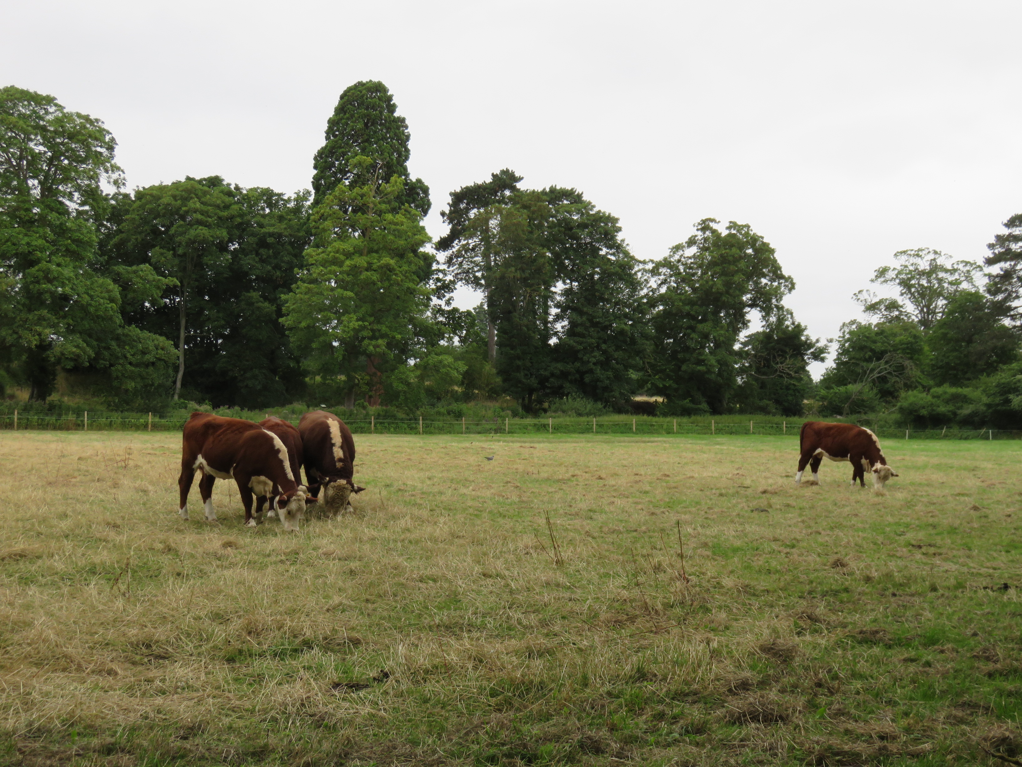 |
| After the castle’s demolition the hay meadows were reseeded and chemically treated to suit commercial dairy cows. This ruined their biodiversity, so now they are trying to bring it back through better management. These fellows’ summer grazing appears part of that plan. |
 |
| Nuuo. |
 |
| A related congregation takes its ease on the opposite bank. Formerly the Howbery Park manor grounds, those fields now host a sprawling complex of environmental science organisations such as the UK Centre for Ecology and Hydrology and a large solar power station. |
 |
| The meadows stretch on past the northern limit of the castle ruins. |
From here farmland takes over for the
short stretch to the commuter village of Benson.
 |
| The vessels moored along here appear barely lived in, when not outright haunted. |
 |
| Much of today’s reach is free of habitation, giving the river a chance to present its more natural face. |
 |
| If not completely. The leisure of the monied classes seems to dominate river activity throughout the Oxfordshire Thames. Even on these beginnings of remoteness, the wayfarer is regularly passed by their pleasure-cruisers. |

 |
| By this point we are more or less clear of the chalk hills. North and west of Wallingford it’s all farmland. |
Benson
Eventually a weir comes in sight,
heralding the village of Benson. The towpath switches to the north bank
here, though rejoining it once across requires a quick circumnavigation of
Benson’s waterside housing.
 |
| The weir is attached to Benson Lock. |
 |
| These are so common a sight now as to almost cease to warrant commentary. |
 |
| Benson Lock is another installed by the Thames Navigation Commission in the 1780s, replacing an earlier flash-lock attached to a fourteenth-century millers’ weir. |
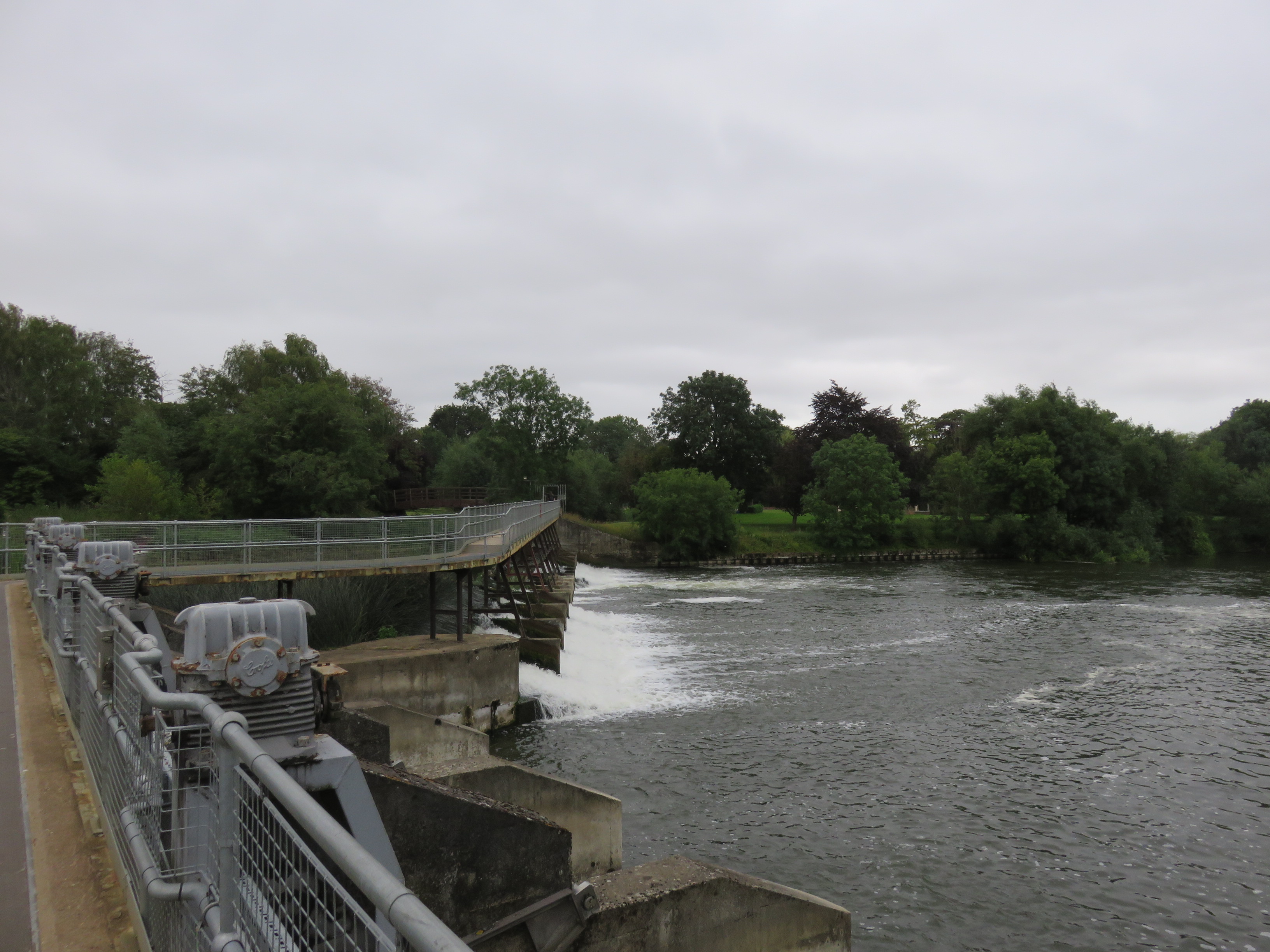 |
| Unusually you can walk atop this lock and weir to cross the river. |
Benson is a residential village and
travellers’ outpost perched on gravel in otherwise marshy surroundings. It was
known as Bensington until a century or two ago, by when they seem to have
found the extra syllable too much effort.
Benson shares in some recurring
themes of this region’s heritage. It has evidence of thousands of years of
human activity, as well as a frontier position that got it fought over in
generations of conflicts: between the Anglo-Saxon kingdoms, between Matilda and Stephen, and between the Royalists and
Parliamentarians in the Civil War. It later flourished in the service of
stagecoach journeys on the London-to-Oxford road, and keeps busy doing the same
for river travellers today with its large boatyard, bungalow park and
waterfront café.
 |
| The riverside at Benson, with pleasure-craft lined up a long way up the quay and large crowds bustling through the café. |
Benson’s other landmark is its Royal
Air Force (RAF) base, built to its east at the beginning of World War II.
Originally installed to train air crews and house fighters and light
reconnaissance craft, it now appears concerned with the trimmed-down air
force’s support helicopters and transportation.
 |
| The path out of Benson passes this complex of holiday cabins, likely aimed at people on long boat journeys. |
 |
| Then it’s straight back into rurality. But the fields here are not quite as remote as they seem. Across them runs the A4074 which became the main Reading-to-Oxford road in the 1980s, replacing the route through the Goring Gap. |

 |
| A more old-fashioned instance of local river traffic. |
While the north bank proceeds through
fields and woods, the south is occupied by the grounds of an old manor house
known as Rush Court. The original house was thoroughly rebuilt in the 1920s and
has since been turned into a residential care home.
 |
| The wall of Rush Court’s ornamental gardens is visible from across the river. |
 |
| Summer draws to a close. A long and bitter winter lies in store for this land. |
 |
| A lighter vessel lingers about the walled Rush Court grounds. |

 |
| Indeed, the flowers here have increasingly had their say for this year. |
 |
| A long, hard winter, packed with plague, persecution and ingrained political abuse. Even surroundings like these can no longer distract from the abject irresponsibility of humankind in general, and the English in particular, in taking this world down its current path. |
In due course another small hamlet
crops up by the river.
Shillingford
As its name suggests, Shillingford
is defined by its river crossing, which since 1827 has taken the form of one of
the Thames’s prettier stone bridges. It is the latest in a line of bridges
going back at least to the fourteenth century and preceded in turn by fords
and/or ferries.
 |
| The cabins on the waterfront here look perilously vulnerable to flooding. |
 |
| Shillingford Bridge. The origin of Shilling in this case is unclear, though most likely refers to someone’s name. |
Shillingford has long connected
important land routes on both sides of the river. Thus its service as a
crossing point is thought to be extremely old – at least as old as the Roman
road system, but probably much older.
For some reason the towpath now
spends some time on the opposite bank before rejoining this one, and there is
no route here along the Shillingford bend. The wayfarer is thus frustrated into
a short detour into the village, and less pleasantly, along the busy Reading-to-Oxford
road.
 |
| Fearsome clusters ambush those who dare walk the narrow path behind Shillingford’s houses. |
 |
| The English do enjoy their walls and fences. This alleyway is an exhibition of several different types. |
 |
| Shillingford’s central crossroads. It’s very small, with houses converted from inns from the days when coaches stopped here. It’s still a busy crossroads for motor traffic, but at present-day speeds everyone passes straight through now. |
 |
| This is a much-used road with poor air, narrow pavements, and long waits for anyone trying to cross it. |
Eventually a path offers
passage back to the river, and from there, at last, entry into the
time-twisting landscape of the Dorchester bend.
 |
| Another of these lurks in the meadow that leads back to the river. |

 |
| The final approach to Dorchester is a straightforward march across this field. |
 |
| From here we have a first
sighting of Dorchester Abbey. Its profile dominates its immediate surroundings,
much as it defines Dorchester’s most recent millennium. Only the most recent, we may note, for from here we must widen out our view of time. |

Dorchester-on-Thames
We now tread on ground that’s
experienced more than six thousand years of continuous human settlement, and
whose very shape has shifted in its recording.
Two geographical features stand out on this riverbend, and in so doing have set the parameters of human activity here.
We encounter the first as we reach a bridge not over the Thames, but over a
tributary which joins it here after its own long journey: the Thame.
 |
| The confluence of the Thames and the Thame. |
 |
| The Thame looks barely navigable, but it’s a major tributary with serious geographical and cultural significance. |
Witness the extreme resemblance of
the names. Thames has been interpreted as ‘dark river’ in this land’s old Celtic languages,
and though the Thame (which unlike the larger river, they pronounce to rhyme
with game) possibly shares this origin, the truth of it is lost in the
fog of prehistory. Such is frequently the way with rivers, which are there all
the way through, often bring people in in the first place, and so tend to carry
the most ancient names of all.
The Thame rises in the Vale of
Aylesbury, an eastward extension of the Oxford Basin whose Late Jurassic clay
dominates the neighbouring province of Buckinghamshire. By flowing south into
the Thames just as the latter emerges from its own southward curve, the pair create
a peninsula and pack it with gravelly alluvium. Like that they have provided a
relatively stable, accessible and defensible seat for settlement in an
otherwise marshy area.
It is significant that from this
point on the Thames is referred to in the Oxford English dialect by a different
name: the Isis. It would be tempting to dismiss this as a posh scholarly
affectation on that university city’s part if not for how the practice’s weight,
enhanced through its use by Oxford’s fearsome rowing subculture, has prevailed
on cartographers like the Ordnance Survey to label it River Thames or Isis
from here on up on official maps. In fact the name Isa first emerges in
writing in the fourteenth century; there is a theory – perhaps put forward by
Oxford academics at that time, and almost certainly erroneous – that the Roman
name for the Thames, Tamesis, was the outcome of this merger here,
linguistic as physical: Thame plus Isis.
 |
| Present-day Dorchester adjoins the Thame on this peninsula. Most of its preceding settlements did too. |
 |
| South across the river, the region’s other defining feature is at once apparent. |
On the south side the land rises into
a pair of hills that offer the only high ground on this level floodplain. This
is an orphaned outcrop of the Chalk Group, which offers sweeping views across
miles of surrounding landscape. This huge defensive, navigational and
aesthetic value has garnered these hills many names. They are the Sinodun Hills
(thought to be from Celtic: ‘old fort’); the Wittenham Clumps (which
strictly speaking refers to the beech woods on their summits); the Berkshire
Bubs (a reminder that ancestral Berkshire encompassed this bank till 1974);
or more colloquially, thanks to a sixteenth-century lady of the local manor who
by this estimation cannot have been small, Mother Dunch’s Buttocks.
That aesthetic value is also sought
by today’s recreational walkers, who climb them for some of the best views in
the region.
 |
| The Clumps are a straightforward climb from the river and can be reached on foot within forty minutes from present-day Dorchester. This is convenient for visitors, but must also have closely integrated the hills into the lives of earlier settlers on the north bank. |
 |
| The view up the peninsula between the rising Thames (at left) and the Thame (invisible at right), with Dorchester village clustered right of centre. On a clear day the spires of Oxford can be glimpsed in the distance. |
 |
| To the west is Didcot Power Station. The huge chimneys of its coal and oil plant, Didcot A, dominated the area till they were demolished in controlled-explosion media spectacles over the last decade. What remains is Didcot B, which continues to burn natural gas. |
 |
| Back downriver the roofs of Benson are in plain sight. From here there is a much clearer view of its RAF base with its hangars and airfield. |

Perhaps that combination is why this
area has been a magnet for migrating humans as far back as the Palaeolithic or Old
Stone Age. From this vast period – considered to span from the first ice-age
immigrations around 400,000 years ago, to the gradual warming of this land in
the last few millennia BCE – Dorchester’s gravel has yielded an impressive
number of worked flint hand-axes. This signature artifact of those times was an
indispensable tool for chopping and carving all manner of meats, skins, bones,
woods and other everyday materials.
A decisive transition marks the
Neolithic or New Stone Age, from around 4000 BCE: namely, that these nomads began to
cultivate plants and domesticate animals. It was this farming that rooted them
to fixed locations, offered food surpluses when things went well, supported
larger populations, and thus gave rise to more complex societies which
rearranged the environment around them. It was a momentous change – and the
challenge in any assessment of it is that it was precisely the pivot which underpins the settled cultures that carry on in the present day. Thus any evidence
about it, still fragmentary at best, is necessarily filtered through both the
curses and celebrations which the humans of today direct, often with fierce
conviction and the gravest of personal stakes, at their current ways of life.
Life for these early farmers was
probably neither the cesspit of sickly, bloodthirsty misery that the fans of
modernity – that is, its minority of privileged beneficiaries – please to
condemn them to for the contrast, nor an idealised golden age free of the raft of
horrors that modernity has largely amplified rather than created from scratch. What
then do we really know about these ancient people? To answer that we have to
look at the evidence they have left us, such as the pottery, earthworks and
burial sites that survive from that period. Of these, Dorchester’s promised to
be some of the most revealing in all of England – at least until that clever
and enlightened modernity got it in its head to lay waste to it by digging it
up for gravel.
 |
| See that big lake by the river? It’s actually the filled-in remnant of one of Dorchester’s gravel pits, which the English quarried out in the late twentieth century for concrete and road construction. In so doing they wrecked the traces of one of the most tantalising Neolithic ceremonial sites yet discovered. |
Around the 1920s and 30s, when the
advent of powered flight offered new views of this land from the air, passing pilots
began to notice cropmarks in the farm fields north of the
present village. Cropmarks are patterns in plant growth which indicate altered
soil conditions beneath – such as caused, for example, by buried ditches or
wall foundations, to whose presence they serve as a clue.
Eventually these came to the
attention of the archaeologists. What they found was astonishing: an entire
Neolithic complex of ritual monuments and burial enclosures, spanning the
period 2-3,000 BCE. They then spent the rest of the century in a race against
the construction industry to rescue what they could from the gravel diggers
and, later on, the builders of the Oxford Road’s Dorchester Bypass.
 |
| Cropmarks made by what came to be known as the ‘Big Rings’ ritual complex, as photographed from an aircraft by Major George Allen in 1938. It’s now that lake in the previous photo. |
Most of the enclosures contained
cremated human remains, sometimes with animal bones, arrowheads, or flint or
pottery fragments. Amidst them stretched the site’s largest structure by
far: a long, linear pair of ditches called a cursus, which ran roughly
where the Dorchester Bypass runs now and whose function remains unknown. Possibly
it was a boundary, a ceremonial route, or an axis of ritual alignment, very likely
with reference to the river. And next to this cursus had stood an outstanding monument:
the ‘Big Rings’ henge (as in Stonehenge) that made such an impression on
passing pilots. Centuries of farming had obliterated everything above the
surface, but the ditches beneath suggested a considerable double-ring of
standing stones or timbers.
We can scarcely guess at the
functions of sites like these, least of all when a nation’s response to such
precious evidence is to annihilate all trace of it in the pursuit of passing material
gain. Yet they do permit some general suppositions. For one, Stone Age humans
were not the grunting cavemen of popular imagination but sophisticated
communities which crafted skill-intensive tools and, far from being consumed by
material drives, re-shaped their environments, often at enormous expense in resources
and organised labour, to express abstract cultural pursuits and better understand
the patterns of nature.
It’s also interesting how what’s now
a largely peripheral belt of fields between Oxford and Reading seems to have
been a core of human activity from at least the third millennium BCE. It’s
easily imaginable that at least as many people would have been involved in
building and operating these monuments as live in Dorchester today. Perhaps we
could have learnt a lot more about them had their successors, in all the
advanced wisdom of their modernity, not, you know, mined their entire site to
oblivion.
 |
| When the sites were wiped out large sections had yet to be studied. How much richer a picture might they have yielded to the advance of investigative methods and environmental sampling techniques since then? |
Excavations of some of the later
sites here found bronze tools and ornaments, indicating the shift to what they
call the Bronze Age. This is considered to have lasted till about 1,100 BCE in
this land, but despite the use of bronze metal (and thus a rise in lasting evidence
in the form of bronze tools, grave goods and ceremonial offerings), Neolithic
ways of life are thought to have more or less persisted.
A more substantial shift came with
the use of iron, with the associated Iron Age in this land lasting through the final
millennium BCE. By that point settlements and populations were growing, robust political identities had emerged, and large ritual
monuments were falling out of fashion. The change is dramatically recorded in
the Dorchester landscape because it was now that a hillfort appeared atop the
Wittenham Clumps.
 |
| The Clumps were occupied since at least the late Bronze Age, but Castle Hill (the eastern one), seen here from Round Hill (the western), was thoroughly fortified from around 600 BCE. Its ditch and rampart are still in outstanding condition. |
By then the Dorchester bend ran
through an overlap between three groups of people: the Atrebates on the
lower Thames to the south; the Dobunni in the upper Thames and Cotswolds
to the northwest; and the Catuvellauni about the Chilterns to the east.
These were Celtic or Belgic societies, but we know them today largely through
their Latinised names and accounts by the Romans who later subjugated them.
Little about their relationships over
these centuries is certain, although by the Roman arrival they were clearly
organised polities which appointed kings, minted coins, and traded far and
wide. How exactly this hillfort figured into their interactions is thus largely
a matter of conjecture, save that it’s easy to imagine its formidable
defensibility and prestige as a place of occupation. Although it has never been
excavated, several studies including a Time Team investigation have dug
up enclosed sites and rubbish pits in the surrounding area. Far from an
isolated outpost, it’s more likely it formed the nucleus of an interconnected
settlement system that engaged as much in trading, crafting and administration of
the surrounding communities as in military activity.
 |
| The commanding view to the south, with the rampart running through in the foreground. |
 |
| The other clump, on Round Hill, is the oldest set of planted hilltop beech trees in England at over three hundred years old. |
 |
| Hills like these usually carry an eerie reputation. They are almost certainly haunted and no doubt concentrate a mass of local folklore concerning ghosts, curses, strange animals, strange noises, hidden treasure, and peculiar weather and seasonal patterns on account of proximity to other worlds. Spend the night here if you dare. |
 |
| Bovine custodians graze the rounds of the Wittenham Clumps as they prowl for human troublemakers. Witness them contemplating action against these on account of their barking dog. |

The hillfort seems to have fallen out
of use towards the end of the millennium. Why is not clear. Perhaps the
politics grew stabler, and visual prestige and defence became less important
than trade and ready access. The outcome in any case is that the focus of
settlement shifted back across the river, this time to the very bottom of the
loop between the Thames and the Thame.
 |
| Specifically to the area demarked by this line of earthworks, just south of the present village. |
This rampart, known today as the Dyke
Hills, is believed to have formed the northern perimeter of a
forty-six-hectare town – significantly larger than the four-hectare hillfort –
that grew up here shortly before the Romans arrived. No less than one of
pre-Roman Britain’s first true towns (an oppidum in archaeological
parlance), its status as a major trading centre is attested by its profusion of
cropmarks indicating large houses and smaller enclosures – most likely
workshops and storehouses – arranged along organised roads, as well as the huge
concentrations of Iron Age coins that have sprung from its earth at the touch
of farmers’ ploughs.
 |
| The ditch beneath the Dyke Hills rampart connected the Thames and Thame and would have surrounded the settlement with water, creating a defensible and well-connected island. |
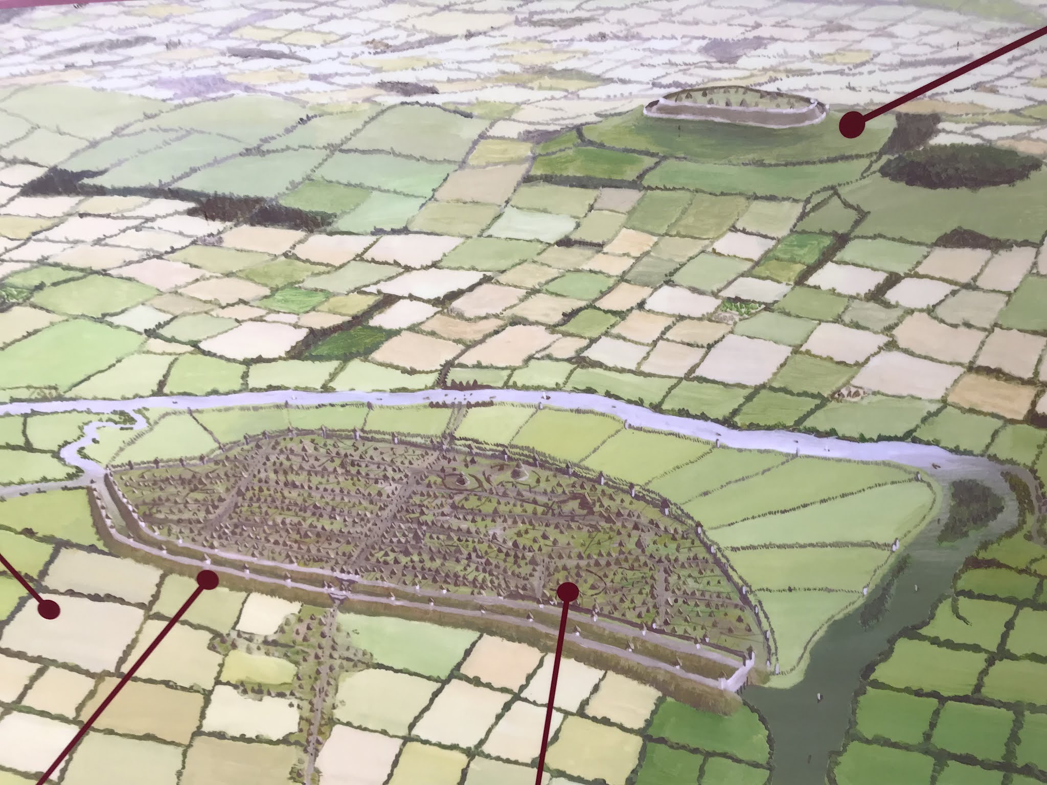 |
| A south-facing impression of this landscape in the late Iron Age, on display in the Dorchester Abbey Museum. The new settlement commands the riverbend; note the moated rampart that's now the Dyke Hills. Across the river the old hillfort still stands prominent on the Wittenham Clumps. |
 |
| Today the settlement’s site supports a woollier population. Army-officer-turned-archaeologist General Augustus Pitt-Rivers (as in Oxford’s Pitt-Rivers Museum) did a big excavation here in the 1870s, battling with profit-hungry agricultural landowners whose ploughs and shovels were obliterating these earthworks much as the gravel-diggers would wreck the Neolithic sites a century later. |
 |
| A peacock butterfly occupies the path, grumbling about countries that place greed for profit and property above the protection of precious heritage. |
This would have been the situation on
this bend when the Romans arrived in the first century CE. They integrated this
land into their empire as the province of Britannia, co-opting its Iron
Age peoples – by force, persuasion, or trickery as the case may be – and
gradually transforming their ways of life under Roman cultural practices.
Logically the name of Dorchester
ought to have its origins in this period. The -chester name element is
common in later Anglo-Saxon place names as a reference to fortified Roman
sites, though what the Dor signifies here is unclear. Excavations have
indeed revealed a Roman fort by the Thame just north of the Dyke Hills
settlement, where it would have controlled both the rivers and the Calleva
Atrebatum (Silchester)-Alchester route on the conquest-enabling Roman road
system.
Whether this caused the abandonment
of the Dyke Hills settlement, or whether its activity was already shifting to
what became the Roman civilian settlement that replaced the fort after its
demolition around 78 CE, is not known for sure. What is clearer is that this
was the first settlement on the site of the present-day village, and so has
influenced all further siting decisions to the present day.
 |
| The gravelly riverbed here meant that Roman builders had to bring in stone from elsewhere. Centuries’ worth of later builders, facing the same problem, often ended up digging for the Romans’ stone footings to recycle them for their own projects. |
If this was one of Roman Britannia’s tiniest
walled civilian towns, its small size did not detract from its importance. Swathes
of impressive finds have burst from the ground over centuries of village
activity, including high-quality glass, ceramic and silver goods such as jars
and cutlery; evidence of high-standard construction such as tiled roofs, mosaic
floors, tessellated pavements and decorated wall plaster; and the considerable
leavings of the farms, pottery kilns and cemeteries that sprawled across the surrounding
area. These, on top of the great effort they patently went to to protect this
town, suggest its crucial role as an administrative outpost and distribution
hub, most likely for this region’s rich agricultural produce.
These discoveries extend over the
later years of Roman rule, thus also helping to inform us about one of this
land’s most complex and psychologically sensitive periods: the long transition
from the declining Roman political and cultural systems, to those of the
Anglo-Saxon immigrants – the latter often spoken of, casually and inaccurately,
as the identity-fount of modern English whiteness.
On this too Dorchester offers a more complicated
picture. For instance, graves have been found of individuals of Germanic origin,
sometimes with Roman grave goods, or items from Gaul or the Rhineland, or in
some cases both. There is a good chance that these were continental mercenaries
(foederati), whom the sub-Roman people of this island were known to
invite in for protection as the Roman army departed. Though signs of Saxon
building and burial practices increase in the subsequent centuries, here as
elsewhere the evidence is of a long and multi-dimensional shift, for much of
which groups with different identities were living in close contact with one another. The quality of some of these finds suggests a persisting level
of wealth in sub-Roman/early Saxon Dorchester, and thus a continuing regional
importance for this town.
 |
| These days another of these World War II pillboxes, unusually made of brick, guards the southern approach to Dorchester. |

The consolidation of the Anglo-Saxon immigrants
into settled kingdoms placed Dorchester yet again on a frontier zone. This time
it was the young kingdom of Wessex which looked across the river at the
great northern heavyweights of the period, Mercia and Northumbria
– the last time, incidentally, when the main power on this island was in the
north.
Dorchester’s status received a major
raise in this period. In 635 BCE, as recorded by the Northumbrian historian
Bede, a Frankish missionary called Birinus arrived, sent by
the Pope to convert the West Saxons to Christianity. Dorchester was significant
enough that it was here that Birinus presided over the baptism of Wessex’s
king, Cynegils, ahead of the latter’s daughter’s political marriage to the
already-Christianised king of the Northumbrians, Oswald. As part of the
arrangement Birinus was made the first Bishop of Wessex, and given land in and
around Dorchester to establish his cathedral.
In other words, Dorchester was suddenly the central religious headquarters of a newly-converted kingdom. Its new church
would in time evolve into its present one, while Birinus’s own name would later
be revived and exalted as the regional founder-figure for English Christianity.
For all this religion however, the
deeper significance of these events was political. In Dorchester the nascent
Wessex kingdom now had an anchor for its expansion north into the Thames
valley, as well as a platform for managing its interactions with its stronger,
more established rivals beyond it. The latter’s advantage was proven when
Dorchester subsequently fell under Mercian control. Its status as an
ecclesiastical centre was taken off it in favour of Mercia’s own more central
bishops of Leicester and Lindsey (Lincoln), and it didn’t get it back till
Mercia was devastated by the Scandinavian Vikings some two centuries later,
opening the way for the rise of Wessex under Alfred, the Viking defeat, and the
partition of not-yet-England into Saxon and Viking realms.
By that point however the rise of Alfred’s burhs at Oxford above and Wallingford
below suggested that beyond its status as a religious centre, Dorchester’s
commercial and strategic situation was in decline. This was confirmed when
after the Norman conquest of 1066 that ecclesiastical status was removed to
Lincoln yet again, this time for good. Nonetheless as an outpost of the
Lincoln bishopric Dorchester remained productive, sufficiently so that around
1140, on the site of the Saxon cathedral, the Bishop of Lincoln commissioned a monastery
whose main building dominates the local landscape to this day: Dorchester
Abbey.
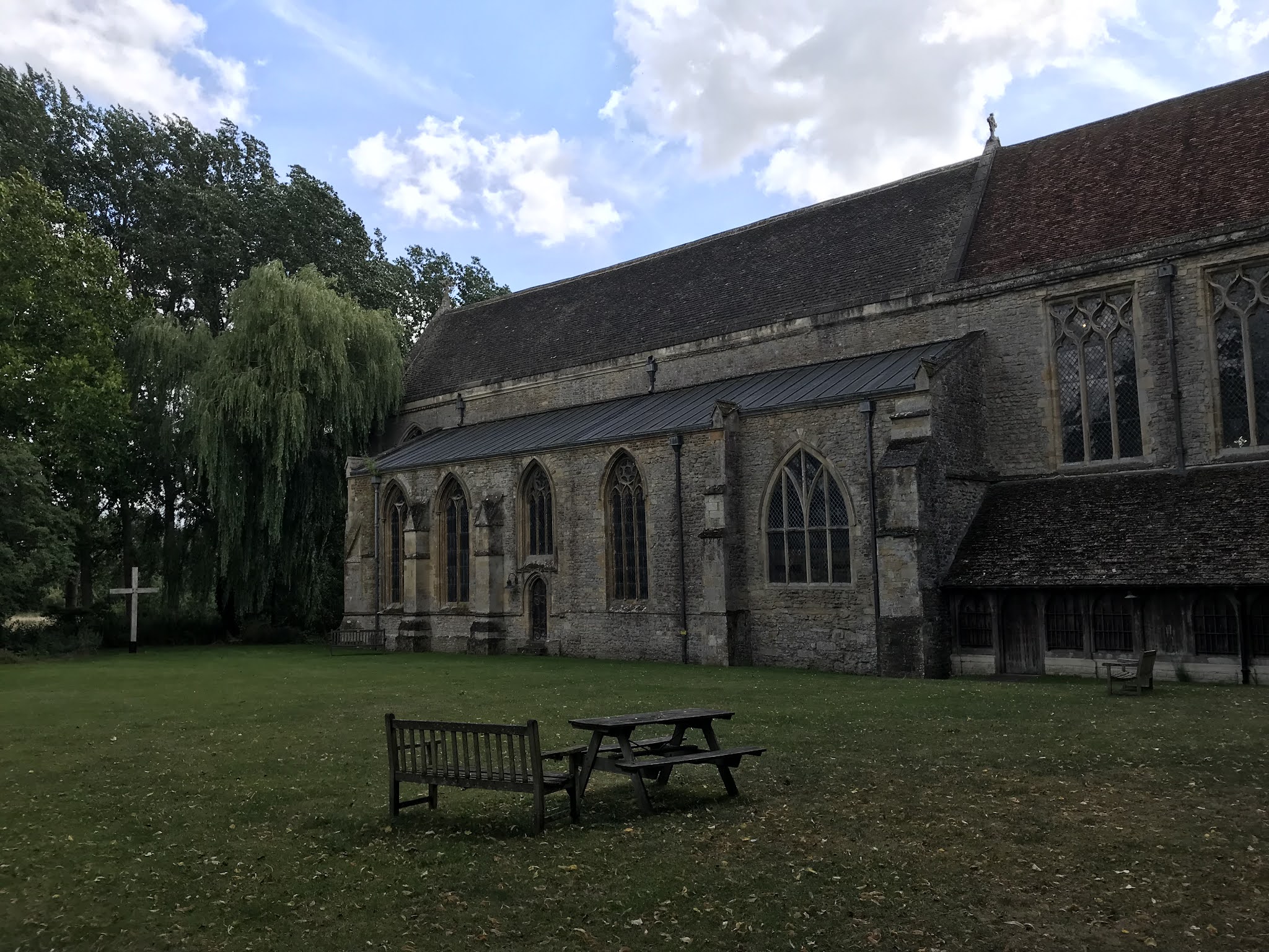
 |
| A close-up view of the Norman abbey, within whose structure traces of masonry from the Saxon cathedral are said to survive. |
 |
| Unlike many English churches nowadays this one’s usually open, and actively welcomes visitors to poke around inside as much for historical interest as Christian observance. |
The Abbey was settled by monks from
an independent branch of the Augustinian order called the Arrouaisians, who
migrated in from across the Channel. Arriving as they did some decades after
the Norman conquest, they missed out on its wholesale land-grabs and so got
little in the way of manorial estates with resources and income. Instead they
made do with spiritual taxes and fees, and gradually accumulated holdings up the
Thame watershed in the centuries that followed.
 |
| The building survives from this period, though has received many upgrades and renovations over the millennium. This window for example contains a mix of medieval and Victorian glass. |
 |
| The monks came up with a crafty scheme to raise their profile: they claimed to possess the original relics of Birinus. Dodgy as this was, it gave rise to a new cult of Birinus which drew loads of pilgrims to Dorchester. The money they spent here enabled the monks to fund an extensive building programme, including for a Birinus shrine. This did not survive Henry VIII’s crackdown in the 1530s, but Birinus’s name remains indelibly infused in its atmosphere. This for instance is the St Birinus Chapel; the little circle in its window is the building’s oldest glass, dating from around 1225. |
 |
| Another of the Abbey’s original pieces: the Norman lead font from around 1170, carved with figures of the Apostles from Christian mythology. |
Dorchester’s monks were pensioned
off, apparently in compliance, when Henry VIII and Thomas Cromwell crushed the
monasteries in the 1530s. Much of the complex was lost as a result, but
Dorchester Abbey’s main building was saved when it was bought by Richard
Beaufort, a rich local farmer, and returned to the community as the ordinary
parish church it still serves as today. It also escaped the worst of the next
round of obliterations, that wrought by the iconoclastic Puritans during and
after the Civil Wars. Despite being expensive to maintain it received some
dedicated restoration under the Victorian boom in interest in gothic
architecture, and stands on today as one of England's better-preserved large Norman monastic
pieces.
 |
| This list of its heads – bishops of the Saxon cathedral (left), abbots of the Norman monastery (right), and vicars of the English church (centre) – is a good answer to those who use Anglo-Saxon as a byword for whiteness. How many Haeddis, Aelfnoths and Wulfwigs do you come across today? |
 |
| On the Abbey’s north side is its cloister garden – a restful place, good for tranquil contemplation. The Dorchester Abbey Museum runs out of the monastery’s old guest house next door, with delicious cakes available at the tea rooms out back. Both currently have good COVID-19 safety measures in place. |
Dorchester’s national impact has since
declined, perhaps to a quieter level than ever in its history. Left as a
largely unremarkable farming village, its fields were Enclosed under a small
number of families like Beaufort’s with its agricultural base backed up by
milling and smithing. The village more or less fed and serviced itself,
sprouting local shops as well as numerous inns and pubs; the latter straggled
out of Dorchester’s old tradition as a road and river waypoint but got a brief
boost in the era of barges and turnpikes. By around the late eighteenth century
however the village became notorious for its poverty, and struggled to support
its victims of agricultural depression against the cruelty of that era’s Poor
Laws – the antecedent to the present Conservative Party’s abuse of the welfare
system to torture and punish people for being poor.
 |
| Look at this. When will humans cease to blame individuals for ‘exceffive senfibility’, and actually take some responsibility for the ‘rude Shakes and Joltings’ inflicted by their societies’ abusive values, practices and prejudices? |
 |
| Almost all of Dorchester’s shops and services have since turned into private houses. As ravening developers have more or less bypassed this village, many of these are living pieces of history; elements persist from their initial construction hundreds of years ago despite centuries of modifications since. Timber frames, wattle and daub, cob (i.e. mud mixed with hair or straw to stabilise it), flint, and even chalk all attest to the village’s creative and resourceful use of materials in the local absence of suitable building stone. |
 |
| Facing the Abbey, the George Hotel is one of the few Dorchester businesses still in service. Its fifteenth-century timer-framed building (though much altered since) is one of the grandest in the village. |
It’s easy to overlook this tiny settlement
in the apparent middle of nowhere. Enter its landscape with senses open,
however, and they quickly fill with a depth of heritage totally belied by its
settlement’s present-day humility. It presents a human story that runs unbroken
all the way back through Saxon immigrants, Roman occupiers, Iron and Bronze Age
traders and crafters; all the way back, indeed, to those prehistoric hunter-gatherers who came together and, for the first time in this land, took up the way
of the settler which, for good or for ill, the English carry on today.
Okay, admittedly for some quite
abominable ill. From the fount of settlement, not inevitably but by choice, has
arguably come the cult of property and a catastrophically murderous hostility
to anyone it deems unfitting: that is, nomads, wanderers, refugees, homeless people, and every indigenous
society they wrecked when they carried their settlement practices over the
sea. In a further irony, it was also from the way of the settler’s most
triumphant expression – cities – and their defining material, concrete, that
came the hunger for gravel which has done the most, on the Dorchester bend, to
destroy the very six-millennia-long story from which it emerged.
Nonetheless it is writ in this floodplain still.
You don’t have to dig through books or archives to read of it. Only walk,
instead – up the hills, along the ramparts, through and around the Abbey – and
you'll know it through your soles.
That’s the other irony. Here you best
learn the story of settlement by doing that which all settlers had to do first, yet too often come to despise when others do it too. You move. You migrate.

Very special thanks to the Dorchester
Abbey Museum for informing much of the content in this section, and for its
efforts to ensure a safe visit in COVID-19 conditions.
For those interested, a more detailed
overview of Dorchester’s story – with lots of photographs and diagrams – can be
found in Dorchester
Through the Ages by Jean Cook and Trevor Rowley (eds.), published by Oxford
University Department for External Studies in 1985.
No comments:
Post a Comment