Showing posts with label winter. Show all posts

Sunday, 31 January 2016

5) THE HAKKODA MOUNTAINS 八甲田山系 – The Wind Rages

A Voyage to Aomori, Part 5 of 5

  
There are those who claim that happiness has nothing to do with your circumstances, and everything to do with how you choose to respond to them. Such people seem quite numerous nowadays; whether more so than in the past I cannot say.

They are fools.

One does not simply choose to be happy. External circumstances matter. We have created societies that systematically break people. How callous, or plain ignorant, does a person have to be to expect anyone to accept and adapt to a world like that?

And yet, there are places our madness has not yet reached. Places free of arrogance, cruelty, poverty, gender or greed. Places that were there before us and will be there long after us. Places beautiful before anyone was around to corrupt the concept of beauty – a primordial beauty, one we cannot define but know at once when we see it, as though by an instinct as old as love itself.

It was a pain that should not have existed, brought on by the failure of human society, that drove me to Aomori in the distant north of Japan in search of respite. And on my final day there, I found one of the most formidable such places of beauty that I have ever known. It was unexpected – not part of the original plan. And it was guarded by some of the toughest combinations of weather and terrain I have yet encountered.

A location where big explosions once happened bigly.
But it was necessary. It was right. For the winds, the rocks, the trees, the skies, no matter how fierce, how rugged, how sharp, how cold, are not mad. Never have they hurt out of malice. They exclude and alienate no-one; all are welcome in their realm. Unlike society's, their conditions are fair. I could accept them with no hesitation. And in return for what they take, they give a thousandfold.

They give better external circumstances. Beautiful circumstances. Circumstances, if not for happiness, then at least for something magical and profound; something which speaks to your humanity at a level our shallow materialist individualisms no longer bother with.

The Hakkōda Snow March Disaster
Make no mistake, that does not mean the Hakkoda Mountains will not kill you if you do not approach them with care. The Aomori Fifth Infantry Regiment, a unit of the Eighth Division of the Imperial Japanese Army, learnt this in supremely miserable fashion back in the New Year of 1902.

Friday, 20 February 2015

Ogawa-machi (小川町), Saitama: Mountains, Temples, Forests, Farms


The mountains of Chichibu and Oku-Musashi in Saitama, north of Tokyo, recede into clusters of lowland hills around the centre of the prefecture, giving way towards the great Kanto Plain in the east. The settlement of Ogawa-machi (小川町), nestled amidst this transition zone, is a historic Japanese countryside town of about 35,000 people known for its long traditions of washi paper-making and sake brewing, both nourished by the area's high-quality mountain water. In recent decades Ogawa has also emerged as one of Japan's leading organic agriculture centres, with certain farms gaining high national profile for their pursuit of sustainable systems in energy, waste management, and food production.

It was here that I opened my hiking for the year 2015 with this restful walk through Ogawa's surrounding lowlands and neighbourhoods. The first half crosses a couple of low peaks overlooking the town, offering two consecutive 360-degree views for a really not so demanding climb. The second half winds through the outskirts of the town and lets you soak in the flavour of its farms, shrines, temples and peaceful neighbourhoods.


This is an easy walk, about 8km long, and requires only 3 to 4 hours to complete. There is only one significant uphill stretch, to get onto the adjacent peaks of Kannokura-yama (官ノ倉山) and Sekison-san (石尊山), both less than 350m high. Do be prepared though for one or two scrambles down gravelly slopes, including one that involves holding a chain for support.

To get there, go to Ikebukuro and take a Tōbu Tōjō line express train all the way to the end to Ogawamachi station, a ride of about 1 hour. Change onto a local train (on the same line) to go one stop further to bu Takezawa (東部竹沢) station. The walk ends back at Ogawamachi station, in the town centre.

Click the link below for more photos and route guidance.

Saturday, 27 December 2014

Bukō-san (武甲山), Chichibu, Saitama: The Mountain That Built Tokyo


To round off this year's hiking, here is a mountain which will be familiar to anyone connected with Chichibu. Bukō-san (武甲山) stands at 1304 metres high, towering over Chichibu town independent of all other mountains. Its northern face has been completely carved out into terraces, making it instantly recognisable.

From these terraces come limestone which dates back 200 million years, and which over the last 100 has been quarried at an escalating rate on account of its service as a key ingredient in cement. More specifically, it is this cement that has fed the eruptive growth of the thousands of roads, apartments and skyscrapers of Tokyo, first during the Taisho period (1912-26) but most dramatically following the post-World War II economic explosion.

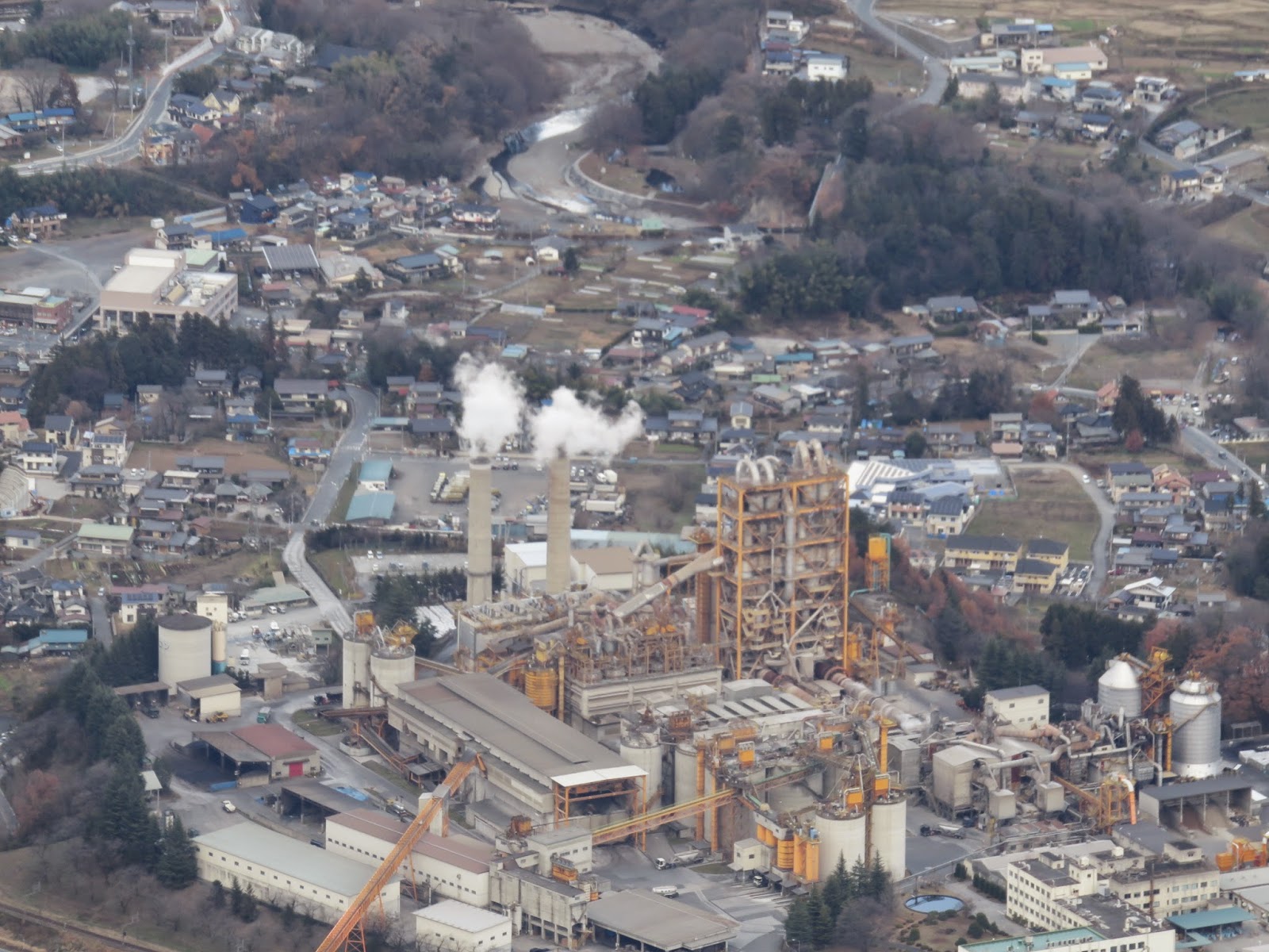
Limestone from the quarries is transported to the many concrete plants that have sprung up below, evidently centrepieces in the local economy, and there it is processed to feed the Tokyo construction industry.

Perhaps surprisingly, this has not reduced the mountain to some devastated, mined-out wasteland. On the contrary, the southern flanks offer an refreshing hiking experience where aside from the odd industrial siren, the quarries rarely intrude on your day. Admittedly demand for wood has done to the south what demand for concrete has done to the north: much of Bukō-san's forest is young sugi plantation rather than true wild woods. That said, these forests tingle with the whispers of sacred sites and secrets from a mysterious, more spiritual era gone by; at the large shrine on the summit, for example, the evidence of devout observances goes back centuries. And at the peak, if you plan well enough to make it there on a clear day, there unfolds a glorious mountainscape that surely ranks among the finest views in the region.


This walk is just over 9km long, takes about 4-5 hours, and is a navigationally straightforward up-and-then-down concern. There is no major technical challenge, but it can get rather steep in places and presents a good workout for anyone of reasonable fitness.

To get there, take the Seibu Ikebukuro Line to Hannō (飯能), where you can change on the same platform to the Seibu-Chichibu Line as far as Seibu-Chichibu (西武秩父) station. From here, take a taxi for about 20 mins. (approx. 2500 yen) to Ichi-no-torii (一の鳥居), on the east side of the mountain. (You can also get off the train one stop earlier at Yokoze (横瀬) station and walk, but this takes an extra two hours along a road in frequent use, not least by trucks trundling in and out of the concrete plants on the way.) You'll finish on the west side at Urayamaguchi (浦山口) station on the Chichibu Main Line; note that this line does not accept PASMO or SUICA cards.

As an aside, like most walks in this part of Saitama, you will pass Musashi-Yokote station on the way. By means of a platform sign it proudly declares itself “the station with goats", so be sure to look out of the window for reference.

“House of Goats”.

Thursday, 27 February 2014

The Snows of Izugatake (伊豆が岳)


Musashi: the old province that encompassed the lands around what is now Tokyo. Though abolished in 1868 with the introduction of the prefecture system, the name was retained in many of its old districts, whether for memory, or prestige, or differentiation. To this day, consider all those train stations which bear Musashi in their names.

Oku-Musashi, or “Inner Musashi”, now refers to the mountains of western Saitama, the prefecture bordering Tokyo to the north, whose wilds represented the inner reaches of the old Musashi province. These peaks are relatively low, typically around 1000m or so, and stretch across the west flank of Hannō city as they rise, further west, into the great mountainscapes of Chichibu (contiguous with Oku-Tama to the south, some of whose mountains also feature in this blog).

This was my first hike in Saitama, and as with Oku-Tama and Tanzawa, these mountains have their own distinct character. Another level closer to Japan's central highlands, there is a certain Alpine something about Oku-Musashi. My route began at Shōmaru station on the Seibu-Chichibu Line – about an hour and a half from Ikebukuro station in Tokyo – and ascended to the summit of Izugatake (伊豆が岳), the high point of the walk at 851m. From there a long ridge with many sharp peaks trails south then east to Ne-no-Gongen temple (子の権現), then descends, gradually, back into the valley past the mines of Agano, finishing at Agano station. Though 851m might not sound like much, in a February of brutal snowstorms it was in fact quite satisfactory.

Quite satisfactory.

The result was an eight-hour slog through snow that reached a metre deep in places, up and down sinew-shredding gradients fit for a lunatic, along a course more properly popular for its thousands of colourful flowers and rich greenery at saner times of the year. As such I will not be presenting it here with the usual detailed instructions, for the magnitude of the snow meant I had next to no contact with the actual earth of the path at any point on the route, so I cannot purport to advise on it. If your idea of a hike is some pleasant exercise through bright and leafy nature, you might want to give Izugatake a miss until summer. However, if it is in fact a full-scale body-breaking, soul-wringing catharsis you actually want, or if you are struggling with emotional poisons only the cleansing force of the primal earth can purge, then by all means head for Izugatake right now, for you will find nothing better than these mighty snows to plough the toxins from your psyche.

“Beware of forest fires.”
Ne-no-Gongen temple.

If you attempt it, give yourself at least eight hours of daylight, bring plenty of food and water, and go with maximum respect for the challenge before you. Good shoes that can survive being under snow all day (i.e. underwater) are essential; crampons are strongly recommended. Izugatake is popular enough that you will run into other people – likely elderly Japanese super-hikers – on the mountain itself, but most of the ridge sees little traffic in these conditions, and there are no services until near the end.

The route is long and often steep – imagine the North Takao Ridge with fewer but higher peaks – but the biggest drain on your energy will be the snow itself. Expect most of your footsteps to immediately sink until your other foot is level with your thigh. Expect also to fall forwards a lot when this happens; the deep, soft snow makes this safe, but you still have to put the calories into pushing yourself up again, and after dozens of times they start to add up. Definitely not a place or season to faff around, then, but if you know it is what you need, then you will come out a better person than you went in.

Wednesday, 5 February 2014

Mt. Takanosu (鷹ノ巣山) - The Falcon's Nest


Many fine mountains rise up in the wilderness of Oku-Tama in western Tokyo. A couple are covered on this blog: the sacred Mitake-san and pointy Ōdake-san, as well as the Takamizu three mountains.

Further in are the more serious mountains, like the forested pyramid of Gozenyama over Lake Oku-Tama, and the lush and rocky valleys and streams of Kawanori. Neither of these are featured here, as I have saved them for a Tokyo hiking guidebook I am currently writing (and seeking editorial oversight and publishing for – feel free to leave a comment if you know anyone who might be interested).

And then, deeper still, you have buggerations like these.


The high peak on the right is the 1737m-high Takanosu-yama (鷹ノ), or “Falcon's Nest mountain”. Still within the Tokyo Metropolitan Area, it is a herald, the first prominent peak on a ridge that rises west to Tokyo's edge, to Kumotori-yama, the capital's highest mountain at 2017m. It is said that during the Edo period, government officials would come to Takanosu to hunt hawks – and wanted to keep the birds to themselves, so had the mountain placed off-limits to the general public.

Nowadays the government won't stop you, but you still have to convince the mountain itself of your worthiness. For a good challenge, scale it from the north side, starting in Nippara, one of Oku-Tama's isolated mountain villages famous for its limestone caves. This confronts you with a nasty, calf-crunching sustained ascent up a vertical distance of 1.5km, a gauntlet of narrow slope trails and merciless gradients. After reaching the summit, another four hours along the gentle but neverending Ishi Ridge will return you to Oku-Tama town and the train station. And if you are feeling particularly insane, you can do this now, in February, where peak and ridge alike soar high above the snow line and those punishing trails are locked in ice. Like this.

Yes, that is the path.
And so is that. Doesn't it look fun?
But if you do, you may just find that the mountain agrees that insanity is better, indeed, than “normality” in a world at any rate gone mad. And it will reward you, in proportion, as you stagger onwards and upwards, puncturing at last through that mad world's ceiling to come upon a landscape of utter wildernesses of freedom, more formidable than you could ever have the right to expect so close to a world-class urban colossus like Tokyo. And beyond the peak, you may just find you have the ridge all to yourself: an authentic and haunting winter wonderland, where furry animals stop to watch you, mountains line the horizons, and the madness of humankind fades to oblivion.


Needless to say, this is not a picnic. “Insane” is not the same as “careless”. Takanosu in the snow is right up against that difficulty threshold where specialist ice equipment becomes mandatory; crampons or at least a hiking stick will do you no harm. Sturdy shoes with good grip are essential, as are a map and a compass. At times the ascent becomes a full-scale scramble on all fours and a serious test of body and mind, and under no circumstances, save the most extreme, should it be attempted in wet conditions, especially at this time of year. Start early and plan absolutely to be down by sunset, and over-estimate how much food and water you will need, for the ice and snow will wear you down fast. Note too that the entire route, though well-signposted and hard to get lost on, is unserviced by shops or facilities.

Above all, treat the mountain and its life with respect. You don't have to submit, but nor should pride have a place in your rucksack. Deal with the mountain as an equal; teach it and learn from it. If you do, then the trees, the rocks, the snow and the mountain itself will be your friends and help you on your way. Literally, as we shall see.

Oh, and watch out for bears.


Takanosu-yama
Length: 15.7km – or 32,161 steps, as reckoned by Comrade Nintendo 3DS step counter.
Hiking time: Allow at least 8 hours.
Height: The first 3 hours are a sustained climb from 630m (in Nippara) to the 1737m peak of Mt. Takanosu. The rest is much gentler but very long, with some short steep descents on occasion.
Access: Take whatever train line is convenient out west to Tachikawa, then ride the Ōme Line all the way to the end, to Oku-Tama station. Then take Nishi-Tokyo Bus No. 20, right outside the station, to Naka-Nippara bus stop (中日原), which takes 28 minutes and costs 450 yen.
Click here for bus timetable: left column for weekdays, middle for Saturdays, right for Sundays and public holidays. From central Tokyo this whole journey takes about two and a half hours, so be sure to plan precisely with train and bus times.