Friday 3 June 2022

NEW RELEASE: In Search of the English - A Walking History

Announcing the release of a major work: a critical walking history along the Capital Ring trail on the outskirts of London. In Search of the English – A Walking History is now available to everyone, free of charge, at http://www.aichaobang.com.
 

This book is based on a journey I undertook in 2018, wandering in dark personal strife while stranded in a country which, for all the years I’ve spent here, has ever left me an alienated stranger.
 
It so happened that this was also a time of pivotal strife for the English people. Split rancorously at the height of their Brexit contestations, the seams in their three-hundred-year-old United Kingdom had started to crack, and soon COVID-19 would appear on the horizon. But perhaps a different event represented, most powerfully and painfully, the distress to which English modernity had fallen. The burnt-out husk of Grenfell Tower, consumed in a disastrous fire the previous year, stood in towering symbolism of the shameful failures and abusive power relations in which the English national reality had come to ruin – and in staggering contrast with the ideals of freedom, democracy, prosperity and rule of law which, in spite of it all, stand on so insistent in their national storytelling.
 
Somehow, then, my bitter and despondent wander grew into a thorough immersion in English stories and problems as encountered on this circuit round their centre of power. The outcome is a reflective blend of travelogue, history and mythography: a fifteen-chapter exploration of these strands of Englishness on a quest for who they think they are, who they actually are, how it all went so wrong for them, and just perhaps, what they might do for a better future.
 
In Search of the English: A Walking History now available here:
 

Tuesday 3 May 2022

THAMES: 20) It Turns Round in a Circle


Thames Head, they’ve called these meadows since time immemorial. Here, they say, the river is born, in dandelion carpets beneath a broad Cotswold sky.
 
Folk reckoning was buttressed over the centuries by journalists’ and travellers’ articles, scholarly opinion, and eventually by formal recognition from the Ordnance Survey and Thames Conservancy. On account of the last a marker stone now stands in these fields, officially recognising its base as the source of the River Thames.
 
But is it?
One of the river’s many headwater channels runs through the village of Ashton Keynes. It claims this channel as the true river. But who can say for sure?
Cricklade’s North Meadow, putting on its annual display of snake’s head fritillaries.
Above Cricklade the river breaks into a maze of headwaters and ceases to exist in the singular. These waterways’ differences in length, depth and flow are trivial now, and they come and go with the seasons, making any attempt to designate one or another as the true or main Thames arbitrary. However, if you follow one of these channels – officially a tributary, the Churn – you will come to a spot further north called Seven Springs, where a different marker stone, backed up by a notice from the local council, identifies that site, ‘despite the controversy over the years’, as the ultimate source of the river.
 
There’s a problem here. It’s a sensitive one. This is the English’s principal river. It's fed and watered them, inspired them, flooded them, borne them in and out on their migrations, their trades, their wars, their nation-building dreams, their industrial and imperial madnesses but where, in the first place, does it come from?
 
Clearly this dispute had all the ingredients for violent upheaval across these restive western provinces, and in 1937 it made it into parliament. The representative for Stroud, a Mr. Perkins, whose constituency included Seven Springs, insisted to the Agriculture Minister that Seven Springs was in fact the ‘correct’ source on the grounds that it was fourteen miles further from the estuary than Thames Head, as well as twice its height above sea level. The next Ordnance Survey map, he argued, would do well to mark it accordingly.
 
This would indeed have reflected established geographic practice for reckoning a river’s source, while not incidentally making the Thames longer than the Severn. But the pertinent fact wasn’t one of distances or elevations. Rather it was that Mr. Morrison, the Agriculture Minister, just happened to be the MP for Cirencester whose territory included Thames Head. And so he replied: ‘I understand that it is not an invariable rule...to regard as the source...the source of the tributary most distant from its estuary’. Further challenged, to laughter, that Thames Head also periodically dries up (likewise true), he simply shut the matter down: ‘I am aware of these considerations, but they do not alter my view, as confirmed, that the River Thames rises in my constituency and not in that of my honourable friend.’
 
As so often in this world, it seems the question of the source is a question not of truth, but of power.
 
In that connection, let the statement of this field and sky offer some strength, however small, to whoever needs it right now.
What says the river itself?
 
Well, the reality of rivers is that they don’t gush from a single point. They accumulate, diverse and disparate, all the way down their drainage basins. For a few seconds you are a source too, whenever in the course of a walk like this you spill your flask or pee in the bushes. Then it flows into the sea, rises as cloud, and falls as rain to begin the journey all over again.
 
In which case, perhaps the nineteenth-century scientist Thomas Huxley, in an 1869 geography lecture, put it best:
 
 
Perhaps much else does too but not this journey. 250 kilometres and two and a half years from the ‘cold, fog, tempests, disease, exile and death’ of the estuary, as Marlow in Heart of Darkness had it – and finding this still quite a fair description all the way up – we attain the edge-of-the-world sunlit slopes where the water’s trail is lost. And because this expedition (or perhaps thankfully, this text) has to end somewhere, let it take as its destination, arbitrarily of course, the place where centuries’ weight in custom marks, if not the One True Source, then the human commemoration of those water molecules’ reunion, there and everywhere, into that party which, in its journey together, has come to be known as the river – the Dark River – the Thames.
 
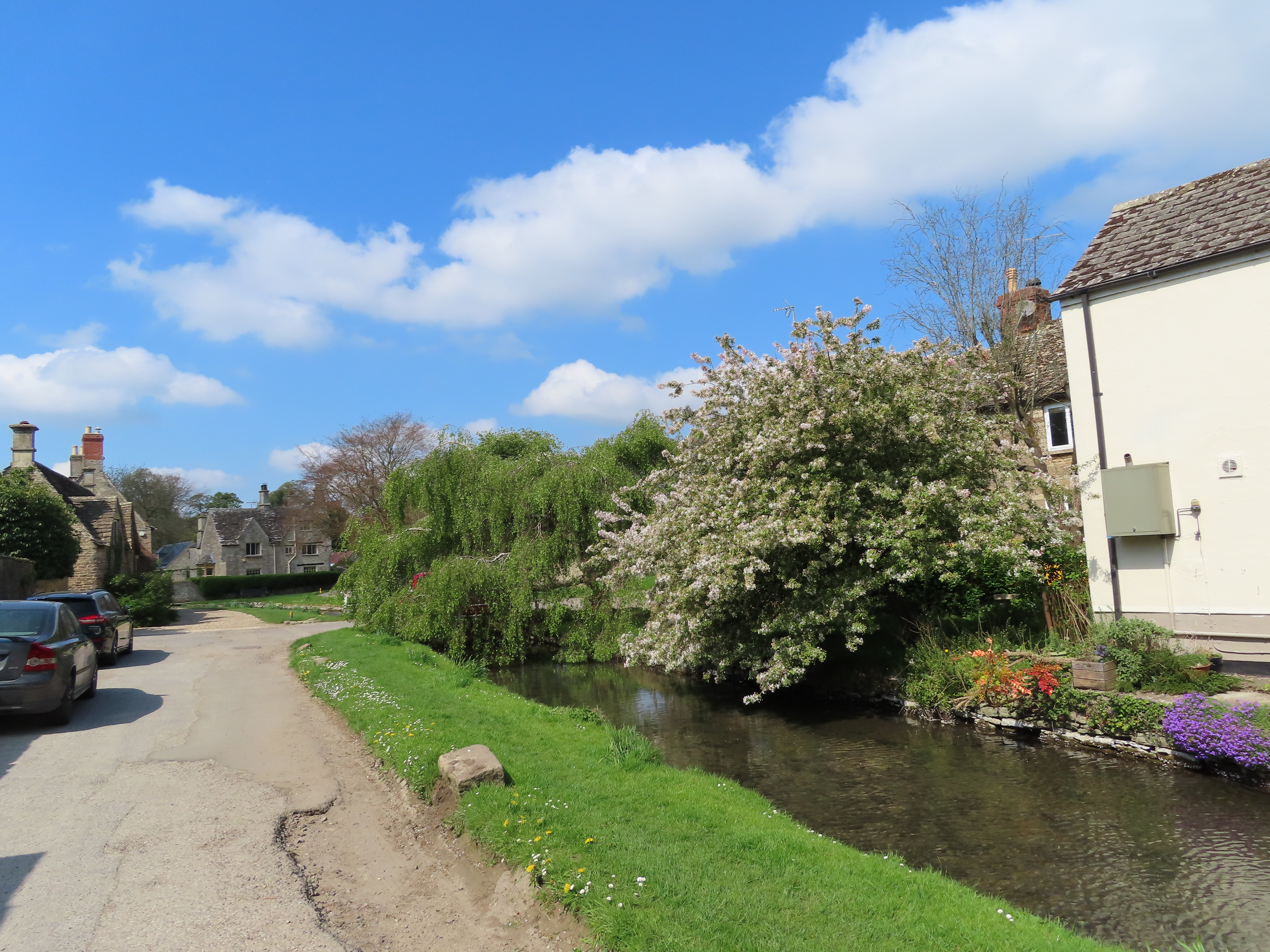
The river upstream from Cricklade’s Town Bridge, which helpfully labels it right where the name starts to lose stable meaning.

Start: Cricklade (no train station; buses to Swindon)
End: Thames Head (nearest station: Kemble)
Length: 19.7km/12.25 miles
Location: Wiltshire – Wiltshire; Gloucestershire – Cotswold
 
Topics: Cricklade North Meadow, the Cotswold Water Park, Ashton Keynes, Somerford Keynes, Ewen, Kemble, Thames Head and the Source
 

Tuesday 5 April 2022

THAMES: 19) The Passages


Lechlade and Cricklade. The Thames’s highest towns. Here at last is the river’s cradle, its nest of honey-and-mustard Cotswold limestone.
 
Narrow, shallow and clogged with vegetation, the river from here on up is unnavigable to all but the most tenacious of small craft.
Cricklade, the river’s uppermost town and goal of this the penultimate section.
But the foggy cloak of a hesitant spring sky hangs heavy over a world whose wheels, already juddering when this expedition began some thirty months ago, now appear to be spinning clean off.
 
The COVID-19 pandemic, and the ongoing vengeance of twisted authoritarian power fantasies – in Syria, in Yemen, in Myanmar, in Ethiopia, in Afghanistan, and now the invasion of Ukraine by Putin’s Russia – have drowned in blood any remaining illusion that humankind, morally and politically, has improved in the course of its own journey of millennia. In England the abuses noted on the way up this river have yet to explode on the sheer scale of those disasters, but easily belong to the same trajectory of arrogance, cruelty, corruption, contempt for the different, and forsaking of reality for a fortress of self-aggrandising lies. The fleeting promise of modernity, of a future for humanity better than its past, lies in tatters; replaced, it seems, by one of fresh atrocities as vile as any in human history.
 
In such a world, disillusionment is rational. Rage; futility; doubts, in all sincerity, about whether humanity is a life-form that can solve its own problems. In such despair, projects like this one come to feel meaningless. After all, with no disrespect to the good natives of Lechlade and Cricklade, are we to expect their hinterland of fields and brooks to hold the remedies to this nightmare?
 
 
Well, their stories do matter. For a start, they too participate in a world where nowhere is truly far anymore.
 
Lechlade’s Thames Street – for now, in honour and solidarity, part of Cotswold Raion, Gloucester Oblast, Ukraine. This must be the first time in this region’s history that the Ukrainian bicolour flutters from its masts and flagpoles, in a startling echo of its blue streams and yellow-gold cottages.
The illusion of these towns’ high remoteness trickles even through the sound of their names. They alone on this river carry the element -lade, an obscure echo of Anglo-Saxon Old English (ge)lād which indicates a passage or crossing of some kind. It’s unclear whether this means a passage across the river, i.e. a ford; or a passage of the water itself, perhaps indicating some of the many little tributaries which merge on these meadows and journey on together as the dark river.
 
Their service to human passage was clear enough. Dwelling on the Thames’s flood-prone headwaters at its furthest point reachable by boat, and so close to where it gives way to its mighty and storied neighbour, the Severn, these two towns’ situations – Lechlade as a trade post, Cricklade as a strategic junction – have been pivotal. On this journey up they are the final threshold, the passages to the Cotswold nurseries, the beginning of the end. But for the water, they lead to everywhere in the world.
 
Upstream from Lechlade’s Halfpenny Bridge. The Thames’s uppermost boatyard can be glimpsed through the trees.
 
Start: Lechlade (no train station; buses from Swindon via Highworth)
End: Cricklade (no train station; buses to Swindon)
Length: 16.8km/10.5 miles
Location: Gloucestershire – Cotswold; Wiltshire – Swindon, Wiltshire
 
Topics: Lechlade, the Thames and Severn Canal and limit of navigation, Inglesham, Kempsford, Castle Eaton, Cricklade