Thames Head, they’ve called these meadows since
time immemorial. Here, they say, the river is born, in dandelion carpets
beneath a broad Cotswold sky.
Folk reckoning was buttressed over
the centuries by journalists’ and travellers’ articles, scholarly opinion, and
eventually by formal recognition from the Ordnance Survey and Thames Conservancy.
On account of the last a marker stone now stands in these fields,
officially recognising its base as the source of the River Thames.
But is it?
 |
| One of the river’s many
headwater channels runs through the village of Ashton Keynes. It claims this
channel as the true river. But who can say for sure? |
 |
| Cricklade’s North Meadow,
putting on its annual display of snake’s head fritillaries. |
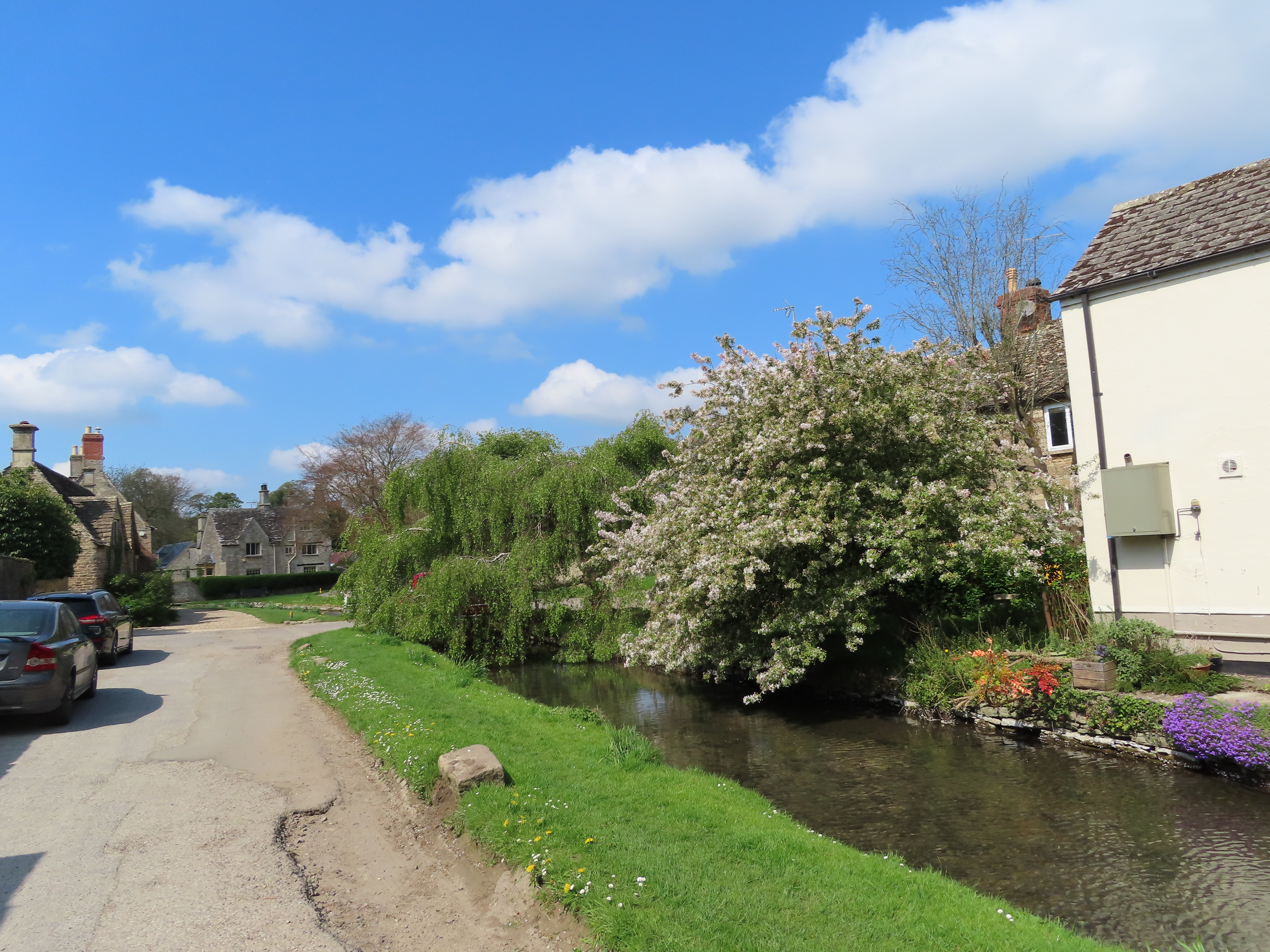
Above Cricklade the river breaks into
a maze of headwaters and ceases to exist in the singular. These waterways’ differences
in length, depth and flow are trivial now, and they come and go with the
seasons, making any attempt to designate one or another as the true or main
Thames arbitrary. However, if you follow one of these channels –
officially a tributary, the Churn – you will come to a spot further north called Seven Springs, where a different marker stone, backed
up by a notice from the local council, identifies that site, ‘despite the
controversy over the years’, as the ultimate source of the river.
There’s a problem here. It’s a
sensitive one. This is the English’s principal river. It's fed and watered them, inspired them, flooded them, borne them in and out on their migrations, their trades, their
wars, their nation-building dreams, their industrial and imperial madnesses – but where,
in the first place, does it come from?
Clearly this dispute had all the
ingredients for violent upheaval across these restive western provinces, and in
1937 it made it into parliament. The representative for Stroud, a Mr. Perkins,
whose constituency included Seven Springs, insisted to the Agriculture Minister
that Seven Springs was in fact the ‘correct’ source on the grounds that it was
fourteen miles further from the estuary than Thames Head, as well as twice its
height above sea level. The next Ordnance Survey map, he argued, would do
well to mark it accordingly.
This would indeed have reflected
established geographic practice for reckoning a river’s source, while not
incidentally making the Thames longer than the Severn. But the pertinent fact
wasn’t one of distances or elevations. Rather it was that Mr. Morrison, the
Agriculture Minister, just happened to be the MP for Cirencester whose
territory included Thames Head. And so he replied: ‘I understand that it is not
an invariable rule...to regard as the source...the source of the tributary
most distant from its estuary’. Further challenged, to laughter, that Thames Head also periodically dries up (likewise true), he simply shut the matter down: ‘I
am aware of these considerations, but they do not alter my view, as confirmed,
that the River Thames rises in my constituency and not in that of my honourable
friend.’
As so often in this world, it seems the
question of the source is a question not of truth, but of power.
 |
| In that connection, let the
statement of this field and sky offer some strength, however small, to whoever
needs it right now. |
What says the river itself?
Well, the reality of rivers is that
they don’t gush from a single point. They accumulate, diverse and
disparate, all the way down their drainage basins. For a few seconds you
are a source too, whenever in the course of a walk like this you spill your
flask or pee in the bushes. Then it flows into the sea, rises as cloud, and
falls as rain to begin the journey all over again.
In which case, perhaps the
nineteenth-century scientist Thomas Huxley, in an 1869 geography lecture, put
it best:
Perhaps much else does too – but not this journey. 250
kilometres and two and a half years from the ‘cold, fog,
tempests, disease, exile and death’ of the estuary, as Marlow in Heart of
Darkness had it – and finding this still quite a fair description all the
way up – we attain the edge-of-the-world sunlit slopes where the water’s trail
is lost. And because this expedition (or perhaps thankfully, this text) has to end
somewhere, let it take as its destination, arbitrarily of course, the place
where centuries’ weight in custom marks, if not the One True Source, then the human
commemoration of those water molecules’ reunion, there and everywhere, into
that party which, in its journey together, has come to be known as the river –
the Dark River – the Thames.
 |
| The river upstream from
Cricklade’s Town Bridge, which helpfully labels it right where the name starts
to lose stable meaning. |
End: Thames Head (nearest station:
Kemble)
Length: 19.7km/12.25 miles
Location: Wiltshire – Wiltshire;
Gloucestershire – Cotswold
Topics: Cricklade North Meadow, the
Cotswold Water Park, Ashton Keynes, Somerford Keynes, Ewen, Kemble, Thames
Head and the Source
Cricklade North Meadow
Above the first (or last) town on the
Thames (as Cricklade styles itself), the Thames, the Churn, and a
network of smaller braids have created a patchwork of seasonal flood meadows.
The largest of these is Cricklade’s natural highlight: North Meadow, a
common hay meadow whose traditional management practices have made it an
extraordinarily diverse national nature reserve.
 |
| Smaller meadows buffer the
main North Meadow as well as the housing along Cricklade’s northern flank. |
 |
| The houses follow what was
originally the north wall of the Cricklade Anglo-Saxon burh. Further west you have these, part
of its twentieth-century residential expansion. |
As is in evidence here, Cricklade’s fortified
settlement has long been surrounded by agriculture.
 |
| Horses are attended to at this
small riverside farm. |
 |
| The weir on this site
apparently used to belong to Cricklade’s West Mill, till it was demolished in
the 1920s or 30s by the Thames Conservancy. Its replacement appears to be an
Environment Agency gauging weir. |
 |
| North Meadow. |
North Meadow operates under the Lammas
land system: hay is planted in February and harvested around Lammas Day
(traditionally August 12th), after which the meadow is kept open as a common
flood-pasture for grazing animals through the remaining half of the year. Over eight
centuries this cycle, still administered by Cricklade’s ancestral manorial
court system (the Court Leet) with more recent support from
Natural England, has turned this meadow into one of the biologically richest
grasslands in the country. Its ecosystem harbours over 250 species of wild
plant, but one in particular stands as Cricklade’s special symbol.
 |
| One with whose peak flowering
this walk just happens to coincide, producing a breathtaking final display to see
out this journey. |
The snake’s head fritillary, Fritillaria
meleagris, used to grow widespread in this country till centuries of meadow
clearances for agriculture and over-collection for markets and flower shows
drove its wild population to the brink. Now protected by law, Cricklade’s North
Meadow happens to be this flower’s main surviving stronghold; the fritillaries
here are thought to make up some 80% of those remaining in England.
 |
| Most of the fritillary flowers
are purple, but white ones are on the increase. |
 |
| People used to pick these
freely, but it’s now prohibited. The meadow has sustained damage from
trampling, as well as from dogs disturbing ground-nesting birds and leaving
deposits which pollute the soil with phosphorus. There are now severe penalties
for even leaving the footpaths. |
 |
| Hard as it might be to
believe, this little stream is the Thames. |
 |
| Supposedly this bridge used to
carry a small canal, a branch of the Thames and Severn Canal now repurposed as a public
bridleway. |
If you’re here in good season you’ll
want to take your time in North Meadow, so make sure to factor it into your
walking plans.
 |
| Don’t forget the plentiful
non-fritillary species either. The rich plant life supports thriving
communities of insects, reptiles and birds. |
 |
| You can check this webpage for live updates on the
fritillary situation courtesy of Cricklade Court Leet. |
Then there’s a little more farmland
to cross.
 |
| Fortunately there are nuuo. |
 |
| Like this. |
This region is not actually quite as
remote as the sweeping peripheries from here to the Oxford Basin. The invisible
presence here is Cirencester: a market town north up the Churn (whence Ciren) that was the Iron Age capital of
the Dobunni people, before their Roman allies fortified and developed it as Corinium
Dobunnorum, the second-largest city in Roman Britain. Later re-emerging as
a rich Cotswold wool town, it is now the effective capital of the Cotswold Hills
and has dragged a constellation of high-prestige agriculture, trade and tourism
into an orbital zone which sweeps across the Thames’s springs.
 |
| This bridge used to carry a
railway from Cirencester to Swindon, a large railway junction town down in
Wiltshire. |
 |
| The railway lasted till the
1960s, when it fell victim to the Beeching Axe. Its noticeably straight embankment
survives as this riverside footpath. |
At length the river curls around the
tiny hamlet of Hailstone Hill, an outpost of Cricklade – and then is ambushed
by a most audacious geographical rearrangement.
 |
| This area is home to a large
population of great and blue tits. They like to wait till you have your camera
exactly ready then fly off at the last second. |
Cotswold Water Park (East)
The Cotswold Hills are renowned for
their yellow mid-Jurassic limestone, about 150 million years old and much in
favour as a local building material. But in low-lying valleys like the
Thames’s, a more recent half-million years of Ice Age glacial melts have carpeted
this rock in huge deposits of gravelly debris. Over a still more recent fifty
years, industrial-scale quarrying for this gravel to make concrete has carved this
landscape to pieces: gouging out pits, ripping apart hedgerows and waterways,
and throwing the water table into upheaval right here amidst the river’s
ancestral springs.
As they deplete the old pits and move
on to new ones, they leave the river’s channels to fill them in. The outcome is a sprawling mosaic of some 150 artificial
lakes, and increasing – which, as though it makes it all okay, have together
been re-imagined into the Cotswold Water Park.
 |
| The first glimpse of this
handiwork is the Cleveland Lakes, which make up the southeastern-most marl lake
cluster. They encompass one of the Water Park’s several waterfowl-rich nature
reserves. |
 |
| This atmospheric old farm
bridge retires on the lakes’ southern perimeter. |
The Cotswold Water Park now sprawls
over a hundred square kilometres and incorporates a matching sprawl of human activity.
Large swathes have emerged as thriving wildlife sites and received protection
as nature reserves or Sites of Special Scientific Interest (SSSIs),
but the smiling face of the thing is recreational: a middle-class wonderland of
sailing, fishing, birdwatching, watersports and holiday cottage retreats.
 |
| Camping and boating on the
Cleveland Lakes. The Water Park was previously run by a company, but it went
defunct in 2012 when its chief executive was imprisoned for massive fraud after pocketing some £700,000 at the Water Park’s expense. It’s now overseen by
a coalition of registered charity trusts. |
 |
| Water-skating in action,
complete with ramp for high-decibel somersaulting. Precious contact point
between humans and nature? Or shocking desecration of the Thames’s hallowed spawning
grounds? The debate goes on. |
 |
| Across the lake, a
gravel-hungry yellow monster prowls through the trees. |
 |
| The river somehow keeps its
identity as it threads between the lakes, many of which it feeds through
underground culverts. |
Eventually the river breaks from this
latter-day lakeland, and trickles round its southern rim to skirt the largely
vanished hamlet of Waterhay.
 |
| Further ahead the river joins
the Swill Brook, which comes in from the west. Officially a tributary, the
Swill Brook is actually larger than the designated Thames, most likely a
result of the gravel mining. It’s a reminder of the river’s distributed
sources and how they change over time. |
 |
| Nuuo. |
 |
| This too might have been a
headwater channel till the quarrying ruined its flow. |
From here the trail leaves the river
to cut between two more lakes, before rejoining it in the village of Ashton
Keynes.
 |
| Even where they haven’t
quarried, the gravelly terrain is in evidence. |
|
 |
| This lake and its partner
appear to be part of the nature reserve, hence the absence of touristy
troublemaking. |
 |
| A fairly uncommon orange tip
butterfly. |
Ashton Keynes
This village is the last to make
immediate contact with the river. Ashton Keynes sits on two
main channels and multiple smaller ones, of which the one that runs through its
middle, it claims, is the main Thames. If we accept that, it gives the
village a surprising distinction: the only settlement, barring London (too
wrong to count), to stand astride the Thames on both banks.
 |
| Young woods and sports fields
on Ashton Keynes’s southern approach. |
 |
| The sports fields are lively
on this warm spring weekend. |
 |
| For a small Cotswold village
it has a fearsome militia that will visit you at night if you dispute the
matter of which channel is the proper Thames. |
 |
| The bluebells are out in force
today. |
Settlement at Ashton Keynes is
ancient, with much archaeological evidence uncovered by the
gravel digging. Ashton is thought to have indicated a place where ash
trees grew, and is the more ancestral part of the village’s double-barrelled
name. It gained the other when following the Norman conquest its manor fell
under the control of the de Cahaignes family: a powerful dynasty which built a
castle on the village’s north flank (whose earthworks remain), acquired
widespread lands, and whose best-known output was a certain John Maynard
Keynes, the characterful twentieth-century economist.
 |
| This channel that flows along Ashton Keynes’s high street is officially considered the main
Thames. It’s probably safest not to challenge that claim too loud here. |
 |
| They’ve even wheeled out the
old man of the river to cement that claim, probably paying him to hit those who
contest it with his shovel. |
 |
| It’s a picturesque place, but
its intercourse with the river’s web of channels makes it highly susceptible to
flooding. |
 |
| In recent decades the village
has served as a node for both the gravel quarrying and Cotswold Water Park
tourism. At right is what used to be one of its four market crosses; all four
were smashed by the parliamentary Puritans during the civil wars. |
 |
| By another ruined cross the
river flows in from the northwest. |
Cotswold Water Park (West)
Above Ashton Keynes, the infant river
braves another cluster of Cotswold Water Park pit-lakes. This western zone is
centred around a chunk of holiday homes, with its lakeshores comfortably done
up for paid leisure-class recreations.
 |
| The river enters Ashton Keynes
beneath this little mill sluice... |
 |
| It briefly takes on a
canal-like appearance here, perhaps having been worked for the manor’s
milling. |
 |
| The next round of lakes
begins. |
 |
| If everything suddenly falls
down, it’s because this fellow has pulled out the bit that kept it standing. |
This side of the Water Park is jarring.
The river threads between its lakes as before, but the sense is of a
constant effort to segregate their worlds, as geographically nonsensical as
that may seem. Wicker and wire fences, code-locked gates and private property
signs abound, altogether suggesting that the capitalist classes begrudge the
public right of way along the river and would like to make it absolutely clear
that everything else in this landscape is for paying customers only.
 |
| They’ve even assembled wooden
llama golems that will headbutt you if you cross into their lakeside amenities. |
 |
| The gated entrance to what
used to be the Lower Mill Farm, which fed the local animals when this area was
still agricultural. It’s now the Lower Mill Estate of posh holiday
accommodation. |
 |
| Now pay up. |
Somerford Keynes
Another ancient settlement stretches
out along the Water Park’s northwest escape road. Somerford Keynes
eventually became an appendage of the local Keynes domain. The more
important part of its name, Somerford, suggests it was a summer fording
point, back when the river was still consistently too high to wade across.
 |
| Somerford Keynes is small and
largely residential. |
 |
| It’s a bit of a diversion from
the river, but well-positioned for a rest stop and some lunch at the friendly and recommendable The Bakers Arms pub. |
 |
| Victorian “restoration” swept
away much of the village’s All Saints Church’s historic features, but its
oldest elements go back to the seventh century. Somerford Keynes first appears
in writing at that time, as a land grant to the monastery at Malmesbury. |
 |
| An extremely Cotswold
structure. |
 |
| Once an English national icon,
red telephone boxes have gone into drastic decline with the rise of the mobile
phone, and now only about 10,000 remain. Many have been repurposed as art
installations, mini-libraries, or defibrillator boxes like this one. |
The river glides down in parallel
with Somerford Keynes to the west, through the suggestively-named Neigh Bridge
Country Park.
 |
| Neigh Bridge Lake is the last
of the Cotswold Water Park gravel-lakes. The name appears to indicate a bridge
that was used in winter when the ‘summer ford’ was impassable. |
 |
| The river is very shallow here,
and regularly splashed in by dogs and small children. |
 |
| Again, you are challenged to
imagine that this is the same water that carved through the Chiltern chalk, drenched
the southern marshlands, and still courses in raging bulk through both the
reality and imagination of English metropolitan power. |
 |
| Another glimpse of Somerford
Keynes’s church, from across the farm fields of its former manor. |
At last we are clear of the gravel-mining
legacy. We are more or less there now. From here a soft stretch of farms and
hamlets ease the Thames from its springs, whose aquifer spreads
wide beneath this soil. As for where exactly it breaks the surface – well,
that depends.
 |
| In dry periods it’s been known
to trickle out around here near Neigh Bridge, leaving its upper course dry. On
this particular day there’s mileage in it yet. |
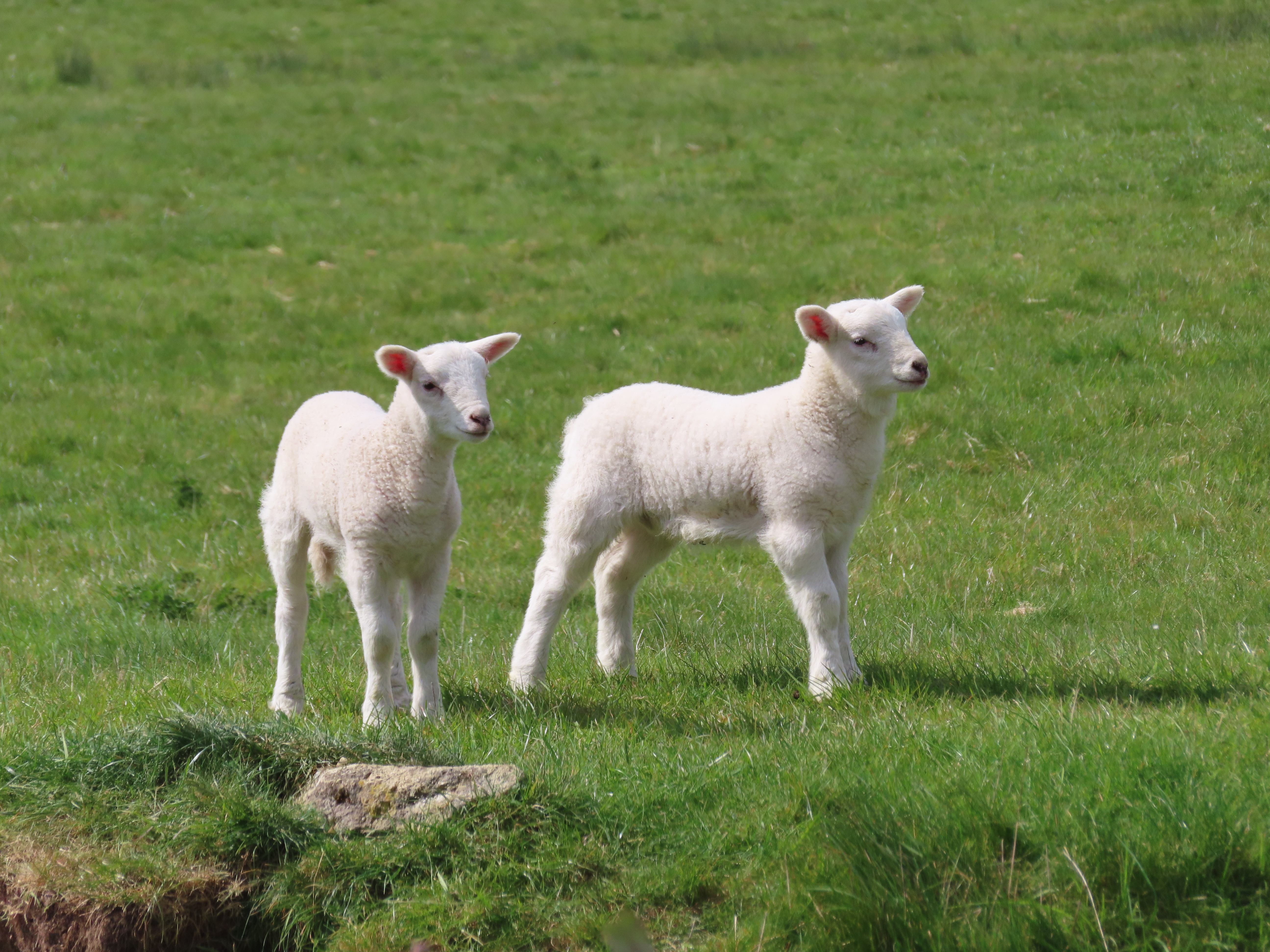
The water is not the only thing
that’s recently emerged on these farms.
 |
| Old Mill Farm is part working
sheep farm, part rental holiday cottages which offer interaction with the lambs
as part of their charm. |
 |
| There are definite advantages
to doing this walk in spring. |
A strange tranquility descends
on these fields now. Amidst birdsong and the whoosh of a cool north wind,
animals and structures alike line up to let you know you approach significant
ground.
 |
| Ever narrower, ever
shallower. |
 |
| These are special calves – the
final nuuo of the journey. |
Ewen
You’d be forgiven for thinking that Ewen
heralds the end, given its name supposedly indicates the source of a river.
We’re not quite there yet though.
 |
| On and on and on and on... |
 |
| This well-disguised gateway to
the underworld is where you’ll respawn if you get killed between here and the
source. |
 |
| Ewen appears. |
Ewen is another quintessential tiny Cotswold
hamlet, almost entirely residential and with typical appeal for holiday
getaways. It is significant as the former site of what was probably the highest
mill on the Thames, before the gravel-mining drained the water table.
 |
| Ewen’s central T-junction. |
 |
| Ewen’s other T-junction.
Variety isn’t the main draw here. |
 |
| Most of it looks rather like
this. |
 |
| This is an Angry Ear Vine,
which crunches up its leaves as a sign of exasperation with the poor quality of
English political discourse. |
Kemble
From Ewen it’s only a short push on
to the river’s highest settlement of all.
 |
| Yes, that’s the river on the left. |
 |
| The houses of Kemble manifest
across gloriously golden rapeseed fields. |
 |
| Yellow joins the established
greens and blues as the third colour of the Thames’s fountains. |
 |
| Despite being the river’s
highest settlement, Kemble makes trouble by actually being set back from it a
kilometre or so, requiring a diversion unless you’re straggling there
afterwards to leave via its train station. |
Though not particularly large, Kemble
punches above its weight by its proximity to both Cirencester, to the northeast
up the Roman Fosse Way, and the Cotswold Airport to its west. Formerly a
WWII-era RAF base, the latter was indeed known as Kemble Airport till
they changed its name in 2009, no doubt in a deliberate assault on the
village’s pride.
 |
| Kemble is predominantly
residential, and bears a quiet history that goes back through Anglo-Saxon
settlement to service to Roman traffic. |
 |
| Kemble also breaks the pattern
of these interior settlements by holding on to a working train station – on the
London-Cheltenham main line at that, with regular services to Paddington within
an hour. It was a key regional junction till its other lines fell to Beeching
in the 1960s. The station is an original Brunel creation from 1845, complete
with a little internal garden area. |
 |
| The waiting room for the
station’s invisible sky-platform, whose services connect the source of the
Thames to other worlds. |
Thames
Head
Well, let’s suppose there is no “true”
source; that the source is everywhere some of the time and nowhere all at once.
Let us say that this channel, which
they’ve (mostly) decided is the “actual” Thames, is just one of many where its
water begins (or repeats) that new (or old) stage of its journey as a liquid surface flow.
Is there at least a spot, then, where
it emerges from the ground?
Even this is not so simple.
 |
| The first of three or four
fields north of Kemble, any of which, on a given day, might be the active
springs. The dry stream beneath this bridge is itself another tributary in
wetter periods. |
 |
| Into the next field, and here
is its emergence: the source – or a source – for the moment, if not
yesterday or tomorrow. |
 |
| A helpful indicator of the
water’s shallowness: approximately 0.1 Woofs. |
In one sense – the immediate, the
particular – this is the end. The water recedes to nothing here: goes to
nowhere, comes from nowhere. This is the source.
 |
| Final sight of the water.
Here it ends; here it begins; here it carries on. |
 |
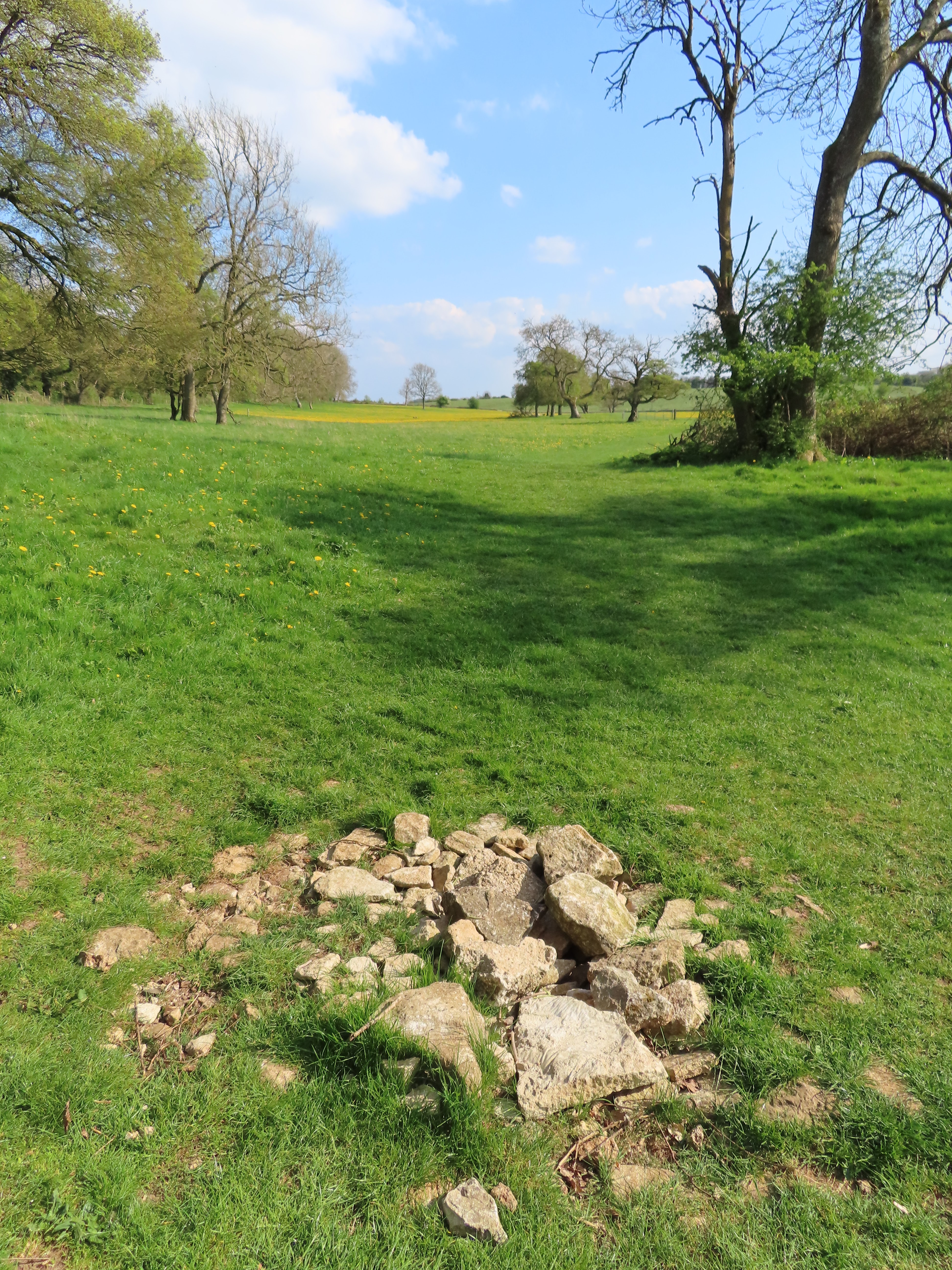
| On the other side of the
trees, the channel is dry. But notice the stones that people have piled up
here, as though to mark this spot as another regular source when wetter weather
raises the groundwater. |
Given this variability, it might be
more fitting to consider all of these fields the source. And perhaps we
have it easy; imagine how still more confounding the question is for rivers
that come from marshes, lakes, or glaciers. Nonetheless, humans seem to enjoy
reducing complex, chaotic realities to over-simplified imaginary absolute
truths, so inevitably they’d put down an officious marker on a single spot as
though to declare it The Source in all times and conditions.
By its arbitrary nature you might
expect such a thing to be anticlimactic, if not some downright tacky tourist
trap. But having come this far we might as well find it, at the
highest place on these springs to be found frequently wet. It awaits in the
next field, across one last major piece of history.
 |
| The A433, once upon a time
known as the Fosse Way. |
The Fosse Way is thought to
have originated as a boundary: the outer frontier of the first phase of Roman
rule following the emperor Claudius’s conquest of this island in 43 CE. It most
likely started as a defensive ditch, or fossa in Latin. Then
Roman-controlled territory expanded and the ditch turned into a road, connecting
two key forts – Lincoln (then Lindum Colonia) in the northeast, and Exeter
(then Isca Dumnoniorum) in the southwest – in a long diagonal all the way
across the island.
Though now fragmented, most of it
survives within the present-day road system, with parts easy to
distinguish on maps for their striking straightness. The segment which here
follows the A433 across the infant river was important in its own right,
linking as it still does the pivotal Roman centres of Corinium Dobunnorum
(Cirencester) and Aquae Sulis (Bath).
 |
| The final field, known as
Trewsbury Mead, with the Fosse Way at right. The depression down the
middle of the field is the currently-dry riverbed. |
For an anti-climax this place is atmospheric. The growl of traffic on the A433 recedes beneath an
oasis-like solitude of sweeping winds, creaking boughs, and daffodils springing
as though from blessed ground.
 |
| Even without water, the
river’s regular route through this grass is conspicuous. |
 |
| This stone wall is said to
have been built for easy passage by the river underneath. |
This exploration began late in 2019,
amidst the still-ongoing turmoil of Brexit. In the course of the journey, England and this world have further staggered from devastating
blows which took many by surprise, but were really escalations of the same
malaises already dragging humankind back into its own historical river of
catastrophes. They included the disastrous response to the COVID-19 pandemic,
which forced a year-long interruption at
this journey’s halfway point; and now, as another set of violent nativists take out their demented fantasies on the Ukrainians, humanity is left reeling from a new round of bloodthirsty atrocities and promises of nuclear annihilation.
It
comes from nowhere; it turns round in a circle.
Lives, hopes and dreams, mown to
oblivion for no reason at all. A love-capable lifeform, with the proven will
and capacity to strain its senses to the very limits of time and space – crushed
back to a fraction of its potential by the same shameful brutalities and senseless systems of belief and practice, which, though they shouldn't exist, should never have existed, have disembowelled every generation's best efforts to banish them.
It comes
from nowhere; it turns round in a circle.
 |
| The final gate – and of course
it’d be a gate to nowhere. Goodness knows what it’s doing here. |
 |
| They probably wanted to put up
arches, banners or pillars or something to mark the birth of their great river, but
with austerity cutting them to the bone, this had to do. |
It’s also been personally tumultuous. My
expectation was never to get this far. Rather, while stranded in this country
after a near-annihilation of my own in Japan, I got into a daze of wandering
that at length, led to this river, this quiet presence in the background of my
life since my earliest ill-fated involvements with this country.
To setting off up it,
and seeing how far I could go.
That question, at least, finds its
answer here.
 |
| The “official” source, as the
Thames Conservancy and succession of hands that put these stones here would
have it. |
 |
| Want to walk all the way
back? |
 |
| The North Sea is that way. |
I can’t pretend things have improved.
True, these thirty months brought the completion of my most significant writings so far, as well as some of the most inspiring encounters I have known. But
inseparably, they have also been a gauntlet of further traumatic disasters – all embittering, all exhausting, all harrowingly painful, and always, always on account of humans, whose ways I find as impossibly alien and twisted as ever.
It's beyond words now; beyond comprehension. This world shall never be my home. I set off up the Dark
River in darkness, and now take leave of it in darkness.
It comes
from nowhere; it turns round in a circle.
But to the river – I pay
tribute. It’s been as reliable a friend as any in this beleaguered world.
Perhaps I owe my future to it, since, sixteen years ago now, driven into existential
crisis by this society, saturated with agony and lost in an infinite desert of care, support or understanding, I could do none other
than seek a final way out through its water – perhaps the very water that now
cycles back beneath this soil – only to be sent back, through the shock of its
cool embrace, with the flicker of a thought that perhaps, just perhaps, there
was more I could yet do for this world.
If that was the Thames’s doing, then
it’s a fitting honour to have got to know it in its entirety. So I part from it
with this wish: that one day, it will have the pleasure to flow through a
nation free at last from this abyssal cycle of poverty and corruption, lies and
abuse; a nation setting off up a newfound path of honesty, responsibility and compassion, as befits the river’s
ever-generous gifts to it. Would that these reflections of mine, from estuary to source – however
partial, poor-sighted or plain exasperating – provide at least some
small contribution to those who would make it so.
Chaobang, April 2022


%20Cricklade%20to%20the%20Source.png)


No comments:
Post a Comment