Lechlade and Cricklade. The Thames’s highest
towns. Here at last is the river’s cradle, its nest of honey-and-mustard Cotswold
limestone.
 |
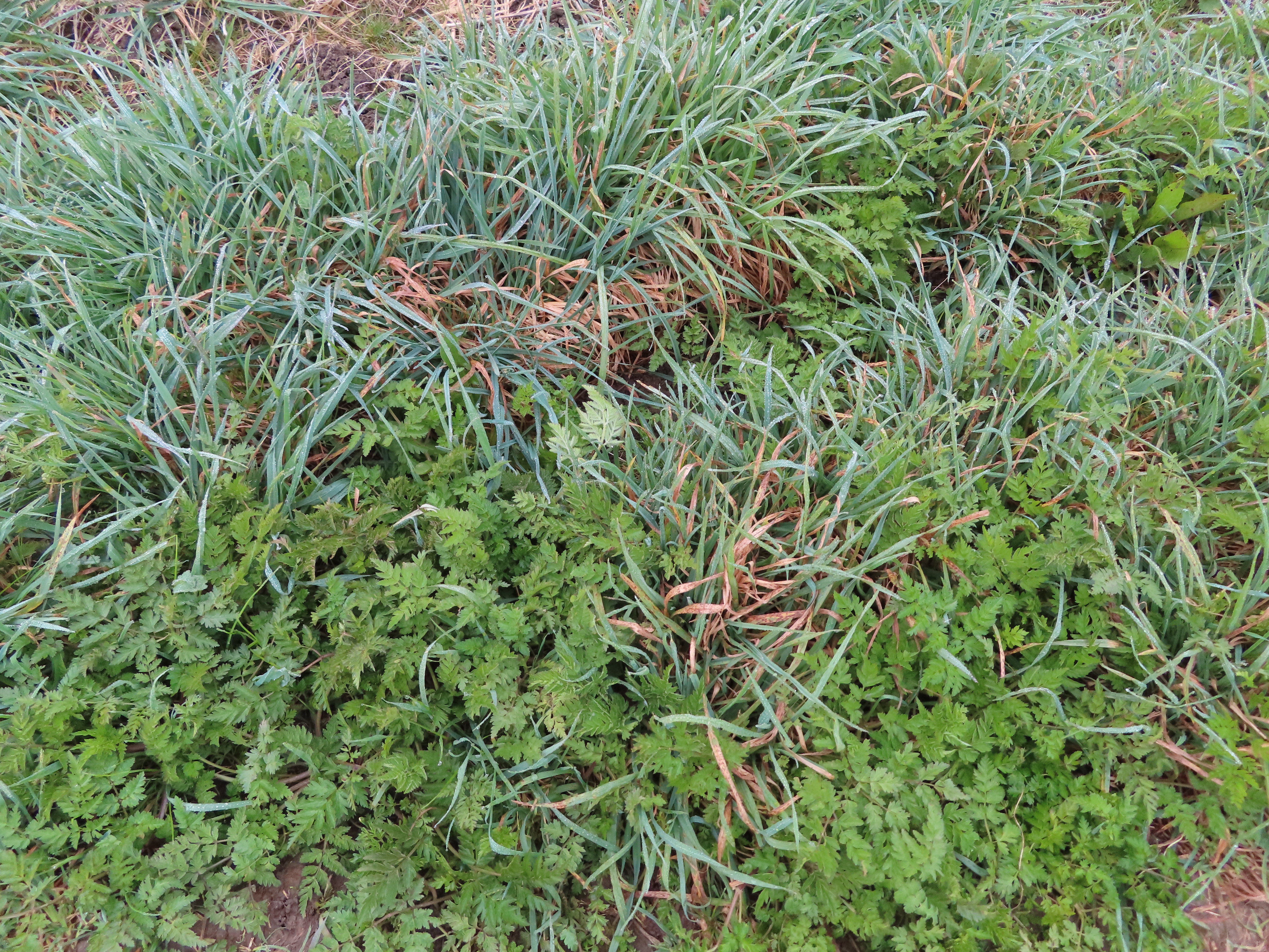
| Narrow, shallow and clogged
with vegetation, the river from here on up is unnavigable to all but the most
tenacious of small craft. |
 |
| Cricklade, the river’s
uppermost town and goal of this the penultimate section. |
But the foggy cloak of a hesitant spring sky hangs heavy over a world whose
wheels, already juddering when this expedition began some thirty months ago,
now appear to be spinning clean off.
The COVID-19 pandemic, and the ongoing
vengeance of twisted authoritarian power fantasies – in Syria, in Yemen, in
Myanmar, in Ethiopia, in Afghanistan, and now the invasion of Ukraine by
Putin’s Russia – have drowned in blood any remaining illusion that humankind,
morally and politically, has improved in the course of its own journey
of millennia. In England the abuses noted on the way up this river have yet to
explode on the sheer scale of those disasters, but easily belong to the same
trajectory of arrogance, cruelty, corruption, contempt for the different, and
forsaking of reality for a fortress of self-aggrandising lies. The fleeting promise
of modernity, of a future for humanity better than its past, lies in tatters;
replaced, it seems, by one of fresh atrocities as vile as any in human history.
In such a world, disillusionment is
rational. Rage; futility; doubts, in all sincerity, about whether humanity is a
life-form that can solve its own problems. In such despair, projects like this
one come to feel meaningless. After all, with no disrespect to the good natives
of Lechlade and Cricklade, are we to expect their hinterland of fields and
brooks to hold the remedies to this nightmare?
Well, their stories do matter.
For a start, they too participate in a world where nowhere is truly far anymore.
 |
| Lechlade’s Thames Street – for
now, in honour and solidarity, part of Cotswold Raion, Gloucester Oblast,
Ukraine. This must be the first time in this region’s history that the
Ukrainian bicolour flutters from its masts and flagpoles, in a startling echo of its blue streams and yellow-gold cottages. |
The illusion of these towns’ high
remoteness trickles even through the sound of their names. They alone on this
river carry the element -lade, an obscure echo of Anglo-Saxon Old
English (ge)lād which indicates a passage or crossing of some kind.
It’s unclear whether this means a passage across the river, i.e. a ford; or a
passage of the water itself, perhaps indicating some of the many little
tributaries which merge on these meadows and journey on together as the dark river.
Their service to human passage was
clear enough. Dwelling on the Thames’s flood-prone headwaters at its furthest
point reachable by boat, and so close to where it gives way to its mighty
and storied neighbour, the Severn, these two towns’ situations – Lechlade as a
trade post, Cricklade as a strategic junction – have been pivotal. On this journey
up they are the final threshold, the passages to the Cotswold nurseries, the
beginning of the end. But for the water, they lead to everywhere in the world.
 |
| Upstream from Lechlade’s
Halfpenny Bridge. The Thames’s uppermost boatyard can be glimpsed through the
trees. |
Length: 16.8km/10.5 miles
Location: Gloucestershire – Cotswold;
Wiltshire – Swindon, Wiltshire
Topics: Lechlade, the Thames and
Severn Canal and limit of navigation, Inglesham, Kempsford, Castle Eaton, Cricklade
Lechlade
Close to the confluence with the seasonal
River Leach, whence its name, Lechlade is rich in thousands of years of archaeological
remnants: a neolithic cursus, Bronze Age barrows, Iron Age grain
stores, and a villa in the orbit of the Roman administrative centre of Corinium
(now Cirencester). But the current settlement is likely late Anglo-Saxon in
origin, and was sufficiently established by the Norman conquest to appear as Lecelade
in the 1086 Domesday survey.
 |
| The Cotswolds are known for
their beige Jurassic limestone – rich in fossils, but also resistant to
weather, easy to split into blocks, and thus a much-quarried building material which
gives this region's towns and villages their distinct visual character. |
But it was in trade that this town
would build its future. In 1210 it was granted a market charter by King John
(of Magna Carta confrontation fame five
years later, with Isabella’s second husband one of the barons who forced him to
the table). So began Lechlade’s rise as an inland port, feeding downriver the
lucrative goods for which it grew to serve as a waystation: Cotswold wool,
Worcester salt, Taynton stone, and of course, Gloucester cheese.
 |
| Lechlade town centre, with St.
Lawrence’s Church as its focal point. The town’s famous marketplace made use of this space till its final closure in 1928. |
Lechlade’s sizeable church suggests
how lucrative. St. Lawrence’s is one of the Cotswold ‘wool churches’,
larger-than-life piles of prestige built on huge donations from local wool
farmers and merchants as a statement of their sway. It grew up in the 1470s,
partly out of materials from Isabella’s priory which shut down in financial
difficulties a few years earlier. Decked in elaborate stonework with plentiful carvings
of the woolmongers and their clout-bearing emblems, the church’s tall spire soars
above the surrounding landscape, thus doing long practical service too as a landmark
for river or road travellers straggling through these rural reaches.
 |
| The spire was added around
1510 by Katherine of Aragon, Henry VIII’s first wife, who came into control of
the Lechlade manor at that time. She also appears to have got its dedication
changed to St. Lawrence, who was Spanish like her. |
 |
| Apparently they’re very proud
of their brass chandelier. Later this place’s atmospheric churchyard would
inspire a poem by Percy Shelley, for which in turn they named its path after
him – likely making this one of this country’s few churches to name part of its
premises after an atheist. |
Lechlade attained its heyday on the
approach to industrialisation, as its trade grew increasingly commercialised on
the development of the turnpike, coaching and river transport systems. Wharves,
inns and alehouses flourished in support of this traffic, which exploded onto a
whole new order of magnitude with the completion of the Thames and Severn
Canal a kilometre upstream in 1789. With the navigable Thames, London and
all, now linked to the Severn – Britain’s largest river, with its major western
ports – Lechlade became a junction not only for wool, salt and cheese but also
enormous quantities of coal, iron, copper, tin, and assorted textiles and
foodstuffs travelling down to the capital from England’s western provinces,
while up the other way came timber and gunpowder, much destined no doubt for
the slave-trading atrocities of Bristol.
 |
| The Riverside Inn, by
Lechlade’s Halfpenny Bridge, was formerly a warehouse on one of Lechlade’s
bustling wharves from this period. A shade of the wharf itself lives on as the
boat hire at right. |
 |
| The Halfpenny Bridge dates
from 1792, three years after the Thames and Severn Canal, when it replaced a
ferry as business grew crowded. Supposedly pronounced heypenny, it
refers to the toll (in the old English currency) that it charged pedestrians to
cross till 1839, when they angrily got it abolished. |
As elsewhere, this prosperity receded
in the nineteenth century as railways replaced rivers and canals as the
favoured industrial transport network. This relieved Lechlade of its function
as a key junction, but it did get a railway station of its own in 1873, only to
lose it in 1962 to the Beeching Axe. By the late 1920s the Thames and
Severn Canal was a dilapidated wreck. Though no longer the flourishing trade
post of old, Lechlade took advantage of new forms of road, rail and river
transport to revive itself as a low-key recreational oasis, turning its
traditional agriculture to feed a new influx of rowers, cruisers and tourists. Its
most recent transformation came on account of the world wars, which saw the
Cotswolds sprout a smattering of RAF airbases. Two of these, RAF Brize Norton
and RAF Fairford, remain operational as major employers in these parts, driving
some late-day population growth and residential sprawl out along Lechlade’s
north and west roads.
 |
| So persists Lechlade – much
quieter than it used to be, and known mainly for its status as a picturesque
Ultima Thule for the recreational boaters of today’s Thames. |
The Thames and Severn Canal, and Limit of Navigation
Setting off upstream, we approach a
momentous threshold.
 |
| Through the trees is Lechlade
Marina, the river’s final boatyard. Note the Ukrainian flag on the second-last
boat upstream. |
 |
| Human activity swiftly gives
way to the open fields that constitute most of what remains. |
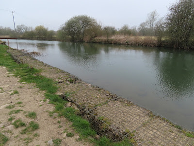 |
| Some gabions they’ve placed to
combat heavy erosion along the riverbank here. This approach to the Thames and
Severn Canal was a critical connection in industrial times and would have likely
experienced much engineering for ease of traffic. |
 |
| But today, this footbridge is
as far as they go. Virtually all watercraft are advised to turn back here. |
Here the Thames and Severn Canal
joined the river, alongside the mouth of a tributary called the Coln. Ostensibly
an idyllic Cotswold limestone stream, the Coln is in fact one of many English
rivers now made filthy through the illegal dumping of sewage by unaccountable water
companies.
 |
| The River Coln enters the
Thames at right. The debris behind the willow stands on the derelict ruin of Inglesham
Lock, at the head of the Thames and Severn Canal. |
 |
| The Inglesham Round House,
one of five that housed the canal’s keepers. The cylindrical design was a
Thames and Severn Canal peculiarity; some of them, like this one, also featured
an inverted conical roof to catch rainwater. After the canal’s decline it was
converted to a private residence. Notice also the ruined footing of a
footbridge (at right) which crossed to the canal’s towpath. |
This site is quite the paradox. For
all practical purposes this is the limit of navigation, the beginning and end
of the line. From here on the natural river prevails: wild, swift, shallow, packed
with weeds and thorns and rushes and low-hanging branches, with no further
locks, weirs, boatyards or other facilities to get anything heavier than a
canoe out of trouble. But for the brief century in which the canal was in
operation, this beginning and end magically became a middle: a water-bridge,
the central passage between the east and west rivers, the North and Celtic
Seas. For this most fleeting of moments, this flit of an English attempt at an
industrial modernity, the Lades, the passages, consummated their name.
Like that modernity, the Thames and
Severn Canal has gone. Also like that modernity, there are people attempting to
revive it – namely the Cotswold Canals Trust, whose armies of volunteers have
since 1972 been pursuing a painstaking multi-phase scheme to restore it as a
recreational waterway. Further like English modernity, these efforts have struggled
with inadequate funding and greedy private landowners, and so remain, at best,
a long-term prospect.
Inglesham
Here then are the true headwaters, uncontrolled,
uncontrollable, above and beyond.
 |
| And inevitably, lurking thick
in its fog, there are nuuo. |
 |
| They see you. |
 |
| And so does...whatever
chilling manifestation this is. Up here the rules of the human world no longer
apply. Be ready to encounter monsters, nightmares or apparitions from any other
level. |
The floodplain across from Lechlade houses
what’s left of Inglesham, one of the many medieval ‘lost villages’ in
these parts. Most of its remaining hundred or so residents have long since
retreated up the road to the farming hamlet of Upper Inglesham, leaving only a
tiny cluster on the riverside meadows...
 |
| Inglesham. |
...and among them, a remarkable
surprise.
Inglesham’s St. John the Baptist
Church is redundant – that is, no longer in use by the English religious
establishment, and left standing only as a piece of civil heritage. We came
across something similar all the way back in Boveney, near
Eton: a mysterious
little temple whose wood and stone, though assembled in service of English
Christianity, seem soaked with whispers of deeper animistic secrets.
 |
| The church’s exterior. The
building dates to around 1205, but has elements that go back to Anglo-Saxon times. |
Extraordinarily, it has survived
largely unaltered to the present day. This makes it one of the very few
churches of such age to withstand successive tides of English religious
violence, from Henry VIII’s assault on the
monasteries to the iconoclastic sledgehammers of the Puritans. Anything that survived those was
then liable to get killed not out of hate by its enemies but, as is so often
the case, by supposed friends insisting it was for their own good – that is, the
over-enthusiastic Victorian restorers who wrecked the churches’ ancient arts,
architectures and atmospheres with flashy and extravagant refurbishments.
That this church escaped that fate is
principally thanks to our recent acquaintance William
Morris, who bristled
with resentment at what he saw as the vandalisms and forgeries of these destructive
‘restorations’. His Society for the Protection of Ancient Buildings advanced an
alternative approach, of repairing and protecting them as treasures of cultural
heritage, and in this capacity Morris personally oversaw this church’s
sensitive repair in the 1880s.
 |
| As a result of Morris fending
off the ‘restorers’, this church retains rare archaic features and fixtures – an
architectural simplicity, carved wooden screens and box pews, wall paintings –
that afford it a profoundly different character from most English churches
today. |
 |
| The wall paintings are mostly
Biblical texts or illustrations. They span the thirteenth to nineteenth
centuries, often with paintings from different periods layered on top of each
other. Despite Morris’s efforts they remain under grave threat from water
ingress, especially after the theft of lead from the roof in 2017. The Churches
Conservation Trust is currently trying to raise money to fix it. |
 |
| One of the building’s most
ancient elements: an Anglo-Saxon stone carving of Mary and the baby Jesus.
Though a common Christian motif, this is a staggering survival in a
spiritually-insecure country which smashed up most of its ancient religious monuments
like this one. |
 |
| And of course it has an
armoured phantom who comes out at night. |
And now it’s time for a long slog
through riverside fields, down which the river comes rolling unimpeded. And straight
out of Inglesham, as if to make totally clear that humans don’t make the rules
here, the fog produces guardians to whom all who would pass must offer tribute.
 |
| Nuuo. |
 |
| Notice how effectively they
have aligned themselves so as to bodily block access to the field. |
 |
| The required tribute differs
depending on what they think of you. And once admitted, they will keep their
gazes fixed on you so you don’t do wrong things on their terrain. |
After that...
 |
| It’s all like this again. |
 |
| And this. There really isn’t
that much else out here. |
 |
| Occasionally this, perhaps. |
At this point historic sites and
narrative landmarks are few and far between, rarely marked on the maps, and
easy to miss when they come.
 |
| The tiny stream beneath this
footbridge is in fact the River Cole. It’s more significant than it looks, with
a very long record of human modification for milling, agriculture, flood
protection, and, since 1995, a major project to restore its natural water
profile and ecology. Much of it runs across protected National Trust land and
marks the provincial border between Oxfordshire and Wiltshire. |
 |
| The river says: “I did tell them
it was unnavigable. They could have listened.” |
 |
| And this must be where the
cows put people who refuse to proffer tribute. |
Through a riverside thicket, another
surprise awaits.
 |
| Spring has yet to reach this part. |
 |
| The trees here are equipped
with ancient laser cannons; be careful not to wake them. |
 |
| Evidence of preparations underway
for the worsening consequences of Brexit. |
At first sight, the field beyond the woods
might be any other.
 |
| One of the extremely few
watercraft of notable size to be found this far up. It’s unlikely to go
anywhere soon. |
 |
| Closer inspection of this
field reveals a not-especially-agricultural instrument. |
This is apparently an active airstrip
– most likely a private one, with a very long taxiway off to a hangar amidst
the farms of Upper Inglesham. Another expression perhaps of the strong imprint
of twentieth-century military aviation in this region.
 |
| From this snarl of thorns the
Bydemill Brook trickles into the Thames. |
 |
| If you approach the tree
barrier, the fog thickens to zero visibility till you stumble into an invisible
wall, and the message appears: “You cannot go further.” |
Kempsford
At this point some thicker strips of
bush occupy the riverbank, forcing a two-kilometre detour over farm fields.
 |
| Red on the left, silver on the
right. |
 |
| English paddy fields? Who
would have thought. |
The river is momentarily rejoined at Hannington
Bridge – which is in fact two bridges, carrying a minor road across the
main river and a side-channel.
 |
| Again, in this high-level
close-to-the-end fog be prepared to encounter creatures from any other zone. |
 |
| These may look like their
cousins from previous areas, but don’t be fooled: their HP and DPS are
extremely high. |
 |
| The river at Hannington
Bridge, dense with vegetation. For those rash enough to take their boats beyond
Lechlade, this is typically about as far as they get before the machetes fall
from their trembling arms and the chains snap off their chainsaws. |
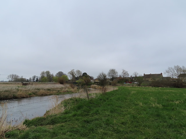
Again the riverside becomes
inaccessible, with wayfarers diverted along side-channels. The south bank here
is a broad web of farm fields, but over to the north the village of Kempsford
sits on the river and the ruined Thames and Severn Canal.
Small and isolated as it is,
Kempsford – whose Anglo-Saxon name, Kynemereforde, is commonly translated
as ‘Ford of the Great Marsh’ – bears some weight in military heritage. It first
appears in the Anglo-Saxon Chronicle in the entry for the year 800, which
tells of an army of the Hwicce, a Gloucestershire people who by then were
clients of Mercia, riding out from this village to do battle with a Kingdom of
Wessex force coming across from the Wiltshire side. Wessex won, but both sides’
commanders were killed. Then after the Norman invasion Kempsford’s manor passed
through a long succession of fighting nobles – most famously John of Gaunt, first
Duke of Lancaster and progenitor of many English monarchs in the late
Plantagenet violence-pit.
 |
| The tower of Kempsford’s St.
Mary’s church overlooks the riverside fields, long in use for archery training. |
 |
| The church is twelfth-century,
but its tower was added by John of Gaunt in the 1390s and acquired a heap of
dynastic emblems. Unlike the little church in Inglesford this one did get a
thorough Victorian ‘restoration’ in the 1850s, so most of its present interior
is recent. |
Today Kempsford’s military story continues
on account of the large RAF Fairford airbase to its north. Built in 1944
to provide air support for the Normandy landings, it remained in use during and
after the Cold War as a base for United States Air Force heavy bombers,
including for the 2003 war of aggression in Iraq. Exercises have continued
there since, with four B-52s arriving just this February amidst the ongoing war
in Ukraine.
 |
| On the south bank the detour
continues to Castle Eaton, past this hostel for extremely small people. |
Castle Eaton
Access to the river is properly
regained at another ford village, Castle Eaton. No-one seems to know if
the castle actually existed or where it was if it did, but there was supposedly
a Norman fortified manor house near the site of the village’s present church.
 |
| Today this village joins the moral
fortification of the human race against Vladimir Putin. |
 |
| Castle Eaton has its own St.
Mary’s church. It has Norman origins (if likewise ‘restored’ by the
Victorians), but most of the village’s Cotswold-stone core seems to be
eighteenth-century or so. |
 |
| Castle Eaton’s Red Lion
pub asserts to be the first (i.e. most upstream) pub on the Thames. |
And from there, it is all open
countryside as far as Cricklade.
 |
| Castle Eaton’s west outskirts.
You can just glimpse its bridge, a ‘deplorable iron trough’ in the words of Thames
explorer Fred Thacker in 1920, which replaced a locally-beloved timber
construction twenty-seven years prior. Another explorer, Charles George Harper,
was equally seething in his 1910 Thames Valley Villages: ‘We cannot
frame to use language too strong for a crime so heinous against the
picturesque’, committed on account of the ‘wicked ways of the Thames
Conservancy’, that most ‘diligent destroyer of the beauty of the river’. |
 |
| A random holiday campsite and
bungalow park crops up outside the riverbend here, with a mysterious older
chalet in its midst. |
 |
A small friend.
|
 |
| One of a cluster of ponds here
that are almost certainly filled-in gravel pits – a herald of their vast constellation
beyond Cricklade that now constitute the Cotswold Water Park. |
If you somehow get a canoe out here,
these stretches seem not quite as impenetrable as those down to Lechlade. But
you would still have to contend with the thick submerged plants and rumours of
monstrous boat-ramming fish.
 |
| It looks sedate enough, after
a good week or two of dry weather. But flood conditions here after heavy rains
must be another matter entirely. |
 |
| Another light thicket. |
 |
| Fields. Reeds. Swans. |
There is extremely little settlement
in reach of the river here. Most of these fields appear attached to some tiny
farm clusters together labelled on the map as Water Eaton – presumably agrarian
offshoots of Castle Eaton.
 |
| This one, for instance. |
 |
| One runs out of things to say
about this terrain. Not much further to go though. |
 |
| The largest bit of Water
Eaton. They appear to have electricity, at least. |
 |
| Not the usual farm field crowd. |
Cricklade
Church towers are about the only
landmarks tall enough to alter the skyline up here. No surprise, then, as to
the first sign of Cricklade that comes in view.
 |
| The four-pointed tower of St.
Sampson’s Church, Cricklade, announces the final waypoint on this expedition. |
 |
| Numerous wooden footbridges
like this span the river on the Cricklade approach. |
 |
| What’s in the pipes? |
Just outside Cricklade, these
reaches’ noisiest human intrusion by far comes soaring in. It is the A419
Cricklade Bypass, part of the Swindon-Cirencester dual carriageway put through
over this concrete bridge in 1988.
 |
| An ancient road, here in use
by that most modern of tyrannical regimes, Amazon.com. |
For all its offence to the eyes and
ears, this is only the latest incarnation of a far more ancient road: the Ermin
Way, built by the Romans to link their forts in what is now Gloucestershire
with their southern centre of Calleva Atrebatum (now Silchester). It is almost
certainly to this route, with its crossing of the Thames about this site, that
the settlement of Cricklade owes its existence.
 |
| The outskirts of Cricklade,
the ‘first town on the Thames’. Under the bridge at left arrives the River Key,
one of the many tiny tributaries that converge around this town. |
 |
| Here too is Cricklade’s
‘Millennium Wood’, planted by its residents to mark the year 2000. |
It is also here that the topmost
Thames’s mess of fragmented channels merge into the relative stability of the river
we have followed thus far. Cricklade sits on a hill surrounded by the low-lying
floodplain meadows where this takes place, whence one theory concerning its
name: ‘rocky passage’, from Old Welsh creic for ‘rock’.
 |
| As with Lechlade, Cricklade has
an old core centred around its high street, and a sprawl of newer (post-WWII) residential
housing to its east, west and south, likely driven by the nearby airbases and
Cotswold tourism. |
 |
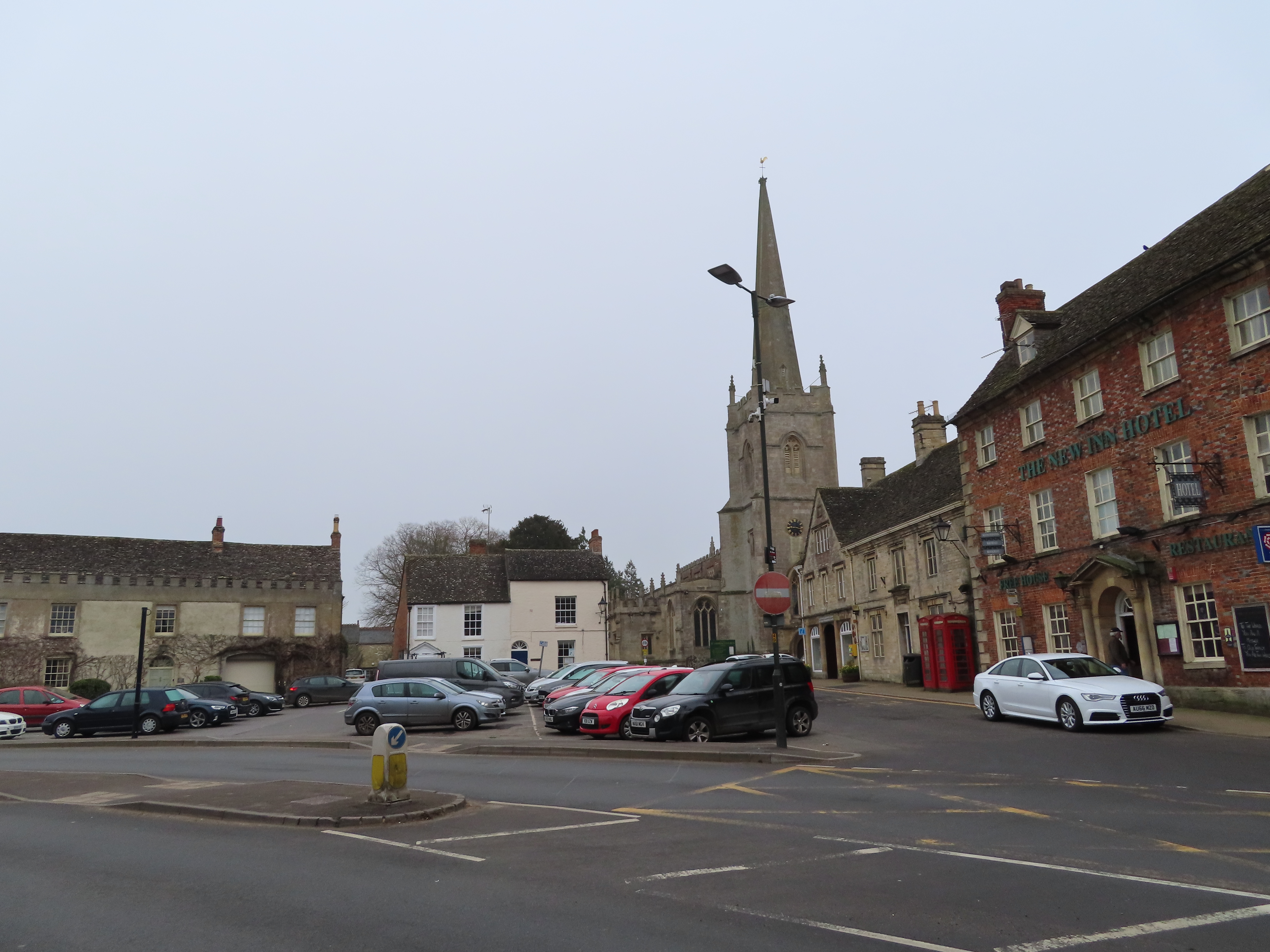
| The river at Cricklade Town
Bridge, setting off on its long downstream journey. This limestone bridge at
the head of the high street dates only to 1854; the historic and strategic
Ermin Way ford would have been closer to the present A419 crossing. |
 |
| Cricklade high street. The
fortified town’s grid-like layout and square-shaped ramparts are still very
apparent on present-day satellite images. |
The security concern of the time was
the Danish Vikings, who as per their treaty with Alfred had come to control
most of what is now eastern England, including the former Mercian kingdom to
the north. But with each passing generation Cricklade’s fortifications would be
reduced, repurposed or upgraded to ward off a succession of new threats as the messy
proto-Englands of this age gave way to each other. The defences were
refurbished by Alfred’s successors, kings of a prospective Anglo-Saxon England,
but then torn down in the early eleventh century by Cnut, king of a
Scandinavian England unified with Denmark and Norway. Then came a Norman
England, and by Matilda’s and Stephen’s nasty little twelfth-century conflict Cricklade’s
defences were up and running again, with evidence of one of Matilda’s
supporters even building a temporary castle here.
Beneath these changes of hands and of
Englands, Cricklade emerged as a consistent settlement. Its strategic value
gained it royal attention, its own mint for a while, and eventually privileged
tax breaks and rights to hold markets and fairs. So despite its militarised
condition medieval Cricklade seems to have picked up quite a pleasant
reputation, with its contemporary description by William of Dover (Matilda’s
friend), ‘In Loco Delicioso’ – Latin for ‘in a delightful place’ – now the
town motto.
 |
| Cricklade’s great landmark is
St. Sampson’s church, a monumental Norman heap of stone pinnacles many times
more massive than you’d think it has any right to be. The dedication to Sampson
– properly Samson of Dol, a Welsh or Cornish priest and founding missionary to
Brittany – is extremely rare in England. |
 |
| The church appeared in the
tenth or eleventh centuries, but the not exactly modest tower, which took a
century to build, was completed in the 1550s. |
 |
| And here it is from the
inside, with red hatch accessible only to people with the wealth to afford
jetpacks. |
 |
| Cricklade’s town cross is here
too, having been moved to the churchyard from the central crossroads in the
1810s when it was deemed a traffic obstruction. |
 |
| Cricklade’s other church, St.
Mary’s, probably originally an offshoot of St. Sampson’s, stands at the north
end of the high street beside the river and Anglo-Saxon rampart. In 1981 it was
declared redundant by the Protestant Church of England and returned to the
Catholics after centuries of persecution. |
The loco delicioso did not
last long. The bubonic plague did its usual here, as did the civil wars, which,
though sparing Cricklade most of the fighting, took a heavy indirect toll
through market closures, impoverishment, disease and dislocation. Though it
recovered from these hits and gradually grew on, by the nineteenth century its
repute had practically inverted. Its most abiding damnation came from the pen
of journalist and anti-corruption campaigner William Cobbett, who lambasted Cricklade as a ‘villainous hole...certainly a
more rascally place I never set my eyes on.’ Repulsed by the poverty-stricken
pile of mud, flies, stenches and political rottenness into which this town had
apparently descended, he seems to have run out of words: ‘this Wiltshire is a horrible county’.
 |
| The Vale Hotel,
formerly the White Horse Inn and likely a turnpike posting house before
that, stands at Cricklade’s (and the old burh’s) central crossroads. The
old town cross in the churchyard used to stand on this site; the current red
and black clock thing replaced it in 1897 for Queen Victoria’s diamond
jubilee. |
 |
| Some more from Cobbett: ‘The
labourers seem miserably poor. Their dwellings are little better than pig-beds,
and their looks indicate that their food is not nearly equal to that of a pig...In
my whole life I never saw human wretchedness equal to this’. |
 |
| Cricklade has since worked
hard to restore the cleanliness of its image. This is a glimpse of some of its Snake’s
Head Fritillaries (Fritillaria meleagris), a lily with a striking
chequered pattern. These are now extremely rare in this country; its vast
majority flower on Cricklade’s northern water meadows. |
Cricklade appears to have somewhat
recovered, and today once more carries a proud aesthetic consciousness: a
town of flowers, fresh breezes, architectural heritage, Cotswold tourism, and
of course, that singular status of the highest town on the Thames. And yet,
like Lechlade and the remotest fields and hamlets in between, it remains
connected to the distresses of its wider country and planet. Present-day
England sinks deep in a new period of poverty-creation in which years of
austerity, destruction to the welfare system, Brexit staff shortages and supply
chain disruptions, and the abysmal COVID-19 response, now combine with crises
in energy and costs of living to create a perfect storm of hunger, homelessness,
cold, disease and mental breakdown – even before the shadow of Russian
atrocities in Ukraine and the vengeful return of crazed Cold War geopolitics.
Of all the levels of the Thames, one
might suppose that this one, here at its height of heights, is as good a place
as any to get away from it all. But there is no getting away – no more now, in
this globalised age, than in these idyllic-looking headwaters’ turbulent past
of battles and sackings, plagues and prejudices, poverty and corruption. No
reason, either, that the hells unleashed on Kharkiv or Mariupol could not
happen here one day, and soon, whether at foreign hands or English ones. The
horror is a horror of all humankind; any emergence from it, the responsibility
of humans everywhere.
Only one character in this story
knows of this world in a state where such things did not have to happen. It is
the one we have followed all along – followed all the way up here to where,
having assembled its water, it takes this passage, these lades, out to a
world gone mad.
It might be too much to hope that
taking them in the other direction could bring us outside it: to a different time,
a different place, a different world.
 |
| Upstream from Cricklade Town
Bridge, towards the Thames’s springs. |
But we’ve come this far. Might as
well find out.


%20Lechlade%20to%20Cricklade.png)


No comments:
Post a Comment