Privilege
Forts like to appear immortal. That after all is how privilege protects itself:
by seeding the belief that it’s innate, essential, morally ordained, rather
than a violent seizure of power within history.
How about the
Thames’s other great castle?
Yes. There was a third. It was every bit as mighty, massive and politically consequential
as the other two. Unlike them it actually had to fight off siege after siege
after siege. And it did. It capped the entire set of core English strongholds;
only those two were a match for its power and prestige.
Ever
heard of Wallingford? Thought not.
Today
the river brings us to a Privilege Fort of yesterday, although its retirement
appears more comfortable than most. Nestled at the bottom of the Oxford Plain where
once it guarded the Goring
Gap, the little town of Wallingford potters quietly about in the rustic margins between Oxford and Reading. But get up close and poke it, and you might just get it to tell you
the story of its days as the capital of the royal centre, the unbreakable
shield of dynasties, and the pivot of those conquests, rebellions and civil
wars in whose bloody crucible a shape was first carved for the English nation.
Which
begs the question: What happened to it?
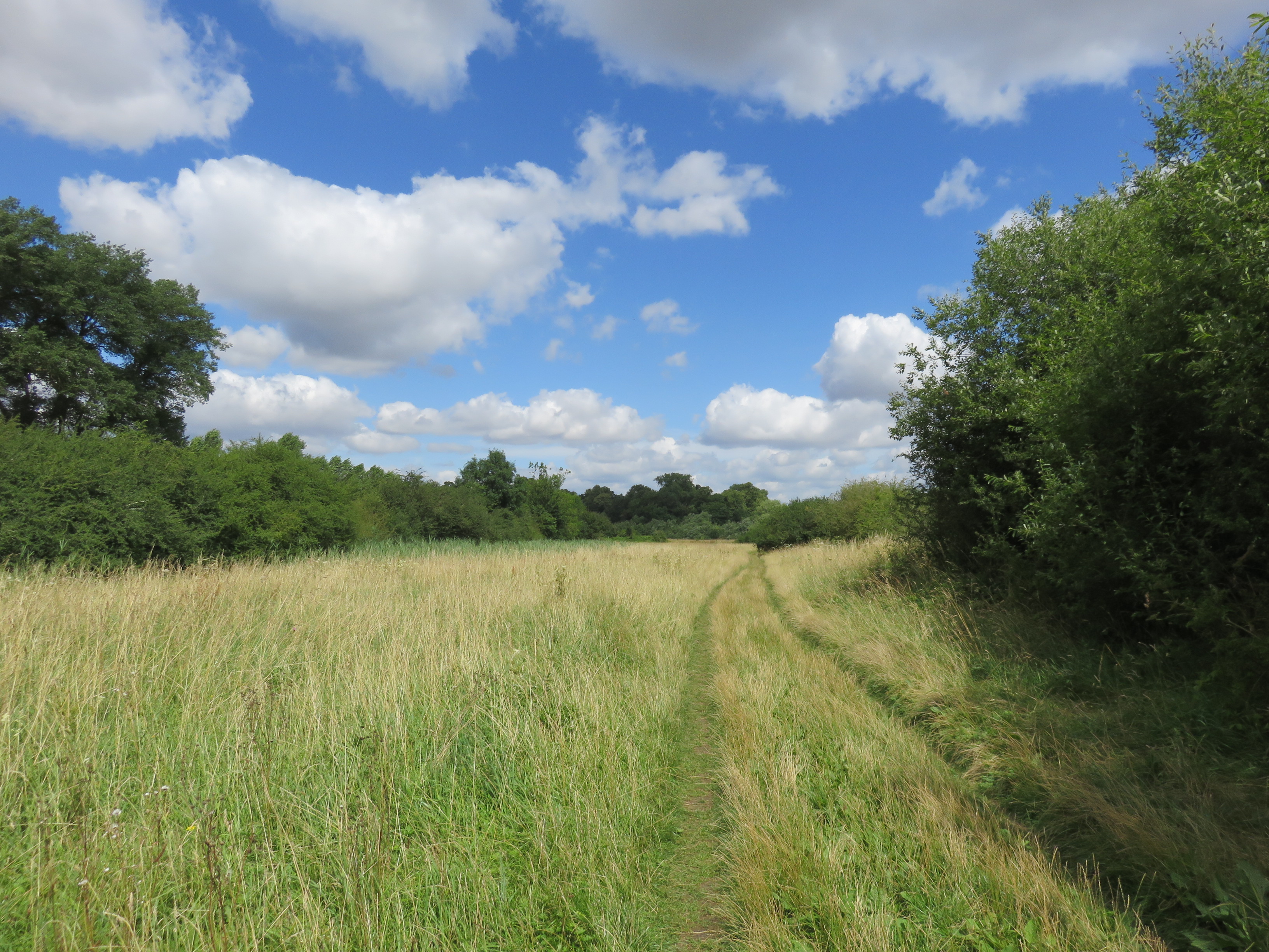
 |
| The castle once filled this entire plateau.
Does something like that simply disappear? From memory as much as from
landscape? |
 |
| Perhaps it was murdered. Wallingford was also the later-life home of the
detective-novel writer Agatha Christie – recognised by Guinness as the
best-selling fiction writer of all time – as well as a principal filming site
for the TV drama Midsomer Murders. One is advised to stay alert to suspicious
middle-class people with knives and poisons leaping out from its innumerable
little corners like this one. |
This
mystery awaits in a straight strike north from the Goring Gap. This is more or
less a two-phase walk: there is the spruced-up high-bourgeois white fantasyland
beyond Goring and Streatley, followed by a wilder push through Berkshire bush
the rest of the way. All in all it’s very green, and if you can bear the
typical all-pervading English structural injustice then it actually offers some
really nice walking on a warm summer’s day like this one.
 |
| The river north of Streatley. There’s plenty of space to walk around people on
this one, but be considerate on occasional narrower passages through foliage. |
Among
those injustices, do not forget, of course, that this country’s self-inflicted
COVID-19 disaster goes on. While most of this route is out in the open, social
distancing, face masks, and general hygiene considerateness are strongly advised in
the built-up settlements and on public transport.
 |
| North from Goring Bridge, with the Swan Hotel of Streatley at left. |
Start:
Goring Bridge (nearest station: Goring and Streatley)
Length:
11.2km/7 miles
Location:
Berkshire – West Berkshire; Oxfordshire – South Oxfordshire
Topics:
Streatley, Moulsford, Wallingford: Saxon fort, Norman castle, English ruin
Streatley
We
begin by crossing back to the west riverbank for a quick duck through
Goring-on-Thames’s counterpart of Streatley. The village’s name, suggesting
a clearing (leah) on a road (stræt), identifies its long strategic
importance. Most likely the road in question is the old north-south Roman road through
the gap in the
chalk hills, though
it could also refer to the far older east-west Ridgeway.
 |
| The Swan Inn that dominates the Streatley riverside goes back to at least the
mid-nineteenth century, though is thought to be considerably older. Its current
incarnation is as a posh hotel, restaurant and rental space for functions. |
 |
| Behind the Swan is Streatley’s St. Mary’s Church, a nineteenth-century
extensive rebuild of a Norman thirteenth-century structure (which itself likely
superseded one still older). |
 |
| From there it’s straight into the woods and back to the river. |
Hemmed
in by the Berkshire Downs, Streatley is tiny, with Goring getting most new
development when the railway came through. It ends almost as soon as
it began, conceding the riverbank to a succession of farms and open fields.
 |
| For now the path is the remnant of the old working towpath, where horses once
pulled barges along the river. Today’s terrain is easy walking for the most
part. |
 |
| Flower meadows abound on these reaches. |
Meanwhile
the lavish property-playgrounds of Goring sprawl their monied way up an east
bank replete with gardens, follies and boatyards. Their growling lawnmowers
puncture the chorus of insect and bird chirps, while the water itself endures a
regular traffic of their pleasure-cruisers.
 |
| This one has the lookout turret for a cleverly-disguised subterranean bunker,
no doubt for sheltering from the consequences of the English caste system. |
 |
| Here on the west side, what was probably once a working inlet has been
repurposed as a water feature for well-off residences. |
A
pleasant wide meadow then opens up, popular with such dog-walkers, picnickers,
small children and fishing parties as are a frequent sight through this
section. Here the pleasure-craft back up as they queue to get through Cleeve
Lock, the only lock and weir we will pass today.
 |
| Some sizeable hard-worked thistles here. |
 |
| Cleeve Lock is one of the smaller ones, built first in 1787 then rebuilt in
1874. Cleeve was a separate village that has since been absorbed into Goring. |
 |
| The old mill with the weir has joined the ranks of Goring’s lavish private mansions.
River travellers like to note that the downriver reach to Goring Lock is the
Thames’s shortest between locks, while the upriver reach to Benson Lock (beyond
Wallingford) is its longest. |
Beyond
the lock the property-incursions grow gradually sparser. To the west, views
open up of golden wheat fields trailing off the Berkshire Downs.
 |
| The Leatherne Bottel on the east bank is another old establishment that
has since been fancily done up by the leisured classes, in this case into the
Don Giovanni Italian restaurant. It is something of a celebrity-magnet, but the
site’s repute goes back at least three or four hundred years to when its
springs were said to have medicinal properties and drew visitors over great
distances. |
 |
| A heron keeps a watchful eye on passers-by. |
Eventually
the river ducks into a copse of willow trees at Runsford Hole, a pocket of
denser greenery that precedes the approach to the only settlement on this side
between the Goring Gap and Wallingford.
 |
| Regrettably there’s lots of this too. In fact the land belongs only to itself,
and you should refrain from the activities listed here out of consideration for
the actual land and others who use it, not imaginary claims to its ownership. |
 |
| Runsford Hole is obscure. Few clues remain as to where the name comes
from, or what feature on this bit of river afforded it a name in the first
place. These willows appear to be coppiced; perhaps they were regularly managed
and harvested in earlier times. Osiers, they call them in that capacity. You
can make lots of stuff out of them. |
 |
| Younger willow shoots up thick here, necessitating a little pushing through their
growths. |
Now
here’s another imaginary line. It is hereabouts that the wayfarer passes, unremarked,
from Berkshire into Oxfordshire. However this has only been the case since the
administrative reforms of 1974. For over a thousand years prior Berkshire
extended some way further up the Thames’s western flank, beyond the Berkshire
Downs and out across the Vale of White Horse.
 |
| To the west, the farmed slopes of the Berkshire Downs roll into the Oxford
Plain. The Vale of White Horse runs off between these foothills and the
Thames’s uppermost reaches. |
 |
| It’s quite nice here. You could almost forget what a state this country is in.
Almost. Countries which forcibly deport people for their skin
colour don’t deserve to be allowed to forget it. |
Moulsford
Suddenly
there materialises a built embankment lined with small boats, followed by the
re-emergence of affluent residences. It is the approach to Moulsford, a
village that briefly breaks up this old Berkshire rurality.
 |
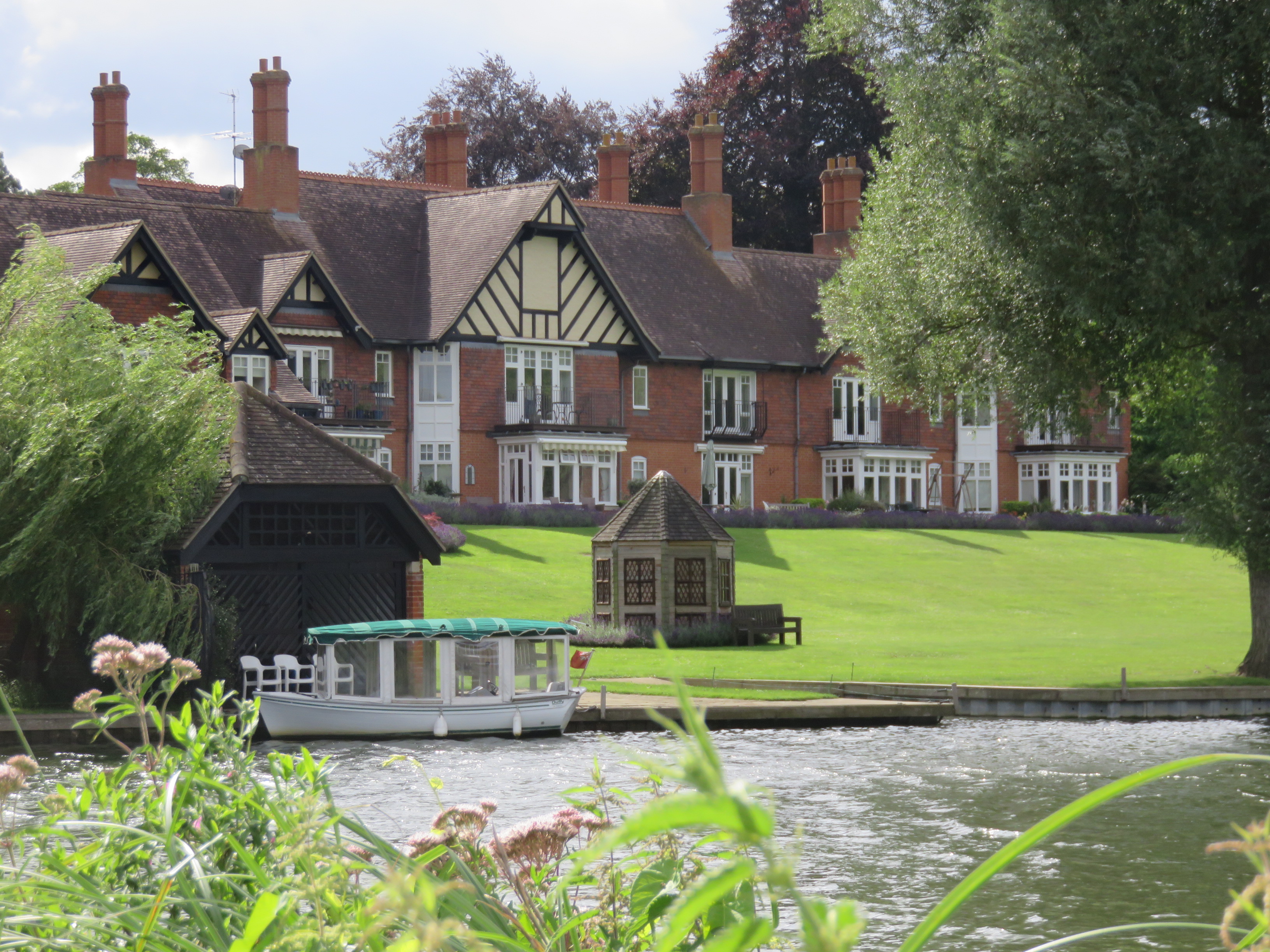
| One of these parts’ more bizarre riverside properties: Moulsford’s ‘Egyptian
House’, completed in 1999 under apparent commission by a professional
Egyptologist. |
Moulsford
was traditionally a manor held from Norman times by the ennobled Carew family,
though more recently it has served as a hotel, US Air Force
facility, and a nursing home before falling into private control. To more
immediate aggravation it gave rise to another set of riverside property-grabs, thus
forcing the towpath onto the opposite bank past another manorial remnant, the
hamlet of South Stoke.
With
the demise of the Moulsford Ferry by which the river workers got around this
problem, wayfarers are left with no choice but to detour inland up the A329,
the descendant of the old Roman road.
 |
| The Beetle and Wedge Boathouse – now another fancy restaurant – sits on the
former timber wharf which ran the ferry until 1967. Its name records its prior
incarnation as a workers’ trading inn: a beetle in this sense was a
mallet used for driving wedges into logs, which would have been split here then
floated down the river. |
 |
| For all its long history, the road through Moulsford today has little to
recommend it. The village is upper-bourgeois residential with a couple of
prestigious private schools. |
 |
| Moulsford’s little church, with distinct timber bellcote, is an 1840s Gothic
Revival piece that replaced a twelfth-century chapel. |
 |
| At the north end of the village the buildings and sports fields of Moulsford
Preparatory School (boys only, because this is a shamefully gendered country) occupy
a large riverside complex. Here they seem to be expanding across the road to
build an additional school facility for smaller children. |
Moulsford
has one other major structure, which faces explorers who make it past the
settled area and find the farm track back to the river.
 |
| Looks familiar? |
Moulsford
Railway Bridge is a monumental four-arch Isambard Kingdom Brunel piece much
like its nearby
counterpart at Gatehampton. Like that one it was constructed at the end of
the 1830s to run the Great Western Railway up to Oxford, and has remained in
decent service since with few structural alterations.
 |
| A boardwalk helpfully enables walkers to proceed through the westernmost arch
without getting wet. |
 |
| From this angle you can see it’s actually two bridges. They added the second in
the 1890s to increase capacity, building it as close to Brunel’s design as they
could. |
From
here the grass grows taller and the brush thicker with life. A more immersive
nature walk through wooded fields and marshes offers a temporary respite from
the nightmares of humankind.
 |
| Before, beyond, and through it all, there is the river. |
 |
| Others have come and just as surely gone. No-one can own it or claim special
entitlement to its services. All are its guests. |
 |
| During an ITV interview in 2017, then-Prime Minister Theresa May, when asked to
identify the naughtiest thing she’d ever done, infamously replied that she’d
run through fields of wheat as a child. The blank stares might have subsided by
now but the very image of English wheat fields may be forever tarnished by the
association. |
 |
| A Red Admiral butterfly. Crickets thrum through the meadows here, and a
professional birdwatcher was encountered with camera fixed resolutely into the
trees. This unbuilt stretch has got to be one of the most biodiverse on the
middle Thames. |
Even
here however, this people’s dodgy history necessarily intrudes on the scene.
 |
| Sightings of these World War II pillboxes grow more frequent as we follow the
river into Oxfordshire. One is led to suspect they were systematically
installed under a single operation. |
 |
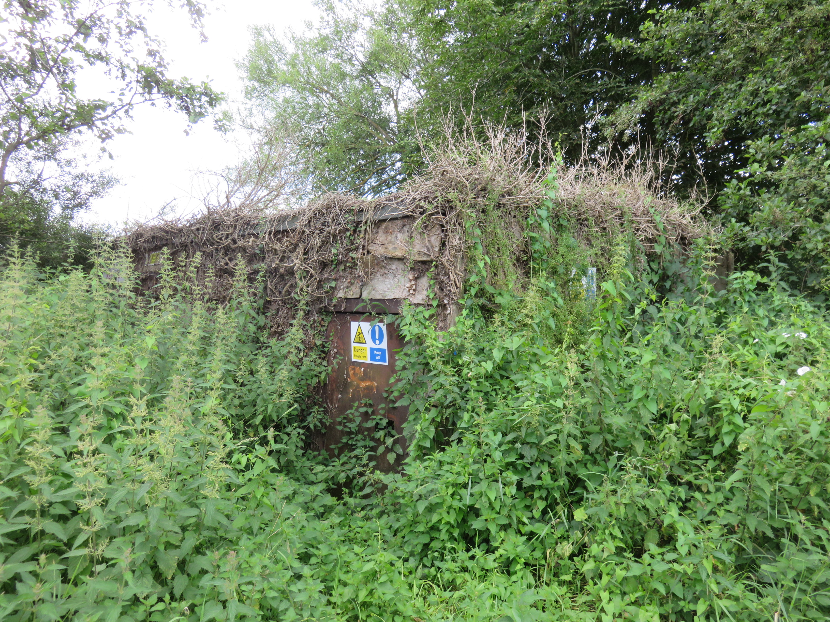
| Goodness knows what this one is. It’s thoroughly overgrown and plastered with
warning signs. Gateway to another world perhaps (if only). |
By
the time the towpath returns to this bank we are in Cholsey Marsh, a protected
nature reserve. A rare riverside marsh that hasn’t been drained for
agriculture, it provides a haven for birds like kingfishers as well as some
very uncommon lily and snail species.
Historically
the marsh extended further. On its inland side (up a road called Ferry Lane,
where presumably an old ferry provided crossings between towpath segments) the
village of Cholsey grew up in the Anglo-Saxon centuries on what was then
an island in the marshes called Ceol’s Eye. It later passed to Reading
Abbey, whose monks built a barn there in the fourteenth century to hold the
taxes that farmers paid them in produce (tithes). Apparently one of the
most massive barns ever built in the world, it was torn down in 1815 when later
occupants lacked money to pay for its repair.
 |
| Cholsey Marsh. |
 |
| Beyond the trees on the far bank is the tiny village of North Stoke. |
 |
| Local hunter-gatherers toil for their dinner. |
 |
| One of the most affirming experiences of exploring on foot has to be encounters
with professional dog-walkers at just the moment the dogs are splashing in the
river. Timed correctly, they will all bark and run at you and take turns to
jump, pressing their wet paws on you and sniffing and nuzzling till you stroke
them. |
It’s
pleasant out here. Make the most of it while you’re there, for you’ll still get
your daily gaslighting by the Tories when you turn on the news in the evening.
 |
| This is one of a pair. They’ve set it back to cover the field... |
 |
| ...while on the opposite bank its partner perches over the water. In the event
their defensive contributions were precisely nil. These days they no doubt make
the country more vulnerable by keeping nationalist narratives of World
War II salient in the minds of passers-by. Do they feel exceptional, when these
enter their line of sight? As their minds fill with images of treacherous
Europeans lurking hungrily round the edges of the picture, do they cast their
support for those in their politics who feed on their xenophobic paranoia? As
the Irish journalist Fintan O’Toole has observed, the English have never truly
recovered from winning that war. |
 |
| There. A field. No nationalists in it. It’s happy for you to stand in it no
matter where you’re from or how much money you have. Let’s build bunkers to
fortify it against the Home Office. |
 |
| It’s not actually hiding. It’s trying to make you think it needs to hide,
in order to imply that all foreigners are nefarious. |
Slowly
but surely, the bush falls away as people’s gardens creep up to the riverside.
Wallingford is close.
 |
| This is unusual. Unlike most riverside residences we’ve witnessed, this string
appears happy to have the towpath run across their lawns. With their regular
benches and berths, they create the sense of a rare liminal zone that’s within
the private fences but also comfortable for the public to exist in them. |
 |
| Shield? Gong? Cooking pot? Ritual summoning instrument? |
 |
| When the river doesn’t like it, it takes it back. |
One
last peculiar little village peeps across from the east bank here. I haven’t a
clue how you’re supposed to pronounce Mongewell, but apparently it’s an
Anglo-Saxon reference to the spring of someone called Munda. Its historic
significance goes back way further, given its extensive Iron Age earthworks
whose embankments and cuttings run east into the Chilterns. Perhaps they were
defensive; more likely they eased access into the hills for routes like the
Ridgeway.
More
recently Mongewell manor house and its park were used by the RAF during World
War II. It then became a Jewish boarding school called Carmel College, known
for its eccentric Modernist architecture and – as seems so typical in this
institutionally abusive country – an appalling sexual abuse scandal that didn’t
properly emerge till two decades after the school’s closure in 1997.
 |
| Mongewell Park’s boathouse. The buildings stand derelict, and are occasionally
used by film crews as they wait for developers to turn them into unaffordable
housing. |
 |
| This high up its course the water appears to glide so gentle, but as ever in
its history there can be no underestimating its power. This is a fresh memorial
to a local called Dean Luckett, who appears to have died in early July this
year after getting into difficulties in the river during a fishing trip. |
 |
| The A4130 bypass carries road traffic around Wallingford. The bridge’s
construction in 1993 came with investigations into ancient archaeological sites
on both banks, which it was positioned so as not to disturb. |
 |
No, you definitely do not want to tie or latch up any cows you might find in this
field. Cows cannot be expected to take kindly to such an exercise. Also, there weren't cows.
|
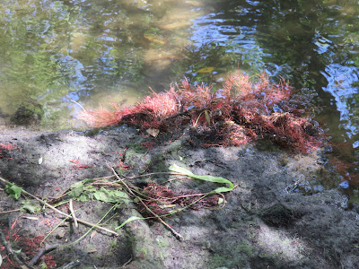 |
| The combination of river water and toxic politics has here given rise to a
hairy alien life-form. |
And
now the fences and buildings hem in the towpath, dragging it at length into the
goal of this section.
 |
| This house is the remnant of Wallingford Lock (a.k.a. Chalmore Lock), which
only existed from 1838 to 1883. Used only in summer to raise the upstream water
level, it fell into disrepair as the rise of the railways took money off the
river, and was finally removed in the face of local opposition. |
 |
| And here we have one of the firmest signs yet that we have entered Oxford
University’s sphere of influence. This is no less than the headquarters of the
Oxford University Boat Club, resurrected here after its original base, in
Oxford itself, burnt down in 1999. Its rowers train rigorously here for the annual
Boat Race in west London. |
 |
| And as a couple of hotels and Wallingford’s own boat club (formerly a
malt-house) enclose the riverside, we are funnelled towards Thames Street and
into Wallingford proper. |
Wallingford
At
first sight, Wallingford is just another well-placed river crossing whose
fertile fields and strategic routes have drawn settlers since at least the Bronze
and Iron Ages. As is its way, the river has taken good care of their tools,
ritual offerings and human remains, occasionally yielding samples to the
inhabitants of today.
 |
| The way into Wallingford lies down ye-olde village streets like these, hemmed
in by quaint houses which no doubt harbour the kinds of murderous interests
Agatha Christie wrote about. |
 |
| Wallingford has no fewer than three parish churches, plus several for more niche
denominations. St. Leonard’s, here in the southeast corner near the river, is its
oldest. Its Anglo-Saxon herringbone stonework is visible here, although much of
the building had to be restored after heavy damage in the Civil War. |
 |
| Closer to the bridge is the medieval church of St. Peter’s, likewise blown up
in the Civil War then rebuilt. In another sign that Wallingford is special,
this church’s doors are actually open so you can go in and poke around. Here in
its floor is the tomb of William Blackstone (1723-80), probably England’s most influential
judge, whose Commentaries on the Laws of England were foundational to
both English and American law (including of course in the racist, sexist and property-fetishising
ways for which both systems are traditionally known). |
Wallingford’s
name appears to derive from Welsh people’s ford in Anglo-Saxon Old
English. It is of note that by following the road west from here you do
eventually end up in Wales, but in those centuries ‘Welsh’ was a generic term
among the Anglo-Saxon immigrants for the Celtic/Sub-Roman people who already
lived here (and from whom the modern Welsh, who call themselves not Welsh but Cymry,
‘our fellows’, descend). The suggestion is that they had a significant presence
in this settlement, and that as in much of England, the process by which the
Anglo-Saxons superseded them was lengthy, complex, varied, and still
incompletely understood.
 |
| Though a fording spot for as long as it’s existed (it’s in the name), a bridge
is attested at Wallingford since at least 1141. It’s gone through several
incarnations, the present dating to the 1810s when it was rebuilt following
flood damage. Tolls were charged to cross until the 1930s. |
Take
this Welsh road west and two towns down you come to Wantage, birthplace of Alfred
‘the Great’: king of Wessex, then of the unified Anglo-Saxon peoples. Alfred is
known among other things for the decisive defeats he dealt to the invading
Vikings in the 870s, with whom he agreed the partition of not-yet-England and spent much of
his reign seeing to the Saxon part’s long-term defence. At the heart of his
strategy was the construction of a network of garrisoned forts, known as burhs
(whence today’s boroughs). These served to protect against further
invasions while anchoring the commercial and administrative life of their
regions.
Some
burhs, such as Alfred’s capital at Winchester, were adapted from existing
(often Roman or older) fortified settlements. Others were new, and of these
Wallingford’s position was deemed of sufficient importance to warrant one of
the largest such investments. This was the policy which raised a small ford
town into one of the two largest burhs in the country (along with
Winchester), accumulating within its ramparts a busy population, a rich trading
and crafting economy and even its own royal mint, as well as a network of
connected manors in the surrounding farmland. By the turn of the millennium
Wallingford had become in effect the provincial capital of Berkshire.
 |
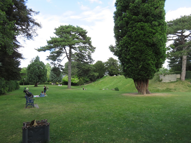
| Of all Alfred’s burhs it’s also one of the best-preserved. This is the Kinecroft
in the town’s southwest corner, which together with the Bullcroft to its
north were set aside for grazing cattle. The view is from its rampart – the original
Saxon defensive earthwork, which lines its west and south edges in remarkably
good condition. The Kinecroft is now a public park and is used by the town for big
community fairs and festivals. |
 |
| Such a deep and lasting heritage breeds fearsome fungi. |
 |
| Wallingford High Street. This appears to be mostly residences, with the
town’s main shops and civic facilities clustered round its market square instead.
The town’s planned street-grid system and rectangular ramparts, both still very
apparent, for a time confused the later English into believing this was a Roman
settlement. |
All
of a sudden Wallingford was a massive deal. So vital it became for controlling
England that when the Normans took over in 1066, it was one of the very first
places Duke William made for after his victory in the Battle of Hastings. Struggling
to get into London, he instead brought his army up here. Wallingford’s thegn
(Anglo-Saxon lord), Wigod, was sympathetic to the Normans and allowed them to
cross the Thames unopposed. It was here they obtained the submission of Stigand, the
Archbishop of Canterbury, thereby conferring legitimacy that defused much continuing
Saxon opposition to William’s claims to kingship. Meanwhile one of William’s
minions married Wigod’s daughter, thereby beginning the planting of the Norman political
nobility in the region’s manors.
William
had his own, more extreme version of Alfred’s burh strategy: the
construction of colossal Norman castles both to facilitate military control and
to awe the populace into submission. Straight away three of his most formidable
went on the Thames to protect the heartland of his new realm, of which two, the
Tower of London and Windsor Castle, we have passed already.
And
the third? Well, here already was a successful Saxon fortified town, ideally
positioned so as to guard the chalk pass and the ancient east-west routes. Where
better?
 |
| Wallingford Castle meadows, north behind the high street. Another of Wallingford’s
public green spaces. Nice rampart, no? |
 |
| And there we are. |
Wallingford
Castle shot up within five years of the Norman takeover. Like its
counterparts it was a motte-and-bailey monstrosity, with two rings of walls and
towers overlooking the river and ford. And beyond its obvious defensive
statement it was built with a full range of facilities to support active royal
and administrative work: a Great Hall, living chambers, courthouses, chapels,
kitchens and dining rooms, bakeries and breweries and spice and wine chambers,
clerical accommodation, armouries, prisons, stables, storehouses, jousting
lists and animal pens.
 |
| This main block of surviving ruins, larger in itself than many entire castles,
was merely part of one of its chapels. To get a sense of the full complex’s
scale requires a look past these walls... |
 |
| ...and out across the hill, all of which was encompassed within the castle’s
walls and yards. There’s nowhere you can stand that lets you fit the entire
site in your field of view at once. |
 |
| This scale model in the Wallingford Museum gives some idea of this thing’s
magnitude. North is to the right. Note the river and bridge in the bottom left. |
 |
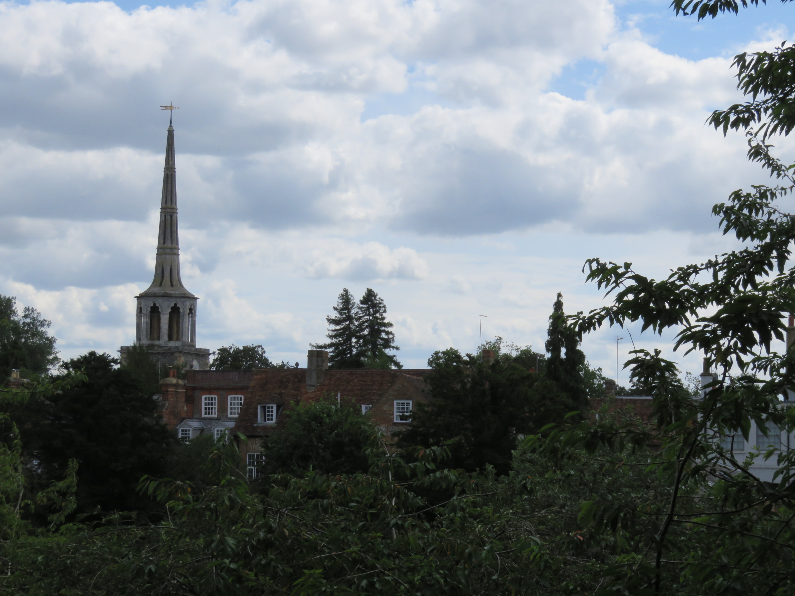
| The hill overlooks the roofs of Wallingford town. The spire is St. Peter’s
Church (the Blackstone one). |
Wallingford
Castle’s first great test came after the death of Henry I, William the
Conqueror’s youngest son who sought to consolidate Norman rule (including by commissioning
Reading Abbey). Despite Henry’s efforts he’d still presided over a feudal
patchwork of self-regarding (and frequently armed) barons and priests more than any semblance
of a coherent state, and his dynastic plans came to grief when his most
promising heir and son drowned in the Channel in the White Ship disaster
of 1120. Thus with Henry’s own death in 1135 came the disintegration of any
reliable succession system, and in its place, a vicious two-decades-long power
struggle between two of William the Conqueror’s grandchildren.
Of this
pair, Henry I’s daughter Matilda – or Empress to her face – had
the more compelling claim, backed up by direct descent as well as marriages
first to the German Holy Roman Emperor (whence her title) and second to the
Count of Anjou (now in France, then a powerful principality in its own right),
giving her wide-ranging continental support, connections and resources. But her
reputedly arrogant and domineering manner alienated many of the English barons
and priests (or maybe they and/or later historians were simply misogynistic – who knows?), such that when Matilda’s cousin Stephen of Blois (another
combative French county) reached England first and declared himself king, a
number of them threw their lot in with him. Many others, perhaps the majority,
had no vested interest in one ruler or another and would direct their private
armies for their own gain through the carnage and social breakdown that
followed when Matilda, having secured Normandy, came in force across the
Channel in 1139.
Later
historians would call this period The Anarchy. It is hard to consider it
a true civil war; unlike the Civil War five centuries later it was more an
elite feudal free-for-all with no meaningful popular or constitutional stake in
its outcome. But that hardly made it any less ugly and miserable for the people of both
the urban centres and rural expanses over which Matilda’s and Stephen’s conflict,
both direct and by baronial proxy, rampaged back and forth for twenty years.
The fighting spread across the claimants’ realms on both sides of the Channel,
swaying in favour of one side then the other, with either getting cornered or
captured then escaping at least once.
But there was, perhaps, one pivot to
which the contest kept returning; one stronghold which just wouldn’t fall.
Secured
early by Matilda, Wallingford Castle was besieged by Stephen no fewer than
three times in this war. But it proved just too strong to take, even when the
would-be king had counter-castles built across the river to pile on the
pressure. It also featured in what grew into one of the more mythic episodes of
the war: Matilda’s personal escape from a surrounded Oxford in the winter of
1141, in which she is said to have fled by a postern gate at night, crossed the
frozen river on foot, sneaked past Stephen’s armies in the camouflage of a
white gown, and from there rode to the safety of her Wallingford garrison.
Within
a few years the conflict had degenerated into a attritional slog, and by the
1150s into a stalemate in which everyone was exhausted. Stephen made one last committed
attempt on Wallingford in 1152 and almost succeeded in starving the castle into
submission – only for Matilda’s son with the Count of Anjou, the future Henry
II, to come to its relief. By this point the worn-out nobles in both armies had
had enough, and they went round their leaders to drag each other into peace
talks.
The
resulting Treaty of Wallingford of 1153 effectively ended the struggle
in a compromise. Stephen got to keep the throne – but after he died it would be
Matilda’s son Henry, and thus her Angevin line, that succeeded him.
Conveniently for the latter, Stephen died the very next year, paving the way
for Henry II to bring the Anglo-Norman and Angevin domains together into a singular
realm. His marriage to Eleanor of Aquitaine brought yet more land into a territory which now stretched from the Scottish frontiers to the French Mediterranean: a composite kingdom which was disparate, quarrelsome, and sure as hell unsustainable.
By a
certain standard Wallingford Castle had succeeded, and spectacularly. William’s
stronghold held the line long enough for his crumbling Norman legacy to reassemble
under a far-reaching dynasty whose bloodthirsty ambitions, and failures to
attain them, would drag England into its lasting unified shape; a dynasty that
would get named for the yellow broom plant on the Anjou crest, the planta
genista, that is to say, Plantagenet. But in more meaningful terms
that legacy was bloody, violent and cruel. The pattern it set was for the terrorisation,
starvation, imprisonment and torture of the populace beneath the violence of
petty ruling-class power struggles – an effect heightened, not lessened, when
the monarchs wrecked their own authority in this way, and so haemorrhaged it to local bullies and alternative power structures; that is to say, those barons
and priests, who would trouble Henry II and
his successors for centuries to come. And it would propel the Plantagenets
into their long and futile war with the coalescing French, culminating in the
loss of all these continental territories, another round of inward bloodletting
in the Wars of the Roses, and the emergence, from their piles of corpses, of
the Tudor dynasty that would build the troubled template of English modernity.
 |
| Wallingford’s fifteenth-century treasure chest, now on display in the Wallingford
Museum. The wood is thought to be Prussian spruce, found only in certain parts
of Eastern Europe and thus a symbol of the reach of the castle town’s trade
connections. |
The
suffering of Wallingford’s population over twenty years of on-and-off siege was
typical of this, but for its service to the Angevin settlement the new king
rewarded it handsomely. The town became only the second in England to get a
Royal Charter, granting it a vast range of privileges. Subsequent kings like John
and Henry III would expand the castle, adding a third ring of walls and
towers, and for several centuries it would serve as a favoured stronghold for
monarchs who, in their perennial struggles with rebellious barons, oft fell
back on it for its impervious reputation.
 |
| Which once more raises the question: what happened to it? |
Decline,
when it came, seems to have washed over Wallingford in waves. The mid-fourteenth-century
bubonic plague pandemic devastated the town, which then found its recovery
hampered by a growing rivalry with Abingdon upriver, especially as the
latter built bridges and got the main London-to-Gloucester road diverted
through it. By the rise of the Tudors the castle itself was crumbling round the
edges, overlooked perhaps in part because the Wallingford area offered little to
sate Henry VIII’s hunting obsession. A practice emerged of taking stones off it
to improve his and his daughters’ preferred castles like Windsor. Cardinal
Wolsey’s closure of Wallingford’s priory in 1525, in a prologue of sorts for
his king’s subsequent rampage against the monasteries, must have done the
town’s prosperity and prestige few favours either.
Nonetheless
the castle was formidable enough to take the loss of a few bits of wall. Such
was its tried and tested reputation that when the English fell about each other
in their worst bout of bloodshed yet – the much more serious, gunpowder-charged
business of the actual Civil War this time – Wallingford’s strength as a
stronghold was remembered and called upon just as it had been so many times
before.
When
King Charles I failed to take back London in 1642, he pulled his army upriver
and made Oxford his headquarters. This put Wallingford front and centre in the
defensive ring of fortified towns by which the Royalists shielded their wartime
capital from parliamentary assault. The king appointed one of his nobles,
Colonel Thomas Blagge, as governor of the Wallingford garrison, and much
as at Reading the populace was made miserable as soldiers got billeted in
their houses and looted their crops, animals, valuables and building materials
to repair and supply the castle.
In
some ways they fared better than Oxford’s other satellites. Just as in its
heyday, Wallingford Castle held the line as tides of English blood swept its
surrounding towns and fields from one side to the other. It was secure enough
for Charles to visit Wallingford in person on numerous occasions, and even for
Colonel Blagge’s wife to give birth and hold a fancy Christening ceremony for
the new baby. Its walls were impenetrable. They held even as the war turned
against the Royalists everywhere else; even as in 1644 Abingdon above and
Reading below both fell to Parliament; even the following year when the
Royalist army was all but obliterated at Naseby; and even the year after that, 1646,
when Oxford itself fell, leaving Wallingford on its own as one of the last
Royalist holdouts in the country.
With
Charles taken prisoner and the war (or at least the initial phase of it) all
but lost beyond its walls, there was nothing left for Wallingford to defend. After
a four-month siege Colonel Blagge surrendered it to parliament’s General
Fairfax in July 1646, by mutual agreement and under very generous terms.
Once
more the old castle had endured. The monarchy’s enemies couldn’t defeat
it here; they had had to defeat it everywhere else instead. The castle had
made, and survived, its final stand...
...only
to die without a fight once the war was over.
With
unrest lingering on into the 1650s, the parliamentary regime – that is to say, Oliver
Cromwell’s military junta – feared that Wallingford’s Royalist sympathies
might be re-ignited against it in future. In 1652 the order was given to
slight, that is, demolish, the castle to the point where it no longer offered any
military utility.
And
so, just like that, Wallingford Castle, invincible through half a millennium of
sieges, was wiped from existence.
 |
| Aside from the main block of ruins and the earthworks, lone shards of masonry
like this are all that survived the castle’s demolition and the looting of its debris
for buildings elsewhere. |
 |
| Today the ruins stand largely unremarked in the Castle Meadows. |
 |
| These fine fellows now use the Castle Meadows for summer grazing. |
 |
| Instead of walls and towers, the castle site now has only this one grumpy bull
to defend it. |
 |
| He does his best. |
Wallingford’s
days as a nationally-significant Privilege Fort were over. It had been plagued,
shelled, impoverished, and ultimately eclipsed by the rise of more illustrious
neighbours, leaving it to face a long slog to recovery in increasingly
competitive industrial times. That said, it seems to have made a pretty decent go
at it. Bereft of its castle and defensive purpose it gradually re-invented
itself as a market town, adding brewing, malting and iron-founding to its
steady agricultural base.
As
with the Thames’s other industrial towns, most of those works made it well
into the twentieth century before disappearing. Yet with all the caveats of
viewing it through a stranger’s eye, Wallingford seems, on the surface at
least, to have staved off the worst of the modern poverty and hollowing-out we have
seen in many such towns left to struggle to find their way, such as Reading
or Maidenhead.
 |
| Wallingford’s market square, revived to new importance in industrial times. The
old Town Hall (centre) came up in 1670 after the restoration of the monarchy, and later
had William Blackstone working there as the town’s legal advisor. Behind it is
Wallingford’s third parish church of St. Mary-le-More, whose present
incarnation is Victorian, but whose predecessor was damaged in the Civil War
and rebuilt with stones from the castle. |
 |
| The marketplace’s narrow streets are still lined with antique buildings, containing either traditional shops or modern ones. The ambience is refreshing, even if the
English flags might set off alarm bells. |
 |
| The old Corn Exchange: built in 1856, now a local cinema and theatre. |
Perhaps
Wallingford’s historical weight, the way it’s built into the very shape of the
town, has given its inhabitants a stronger stake in protecting it. Or perhaps
its position in a railway blind-spot, having lost its rail extension in the Beeching
Cuts (it now runs only as a heritage railway), has diverted the more
ravenous property speculators off its terrain. In any event Wallingford’s
landscape seems to breathe more freely than most settlements in its position –
its character preserved, its cobblestones and greenery cherished, its wealth
clearly present but not ostentatiously flaunted.
One
expression of this is its superb local museum, which is run entirely (and
COVID-consciously) by local volunteers on a charity basis and has filled a tiny
fifteenth-century flint cottage on the west road with thoughtful, detailed and
immersive displays and archaeological finds. But Wallingford’s feel is perhaps
exemplified best of all by its castle ruins. For all its storied
gravity, no attempt has been made to sensationalise, touristify, or otherwise
cheaply cash in on these stones. Instead they stand organically in a public
park, left just as they are to tell their own story to those curious enough to
seek it out. The ruins are free to enter and frequented by locals resting,
strolling or having picnics, while cows graze what were once their walled-up
yard, and small children roll yelping with glee down embankments which no longer offer their protection to the unaccountable English authoritarians of one day or the next.
Perhaps
it’s better like this. The walls of castles like Windsor and the Tower still do
what walls typically do: exclude. They keep your feet off the carpet, your
hands off the treasures, your commoner’s scent out of privileged nostrils and
your eyes off dirty national secrets (unless of course you can fork out for a
ticket then keep to where you’re told.) Alone amongst them, the walls of Wallingford
Castle no longer exclude. Their story, of the impermanence of power, is
everyone’s to hear.
If
you wish to explore this area yourself, be advised that Wallingford is the
first waypoint on this journey without its own train station. Regular buses run
between the market square and the closest station at Cholsey, which lacks
facilities in or around the station, keeps its toilets and waiting rooms
locked, offers no shelter or shade on the southbound platform, and is regularly
passed by nonstop or heavy goods trains at high speed. But at least you can
listen to the meeh meeh of sheep in the surrounding fields while waiting an
hour for your train.
Very special thanks to the Wallingford Museum and
its volunteers for informing much of this article, as well as their care for
ensuring a safe visit in pandemic conditions.


No comments:
Post a Comment