A
hundred million years ago, England didn’t exist.
Nor for
all but the latest sliver of the ninety-nine million years that followed, for
that matter.
What
about the land they now called England? That existed, in a manner of
speaking. But it had no humans yet, and so no names based on imaginary lines on
maps or in minds. It also sat about in tropical latitudes some thousand miles
from where it is now. It had dinosaurs. When it wasn’t underwater – which much
of the time it was.
And
while it was underwater, it had something else: extremely tiny planktons which,
when they died, left behind extremely tiny calcium carbonate shells. There were
a lot of them. More than forty million years’ worth in fact. And that’s why these
extremely tiny creatures are among the most extremely important things to the
people of what is now southern England.
They’re standing on them.
 |
| This stuff. Chalk. |
Standing
on them physically, but also mentally. The English like standing on these
planktons’ contributions. It makes them feel English. Be it rolling downs like
the Chiltern Hills or the soaring cliffs of Dover and Beachy Head, chalk is a
nigh-obligatory feature in the green-and-pleasant landscapes of their national
imagination.
 |
| The low ridge of the Chilterns, gliding down to the gap where the river runs
through the chalk. |
The
cliffs are ironic. Within that imagination their chalk is a barrier, a natural
wall against the inferior barbarian hordes on the European mainland. In
reality the chalk does the opposite. Its province of deposits does not separate
but connects England, France, Belgium and the Netherlands over a
timespan for much of which the island of Britain was no island at all but a
European peninsula. The Dover cliffs are not a wall, but a bridge beneath the Channel to the
Alabaster Coast of Normandy. It’s the
same chalk.
Chalk
– that is the concern of today’s length of river. It is through the outer arms
of this Cretaceous (literally, chalky) realm that the river cuts down to Reading
and the comparatively recent sands and clays of the London Basin. And
having followed the water up that basin, it is time to cross into a
more ancient land: the Jurassic reaches of Oxford, and in their midst, the river’s
origins in Cotswold limestone.
 |
| The view upstream from the Pangbourne-Whitchurch toll bridge, from where we set
out today. |
The
river created this passage itself. Later it would prove important to the human
immigrants by funnelling their boats, roads and railways through its narrow
corridor. And so the corridor sprouted a pair of villages: Goring on one side,
Streatley on the other. From the former comes their present name for this
gap in the chalk: the Goring Gap.
 |
| The river a little downstream of the Goring Gap. For all the chalk’s geological
significance you can only draw it out so far for dramatic effect because its
hills aren’t actually all that high. There’ll be no breathtaking scenes of the
Thames gushing through precipitous canyons. There’ll be plenty of grass though. And cows. |
Start:
Whitchurch Bridge (nearest station: Pangbourne)
End:
Goring Bridge (nearest station: Goring and Streatley)
Length:
6.4km/4 miles
Location:
Oxfordshire – South Oxfordshire
Topics:
Whitchurch, Hartslock Wood, Gatehampton, Goring, and the geology of the Thames
Whitchurch
First off, a smaller crossing: that of the river itself, from Pangbourne into the
village of Whitchurch which faces it on the north bank.
 |
| From atop the bridge, the view back into the London
Basin. Today we leave this for the older, higher Thames. |
 |
| To the west, a first glimpse of Whitchurch communicates the genteel character of
this area’s social landscapes. |
Straight
away we are necessitated to do what we’ve so often had to on this journey and
take an inland detour to get past propertied land-grabs. On this occasion we
can take advantage of this to get up close and personal with the geology in
question, for after following the river along the southern dip slope of the
Chiltern Hills, we now find them sweeping in right up to the water’s edge. To
advance into Whitchurch is straight away to climb uphill.
 |
| Whitchurch is smaller than Pangbourne. Most of it branches off this main road,
here beginning its climb up the Chilterns. |
 |
| Whitchurch’s present St. Mary’s Church is a Victorian do-up of an oft-altered
Norman building. But the settlement’s name of “white church” (Hwitcurke)
came from the Anglo-Saxon structure that preceded it, most likely for being built
out of the chalks and flints of the surrounding hillside. |
 |
| They’re huddling round this tree for protection because they know the politics
has gone all wrong. |
 |
| According to ancient Chinese philosopher Gongsun Long, ‘a white horse is not a
horse’. What about a green horse? |
After
accumulating a little altitude, it’s time to swing left and seek the river
again.
 |
| ...which is easier said than done seeing as a bunch of huge farms has colonised
the riverside here. This is not the fence of someone whose vocabulary includes
words like ‘public’, ‘commons’ or ‘compromise’. It stretches on and on for
about a mile as if they own it. |
 |
| Many of the pastures here seem set up for horse grazing. This horse does appear
to be a horse (but you never know). |
 |
| When the fence concedes a view over the river valley, it is to reveal this
stock of nuclear warheads in the guise of agricultural supplies. |
And
now the ground starts to undulate, as the road turns to path and plunges into
that rarest of environments on these cleared, farmed and propertied riverbanks:
proper woodland.
 |
| The first serious ups and downs on this journey indicate geological happenings
worth paying attention to. |
 |
| Through gaps in the trees the Chilterns roll. Their name is said to come from Cilterne
in the ancient Celtic languages, meaning ‘land beyond the hills’. |
Hartslock Wood and the Goring Gap
The
name Hartslock descends from a family called the Harts who once installed
a lock on the river here. The river didn’t like it and by 1800 it was already
in ruins. But apparently it was never demolished properly, and a hundred years
later boats were still getting damaged by the bits sticking out.
They
tried to farm this area too. With twentieth-century agricultural technology
there weren’t many wild places they couldn’t flatten into commercial
farmland. But here on this slope they gave up. The chalk was too steep, made
the soil too infertile. Hartslock Wood is now a protected nature reserve and
Site of Special Scientific Interest (SSSI), one of the few of its kind
remaining and home to some very rare plants and animals.
 |
| This has not stopped the local people carving cryptic political slogans into
the trees. |
And
then, a short distance into these woods, the ground to the left suddenly drops away. It’s a chalk cliff, directly above the river: we now stand
on the very west edge of the Chiltern escarpment.
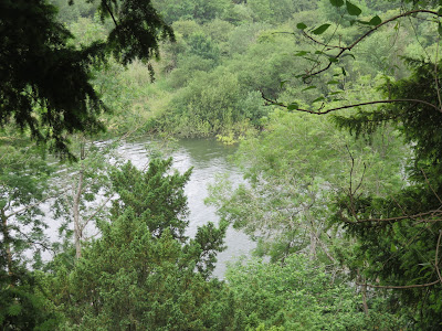 |
| And there’s the river. It might be down there now, but it was that flow which carved
out this gap between the Chiltern Hills... |
 |
| ...and the Berkshire Downs on the other side, which despite getting a different
name are really the same chalk ridge. |
Scattered
across the far side are the dispersed hamlets of Basildon, which might
look like the middle of nowhere but were actually pretty centrally-positioned.
They grew up on the old Roman road through this gap, which was later the
contested frontier between the Anglo-Saxon kingdoms of Wessex and Mercia – thus
getting successively rampaged over by those kingdoms’ armies, the Normans, the
Angevins, and then the bubonic plague. Its nonetheless prosperous manors later
gave rise to Jethro Tull, whose inventions pioneered the eighteenth-century
mechanical revolution in English agriculture.
 |
| Back on the Chiltern side, this tree has grown its roots in a tentacular manner
to express its disapproval for the cosmic horror of the English socio-economic
condition. |
 |
| Is this the Golden Hopelight flower, which grows in the soil of countries where
there’s at least a minuscule chance that they’re not irrevocably doomed? Alas,
no – it would appear to be the easily-misidentified Future-To-Dust Follyblossom. |
 |
| Say hello. |
Let’s
take a closer look at what’s going on here. Here is an extremely
simplified attempt to make sense of this region (as well as a reminder of why I don't draw things):
Like
its human history, the deep history of the British landmass is a story of
migration and diversity (only without the hostile panic at it). The journey of
this land upon the tectonic movements of the Earth’s crust has brought it
through hot and cold, over and under the water, and across the planet’s surface
from as far as where Antarctica is now, ever rising and falling, growing and
shrinking, losing chunks and joining greater wholes.
As
such its present-day geological profile reads like a colourful cross-section of
three billion years of planetary history. The general principle is that the further
north and west you go, the older the layers that rise to the surface, with the Precambrian
metamorphic gneiss of the Scottish far north and the Hebrides lurking at the
deep end of this scale.
 |
William Smith’s famously beautiful 1815 map of Britain’s geology, the first
detailed chart of its scale and kind. This country’s rich range of exposed
rocks from different time periods well-equipped its people for the empirical
study of the Earth, but it was only around the nineteenth century that they
really took off at it, as the scientific and industrial revolutions undermined
the power of religious creation narratives and drove huge economic incentives
in mining and infrastructure. (For his part, Smith was ignored, ruined, and banged up in debtor's prison; only in his final years were his contributions recognised.)
|
Here
at the younger southern end, the Thames threads through several of this land’s
more recent layers. We are now high enough up the river to begin consideration
of the one it first sprung from: the sedimentations of the warm and shallow sea
that covered what is now the Oxford Basin in the Jurassic period, about
145 to 200 million years ago. Oxford’s fossil-rich clays accumulated over that
period, and so did the honey-coloured limestone of the Cotswold Hills,
formed of billions of tiny calcium carbonate shells left behind by tiny marine
organisms and rolled around into cute ovular shapes (ooids) on the
shallow sea floor. Today it is from their midst that the Thames springs.
There
followed a dramatic change in climate, marking the end of the Jurassic period
and start of the Cretaceous. In this chapter of the story, lasting famously to
the extinction event that killed off the dinosaurs around 65 million years ago,
these lands were submerged under deeper seas, further from exposed rocks and
thus from their eroded sediments. As a result the tiny marine organisms of this
time left far purer calcite shells, which over this period, built up into a province
of a softer, more porous variety of limestone: chalk – known as creta in
Latin, hence Cretaceous period.
 |
| Chalk which here regularly emerges from the thin soil, and has a distinct
texture beneath the soles of your shoes. |
The Chalk
Group is the general name for this province of deposits. It encompasses all
the chalk formations of south and east England, including the Chiltern Hills
and Berkshire Downs here at its edge, as well as the Dover cliffs and various
Downs in south England; but also the white limestone cliffs of Antrim in Ireland,
the Alabaster Coast of Normandy and wine caves of Champagne in France, numerous
formations in the Low Countries, Germany and Denmark, and even the
petroleum-bearing shelves beneath the North Sea. At the risk of understating
its complexity (there are multiple chalk subgroups as well as different localised
processes), this chalk is essentially a single contiguous unit developed over
tens of millions of years.
All
this chalk then got crumpled towards its present shape by the violent tectonic
upheavals of around 30-50 million years ago – an orogeny, as they call
it (from Greek óros + génesis, ‘creation of mountains’), whose
plate movements pushed up the long chain of Eurasian mountains from the Alps
and Atlas at one end to the Himalayas at the other. Here at the edge
of the action they only got small “mountains” like the Chilterns and the
Downs, while the spaces in between sank to form valleys like the London Basin.
In London the chalk is still down there, deep
beneath the ground we’ve walked up so far. But during and since those foldings
it has collected a few more layers of deposits, including, eventually, on
account of the Thames and its tributaries.
It’s impossible to state when exactly the
river’s story begins, but for most of its existence it is thought to have run
more or less straight east to the sea. Its change to its present course is, by
the scales we’ve been looking at here, extremely recent. It came about thanks
to the ongoing glaciation (“ice age”) of the last two million years or
so, or more precisely, its alternating glacial and interglacial
periods of advancing and retreating ice sheets (of which the planet is
currently in one of the latter).
It so happened that the early Thames ran
close to the limit of the Arctic ice sheets’ advance. The ice was not all that
thick down here, but grew substantial enough to form blockages to the river’s
route and cause it to grind into the Chalk Group in search of paths of less
resistance, especially when the melting ice turned its flow torrential.
Eventually – it’s not clear exactly when – the water broke through the chalk
right here, creating what they now call the Goring Gap and plunging a
new course into the London Basin. With it went huge loads of glacial debris,
which it would go on to deposit as London’s sand and gravel terraces.
The wider landscape remained in tremendous
flux in this period, with temperatures and sea levels rising and falling. Britain
alternated between peninsula and island. It was connected to the European
mainland till as recently as 10,000 years ago, when much of the North Sea was
exposed as a landmass called Doggerland and the Thames was a tributary
of the Rhine. Only when Doggerland submerged due to undersea landslides around
6,000 BCE did Britain become an island again.
Which is hardly its final destiny. These
processes are still ongoing, right now, at the same patient pace as has always
been their way. It can’t be said, however, that they’re so vast as to be
indifferent as to the humans who came along and ruined it with pretend-games
like nationhood and private property. These too have had real geological
impacts: the draining of lowlands, forest clearance and consequent accelerated
erosion, gravel and clay extraction, and of course, anthropogenic climate
change with its vast and wide-ranging impacts on temperatures, sea levels,
flooding, coastal erosion and ecology. Whether humans like the English will
come to terms with their position as characters within this ongoing story,
rather than authors who think they’ve ended it and stand with arms folded on
its cover, will strongly influence how it unfolds from here.
 |
| This is obviously a tunnel into
another world; on the balance of probabilities, a healthier one where they’ve
made far better choices than in this one. No entry if you’re too tall. |
So let’s press on and – there. You see?
 |
| This. Look at this. The English and
their choices. |
 |
| Presumably this is a World War II
bunker. They were scared of the Germans invading, expected they’d do so by
means of the river, and somehow imagined that if they did a thing like this
would stop them. |
 |
| Then on closer inspection, we see one
of the defining hypocrisies of present-day English nationalism. On the one
hand, shrill rhetoric about how admirable this country’s history is and the
need to protect heritage when it’s statues of slave traders. On the other hand,
shameless contempt for actual heritage, whether it’s localised mistreatments
like this, general funding cuts, or ploughing a massive road tunnel through
Stonehenge. |
Gradually the woods thin and the slopes ease
down to the present-day river level. The trees open up to reveal broad views of
the Goring Gap.
 |
| More of the Chilterns’ western slopes.
Notice the extremely English barbed wire, fending wayfarers off property claims
that should be common land. |
 |
| The chalk is never far beneath your
feet. |
 |
| As the chalk poorly suits this ground
for growing crops, most Goring Gap farmland appears to be pasture for cows or
horses. |
 |
| Despite its narrow isolation, the
Gap’s geography has made it a pinch-point for human travel and communication
routes, thus connecting its villages – eventually – to metropolitan culture. |
Gatehampton
Inside the bend before the Gap is the isolated
hamlet of Gatehampton. This tiny cluster of farms and cottages has
been an outlying satellite of Goring for over a thousand years, though it
picked up a manor house when Enclosure hit it around 1700. But if it’s never
exactly been huge, its modest size belies its historic weight.
Flint hunting tools have been found here from some ten thousand years ago, some
of the earliest post-glacial Neolithic relics in the country, as well as Bronze
Age graves, Iron Age potteries, and the remains of sophisticated Roman and
sub-Roman farm buildings, including a grain-drying kiln and a villa with
painted walls and floor heating.
Clearly this site, on a river ford at the
entrance to the narrowest part of this geographic funnel, has held vital and continuous
importance to humans living on or moving about this land. Indeed, it’s one
theory as to where Gatehampton’s name comes from. The ‘home farm at the gate’: the
gate to the Goring Gap, and by extension to the English interior.
Or gate could actually mean goat.
No-one’s quite sure.
 |
| A riverside cottage at Gatehampton,
named Ferry Cottage for the ferry to Basildon that crossed here for
several centuries. The ferry seems to have vanished after the 1830s when the
bridge up in Goring appeared. |
 |
| The river at Gatehampton, hidden
beneath the reeds. |
Further round this bend, Gatehampton surprises
wayfarers with its most outstanding structure.
 |
| Here once more runs the Great Western
Railway... |
 |
| ...which suddenly rockets across a
more impressive brick viaduct than you’d ever expect to find this far out in the bush. |
It takes only a glance to suspect this bridge
to be an Isambard Kingdom Brunel creation. The English’s most admired
engineer-hero was known for designing structures to be not merely functional
but aesthetically pleasing, a concern which stands out all the more for its contrast
with the soullessness of market-fundamentalist architecture today. This thing
is huge – too huge to fit in one photograph, with four of these great wide
arches stretching beyond the riverbanks. Yet it’s a comfortable hugeness, not a
menacing one, and in its own way fits agreeably into its landscape. As for
function, it’s had a few upgrades and repairs since its opening in 1840 but still
appears up to its job two centuries later.
 |
| A pocket of peace: the ‘Little Meadow’
beyond the railway bridge. |
 |
| Idyllic places of rest like this lose
their magic under the psychology of the COVID-19 age. The more
attractively-positioned a bench like this, the less inclined you are to sit on
it for fear that someone with the virus was recently there. |
 |
| Some positionings are not so well
thought through. |
The Gatehampton farm fields extend a little
further before at last giving way to the residences of Goring.
 |
| And this makes three consecutive
sections with bovine encounters. |
 |
| This is a younger, shyer herd. After
raising their heads to stare a while they turned and shuffled away. |
 |
| Nuuo. |
And then, too soon, another round of
over-propertied encroachments signals the approach to the pair of villages in
the gap.
 |
| It starts on the opposite bank, where
from here on it’s all huge houses with gardens large enough to house several
families of refugees. It’s not lack of space that’s the problem in this
country. |
 |
| Englishness is placing a heron statue
on a river post so actual herons don’t land there. |
 |
| It’s noticeable that some of the
mansions along here have been left to fall into dereliction. This one, The
Grotto, built in 1720 for the Basildon nobility, had a fire (suspectedly
arson) rip through it just this March. |
 |
| Across to the west, the Berkshire
Downs extend the chalk into the old kingdom of Wessex. |
Goring-on-Thames
As the fences close in, a steady increase in
foot traffic indicates that we have entered Goring. Virtually all of these walkers
are white and middle-aged or elderly, which would seem to represent these
settlements’ position on the English class profile. Fortunately they also tend
to come with dogs, making for some more therapeutic encounters on this narrow
towpath.
 |
| One of the last scenes of passably
wild river before drawing into the landscaped pinch-point. |
 |
| Another wartime bunker hides unconvincingly
on a river island. |
 |
| How the English like their walls and
fences. |
 |
| A more salubrious thing to like. This
is a good place to observe how dogs either can’t get enough of the water, or
can’t get far enough from it. This was without doubt one of the former, but one of the latter was observed falling in here
and requiring rescue. |
The closer we get to their centre of
settlement, the fiercer grow the fences and displays of reeking conspicuous
consumption.
 |
| Spikes. Really? |
 |
| This is eyebrow-raising on several
levels. It’d be one thing if it were public. As it is, it kind of leaves you
speechless. |
 |
| The river belongs to everybody, and
everybody belongs to it. It’s a fair question whether this degree of land-privatisation
should be allowed in a healthy country. |
 |
| Are they proud of themselves? |
The final approach to Goring is lined with
lived-in boats, most of which look comfortably well-off and/or have English
flags flying from their masts.
 |
| The towpath downstream of Goring. The
timber bridge is at once eye-catching. |
Goring on the east bank (Garinges in Domesday, 1086) is an Anglo-Saxon
name for ‘Gara’s People’, while Streatley on the west refers to the old Roman road
which came through a clearing (leah) here. The latter’s name as well as
the bridge highlight this pair’s significance.
Perched on either side of the narrowest point
in the Thames valley, these small settlements sit on the crossing of some of
the most ancient tracks in the country. Most ancient of all is the river
itself, but here it is met by the Ridgeway and the Icknield Way, both Neolithic
routes along the top of the chalk. The rich archaeology of these surroundings
attests to long and sustained occupation by humans for thousands of years
prior to recorded history – an importance carried on by the Roman road, and more
recently by the river, road and rail traffic of the industrial age.
 |
| The first bridge between Goring and
Streatley was built in 1837, replacing the old ferry in a long sequence of
fording practices here. The current timber and metal structure dates to 1923
and has been done up with flower baskets to emphasise class status. |
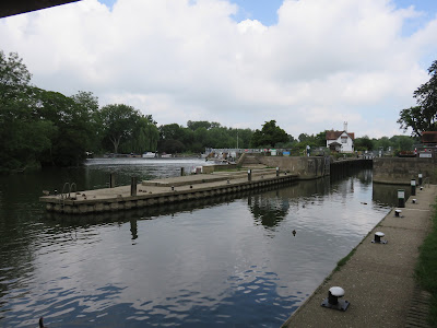 |
| Immediately upstream of the bridge is
Goring Lock and Weir: first built in 1787, with a current build from 1921. |
Goring and Streatley form an interlinked
community and are often referred to together, as in the names of their bridge,
their railway station and their various amenities. But their relationship has a
complicated history. In the Anglo-Saxon period the river placed them on
opposite sides of a boundary between rival kingdoms: Goring in Mercia,
Streatley in Wessex. Though eventually unified under the English state, a
thousand years later its tides of industrial capitalism buffeted them unevenly.
The road on the west side had long made Streatley the dominant village, all the
more so after they built the bridge, but when the railway came through on the east
side Goring expanded in both size and popularity while Streatley found its
expansion constrained by its steeper Berkshire hillside. That is why Goring is
the larger village today, though they claim to peaceful coexistence.
 |
| Post Office, café and ‘doggy
boutique’ on the Goring side of the bridge. A closer look at Streatley should be
possible in the following stage. |
 |
| The road into Goring, beside its old rectory gardens. |
 |
| Goring high street. |
It
was in the industrial period that Goring seems to have acquired the whiff of
money which, while not as in-your-face as some of the hulking Privilege Forts
of the lower valley, nonetheless hangs unmissable in its atmosphere. Wealthy
industrialists fleeing the cities were drawn here both for the fresh, picturesque
situation and the long-trodden connections to both sides of the chalk, now accelerated
with up-to-date transport and communications technology. With their resources these
new-rich arrivals Enclosed the local land – likely with violent consequences
for those who lived off it – and transformed a largely rural collection of
hamlets into a fashionable resort of posh houses, social clubs and sports
facilities whose air of privilege still radiates today.
 |
| This is a village for people with money. A passer-by was excited to point out
that this grand house, next to Goring’s ancient water mill, was inhabited by
the late musician George Michael. It appears to have since been sold for over
£3 million. |
 |
| It has a duck house. In English imagination duck houses became synonymous with
ill-gotten wealth in the parliamentary expenses scandal of 2009, when a
Conservative Party MP’s use of taxpayer-funded allowances to install one in his
pond made them symbolic of the entire corrupt affair. |
 |
| The view west towards the river from near Goring and Streatley train station.
The steep profile of the Berkshire Downs is apparent from here. |
As a
final point, we would be remiss not to address the elephant in the room – that
is, the resemblance of Goring’s name to the perhaps more familiar Göring.
I have not been able to establish whether this most English of villages in the
chalk shares an etymology with the Reichsmarschall of Nazi Germany, but
the mere suggestion is not one from which we might expect a favourable English
reaction.
Nonetheless,
there is surprising irony here in that Goring-on-Thames did house
perhaps this country’s closest equivalent to the man who oversaw the atrocities
of the Luftwaffe. This was the English’s own carpet-bombing air commander
Arthur “Bomber” Harris, who after building his Royal Air Force (RAF) career on blasting
civilians to bits for the British Empire in – guess where! – Iraq and
Afghanistan, burnt his name bloodily into history in the massive area-bombing
raids on German cities in the closing stages of World War II. Perhaps the most
notorious was the February 1945 firebombing of Dresden, which deliberately and horrifically
burnt tens of thousands of civilians to death.
The
English idolise their RAF for its protection of their country in that war, in
spite of its catalogue of atrocities in their colonies before and after it
which they are not taught in schools. Nonetheless, even by their standards
Harris is bitterly controversial. Known as “Butcher” Harris within the force
for his apparent indifference to the staggering losses of life among the bomber
crews he commanded, the epithet has stuck for the blatancy of their war crimes
for whose blame he became the primary lightning rod. He has a statue outside
the RAF church in London – of course he does – but it has been a frequent
target of protests and attacks. The man himself eventually settled in Goring
and died here, apparently unrepentant, in 1974.
 |
| Not so far away from this world’s hell of violence after all then, is it? |
It’s
hardly the first or last time this country ascribed no value to the death or
agony of those it chooses to other. Pertinently, its government has now
announced the lifting of all COVID-19 restrictions amidst a wave of euphoric
jubilation – right as the deadliest strain of the
virus so far is surging at around thirty thousand new cases per day and rising.
Having got fed up of masks and social distancing, it appears that many of the
English have chosen simply no longer to bother. To make their peace, that is,
with how the most vulnerable in their society, those most marginalised in their
health outcomes and their access to care, will inevitably be the ones to eat
the worst of the mass deaths, traumatic mental health effects, and protracted
suffering under the still poorly-understood Long COVID.
 |
| If only thanks and rainbows were accepted currency in shops, right? |
Over
the hundred million years that the Goring Gap took to form, England didn’t
exist. Looking at it now, we might well wonder whether it will for much of the
next hundred million – or indeed, whether it deserves to.


No comments:
Post a Comment