River Thames or Isis, the maps read now. What does it
mean? Two names at once? Or are you expected to choose one or the other, like,
say, chocolate or pistachio ice cream, or a red suitcase or a blue suitcase?
Is it the Isis now? Or still
the Thames? Is this still the same river?
The river itself is silent on this matter. What the names really tell us about are the
humans who come up with them, and here they tell us that there is a set of humans who do things differently from the rest. So
differently, at that, that even the water, the source of all that they are,
takes on an alternate meaning in their presence.
River Thames or Isis. They tell us, in other words, that we encroach
on the core domains of the Oxford English. And that, the Oxfordese tribes would
have us believe, is special.
 |
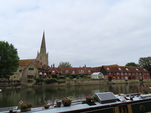
| Abingdon. At population
40,000, this largest of Oxford’s moons has achieved stable orbit – for now – by
drawing on that city’s economic and intellectual atmosphere while exerting one
very much its own. |
 |
| The river at Clifton Hampden,
one of several villages that shelter in the bush along the Thames's-or-Isis's meanders. |
Is that difference substantial, as
far as the river is concerned? As we draw into Lewis Carroll and Philip Pullman
territory, should we expect to find people nosing around in colourful boats
that aren’t from around here, no doubt garbed in suspicious hats and coats? Are
there glimpses of rabbits darting into holes in the undergrowth, pocket-watch
in one paw and bottle of dubious fluids in the other? What is this mystique
about the Oxfordshire leisurelands? By what high otherworldly air are they
supposedly set apart from the long procession of downstream Privilege Forts
which, in flowing through them hereafter, the river must find merely mundane?
Or is it all a magic show, a masquerade
of dialect and illusion? Might it be mere disguise for what’s really just a
continuation of this valley’s nests of wealth and power, here as there seeking
creative ways to write the suffering of those they exclude out of the
story?
 |
| How different is it, really? |
At one level the Oxfordshire Thames would
seem to bear much in common with the fare so far. There are lengthening slogs
across farm fields; white pleasure-cruisers, lazing past with invariably white passengers; and no fewer than three straight cuts, dug through where they
– their monks, their merchants – couldn’t be bothered to put up with the
water’s wilful twists and bends.
But at another level, perhaps one
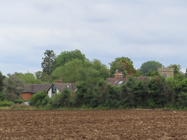
does begin to detect a few kinks in the cosmic fabric. The settlements here are
secretive, hidden behind farm fields or curtains of bush. As at their Dorchester concentration point, the fields in question have been
especially fertile in their yield of clues to thousands of years of habitation
gone by. The long progress through these agrarian margins is intermittently disturbed
by the metallic sheen of cutting-edge science and technology: the satellite
belt of research and development installations that swirl in close orbit of Oxford
University. And in the spaces in between you stumble through a field of much smaller asteroids,
each unique in shape. Those are the bizarre native rituals peculiar to each village
or sub-tribe, the likes of Poohsticks and Bun-Throwing and Morris
Dancing which, just perhaps, can only be made sense of under a Carrollian
suspension of the limits of everyday belief.
 |
| Little Wittenham Bridge. This
unassuming footbridge held international significance as the site of the World
Poohsticks Championships until 2015. |
 |
| A suspicious tree arrangement
spotted in the rustic middle distance between the Didcot power station and the
Culham nuclear fusion research centre. You can’t be too sure of anything in a
landscape like this. |
A world unto itself then? A place
where the imaginary is real, and the real – that is, COVID-19 failure, Brexit-induced
food shortages, and most lately this country’s monstrous and agonising betrayal
of the Afghans – is all consigned to rude imagination?
At times like these regular attention
is drawn to the warnings of one who offered some of the clearest visions on how
truth and reality wither in the authoritarian shadow. It so happens that this
bit of floodplain is also where George Orwell – who it might be noted, took a
river’s name as his own – at last had his bones laid to rest. It’s doubtful his
less corporeal parts get much rest these days, whatever the enchantments called
up by such nomemancy as Thames or Isis.
Start: Confluence with the River Thame,
near Dorchester-on-Thames (nearest station: miles away, take the X39 or X40
bus from Reading or Oxford instead and walk in from the stop on the Dorchester
Bypass)
End: Abingdon Bridge (nearest station:
miles away, take the X3 or X13 bus from Stratton Way to Oxford or Didcot
Parkway instead)
Length: 14.5km/9 miles
Location: Oxfordshire – South
Oxfordshire, Vale of White Horse
Topics: Little Wittenham, Clifton Hampden,
Sutton Courtney and Culham, and Abingdon. Is it special?
Little Wittenham
West of the peninsula between the
Thames and the Thame, a sweeping U-shaped loop in
the larger river creates an even broader peninsula. This one is spread with farm fields and flood meadows and
guarded by sibling hamlets at its neck: Little Wittenham on one side, Long
Wittenham on the other.
 |
| The Wittenham Clumps as seen
from the Dorchester outskirts. As the only high ground for miles around, those ancient hills look out over
much of today’s section. The Dyke Hills, former rampart of a late Iron Age
trading and crafting centre, run across the foreground. |
 |
| Where once stood that ancient
settlement you are now more likely to find these fellows. |
 |
| What reflection does it make
on this country, that so significant a threshold as the confluence with the
Thame has been defaced with COVID-19 conspiracy theories? |
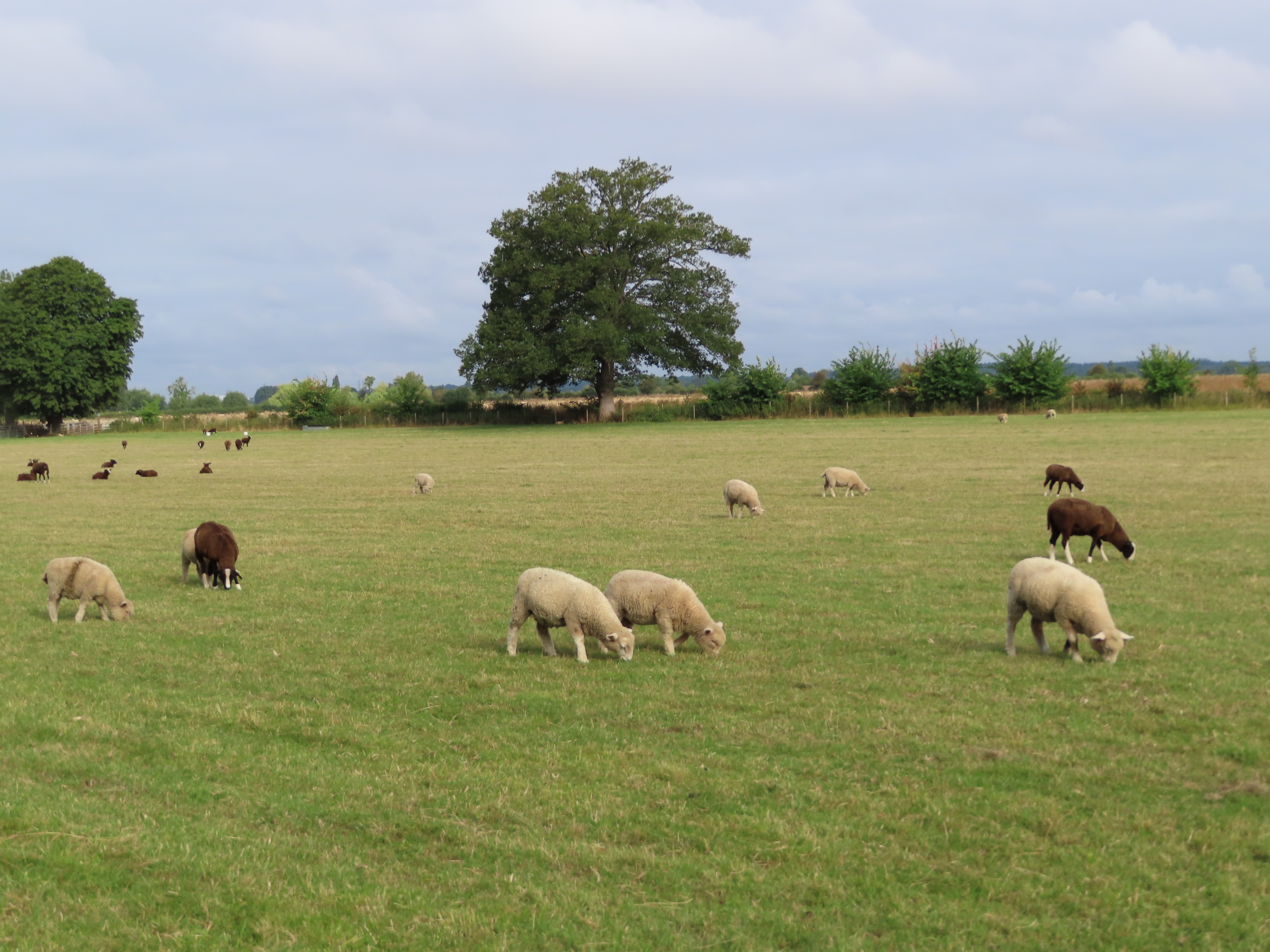
A large pasture holds the bottom of
the Dorchester peninsula, with woolly inhabitants to offer wholesome company round
the first of today’s many riverbends.
 |
| Much breakfast is had on this
field. |
 |
| The black-fleeced and
white-fleeced populations are about fifty-fifty here. |
 |
| Regrettably they tend to
shuffle away in shyness after a few moments, providing no opportunity to touch
the fluff about their heads. |
There are impressively large trees to
be found here at the foot of the Wittenham Clumps.
 |
| Watch out – this one’s armed. |
 |
| These would appear to be horse
chestnuts, known colloquially as conkers. In earlier generations when it
was still safe for young people to go out in this country without getting
stabbed, records speak of a popular competitive pastime by which they would
thread string through the smooth, hard seeds in these shells and swing them
into each other’s, scoring points if they managed to break their opponents’. At
higher degrees of professionalism they were said to harden their own conkers by
aging them or soaking them in varnish. |
Round the corner is Day’s Lock,
whose lock-keeper’s cottage adjoins the footbridge to Little Wittenham. The
bridge might appear a simple white-coated iron and wood affair, but it holds a
special place in English sporting consciousness.
 |
| Little Wittenham Bridge, with
the Day’s Lock cottage on the western bank and a rich white moneyboat shaving narrowly
beneath the bridge. |
In the much-beloved Winnie-the-Pooh
stories of A. A. Milne, the eponymous friendly bear and his companions play a
game in which, while stood on a bridge and facing upstream, each simultaneously
drops a stick into the river. They then wait to see whose stick emerges first on
the downstream side, with that individual considered the winner. Poohsticks,
as this game became known, rose to broad popularity with the success of the
Pooh books and occasionally attained practice as a professional sport, with
detailed stratagems devised around the shape and composition of the stick, the
method of its release, and the identification of the fastest channel of river
current, along with severe penalties for any participant deemed to have thrown
their stick rather than dropped it.
In 1984 the late Lynn David, resident
lock-keeper here at Day’s Lock, had the idea to hold a Poohsticks fundraising
event on this bridge for the Royal National Lifeboat Institution (RNLI) – a
venerable charity devoted to saving lives at sea (and lately vilified by the English
nationalists for rescuing refugees rather than letting them drown). The Poohsticks tournament took off
as an annual event, attracting ever larger crowds to this spot and eventually reaching
a international television audience.
Such was its popularity that by 2015
the crowds had outgrown this little bridge, and the World Poohsticks
Championship was moved for safety to a bridge on the River Windrush further up
the Thames. It was last held in 2018, with the COVID-19 pandemic regrettably
forcing its cancellation for several years running.
 |
| Day’s Lock in action – notice
the two cheerful lock-keepers operating it on behalf of boaters. Built in 1789
by the Thames Navigation Commission, it was apparently named for a family of local Catholic
yeomen – though under
what circumstances is an interesting question given this country’s violent
hostility to Catholics at that time. The lock gradually fell into ruin but was thoroughly
rebuilt in the late nineteenth century. |
 |
| Walking upon the lock’s gates
and weir gets you across the river, but if vessels are passing through then you’ll
need to wait till they shut the gates after them. |
 |
| Upstream from atop the weir. |
 |
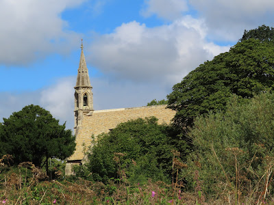
| The fourteenth-century bell
tower of Little Wittenham’s St. Peter’s Church peeks over the treeline. This
tiny village at the foot of the Wittenham Clumps was once held by the abbey up
in Abingdon, which surrendered it under suppression by Henry VIII in the 1530s.
Little Wittenham ended up in the hands of the powerful Dunch family, with the
evidently sizeable hindquarters of one of its female notables – supposedly
Oliver Cromwell’s aunt – producing the hills’ local nickname. |
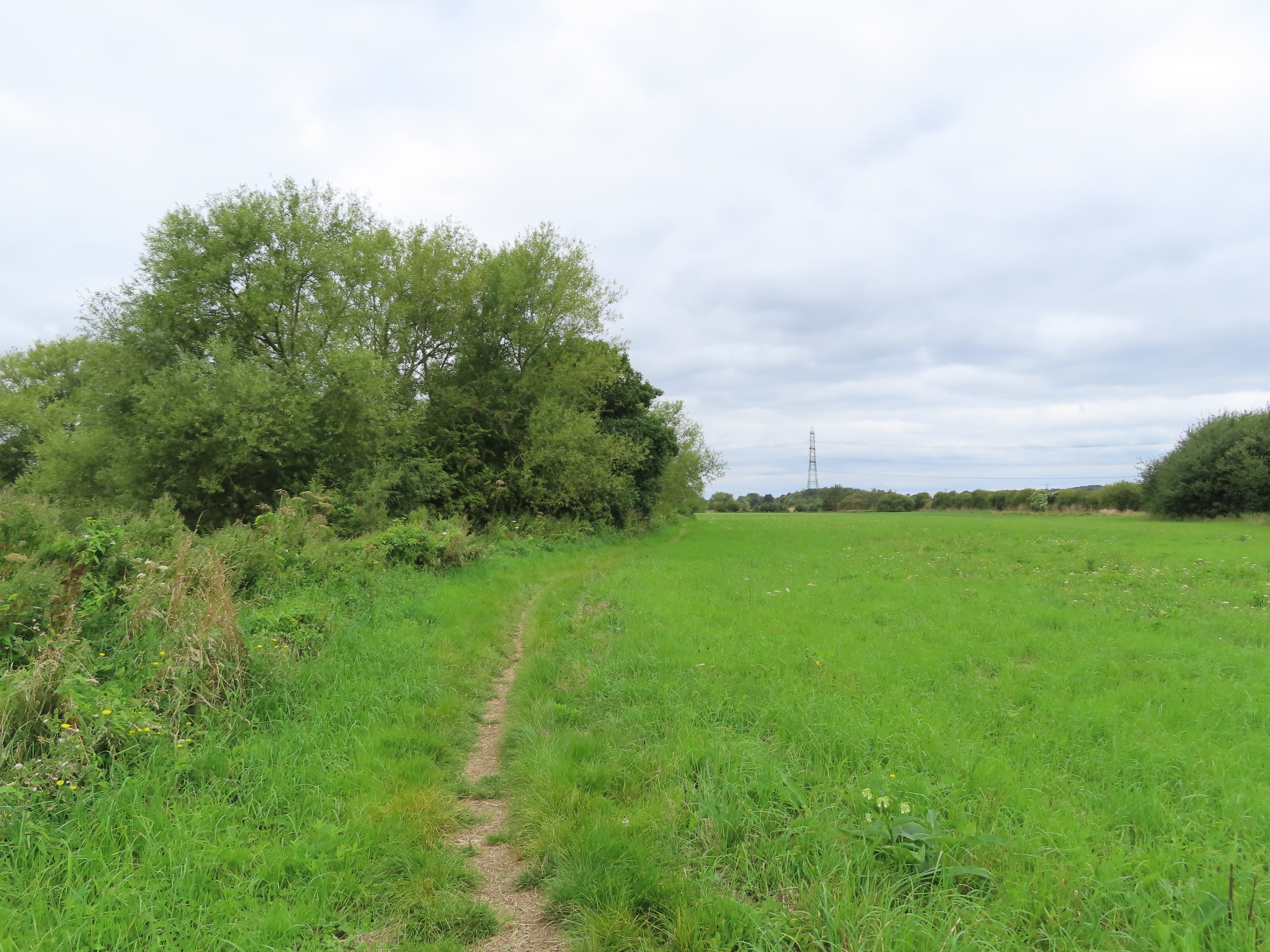
There follows a trek of some four
kilometres round the top of this loop. These low-lying flood meadows make for
easy walking when dry, but likely grow treacherous, sometimes impassably so,
after heavy rains or during the harsh English winter.
 |
| Could the transition from
stone pillboxes to brick ones be another representation of the Oxford glamour?
While the former merely provide a defensible firing position, no doubt these
ones work by disgorging otherworldly magical forces out of portals. Alas their
cunning plan was not thought through: this one’s been defeated by a single
sheep. |
 |
| From here it’s easy to
appreciate the flatness of the river valley in the lower Oxford Plain. The sky
is broad and the horizons are far away. |
 |
| Even in dry conditions these
fields retain water, to the advantage of gregarious congregations like these. |
 |
| Suddenly, a floof. |
Near the top of the loop the back
gardens of affluent houses line up across the water. These are the residences
of Burcot, a tiny hamlet traditionally in the orbit of Dorchester.
Despite a present population of only
about five hundred people, Burcot carried enormous importance as far as the
river is concerned. The hard sandstone river bed and low natural water levels
here meant that till the last two hundred years or so, the river became
unnavigable to boats here. Travellers heading upstream were thus forced to
disembark and continue their journeys by land.
Eventually successive regimes tried
to do something about this. Their first effort, the Oxford-Burcot Commission
appointed by James I in 1605, represented this country’s first government
commission into the management of the Thames. Nonetheless they struggled, and
the problem was really only solved when the Thames Navigation Commission’s
locks and weirs raised the water level at the end of the following century.
 |
| Burcot lost its traditional
importance after that, but from the Victorian period on it revived as an
attractive place to live for the tiny minority of people who could afford it. Almost
all its houses appear to date to within the last hundred and twenty years or
so. |
 |
| The Chinese goddess Nüwā is
said to have created humans by scooping earth out of a riverbank and shaping
them by hand. This appears a candidate for where she created the
English, though one might ought to question her sobriety at the time. |
 |
| The Wittenham Clumps are in
plain sight to the south. You can bet that out here you’re in plain sight of
them too. |
 |
| This looks like a newer
creation. If you row across to its lawn in a canoe and place your fingertip on
a blade of grass, how many seconds till the alarms go off and automated turrets
pop from the ground to kill you? |
In hushed whispers, it’s also
suggested that Burcot, along with some of these other villages in the
Dorchester cluster, were a hotbed of religious dissidence during the height of repressive
English Protestantism in the eighteenth century. There is evidence that adherence
to Catholicism or non-conforming Protestant branches bubbled on in these parts,
perhaps explaining how a Catholic family could stay prominent enough to got a
lock named after them.
Here on the west side meanwhile,
human habitation is limited to clumps of farmhouses in the distance. The fields
along the river belong to a bulkier populace.
 |
| Specifically – Nuuo. These
don’t care what religion you are. They’ll moo at you regardless. |
 |
| A certain rectangularity might
warrant inquiry here. |
 |
| Then there are works. |
Temporary fences and signs of digging
materialise along the northern arc. They are part of a project to transform some
of these water meadows into a full-fledged wetland, as organised by an alliance
of local trusts under the name River of Life.
 |
| The goal appears to be to
improve flood flows into these meadows, thus creating valuable wildlife
habitats – fish, newts, waterfowl and so forth – as well as improving water
retention so as to alleviate the risk of downstream flooding. |
 |
| COVID-19 has slowed the
project but it appears to be getting back underway; a couple of surveyors were
spotted assessing one of the worksites. Notably it’s funded by a European Union
agricultural development grant, making it one of a species of project facing
imminent extinction due to Brexit. |
 |
| Burcot lounges expensively
on. |
 |
| Plenty of dogs come out this
way, with much excitement thrown off by their encounters. Here such an
encounter is unfortunately deferred by the intervening body of water. |
 |
Not so much the Cheshire Cat as the Oxfordshire Dog.
|
Cross a few more fields from here and
you reach another curious little settlement.
 |
| Look. They’re storing dubious concealed
objects in this one. |
 |
| It’s about the right size and
shape for a crate. Doubtless it contains weapons to do oppressive colonial wrong
things with. |
 |
| Boathouses like these are
common along here, but in general come attached to posh houses. That this one emerges
straight from bush can only mean it’s a gateway to an alternate Earth where
this is part of South Scotland Province. |
 |
| Soon the roofs of Clifton
Hampden emerge on high. |
Clifton
Hampden
The operative part of this village’s
name is brusquely pragmatic: village/farmstead (Anglo-Saxon -tun)
on top of a cliff. Historically a tiny rural outpost of Dorchester
supported by the Abingdon road on a fordable spot on the river, its profile
grew with the turnpiking of that road in the 1730s (it’s now the A415),
followed by the coming of the Thames Navigation Commission to fight the
turbulent meanders just upstream.
By then its name had got a Hampden
attached. How is not clear, although the lord of the manor in the 1530s was
apparently a Miles Hampden, whose family must therefore be the prime suspects
as to why this place has inherited the rather less pragmatic – you might say
positively unwieldly – title of Clifton Hampden.
 |
| Clifton Hampden’s St. Michael
and All Angels Church: an 1840s Gothic Revival restoration job, albeit
allegedly with bits inside that date back to the twelfth century. Till the
nineteenth it was a satellite chapel of Dorchester. |
 |
| The highlight of
present-day Clifton Hampden is its bridge. Its architect was George Gilbert
Scott, better known as a prolific redesigner of public buildings and churches
(including the above), hence perhaps this bridge’s picturesque idiosyncrasy. |
The village got a new breath of life
in the Victorian period, when it fell into the control of Henry Hucks Gibbs
(a.k.a. Lord Aldenham), governor of the Bank of England, who commissioned many
upgrades and restorations. With the water level raised by the upstream lock, to
the relief of river traffic but the consternation of people trying to take
cattle across the river, it received this charming bridge made from local red
brick in 1867 to placate the angry latter.
 |
| The bridge was built with
these triangular bulwarks to provide pedestrian refuges, a convenience which
has come into its own in the age of motor traffic. It charged tolls to
cross till the Oxfordshire and Berkshire government councils bought it off
Gibbs’s descendants in 1946. |
 |
| Leisure-craft sit parked along
the riverbank on the approach to Clifton Hampden’s lock and river cut. |
 |
| An extremely suspicious piece
of cargo is spotted being smuggled downstream. Likely it’s something from the
nearby Culham nuclear fusion research centre, getting sneaked away for military
adaptation. |
Across the bridge we descend the west
flank of the flood-meadow peninsula. On its lower corner sits the village of Long
Wittenham, but it is too much of a trouble to reach on account of the
river’s sudden rambles next to it – or rather, the decision of the Thames
Navigation Commissioners to engineer their way through them after getting fed
up of endless accidents, disasters and delays.
The product of their efforts, after
decades of abortive schemes and suggestions, was Clifton Lock – which
was then further delayed for reasons described in the sources in no greater
detail than that ‘the owner of the land was a lunatic’. It was finally
completed in 1822 at the head of the Clifton Cut: a trench they carved
straight through the neck of these meanders to bypass them altogether.
 |
| Clifton Lock, also in action. The
cheerful lockkeeper will shout a greeting to you as you pass. |
 |
| The Clifton Cut: dead straight
and flat all the way along. Long Wittenham along the river’s natural course is
a long detour followed by a very long distance to the next crossing
point (which is maybe why it’s Long Wittenham), so let’s grudgingly forego
it and take the simpler track along the cut. |
 |
| Here at least is one advantage
in doing so. |
 |
| It’s a variegated crowd, this
one. |
 |
| The weir at the head of the
Clifton Cut, where it first diverges from the river (and where you rejoin it if
travelling upstream). |
There follows one of the longest
slogs so far through open farmland, with little in the way of settlements or
installations to distinguish it – or so it appears. In fact the river threads
this marginal band between two serious high-energy particles in orbit of the
Oxford nucleus: the Culham Centre for Fusion Energy to the north, and the
railway junction town of Didcot with its great big power station to the south.
 |
| You wouldn’t think it, looking
at this. Miles of agrarian back-of-beyond, side by side with marvels or monsters
(depending on your point of view) of science and technology. Perhaps that manner
of amalgam is an Oxfordshire thing too. |
 |
| This has to be the aftermath
of some esoteric ritual. What unimaginable entities might they have called
forth here on a starlit summer’s night? |
Halfway up this long reach, the
village of Appleford peeks out from the growths across to the south.
This is an old settlement which appears in Anglo-Saxon land grant records, although
farmers and gravel extractors in the 1950s and 60s discovered large hoards of
Roman coins and pewter artifacts here. The village’s name likely indicates a
traditional role as a crossing point to bring the produce of the orchards to
its south – still Berkshire back then – into Oxfordshire.
 |
| The oldest parts of Appleford’s
church, whose spire pokes out here, go back to the Norman period. Like Little
Wittenham it existed as an appendage of Abingdon Abbey till that monastery’s
destruction by Henry VIII. |
 |
| More nuuo. |
 |
| And more of this, too. How far
up do we suppose they go? |
Appleford also comes with a railway
bridge – and with it the return of the Great Western Railway, which here has
put out a branch from Didcot for the final leg of its linkage to Oxford.
 |
| Both sides of the bridge are
thick with vegetation such that you only get much of a view of it from beneath. Compared with Brunel’s mantlepiece-quality pieces down in the Goring Gap this bridge is a more hard-headed
affair, built first in timber in 1844, replaced with wrought iron in the 1850s,
and finally done up in steel in 1927. |
 |
| The chimneys of the Didcot B
gas power station stand as one of the most recognisable landmarks of this
region and by this point are ubiquitous on the southern horizon. |
After further lengthy trekking
through farms the trail at last dives into a tight riverside thicket – on
emergence from which, after long kilometres with no settlements in sight, two
suddenly crop up at once.
 |
| Enchanted? |
 |
| Yes. There are trees with
faces here. |
 |
| Come here at night and see
what happens. |
Sutton
Courtenay and Culham
Between Sutton Courtenay to the south
and Culham to the north we have another round of hydro-engineering. When the Culham
Cut opened in 1809 it was one of the longest artificial cuts yet made on
the Thames to that date, and served as a proof of concept on which they based the
Clifton one.
The village of Sutton Courtenay,
cumbersome double-barrel name and all, streaks away along the river’s original
course before skewing off down the Harwell Road to make contact with the Didcot
Power Station complex, which no doubt supports a large proportion of its
livelihoods. Wayfarers are once again encouraged to follow the Cut, but the
village harbours secrets not many people know and is well worth a quick
diversion.
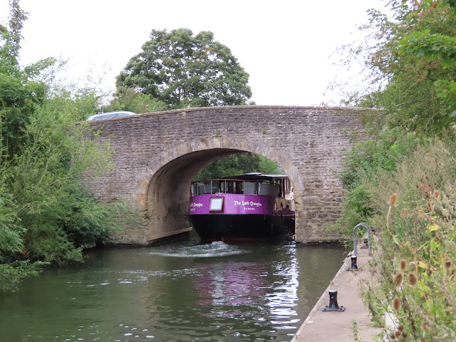 |
| Sutton Bridge, an 1807 stone
crossing with a humongous purple thing trying to squeeze through it. The bridge
gained an extension two years later, so that it crosses both the main river and
the Cut to provide access to Sutton Courtenay. It replaced earlier bridges and
ferries and as at Clifton Hampden used to charge tolls. |
 |
| Culham Lock – named for the
village on the north side – was built out of stone at the foot of the Cut. |
 |
| Sutton Courtenay. This
northern hub around the river and church would appear to be the oldest part of
the village. |
This bend has been inhabited since
very ancient times, but the present village seems to be Anglo-Saxon in origin.
Its initial name of Sutton, meaning south village/farmstead, was named
in apparent reference to Abingdon, of whose abbey it became another satellite
under the Kingdom of Wessex.
Sutton was a pretty major centre in
its own right if we judge by the hints of massive installations found here by Time Team among others. These include not only
one of the largest Saxon timber halls in the country but also an enormous
causeway, which together with the weirs, bridges and islands that emerged over later
centuries, have split the river’s flow into a leafy backwater known as the Sutton
Pools.
 |
| A trail crosses a series of
weirs along the Sutton Pools to rejoin the Cut halfway down. Sutton Courtenay
was big on paper-milling, though the mills have long since disappeared. The
separation of the water flow into no fewer than three channels makes this one
of the more complex segments of the river. |
As for why it’s called Sutton Courtenay,
the culprits were the de Courtenay family from France, a bunch of Crusaders who
developed an English branch in the twelfth century. Specifically, Reginald de
Courtenay is said to have been given this village by Henry II, supposedly for
assisting him in securing his kingship out of the shambolic and bloody power struggle between Matilda and Stephen. Reginald’s family later became
Earls of Devon, where they live in a huge castle and still have a guy in the
House of Lords today.
 |
| Sutton Courtenay’s All Saints
Church, with a twelfth-century Norman tower and a brick porch conspicuously
stuck on in the fifteenth. It narrowly survived the civil war when the vicar at
the time, a supporter of Parliament here under the nose of the king’s Oxford
stronghold, carelessly stored ammunition inside it which of course blew up. |
 |
| Another in the recent trend of
local churches sitting open for anyone to poke around inside. This was rarely
the case downriver. |
 |
| This feathery pair has taken
up residence at the top of the tower. |
There’s more to the church. How about
a look in its cemetery?
 |
| Herbert Henry Asquith of the
Liberal Party was prime minister of this country from 1908 to 1916 and
introduced its first major set of social welfare reforms, including the minimum
wage and free school meals. This cultural seed would blossom in the post-WWII
welfare settlement, then get torn out (or worse, poisoned into a system of
abuse) by the Conservative Party in the present. However Asquith got himself
stuck on the wrong side of the women’s suffrage struggle and was found
ineffective as a war leader in the opening years of World War I, leading to his
eventual replacement. He spent his final years at his country house here in
Sutton Courtenay. |
Asquith’s great granite block is this
cemetery’s obvious centrepiece. Yet there’s another quite considerable name in
here, and this one keeps quietly to itself in one of the rear corners.
 |
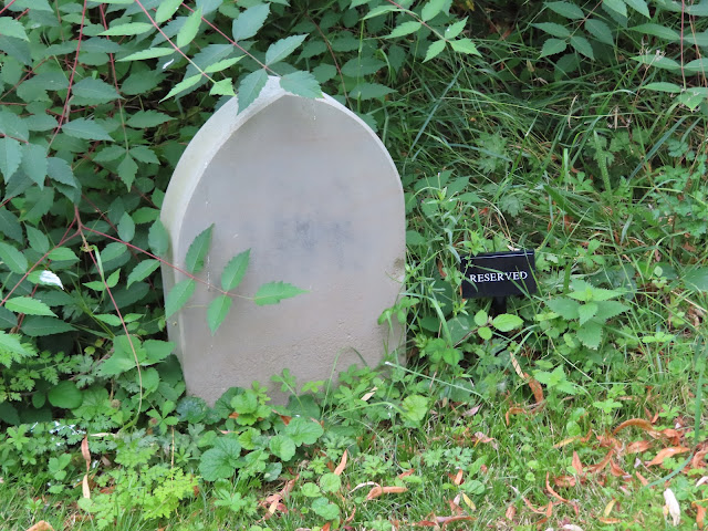
| Eric Arthur Blair – better
known as George Orwell. Beyond the church’s information board there are no
signposts or other indications that he is buried here, and his unassuming
headstone can take some searching for even if you know that he is. |
George Orwell, author of such impactful
works as Animal Farm and Nineteen Eighty-Four, had no particular
connection to this village. Rather before his death in London in 1950 at age
forty-six, he’d stipulated in his will that he wished to be buried ‘in the
nearest convenient cemetery’. With London’s cemeteries apparently lacking space
for him, his friend David Astor, editor of the Observer newspaper and
resident of Sutton Courtenay at the time, managed to get a place for him here
instead.
 |
| And this is the point where you
check over your shoulder. |
 |
| In the church’s entryway is a
collection box for the Abingdon foodbank, launched by an alliance of local
churches in 2009. Oxfordshire is one of the wealthiest provinces in England, but
it too has created clusters of appalling poverty. |
 |
| It at first appears this might
be some exciting Alice in Wonderland potion for changing the physical
properties of whoever drinks it. Alas, on closer inspection it turns out to be
Trump Juice, no doubt left over from the American king’s ill-advised state
visit in 2019. |
Beyond the church the village pulls
away from the river, necessitating a return across the backwater weirs to the
Culham Cut.
 |
| Looking back down the Cut from
atop a footbridge, heavy river traffic is seen accumulating at Culham Lock. |
 |
| This is water sausage
territory. |
Culham is the other village in this pair, another
Anglo-Saxon settlement (Cula’s homestead) formerly under the remit of
Abingdon Abbey. Having grown up in the riverbend it’s now drifted a little way
inland, with the intervening space given over to farmland.
 |
| The roofs of Culham, including
the tower of its 1852 Gothic Revival church. |
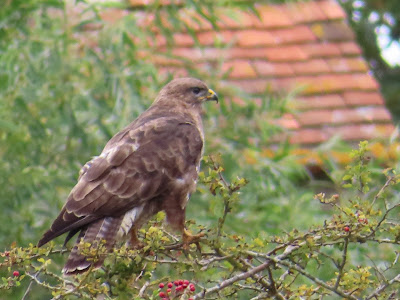 |
| The occasional red kite swoops
around in the skies above the middle Thames. Sighting one at rest like this is less
common. |
 |
| Round the bend the Culham Cut
departs (or rejoins) the main flow, and once more the river is whole – at least
for the one kilometre from here to the next cut. |
 |
| Ploughed fields spread through
the space between river and village. |
After a thousand years as yet another
tiny rural hamlet whose influence remained largely within the reach of its
ploughs, Cula’s homestead would suddenly find its name propelled to the forefront of humankind's efforts to meet the challenges of its energy future. In 1944 a Royal Navy aircraft station was opened to
the village’s east to train reservists, but it closed after World War II and
sat around for a while as a storage centre. That was when the UK Atomic Energy
Authority came along. In those years this was the body with full responsibility
for this country’s civil and military nuclear affairs, and above all for getting
this country its own nuclear weapons. (This included atomic bomb tests
in Australia and the Pacific, with devastating legacies there in the effects of
radioactive fallout and nuclear waste, but be ready for the nationalists to tantrum at you if you mention it.)
The UKAEA identified the Culham site
as a suitable spot to build a cutting-edge nuclear research laboratory, but in
the following decades the Authority’s functions were gradually split off,
leaving it as a research organisation almost entirely concerned with developing
nuclear fusion – the process that powers stars – as a controllable energy
source. To that end the Culham Centre for Fusion Energy, as it is now
known, serves as one of the world’s primary centres for fusion research and
experimental technology. Of these experiments the most iconic is the Joint
European Torus, the world’s most powerful fusion reactor (specifically a tokamak,
originally the design of Soviet physicists). It began construction here in the
1970s, achieved its first plasma in 1983, and so far holds the record in producing
as close to as much power as the amount that must be put in to create and
sustain the conditions to do so (which remains the main technical challenge in
harnessing fusion as an energy source).
 |
| An artificial star in a box:
not exactly the first thing you’d expect in these surroundings,
is it? |
As its name suggests, the JET is a joint
undertaking with the European Atomic Energy Community (Euratom), which supplied
most of its funding. Though distinct from the EU, this country reflexively
withdrew from it straight after Brexit because as a primarily theatrical
exercise it wouldn’t work unless it threw absolutely everything out of the pram.
So out flew a monumental four-decade cooperative investment in some of the
world’s most promising research into solutions for humankind’s existential
energy crisis, and now the entire project has been flung into doubt, managing
its best on temporary arrangements while it waits to find out whether it still
has a future.
 |
| Perhaps if you put your eye to
this you can spot extremely small bunnies making off with bits of the tokamak. |
 |
| Glimpsed through the bushes is
Culham’s old bridge, built by a religious brotherhood in 1422. It was heavily
fought over in the Civil War as an ideal place to attack Royalist convoys
travelling to Oxford. |
Abingdon
And now we draw in to the principal
town on this reach. But first there is the matter of the third and final river
cut on this reach – which was really the first and oldest by far, because where
the Thames Navigation Commissioners dug, there once dug monks.
 |
| The footbridge over the lower
mouth of the ‘Swift Ditch’, which slices through the corner opposite Abingdon.
The town’s suburban outskirts are now in sight. |
This cut is an expression of the
town’s defining – yet muddled – relationship with the river. Abingdon had a
powerful abbey, as indicated by its string of satellite hamlets on this route,
and by the late Anglo-Saxon period its monks were diverting the river’s flow
into weir streams through this corner to power their mills. This caused river
traffic congestion, which in turn caused complaints, so around the 1050s the
newly-elected abbot Ordric had them dig a newer, larger channel. This shortcut,
which became known as the ‘Swift Ditch’, came into use as the main
navigation channel and would remain so till the 1790s, when for reasons likely
connected to lock and canal construction Abingdon’s industrial interests got
that role reverted to the main river.
 |
| These millennium-old
waterworks turned the inside of this bend into an island, known as Andersey.
Named after a chapel to St. Andrew that once stood on it, this is one of the
largest islands on the Thames. It was popular with royalty and held a residence
much used by the Mercian, Wessex or Norman kings of the day. Today it’s
Abingdon’s primary green space and carries the ancient Dorchester road through
parks, fields and sports grounds. |
 |
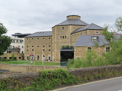
| The entrance to Abingdon
Marina, on whose north side the town’s suburb of Caldecott beings. |
 |
| Abingdon is known for its
750-year-old independent school. It’s boys-only (this being a
shamelessly sexist country), recognisable to fans of Radiohead as that rock
band’s place of origin, and like most such schools has a fervent sporting
tradition. This is its expensive boathouse, built in 2003 and claimed to be the
largest oak-framed building in Europe. |
Further chapters in Abingdon’s
relationship with the river are on show as you follow it up into the town.
 |
| Pleasure-cruisers and
narrowboats line up along the first serious built-up embankment in some
distance. |
 |
| Then an abrupt change in
material signals what used to be the junction with the Wilts and Berks Canal
(as in Wiltshire and Berkshire – the short form was its official name). This
was opened in 1810 to link to the Kennet and Avon Canal and spent a century funnelling the
stuff of the industrial revolution – primarily coal – before it was killed off
by the railways, finally closing in 1914. Its ruins have since either been
built over or abused as a rubbish tip, but in 2001 a partnership formed to get
it restored and has been steadily rescuing bits of it. |
 |
| And then an actual tributary
arrives. The River Ock, whose name comes possibly from a Celtic word for salmon,
dribbles east down the Vale of White Horse to come in here at left. A southern
boundary and millable resource of ancestral importance to the Abingdon
settlement, it looks like a tiny stream but is known to menace the town with
floods when it’s upset. |
And from there we come to Abingdon’s former
wharf, and its bridge which brings us into the town proper.
 |
| Twelfth-century St. Helen’s
Church is an Abingdon landmark and one of its most historic surviving
buildings. It overlooks what used to be the town’s wharf, in its day the hub of its merchant community and the living
conduit of their trade and prosperity. |
 |
| That huge purple creature made
it through Sutton Bridge and has here pulled in for a rest, allowing us to
identify the individual in charge upon its prow. |
 |
| Abingdon Bridge – actually two
bridges, with Nag’s Head Island (here at left) in the middle – is a 1927
rebuild of a limestone crossing erected in the 1410s by Abingdon’s priests and
merchants. The relationship between these two estates seem to have been a core
dynamic in Abingdon’s rise, which the bridge’s completion secured at Wallingford’s expense. |
Abingdon’s assertion is a bold one: it
claims no less than to be the oldest town in Britain. While impossible to
verify, it’s certainly true that the town and its surroundings have thrown up a
wealth of artifacts spanning almost every period of human immigration to and
settlement in this area. These include Palaeolithic hand-axes, Neolithic
pottery, and significantly, a late Iron Age oppidum like that which held the Dorchester bend – only here supposedly contiguous in
time with the present town – along with loads of Celtic coins and imported goods
suggesting a highly active centre of material exchange.
 |
| And if that’s not good enough,
how about an Ichthyosaurus? This Late Jurassic fossil was discovered in a local
gravel pit in 1988 and now sits proudly on display in the Abingdon Museum. |
The oppidum was succeeded by a
small Roman town but developed its lasting identity in the Anglo-Saxon period.
Supposedly known to the Anglo-Saxon immigrants as Seuekesham, this was
changed into Abingdon – from Æbba’s or Æbbe’s hill, they say, even though it’s not on a
hill, suggesting they transferred the name from elsewhere at around the time it
got its abbey.
Abingdon Abbey had its own (rathe more
questionable) claim to be the oldest monastery in Britain. More likely it was
founded around the 670s by the viceroy of Wessex, and rose to some prominence
before getting thoroughly sacked by the Vikings in the ninth century and left
to fall into ruin. Revived under the Benedictine reforms of King Edgar inthe 960s, Abingdon
Abbey became a centre for that movement and would spend the half-millennium
from then till Henry VIII’s crackdown as the thundering heart of the town and
its region.
 |
| Little survived of Abingdon
Abbey’s buildings after its suppression and decay, but its imprint on the town
is tangible to this day. This is its much-restored gateway, connected at left
to the small St. Nicolas Church. The latter was built for the Abbey’s workers
and servants, who were otherwise excluded from its life in a sign of the
tensions between the monastery and the people of the town. |
 |
| And this is “merely” the
remnant of one of the Abbey’s domestic buildings – namely its exchequer, or
financial administration, with its timber-framed Long Gallery (here at left) and a curious and
rare medieval chimney. As its scale makes evident, this huge monastery was as
much a material exercise as a spiritual one. |
 |
| What looks most like the
Abbey’s ruins actually has least to do with it. This is Trendall’s Folly, put
up in the 1860s because the Abbey Gardens’ private land-holders wanted
something that looked like its ruins. Ironically some of these stones
came from St. Helen’s Church so could actually be very old indeed. |
Hand-in-hand with Abingdon’s
religious status rose its economic clout, with the monks in effect its dominant
corporation. The monastery’s river of wealth was of course the river itself,
which provided water and fish, powered their mills, and netted them a fortune
in tolls on traffic at one of the most fordable points on its upper-middle
course.
This went down poorly with the town
growing up in its shadow, its merchants and traders most of all. They had their
own guild, focused at St. Helen’s Church above the wharves which made them
their killing, and they regularly quarrelled with the monks over the latter’s
intrusive control over their affairs. The town’s prosperity in agricultural
produce and textiles (especially wool) gave high stakes to these tensions,
which came to a head in a massive and bloody riot in 1327.
Nonetheless, in the fifteenth century
the merchants prevailed on the monks to let them set up the Fraternity of
the Holy Cross. Despite the sinister sectarian-sounding name this seems to
have been an attempt on the merchants’ part to thrash out some practical
self-government in Abingdon; the Fraternity invested considerably in civic
infrastructure projects such as almshouses, a causeway, and most importantly
the bridge. It also sank a large sum of money into raising a prestigious and
ornate market cross in the middle of the square: a clear statement of power and
prestige in the face of the Abbey’s.
 |
| Abingdon’s market square
today. |
This hard-nosed mercantile culture was
to keep the town going after Henry VIII’s sledgehammer broke the monastery out
of the equation – apparently, and surprisingly, with its willing compliance –
in the 1530s. Like the settlements downstream Abingdon then had to endure both
the crushing impact of this asset-stripping on its market life (further worsened
when the Fraternity itself was abolished by the central government), followed
by its ill-fated position on the front lines of the seventeenth-century Civil
War. The Parliamentary army took control of the town in 1644 in a collapse of
the king’s protective screen around his Oxford stronghold; but as yet unable to
take Oxford itself, the angry Puritan soldiers took out their iconoclastic ire
on the Abingdon merchants’ market cross, which is why it no longer stands in
the square today.
 |
| Although not all is lost; you
can still get awesome hot chocolate from the independent Bulgarian café in its
corner. |
Against these difficulties Abingdon managed
to secure a royal charter in 1556. This elevated its status to that of one of
Berkshire’s core administrative and judicial centres, a set of functions it
shared with Reading till the latter, with its better position in the railway
revolution, surpassed it in its industrial heyday. For its part in this rivalry
Abingdon bolstered its status with some fancy architecture, and towards the
industrial period set out to distinguish itself with a range of unusual
customs.
 |
| Case in point: Bun-Throwing.
This photograph in the Abingdon Museum shows what the market square looks like
on major national or royal events. Abingdon marks these with a ceremony in
which civil officials hurl buns filled with currants off the roof of the County
Hall to the excited throng below. The idea’s origin is unclear but is thought
to have begun with the coronation of King George III in 1760. The long-term
effect of COVID-19 on it remains to be seen. |
In addition to Bun-Throwing this town
grew into a major centre for Morris-Dancing, an old English folk
tradition with strong regional variations. It’s also one of the few English
urban centres to carry on a tradition of late autumn fairs, which customarily
gave farm workers and domestic servants a chance to come into contact with
better potential employers.
 |
| Abingdon’s grand County Hall,
in whose design the English’s architect-hero Christopher Wren is suspected to
have been indirectly involved, was built in the late 1670s as a courthouse and
administrative centre with space for market activity beneath. It now houses the
Abingdon Museum and offers access to the roof terrace for good views across the
town in all directions. |
 |
| Not all innovations in this
period were so well-intentioned. These sticks were used by officials to assault
inmates in Abingdon’s workhouse, built in 1835 under the Poor Law reform to
torture people for being poor. Its separation of men and women, and of children
from their parents, added to the heinousness of its crimes. The workhouses were
the exultation of an English tradition of cruelty, abuse, and the blaming of
victims of political and structural violence for their own suffering – the same
tradition which informs the present government’s austerity programme and
perversion of the welfare system to punish this country’s most vulnerable
people. |
 |
| More abuses: this was Abingdon
Gaol, opened next to the bridge in 1811 as the old jail in the Abbey gateway
grew overcrowded. The prison system was still taking off in this period, with
most inmates (typically driven to desperation by the violence of Enclosure
and/or industrialisation) held prior to getting put to death or transported to
labour in the colonies. The Gaol represented the shift to punitive
incarceration, but closed in 1867 with its functions transferred to the larger prison at Reading. As you can see here, instead of a
memorial to organised mass brutality they’ve gone for full bad taste by converting
it into a leisure centre and luxury flats. |
The rise of the railways passed
Abingdon by, with distaste for them among the local landowners displacing Brunel’s
Oxford branch to Didcot instead. This and the only temporary advantage provided
by the Wilts and Berks Canal risked sidelining the town during industrialisation,
and in the 1860s caused it to lose its administrative honours to Reading.
Nonetheless its mercantile tradition just about held its own by branching into
one or two distinct manufactures.
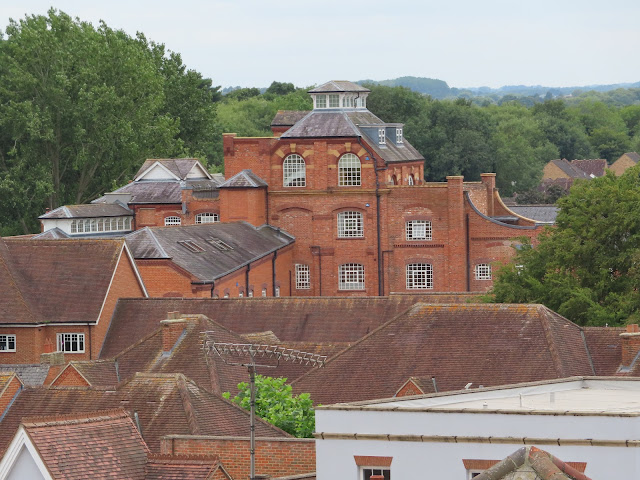 |
| In the nineteenth century Abingdon’s
beer-brewing heritage coalesced into the Morland Brewery, with its headquarters
here (at centre) from the 1880s on. Famous for its Old Speckled Hen
premium bitter, it was sold in 1999 to one of the all-devouring pub companies
of the present day, Greene King, who immediately moved production away to its
own ancestral home in East Anglia. The brewery is now apartments. |
 |
| Old Speckled Hen was
named for Abingdon’s flagship industry from 1929 on: the MG car company, or
specifically a workers’ car within its Abingdon factory. The Abingdon Museum
claims this specimen here to be the final car off its production line, whose
closure in 1980 dealt the town a devastating blow. The MG brand now belongs to
a Chinese state-owned car company. |
Evidently this country’s industrial
decline has hit Abingdon much as anywhere else, Thames or Isis or not. In
the present day however its place within Oxford’s university-city necklace of
high-tech science facilities, equipment suppliers and business parks keeps the
nutrients flowing in an economic bloodstream already enriched by its quirky
cultural scene. As well as the Culham fusion research centre there are the
Harwell and Rutherford laboratories and the Milton Park innovation centre a few
minutes down the A34, in addition to the Didcot railway and energy complex,
numerous technology company headquarters, and of course, Oxford itself.
 |
| Abingdon’s high street, facing
west towards the former Morland Brewery and MG car factory. All these
high-angle views come from atop the County Hall on the market square. |
 |
| Didcot looms across the trees
to the south. If you’re travelling south by rail then that’s where you go when
you need to get out of here. Abingdon did eventually get its own branch line
for a while, only to close it to passengers in 1963 and to goods (such as car
parts for MG) in 1984. |
 |
| And this is east to the river,
with the double bridge and that hideous Old Gaol defining the landscape. The
greenery of Andersey Island spreads beyond. |
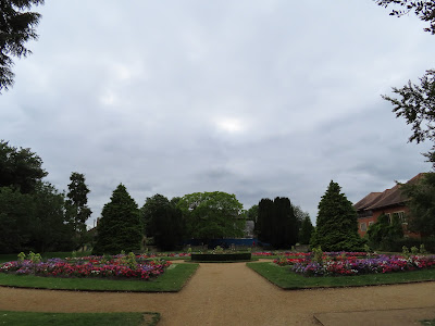 |
| Part of the Abbey Gardens.
Though much reshaped through private hands since the Abbey’s destruction, the
reach of its former grounds gives a great sense of how the town was shaped in
relation to it. |
So it is here, at the last stop
before Oxford, at the button on the collar beneath the head of the middle
Thames, that we should ask once more: Thames? Or Isis? Farms and fields and
villages, just like the rest of it? Or an intellectually-charged passage enchanted by its proximity to other worlds, through whose shifting reeds and
glassy reflections flitter phantasms like Winnie-the-Pooh, flying buns with
currants inside, metal doughnuts with artificial stars inside, and the ghost of
George Orwell as he seethes in his ‘nearest convenient cemetery’...
...and reminds his country that
despite all his warnings, it’s still sold the truth up the river?


No comments:
Post a Comment