
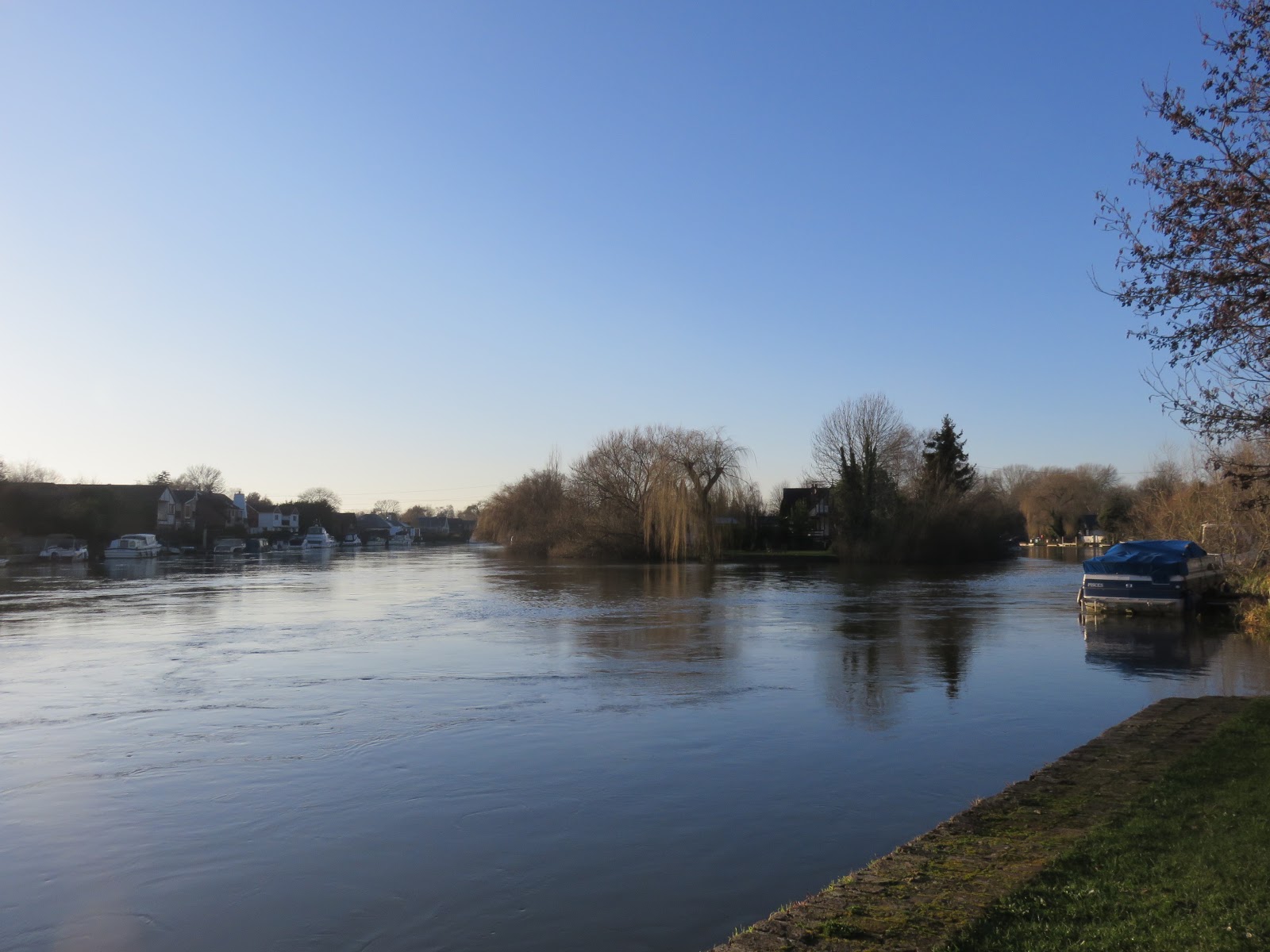
Dawn
of a new year, and a new phase. Our journey up the Thames’s central valley
begins here, and like the future of its people, the first light of 2020 finds it
lost in fog.
The triumph
of Boris Johnson’s Conservative Party (a.k.a. the Tories) in the December 2019 general
election presents the English people with a new phase in their own
journey. Our exploration began with them mired in a protracted struggle over whether to leave the European Union – ‘Brexit’. As of now, Brexit
is secondary. The new government heralds not only the triumph of the Brexit movement’s
most fanatical high priests but a far more ambitious project of cultural transformation,
whose values have manifested over this decade in the Tories’ austerity
and hostile environment policies – or to call them by their proper
names, social and ethnic cleansing.
 |
| Swans seek their breakfast on the river below Kingston Bridge, shielded by fog from the world of human folly. |
No
secret was made of these leaders’ admiration for the darkest demons of
twentieth-century nationalism, whose violences of gender, race and class, and
contempt for the very concept of truth, have burst back out through the crust
of the Earth in so many places worldwide. The English saw what they stood for.
They chose it anyway.
The
most violent consequences will fall on those who did not choose it, who did not
consent, and this will bury once and for all the English’s claims to a democratic polity. As
for those who did select this: they have chosen their fate, and will learn the cost when the lights at the end of their tunnel turn out to be the fires of hell.
 |
| The river, which precedes and outlasts their mistakes, shall guard the true light in the meantime. |
As
for their organised resistance, the opposition Labour Party crumbled
dramatically in England’s fallen industrial heartlands to the north
as its traditional working-class supporters deserted what they saw as its
arrogant and complacent leadership. Here on the Thames, that world could not feel
further away. The Thames valley, so the stereotype goes, is the winding spine
of England’s protected southeast: the lounging, cosseted, corpulent body of the
octopus which sucks the rest of the country dry. Monopolised by some of the most
privileged sections of English society, these provinces are some of the wealthiest in the country and have returned a nigh-unbroken
ocean of Tory blue in election map after election map, disturbed only by the
occasional red or yellow blip in headstrong urban centres like Reading and
Oxford.
They include the
domains of some of the Tory Cabinet's most absurdly impervious figureheads of mediocrity.
Beyond Kingston we must cross the constituency of Esher and Walton, then
Spelthorne, respectively the lairs of foreign minister Dominic Raab and business
minister Kwasi Kwarteng, two of the most accomplished performers in the vacuous
trolling that has become the signature of Tory politics. In spite of this both
were returned comfortably in the election, the former in the face of a
committed challenge from his opponents, the latter by an overwhelming
20,000-vote majority.
That speaks foreboding things about the populations we
are about to traverse. The
crimes of Boris Johnson’s Tories – whose ideologies seek and mock the death of
people like myself, and whose abuses have brought hideous suffering to my
friends in marginalised communities – make it discomforting to venture into
strongholds of such evil. How uneasy lurks the prospect of accepting its populace
as they walk past, as though their murderous voting behaviour can be excused? How
irrefusable the instinct to hold them to immediate account right there on the
towpath one by one?
If
they are to be spared it then let it be out of respect for the river itself. It
is above their sordid politics, does not deserve to be poisoned by having them pushed in it, and might yet have important stories to tell about just what twisted things had to happen in order
that a nation, any nation, could put itself in so small-spirited and shameful a
position.
 |
| Today's section is broad, so click if you want a better view. |
After
all, what can explain the middle Thames’s unyielding grasp on the neck of English
society if not some sturdy historic roots? At a glance, these appear as
varied in shape and texture as they are deep. From the constitutional totems of
Kingston and Runnymede to the elite scholastic keeps of Oxford and Eton, from
the commerce of rich monasteries and industrial boomtowns like Reading to the
warlords’ big damn walls at Hampton Court and Windsor Castle, the wealth and
power of this valley is as much in its stories as in its physical stuff – as
much in emotion and imagination as in armies and bank
accounts.
The
armies and bank accounts give them power, but it is the stories that have
turned that into structures of power. Resisting siege after siege from their
critics and passing it down from one generation to the next, these bastions on
the river guard their power well. They are the Privilege Forts of the central
Thames valley, and a notebook, camera and pair of walking boots might not
enough to topple them. Nonetheless, England’s redeeming characters will
continue to siege them, and can only liberate their treasures on an
understanding of how they came to be what they are, their habits and
assumptions, their strengths and weaknesses. On this account, it might be
hoped, this passage could one day be of some use.
Start:
Kingston Bridge (nearest station: Kingston)
End:
Chertsey Bridge (nearest station: Chertsey)
Length:
17.7km/11 miles
Location:
Greater London – Royal Borough of Kingston upon Thames, Borough of Richmond
upon Thames; Surrey – Borough of Elmbridge, Borough of Spelthorne, Borough of Runnymede
Topics:
Kingston upon Thames and the emergence of England, Surbiton, punting in Thames
Ditton, Hampton Court, Molesey and the waterworks, Sunbury and Walton, the
Shepperton and Weybridge Ferry
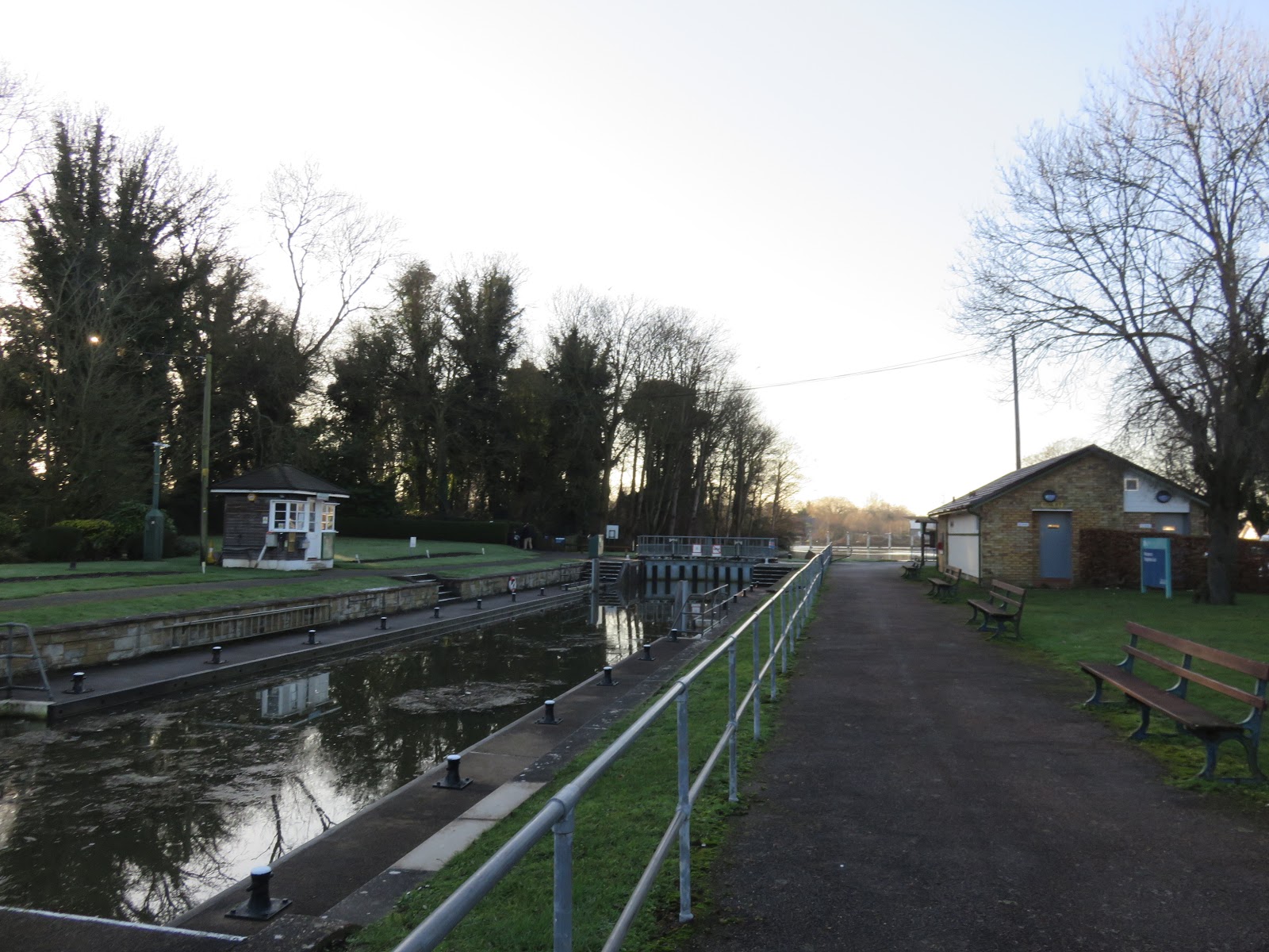
Kingston upon Thames
Kingston
– the ‘king’s estate’. A common place name in England
and beyond (not least the capital of Jamaica), but this, the first of the Royal
Boroughs, is the first of them all. Its fog belongs to a much earlier dawn: the
dawn of the idea of England.
 |
| Kingston Bridge, by far the oldest Thames crossing upstream of London Bridge in these parts and till 1750 the only one. |

Like
all nations, England did not blink into existence in a single moment. It
emerged out of layer upon layer of chaotic coincidences and colliding choices,
a Brownian motion of people, goods, ideas and stories with patterns of will, certainly, but no grand plan or
inevitable destiny. Since then its shape and character have transformed again
and again and continue to do so.
That is important because it is too easy
to take its present territorial claims as its permanent natural extent. They
are not. No country has a natural shape and no land inherently belongs to it.
England is like them all in that regard: joining Norway and Denmark for a bit;
seizing Wales; losing France; settling teeth into Ireland; goading Scotland
into a ‘Union’; then grabbing, abusing and losing large swathes of the
Americas, Asia and Africa. The prospect of the breakup of its United Kingdom –
now made markedly more likely by politicians who, despite their
organisation’s formal name of Conservative and Unionist Party, have
shown themselves English nationalists who do not understand Scotland and Ireland –
would be but one more link in this chain.
At
the other end of that chain, England as a concept did not exist. From around
the fifth to ninth centuries, following the withdrawal of the Roman Empire, the
land now called England was a patchwork of shifting kingdoms established by
immigrants from Angeln, Jutland and Old Saxony, regions now in Denmark and
Germany. From the ninth century on a Scandinavian element joined the picture as
Viking raiders from across the North Sea devastated most of these
kingdoms and established their own domains. They might have overwhelmed the
Anglo-Saxons entirely had not the king of their last independent kingdom,
Wessex, led his people to an astonishing victory and agreed a peace treaty
effectively dividing the island between the Anglo-Saxons and the Vikings. He
then proceeded to consolidate Wessex with the recovered parts of the other
kingdoms through far-reaching legal, educational and military reforms.
The
English now consider this unified Anglo-Saxon realm the crucible of their nation. Its king, this gentle, scholarly, in many ways not particularly English man
called Alfred, is one of only two in their history they call ‘the Great’.
Kingston
upon Thames stood upon the boundary between Wessex and one of the other
major Anglo-Saxon kingdoms, Mercia. Perhaps because of the symbolic power this
gave it for unification purposes, Alfred’s dynasty set about crowning its kings here. They included Alfred’s son, Edward the Elder (900), who together
with his capable wife, Æthelflæd of Mercia, took most of Mercia and East Anglia
from the Vikings; then Edward’s son Æthelstan (925), who pushed into
Northumbria and was the first to be called ‘King of the English’ (rex Anglorum).
The invention of a country called England, of a people called the English,
had begun.
 |
| The Coronation Stone, kept in this fence outside Kingston’s guildhall. The claim is that this is the very magic artifact, recovered in the eighteenth century, on which seven of England’s first kings were crowned. As a matter of fact this is beyond verification, but as is usually the case with such things, the story matters more than the literal object. |
 |
| Clattern Bridge fords the Hogsmill River as it reaches the Thames through Kingston. The stone arches are the oldest part and date back to at least 1293. |
Soon
the coronations moved away as Kingston’s symbolism lost significance,
especially after the Normans, to whom it meant nothing, took over in 1066. But
by then England had little of the ethnic meaning that its name, ‘land of
the Angles’, might suggest. Both the Scandinavians, who ruled it for a time
(especially under the other ‘Great’ king, Cnut), and the Normans, essentially
Frenchified Vikings, made deep and lasting impacts on English politics, class
structures, language and landscape. Nor was this the ‘island country’ of later
imagination, which came only after the failure of centuries of struggle to maintain
an English realm spread as much across western France as the island of Britain.
The concept of race, invented later (yet whose stirrings can be sensed
from this time in prejudice towards Irish people), was as yet meaningless in an
English story whose trajectory, if not destiny, took place in a cosmopolitan
gravitational field.
Kingston
has never forgotten its place at the start of this. With such a distinguished
birth, not to mention control over a crossroads of ancient routes as well as a key ford on the river, its settlement was here to stay
and flourished as a market town with fishing, brewing and trading interests and
a privileged royal charter. It later received a further considerable boost when
Hampton Court appeared across the river, handing its merchants a new mass of
rich and prestigious people to house and feed. Industrialisation brought
railways, suburbs, electricity and a new level of commerce, in particular the
manufacture of fighter aircraft. Even today its market squares and high street
have functioning shops – not exactly something English high streets can take
for granted these days.
 |
| Central Kingston, early in the morning. It gets a lot more crowded during the day. |
 |
| Much of Kingston has been taken over by huge department stores with the usual soul-sapping atmosphere of twenty-first-century consumerism. The largest of these is the Bentall Centre, opened in 1992. |
 |
| But in Kingston this culture is preceded by an older, more substantial thread of commercial history. Before the Bentall Centre there was Bentall’s, which began as a drapery in 1867 and grew by the 1930s into England’s largest department store outside central London. |
Kingston
remains an archway between England’s centre and provinces, benefiting from its
position with a column in both worlds. Technically an outpost of Greater London
since 1965, in the centuries till then it was considered part of Surrey and
like neighbouring Richmond
still identifies as such in its postal addresses. In fact it goes one step
further: Kingston continues to function as the administrative capital of Surrey despite being officially no longer
in it, much to the
consternation of Surrey’s other centres like Guildford and Woking which have
made repeated though as yet unsuccessful attempts to take this status off it. It is the only case in England of which this is true.
Surbiton and Thames Ditton
Beyond
Kingston’s riverside parade of shops and restaurants, the path gives way to
private houses and boating facilities. So let us cross the river for the first
time on this journey and proceed up the northern bank, which in stark contrast
to Kingston is sweeping parkland.


 |
| Notice the rings on their legs. The inheritance of legal history currently places the Thames’s swans under shared ‘ownership’ of the monarch and two of the City of London livery companies, the Vintners and the Dyers. Every July they perform the ancient ceremony of swan upping, effectively a swan census and health check. While originally this was to manage their numbers so rich landowners could eat them, today it is more for education, conservation, and generating TV images of said friendly landowners letting children cuddle fluffy cygnets. |
Most
of this parkland is walled off from the riverbank, to which it concedes only an
outer palisade of trees and grass. That is because this entire peninsula, from
here all the way up to Teddington,
was enclosed and landscaped for the pleasure of one of English history’s
biggest and fattest Privilege Forts of all – even though we still have three
kilometres to go just to catch sight of it.
 |
| Looking back across at Kingston, the fog is just light enough to make out the gap where the Hogsmill river, historically milled but now a vibrant ecological habitat, arrives on its journey from Ewell. John Millais’s famous 1851-2 painting of Ophelia from Shakespeare’s Hamlet took its setting from the Hogsmill, whose scene of riverbank ecology, studied and expressed in the painting in remarkable detail, is considered almost as English as the voracious flies, trespassing litigation and terrible weather that together besieged Millais as he fought to complete the work. |
 |
| The turn of a year it may be but nothing stops the rowers, with obligatory dictator-in-a-motor-boat, heading out for their early morning self-punishment. The far bank bustles with restaurant-goers and pleasure-boaters during the day, while John Lewis’s visage looms on in the background. |
 |
| Against the regional trend, Kingston voted for the Liberal Democrats in the election. Here its residents are escaping the national result by fleeing through portals to other dimensions, whose flashes of light erupt through the apartment windows. |
Everything
now tumbles toward Hampton Court, nest of that ubiquitous historical singularity
called Henry VIII who we last saw getting munched on
by dogs at Syon Abbey. Rather than entertain him, let’s save Hampton Court
for when we get there and meanwhile give due consideration to the smaller
communities across the river.
Most
immediately there is Surbiton, whose name, south farm, identifies
a) its agricultural heritage and b) its position in the orbit of Kingston (contrast
Norbiton nearby). But in the 1830s the railways came and, unable to lay the
London-to-Southampton line through historic and congested Kingston itself,
they ran it past the south side instead. Around it grew a settlement which
for a time, in a plainness uncharacteristic of English toponymy, carried the
name of Kingston-upon-Railway. When Kingston got its own station thirty
years later, they repurposed the name of the old Surbiton farmstead for this
new suburb the trains had cultivated in its place.
Born
of the railways with a short hop to London in one direction and Southampton in
the other, Surbiton has shared in Kingston’s affluence. It also has a
neighbourhood called Seething Wells which despite the chilling heat of
its name suggests that Surbiton’s health might have been contributed to by the
presence of medicinal springs. The sanitation reforms of the 1850s brought
waterworks out here whose clean water was used by Dr. John Snow in his famous
experiments to demonstrate the water-borne bacterial transmission of cholera.
They would not be the only such installation along what would turn out a
popular stretch of river for the water supply companies once the lower river
was put off limits to them by the Metropolis Water Act of 1852.
 |
| The fog lingers over the outskirts of Surbiton. |
 |
| St. Raphael’s Church, built in the 1840s – a Roman Catholic serving of Italian Renaissance with seagull on top. |
Then
resumes the aits or eyots, the river islands that laced the
previous bend. The most common use of these seems to have been to harvest osier
(willow) sticks for crafting baskets and furniture, and Raven’s Ait by Surbiton
was no exception. In the twentieth century it was taken over by a succession of
rowing and sailing concerns, many of which still operate along the riverbanks
here, but then it fell victim to the 1980s Thatcherite revolution and is now a
private asset hired out for luxury events like conferences and weddings. This
was challenged in 2009 when in a reprise of a contest that recurs throughout
English history, a group of activists, labelled squatters by their enemies, occupied the unused island on the argument that it was common land
and attempted to turn it into an eco-friendly community centre. Alas, England’s
undead modernity belongs to its super-rich class of property owners,
not to its citizens, and Kingston Council sent the police to evict them.
 |
| Raven’s Ait, still waiting for its country to work out what democracy means. |
 |
| Boating clubs and marinas adjoin the ruined filter beds of the Seething Wells waterworks, now an ecological conservation zone. |
 |
| On the north side, the outer belt of the vast Hampton Court site shambles on. |
 |
| Assessing the sheer scale of the land enclosed for Hampton Court’s hunting grounds by sight alone requires taking into consideration the curvature of the Earth. Henry VIII couldn’t do without his hunting. Deer, rabbits, hares, pheasants – if it moved and had fur or feathers, it was likely bred and shot in this park. And this is just the bit on the north side; the next several settlements on the south had their land overwhelmed by it too. |
Soon
the fence becomes a wall because Henry VIII wants you to go away. We can lure
him into a false sense of security by appearing to focus on the pretty village-suburb
across the river, then suddenly spin around and resign to giving his damn
palace the attention it obviously craves.
 |
| This brick mushroom has sprouted by the river path to confuse passers-by. Apparently it is a ventilation shaft for a gas main that runs beneath the river. That does not necessarily mean it can’t function as a UFO too. |
 |
| The closer to Hampton Court, the greater the severity of the enclosing barrier. |
 |
| Cosy riverside bungalows line up along the bank of Thames Ditton, each with its own boat and little garden-cum-landing-stage. |
Thames
Ditton clusters on the opposite bank and spills out onto another river
island. The village is old, appearing in a charter in 983, but sat there farming
in relative isolation owing to marshy surroundings on a volatile arc of the
river. It is worth remembering that before weirs like Teddington appeared the
tides were free to rampage up and down here at will, making the river here at
times a raging torrent, at others an unworkable trickle. There are suggestions
that Summer Road, the village’s main thoroughfare (see map), got
that name because it was only passable in that season, being submerged or lost
to permanently wet mud the rest of the year.
Then
one morning its residents woke up and saw Hampton Court had materialised across the
river. Suddenly Thames Ditton found itself perched on a monster’s shoulder,
which needless to say was a dramatic change in its situation. The monarch's minions
dug around in the river channel, possibly alleviating the floods but really to secure
a more stable water flow so their masters could enjoy a grand approach to the
palace. Much to the frustration of the locals Henry VIII also enclosed much of
the village’s land for his deer-killing amusement, although they managed to
prise it back after his death. A more abiding change was the large quantity of
staff attached to the palace who now found in Thames Ditton a convenient place
to live and spend their money.
 |
| Thames Ditton Island, with bridge visible at left. It grew popular for picnics, camping and the occasional holiday bungalow, but only sprouted permanent settlement around the 1940s. |
 |
| A display map from 1768. Thames Ditton (bottom), Kingston (right) and Hampton Court with its huge grounds are all in plain sight, but so is the overwhelmingly rural character of the south bank even on the eve of industrialisation. Most of these fields are now residential suburbs or water works. |
Increasingly
populated and connected, the village nonetheless remained adrift in a swathe of
farm fields and bandit-ridden coaching routes. But when the railways came in
the 1840s, that agrarian character underlay the growth of a picturesque
reputation for the perfect weekend getaway to its holiday villas, market
gardens and pubs merely a brisk ride from London. It picked up a smattering of
local industry – engines, cars, a renowned bronze foundry. Even as the spread
of suburbs at last made it contiguous with Surbiton and Kingston, Thames Ditton
retains an air of riverside relaxation.
It
also has some personal significance.

In
the previous section we came across the English rowing culture, which perhaps
with a hint of bias, I contrasted with ‘more peaceable boat-racing cultures’ I
was involved in earlier in life. To be specific, that involvement was in punting,
and the majority of it took place on this very site courtesy of the Dittons
Skiff and Punting Club (above), with which my school, which need not be named
here, had an arrangement. As such, on two afternoons each week (but not in
winter, when the river is too temperamental), we would unload our punts and
ferries from that slipway and cross to here, where the straight and shallow
riverbank offered excellent conditions to practice the art of propelling a punt
by pushing on the riverbed with an aluminium pole.
 |
| The patch of grass and towpath by the wall of Hampton Court that became the most familiar to me of all the Thames’s riverbanks. The bench is new; I remember the old bench on which some of the senior punters once stood in a poorly-thought-through attempt to demonstrate punting technique. |
Punting
is typically imagined as something leisurely, posh and
idiosyncratically English, perhaps largely thanks to the way it is performed
for tourists by the universities of Oxford and Cambridge. But here we punted
for sport, which entailed all the serious technique and formalised competitive
framework of the rowers but – and this is why I chose it – none of the
militaristic psychosis. We were mentored not by a totalitarian with a megaphone
but by a gnomic and marvellously eccentric old fellow who lived on the river
and, in hindsight, might easily have been a spiritual expression of it.
 |
| Behind us there was always this gate in the Hampton Court wall. England was such an uncharted alien world to me then that this door might have led off into some unfathomable other dimension for all I knew. |
 |
| The view through that gate now, fifteen years after I last set foot here. Surely it was not reasonable for the English chieftains to enclose all this for their private amusement. |
The
basic punting technique follows a repeating four-part sequence: you throw
the pole down, reach up it with your other hand, cover that hand
with the first, then pull to move the boat forward. Throw, reach,
cover and pull. This motion also allows you to steer, ‘pinching’ the
pole into the side of the boat to turn into it or leaning out over the water to turn away. In Oxford and Cambridge they stand at either end of the punt
and each insists that only their own way is correct, but any proper punt racer
knows that you actually stand in the middle (except in a ‘doubles’ race with
two people to a boat, where one stands at the bow, the other at the stern; the
first has more power, the second more control). And in accordance with The
Rules of Punt Racing as issued by the sport’s governing body, the Thames
Punting Club, each race is opened by a Starter who makes an announcement in the
following formula:
This
is a (Championship/Status/Handicap) race over (x) legs of a buoyed course,
turning (x) sets of ryepecks from outside to in – you must therefore keep to
your Station throughout the race or you are liable to be disqualified. When I
see that you are both straight and ready, I shall ask you once if you are
ready, and if I receive no reply, I shall say “GO”.
The
Starter then asks the participants to get themselves ready please, but the
layperson might already have got stranded in the first sentence on account of its containing one of
the obscurest words in the English language. The ryepeck, which is not
found in dictionaries, is a large pole anchored into the riverbed at either end
of the punting course, one for each competitor, who must ‘turn’ it during any
race longer than one leg of the course. Turning a ryepeck is an art form in
itself, requiring the racer to pass on one side, spin around within the boat, throw
the pole down to stop, and simultaneously steer so as to push the boat off past
the ryepeck’s other side. This is probably the sport’s most complex technical
challenge, with the time lost to screwing it up often the difference between
winning and losing a race.
As
with rowing, punt races are held in events called regattas; the word is appropriately
from Venetian. Regattas are structured tournaments with formal rules, race
schedules (encompassing multiple formats), stern-bearded officiation and award
ceremonies, but tend to double as big fun social occasions by the river with a peculiar
and charming cultural flavour of their own. The most established regattas recur
every year on the same sites, and most of those, as it so happens, lie along
the next few kilometres of river, where the names of towns and villages –
Sunbury, Chertsey, Egham and so on – double as bywords for those events and read in sequence like their
calendar.
And
that is where we shall leave these recollections, because Henry VIII’s
annoyance now comes into sight and we need to get it out of the way.

Hampton Court
Once
upon a time, a kilometre or two ahead near the corner of old Middlesex,
they built a settlement by this river bend. Hamm (river bend)
tūn
(village/farmstead): Hampton. So far so simple, till at some point after
the Norman conquest it sprouted a base for the Knights of St. John (a.k.a.
Knights Hospitaller), who we last met at
the Temple in London.
 |
| The first clear glimpse of the palace from the riverside. More importantly, what terrible crime did that bush commit to deserve to be cut like that? |
Then
King Henry VIII manifested his way into this world and with him, in his early
reign, came his formidable chief minion Cardinal Thomas Wolsey:
Archbishop of York, Lord Chancellor, all-round rising star and unstoppable happener
on behalf of the king. In English storytelling Wolsey was no mere henchman but
one of the most ambitiously formidable politicians in their nation’s history.
His meteoric rise to power, which at its peak virtually rivalled Henry’s own, set
up the equally high drama of his fall as well as the murderous paranoia that
would go on to consume Henry’s future.
It
was Wolsey who bought the manor at Hampton off the knights in 1515. By then it
appears to have grown into a pretty decent complex by manorial standards, with
its own hall, garden, church and so forth. For a man to whom architecture
was but a resource to express his own prestige, this was nowhere near good
enough. So over the following years he dumped colossal money on it, adding
rooms, wings, courtyards, kitchens, gatehouses, gardens, and in particular the
lavish state apartments where he could entertain Henry as his guest and make
him feel like a true Renaissance god, all of course while whispering in the
king’s ear just how much he needed his faithful servant Wolsey.
 |
| They still can’t find their democracy. Have you seen it? It's about this ]---[ big. |
 |
| Though the structures themselves were much changed in later centuries, it was Thomas Wolsey and Henry VIII who were responsible for the sheer scale of the thing. |
Needless
to say, politically Wolsey became too tall. His dominance in the government and
church made him many powerful enemies. None was a match for him individually,
but together all they needed was an opportune chance to take him down and they got it
in the prime drama of Henry’s reign. Because England was and is a sexist
country that had little precedent for women’s succession to the throne, Henry became
obsessed with producing a male heir to shore up his Tudor dynasty’s weak
legitimacy. He resolved to cancel his marriage to Catherine of Aragon
(formidable intellect, former ambassador, and acting monarch during a war with
Scotland) in order to marry his crush, Anne Boleyn, which led to his famous
confrontation with the Pope and steamroller ride through the English
constitutional framework. When Wolsey failed to get this arranged for him, his
opponents, in particular the Anne Boleyn faction, put it in the king’s ear that
Wolsey was on the Pope’s side instead of his. Wolsey was instantly stripped of
his property and placed under arrest on accusation of treason. But
Nemesis allowed him one final mercy: unlike other minions Henry went on
to abandon, Wolsey had the great fortune to fall ill and die on the journey back
to London and thus escaped his painful reckoning with the king’s wrath.
Seeing
his fall from favour coming, Wolsey had unloaded Hampton Court onto Henry in
1528. By then the king had got used to enjoying the palace and wasted no time
in turning it into his primary residence. That meant expanding it beyond
comprehension. Its Great Hall, tennis court, ridiculously enlarged hunting park
and nifty water supply infrastructure date from this burst of aggrandisement,
as does its astronomical clock which, significantly, reported Thames tidal
information. So much of the subsequent drama for which Henry is known – whether
in politics, recreation, or his extremely personal brand of toxic monogamy –
took place at Hampton Court, and such is its grip on the national mythology
that despite all the palace’s later uses and transformations, including its
imprisonment of Charles I in the civil war and loss of much of its Tudor
structure under the 1690s Versailles-style renovations of William and Mary, it
is with Henry VIII of the Tudor dynasty, more than anyone else, that Hampton
Court remains associated in English imagination.
 |
| The Great Gatehouse of Hampton Court Palace. The monarchs stopped living in it from George III on and in 1838 it was opened to the public after a huge restoration, with visitor numbers exploding once it got its own railway station eleven years later. To this day it stands as one of England’s top-of-the-pile national tourist attractions. |
 |
| Even a fraction of it glimpsed through a window has more towers, chimneys and crenellations than most people will get through in a lifetime. |
 |
| Nowadays of course they squeeze all the commercial value they can out of such sites. This Christmas ice-skating rink has been erected outside the Great Gatehouse and is clearly proving popular. |
Why
does Hampton Court retain such a gigantic profile? What does it really signify
in the English universe of stories? Has it simply become the grandest
structural expression of that one particular king, who stands similarly larger
than life in that universe for how his forceful personality and shamelessly
gendered behaviour happened to mishmash together to produce a revolution in
what it meant to be English? But then, why him, and not those who came here
later whose roles in that revolution were just as important?
Even
now it is Citizen Henry Tudor who features in Hampton Court’s latest advertising
campaign, menacing London Underground passengers as he towers far too tall over
his Renaissance playground. Is it that his story helps these
people imagine some golden age of a strong, independent England under a proud
authoritarian strongman who believed he could do whatever he wanted – despite
his constant struggles with domestic and foreign political tides, the fragility
which underlay his dynasty, and the self-consciously European style in which he
and Wolsey chose to build this his greatest lair?
There
is history in the sense of what happened, and history in the sense of the deeper
patterns and archetypes which those who come later read into those facts and re-arrange to build worlds of their own. After years of having my historical explorations of
this country barrelled into by this king I am fed up of him and will not give
him any more space here, but there can be no doubt that his sizeable place in
the English historical consciousness owes to far more than his physical effect
on their country. There are symbolisms in his story, meanings embodied right
here in the bricks and turrets of Hampton Court, which say so much more about
how these people imagine themselves.
Molesey
For
most of time there was no Hampton Court. The water precedes it, and has its own
presence here whose effect is to be measured on a broader timescale than the
humans’.
The River
Mole arrives here after a long descent off England’s southern weald. It seems
too tempting to believe it is named after the animal it sounds like for its
burrowing through the chalk of the North Downs. More of its course rather takes
place over impermeable clay, implying a wild temper under heavy rains that does
much to account for the instability of the river here.
 |
| The understated arrival of the Mole, opposite Hampton Court’s Great Gatehouse. |
The
Mole gives name and shape to the Mole Valley which dominates central Surrey but
not to the village-turned-suburb of Molesey, from which it might even be
a back-formation. Molesey is rather ‘Mul’s Island’ – Mulesei – as it
appears in a charter endowing its lands to Chertsey Abbey soon after the
latter’s establishment in the seventh century. Chertsey is the goal of today’s
progress, and here we begin to feel the tug of its gravitational pull.
 |
| Hampton Court Bridge links the palace (right) with East Molesey (left). The bridge came well after the palace’s heyday under Henry VIII – the first was built in 1753, while the current, opened in 1933, is the fourth on this site. Here we cross back to the south bank. |
 |
| And this was the original 1753 bridge: a wooden ‘Chinoiserie’-style willow-pattern thing privately built and run for toll money. It and its successors gave way to each other as decay, traffic and changes to water flow caused by Molesey Lock and Weir necessitated functional improvements. |
Molesey’s
story in many ways parallels Thames Ditton’s, though on a slightly larger
scale; large enough that by around 1200 it was already divided into East and
West Molesey, a distinction it still makes today. It was parcelled out to Norman
knights after their invasion dispossessed the Anglo-Saxon inhabitants. The
appearance of Hampton Court brought good business to its artisans, labourers
and ferrymen, only to then visit on them the loss of much of their land to
Henry VIII’s hunting pleasure, utterly ruining the people who relied on it till
its recovery after his death. Then came the trains and the suburb movement, and
that, as they say, is that.
Only
not quite. Molesey also extends quite a way west and south of its settled area,
over the old lands grabbed for that bloody hunting park. Both there and on the
river itself, the strategic importance of Hampton Court along with the holiday
cruising and boat-racing romance it helped beget, the constant flood threat,
and the prohibition on corporate water extraction on the tidal reaches below,
combined to motivate the inhabitants to exert control over the river flow in
these parts and make the Thames ahead a fervour of industrial-era hydro-engineering.
The first major instance of this is Molesey Lock and Weir, which they finally
got the technology to attempt in the early nineteenth century.
 |
| Molesey Weir, constructed in 1812 to supplement the first set of four weirs and locks that included Teddington. Beyond the weir is Ash Island, densely wooded and privately owned. |
 |
| Accompanying the weir is Molesey Lock, indispensable for the armadas of pleasure boats that came to frequent this stretch of river. Many of these were operated by people with little or no river experience, resulting in a year-on-year catalogue of disagreeable accidents amidst this hazardous set of machinery. As a result the lock and weir and their operational doctrines have been frequently refurbished and improved. |
 |
| A cormorant graces Molesey Weir with its professional consideration. |
 |
| Ash Island is one of a pair, of which this, Tagg’s Island, formerly Walnut Tree Island, is the other. This one was coveted by the royals, then by rich developers who threw off its local osier-growers for greedy property speculation purposes. Eventually it fell into the hands of Thomas Tagg, a boat-builder and royal waterman, who ended up running a luxury resort on it while selling his boats to customers of the highest international profile. As is plain to see, the island now boasts some of the most expensive and exclusive houseboats on the Thames. |
 |
| Through the gap between Ash and Tagg’s Islands, a chunky piece of Switzerland that was brought from that country and put here in 1899. |
The
encroachment of waterworks does not inhibit some displays on the theme of
Englishness by Molesey or its adjacent green space, Hurst Park.
 |
| The local war memorial in East Molesey. If the English are serious about feeling bad about these wars then they should reconsider their election of hate-stoking nationalists. |
 |
| A more unusual depiction of a rowing crew. This would be an unfortunate position to end up in during a race, so perhaps this is a wider symbol of English tendencies in sport. |
 |
| East Molesey Cricket Club: ‘THIS IS HISTORIC GROUND’. Moulsey Hurst, the riverside part of West Molesey now occupied by Hurst Park, is considered one of England’s oldest sports grounds. Those interested in cricket may find it of note that it is said the first ever dismissal of a batsman by leg-before-wicket (LBW) was recorded near here in 1795. |
 |
| The Hurst also featured a prominent racecourse until it was sold off in the 1960s to build housing. Now its site is mostly open green space. |
It
is here that Hampton, the settlement that had Hampton Court inflicted on
its identity, comes into view on the north bank. Largely overshadowed by the
worlds on either side – palaces and pleasure boats east, reservoirs and pumping
stations west – it is a sleepy place that has supported them both while feeding
commuters to London and other nearby centres.
 |
| A temple, but not as they know it; the divinity it enshrines happens to be William Shakespeare. It was built in 1756 by one of his great admirers, the playwright David Garrick, who gave celebrated performances of his characters and housed in this temple his enormous collection of Shakespeare memorabilia. |
 |
| Floating restaurant? Mobile supervillain base? Ghost ship from a spectral nocturnal parade whose captain got drunk and forgot to fade it away when the sun came up? In fact it appears to be a recording studio owned by the guitarist from Pink Floyd. Who knew? |
 |
| St. Mary’s Church, Hampton, in its nest of boatyards, pubs and housing. The present building dates to 1831, though there was probably a place of worship on its site for several hundred years. |
 |
| Back on the south side, here are some political opinions being expressed in Hurst Park. |
As
the park opens out onto quieter riverside another large island appears, and its
structures, along with those on the far bank, take a decidedly proletarian
turn. It is not long before the Molesey side similarly closes in. Soon it has
diminished to a narrow track, hemmed in between the river and a grumpier,
brusquer wall than Hampton Court’s.
 |
| Upstream of Molesey, with the far bank beginning to take on a more workmanlike quality. |
 |
| An installation in Hurst Park displays a series of historical scenes. This one depicts the incursion of Viking longboats up the Thames in the ninth century, most likely with the treasures of Chertsey Abbey in their sights. |
 |
| As this one indicates, Molesey was and is prime regatta territory. The Shakespeare temple stands out clearly at the back. |
 |
| The island, Platt’s Eyot, was originally another osier ground. Clearly this is not luxury resort territory anymore, though it is plugged in to that heritage: Thomas Tagg over on Tagg Island reached out to put a boatyard and electrical works on it to power his pleasure-boating enterprise. In the twentieth century the Thorneycroft shipworks in Chiswick had their secondary boatyard here for building military-grade torpedo boats. The Eyot keeps a lower profile these days. |
 |
| England’s answer to the Parthenon. Don’t put it beyond them to try and sellotape the Elgin Marbles to this. |
 |
| And then, Molesey is this. |
The
reason for the low-key scenery around here is that both sides of the river
house a great batch of waterworks: the Molesey Reservoirs followed by
the Walton Water Treatment Works on this side, and the Hampton Water
Treatment Works on the other. These have been well-concealed by the
landscaping and it is almost impossible to get good views, perhaps because they
are afraid of Vladimir Putin dripping poison in them, but on the map their
dominance is obvious.
All
this is here because of Victorian London’s sewage and hygiene disasters, making
this area, the first stretch beyond that period’s toxic metropolitan Thames,
the closest where the water companies could get a supply that was passably safe
to imbibe. The Seething Wells filter beds were one of the first examples, but
when those struggled with mud they opened the Hampton works instead, whose
reservoirs, which still operate, came with cheerful names like Sunnyside and
more worrying ones like Stain Hill. Rival water companies opened the Molesey
Reservoirs over this wall, although these closed down in the 1990s. Beyond
them, clearest on the map, appeared a set of much larger reservoirs associated
with the Walton works: the Knight and Bessborough pair and the Island Barn
Reservoir in the 1900s, and the sizeable Queen Elizabeth II reservoir in the
1960s. The picture is not complete without also mentioning the comparatively
colossal Queen Mary Reservoir, installed a little way inland to the northwest
in the 1920s.
As such this layout was the product of fierce competition between the Victorian
water companies, much as characterised the rise of the docks,
canals, railways and other industrial-era infrastructure sectors. And like
those, a similar sequence followed: they nationalised the lot into the
Metropolitan Water Board in 1903, which later became the Thames Water
Authority, but then came the Thatcher free-market revolution which saw it
privatised again into the ubiquitous and frequently dodgy Thames Water. All the
waterworks here that are still operational are run by them.
 |
| This wall still bears the Metropolitan Water Board’s name. |
 |
| A glimpse of one of the Molesey Reservoirs through a hole in the wall. These are now disused, but the Hampton works and the larger reservoirs still supply water to London. Many of them double as ecological conservation sites and/or water sports venues. The latest major additions were more than 20,000 floating solar panels on Queen Elizabeth II (the reservoir, not the individual) to offset some of the considerable energy demands of the modern waterworks. |
 |
| More resources for storytellers of the island nation under siege: tank traps placed here in World War II in case a Nazi invasion chose to land on this exact spot. |
 |
| They apologise for any inconvenience. |
And
yet, in a valley unequivocally claimed by the leisure classes, this intrusion
by such mundane concerns as watering the urban corporate serfs was unlikely to
last for long. One need not stroll much further to witness riverside comfort
resume business as usual.
 |
| The outskirts of Sunbury. On appearances a long way from the Tory pogrom against poor people. |
 |
| Lurking at the back there is Sunbury Court. This eighteenth-century mansion is now used as a training and conference centre by the Salvation Army, the Protestant Christian charitable organisation that has come under serious controversy because of harmful practices arising from sexual and gender-based prejudice. |
Sunbury and Walton
Sunbury
is a suspicious name. In England natural instinct takes issue with anything that
has ‘sun’ in it and in this case is correct to do so: Sunbury was named not
after the sun but as the fortification (burh, as in borough) of
someone called Sunna. This makes it another in this long chain of riverside
settlement whose permanence likely begins with Anglo-Saxon immigrants,
although as usual the evidence of archaeology indicates people coming and going
since long before.
In
Sunbury the river supported trade and small-scale industries like rope-making
in its otherwise chiefly agricultural corner of Middlesex. Now largely
suburbanised, it too retains a distinct flavour of riverside leisure like the
other settlements along here. It is a key location in the ‘swan-upping’
mentioned near the start, as well another popular annual regatta.
 |
| The waterfront of Sunbury Park, which appears to slope straight into the water. On the few days when the sun does actually exist in this country this must become quite an exciting riverbank. |
 |
| Most of the Sunbury suburb has extended well out of sight of its riverside origin. In England church sites, like St. Mary’s in the background here, are often an indication of the core from which a settlement grew (because ‘before one can have somewhere to live, the temple must be built’, as says Gilbert Rist in The History of Development). The ground in Sunbury slopes slightly up from the river, which would have favoured it with reduced flood vulnerability. In the foreground is Sunbury Lock. |
 |
| The lock was built in the 1810s to improve navigability for working craft, but these days mainly serves pleasure-boaters. |
 |
| Their playing around on the river diverts attention from some residues of industrial heritage – gas works, gravel pits and leftover open spaces – that have been shunted into the background on the south side. Much of it once fed or ate from the wharf in Walton up ahead. |
 |
| Sunbury Weir. As at Teddington there has recently been a row about whether to install ecologically-destructive hydropower machinery in it. |
 |
| Another trace of a pocket of hard-working heritage that intrudes on the leisured idyll. The helpfully if not imaginatively named Weir Hotel is well-positioned for a recreational clientele, but in industrial times would have mainly catered to working cargo barge crews. |
Then
the river shifts from the Sunbury sphere of influence to that of the next
settlement along. Walton-on-Thames is one of the larger inhabitations in
this area as well as one that most rewards putting a magnifying glass to its
name. Like the others here it is Anglo-Saxon Old English, with ton
signifying a town. But Wal evokes wealas, a momentous word for
‘foreigners’ or ‘strangers’ that became the immigrants’ name for the people now
called Britons, that is, the Celtic peoples already living here (not to
be confused with British, a separate concept that only came much later with
the invention of the United Kingdom). Wealas is most tangible today in
the name of Wales and the Welsh, literally ‘the foreigners’, whose country, as
John Higgs observed in his excellent Watling Street, is ‘not just the
place to the west of England (but) also what is underneath England’. (Needless
to say their name for themselves in their own language is the completely
different Cymru, whose original meaning is close to ‘land of compatriots/fellow
countrymen’. See also the related Cumbria.)
The provocative
suggestion is that the Anglo-Saxon settlers were observing
Walton-on-Thames as a ‘settlement of the Britons’, whose established life preceded their arrival. While not simple to verify, what is certainly true is
that the town has offered a rich archaeological yield that includes flint
blades from Neolithic times and an Iron Age fort up on the hill where the main
town is now. As an ancient fording point between the difficult Mole and Wey
valleys Walton is also spoken of a candidate for the place Julius Caesar
crossed the Thames in 54 BCE on his second invasion, finding it fortified with
wooden stakes by the local Celtic people, the Trinovantes. Legends
like these are commonly romanticised, especially when they give local areas
claim to participation in big historical phenomena; in Walton’s case the
serious attention of such reputed historians as William Camden, along with the
discovery of actual wooden stakes here, have argued with challenges based on
the arrangement in which those stakes were found – suggesting a bridge rather
than defensive work – and the changing position of the river over time. But as
with the legends of Henry VIII and Hampton Court, the shapes these stories take
in the minds of successive generations can tell us more about these people than
the facts they derive from.
 |
| Wheatley’s Ait occupies the centre of the river at Walton, where it has mirrored the other islands’ journeys from osier harvesting ground to exciting weekend getaway. Today a few residential houses and holiday bungalows share it with what looks like an Environment Agency dredging facility – because they know the river isn’t going to just sit there and let them stick all these locks and weirs in its flow unless they keep a constant and vigilant eye on it. |
The
core of Walton is up on the hill, away from this historically marshier
riverside which has its own peculiar set of names. The principal one seems to
be Cowey Sale, whose provenance can be traced through orbiting asteroids
in space and time like Cow Way, Cowey Stakes (a reference to the
Caesar legend), and an old wooden bridge over a nearby stream called the Seale.
It seems likely cattle that grazed on the nearby farmland would have been
herded around here to drink water or be loaded onto barges. Another possible
influence is from the sallows or willow trees that grow hereabouts.
Industrialisation
turned Walton into a bit of an anomaly in these parts. Rather than getting
descended on by London’s wealthy escapees, Walton put on its overalls and built
a wharf to cater to the surge in working cargo traffic. Until the canal link
was put through to Brentford it was the middle Thames that had to cope with the
boatloads of raw materials, agricultural produce and crafted goods from the
northern and Midland workshops, and the wharf at Cowey Sale emerged as one of
their last key waypoints on the way to London.
 |
| Walton Wharf as it looks now. A great deal of coal was unloaded here to feed the nearby gasworks. |
 |
| As the cargo barges gave way to pleasure boating, the long, straight length of the Thames past Walton came to be known colloquially as the Walton Mile. Between the 1860s and World War I this was one of the most popular and crowded regatta locations of all. The water looks peaceful but in fact is fast-flowing; notice its height. |
 |
| More inhabitants take some rest by the riverbank, reflecting darkly on the difficult times to come. |
 |
| Walton can be escaped via this footbridge over a marina entrance. Fishing, as seen here, seems a common pastime for the local hunter-gatherers on this part of the Thames. |
Walton’s
west side opens out onto meadows where the town shows off its bridge. It is not
the first, not the second, but the sixth on this site in a
two-hundred-and-fifty-year cascade of collapses and criticisms.
 |
| Walton Bridge v6.0, opened in 2013. The less said the better. |
 |
| A rather more creative pile of matchsticks that was Walton’s first bridge, built in 1750 but an unfortunate victim of decay and demolition thirty-three years later. |
 |
| Here’s the current bridge from the other side with the sun on it, as though that represents an improvement. |
Now
the riverbank gains a hint of a rough edge again as we approach some more
complex behaviour on the water’s part. Most of that concerns its branching into
a network of channels at the confluence with a major tributary, the Wey.
 |
| A further instance of provisioning the local river life, though in this case the seagulls have got involved and, practicing what they have learnt from the political culture, are harassing the other birds and taking their bread off them. |
 |
| It is this kind of territory. Somewhere behind the trees meanwhile flows a side-channel with the curious name of the Engine River, with significance for the humans in that it used to mark where Middlesex gave way to Surrey. Now this entire zone is in Surrey, but the Engine still separates that province’s council districts of Elmbridge and Spelthorne. |
Between
the Wey and Walton the river swings north in a wild set of U-shaped meanders,
which of course it is completely entitled to do and should be further
appreciated by the humans for keeping them perfectly navigable. This was not
however to the satisfaction of the Thames Conservancy, who figured that
precious minutes could be shaved off of navigation, and upstream flooding made
gentler somewhat, if they dug a quick shortcut to bypass that entire set of
bends.
The
result is the Desborough Cut, an artificial straight line chopped audaciously
from Walton to the Wey confluence in the 1930s. It has created one of
the only places on the Thames where the main channel splits into two. In so
doing it turned the land in between into the artificial Desborough Island,
which hosts another water works but is otherwise trees and playing fields.
 |
| The eastern corner of Desborough Island, where the Cut rejoins the main Thames. A bridge at either end of the Cut connects to the island. |
 |
| At left, the bridge also serves as a forum for political commentary. |
 |
| Desborough Island’s water works can be glimpsed through the trees. The name is from the first Baron Desborough, who chaired the Thames Conservancy at the time. Desborough was his title in the nobility; his actual name was William Grenfell (not to be confused with Francis Grenfell, namesake of Grenfell Tower). |
 |
| The rest of Desborough Cut looks like this. What Desborough actually brings to mind is Desbreko, the large, angry skeletal fishes from The Legend of Zelda: Majora’s Mask. They wouldn’t look too out of place in here. Let's call it Desbreko Island from now on. |
 |
| Just beyond Desbreko Island is D’oyly Carte Island. Yes. The fault is theatre manager and hotelier Richard D’oyly Carte’s, whose name suggests Norman French origins. Founder of the extremely exclusive Savoy Hotel, he bought the island and tried to set up an annexe for the Savoy on it but was refused a licence to sell alcohol by the local magistrates so settled for a mere grand guesthouse instead. It appears currently to be on sale if you happen to have £3.2 million to hand. |
The Shepperton and Weybridge Ferry
The
arrival of the River Wey, whose name origin is unknown, marks a
meaningful meeting of ways. At its confluence the three-way junction flowers
into a web of curvy, crisscrossing channels with inhabited islands in the
middle, some of them either created or complicated by human engineering. The
Wey cuts through the North Downs from the bottom of England much as the Mole
does, but on its way it passes Guildford and was thus targeted for
transformation into a special role that boosted that town into the major Surrey wealth-fortress it is now.
In
the seventeenth century a local magnate, Richard Weston, wondered what it might
do for Guildford’s merchants if the unnavigable Wey could be made accessible to
ships, thereby connecting them to the Thames. Though his work was interrupted
by having to flee the civil war in the 1640s, he happened to spend his exile in
the Netherlands which gave him some quite instructive exposure to what you can
accomplish through skilled waterway engineering. Completed after his return the
next decade, the Wey Navigation became one of the first and heaviest
river canalisations in England. It anticipated the canal boom that would serve
as the bloodstream of the coming industrial revolution a hundred years later, and
gave Guildford, as well as Surrey more broadly, a massive head start.
 |
| The confluence with the Wey, the lowest of whose channels comes in at left. Beyond it is one of several islands colonised by Weybridge. The outskirts of Shepperton are at right. |
Two
towns control the land on either side of the Thames-Wey meeting. To the north
is Shepperton – ‘shepherd’s hamlet’ – whose urban area is set a little
away from the river. Long a quintessential Middlesex breadbasket, it has grown
into a leafy and fashionable village-suburb with a dash of small industrial,
film and literary flavouring. On the south side, upon the Wey’s approach and
spilling onto the islands in the confluence itself, is self-explanatory Weybridge,
at whose name I must confess a deep-seated reflex of irritation ever since the
time, many years ago, when I read an old Chinese history book by an author who, struggling to render in English the difference between the states of Wei (衞)
and Wei (魏) in the Warring States Period, followed
the maddening standard of writing one as ‘Wei’ and the other as ‘Wey’ – and then,
in a further unforgivable act of Englishness, added as a pronunciation note ‘as
in Weybridge’. I should swiftly add that this recollection is not in any way
intended to defame the residents of this town, who I am sure, in spite of their
conspicuous whiteness, are guilty of nothing in this matter.
Enriched
by their position on these canalised trade networks, Shepperton and Weybridge
burgeoned into quintessential postcard-towns for this valley of privilege, cosy
nests laid thick with wealth on branches encircled in money-vines. If they fly
the flag for the idyllic village daydreams of English conservatism (in which we
should distinguish the traditional, questionable but honest kind from the cult
that has captured its party), then that flag is perhaps hoisted highest in
Weybridge’s appearance in H. G. Wells’s War of the Worlds (1897) when
during the Martian invasion of England, it is here that the humans manage to shell
down a Martian tripod into the Thames – a rare moment of victory and defiance
before its vengeful comrades rake both towns with destruction.
Despite
the election result we are not here to follow the Martians’ example today.
There is another phenomenon here which once was commonplace on the Thames, but
whose eclipse by the roads and railways has left it, so they say, the river’s
one surviving instance. The trail on the south bank continues on the north, and
there is no bridge. The river is too cold, too fast and too English to swim. The
only way to cross is by ferry.
 |
| The Weybridge berth of the Shepperton and Weybridge Ferry. |
The
ferry, and in particular the ferry operator, is of course not some mere piece of scenery but an archetype whose potency is ancient and immense. A ferry provides passage
between two worlds the traveller cannot cross on their own. Those worlds might
be geographic like Weybridge and Shepperton, or they might be metaphysical,
such as, say, the worlds of life and death. If a ferry is required for that
crossing, the one who controls it thus gains enormous power and can charge an
ominous toll – say, your soul – in exchange for the only means to overcome the
dividing obstacle. The alternative is to be stuck in some unfulfilled limbo
between one world and the other, be it to wander in undeath or stay stranded by
the Wey and unable to complete a certain journey up a river.
The very
suggestion that such a liminal space exists, let alone that it’s where you’ll
go if you don’t pay up, is a compelling way to introduce trouble in the binary
cosmologies of this world. It is also the secret of the ferryman’s power and
mystique: as they ply that space, they too are a liminal figure. They know the
world of either riverbank they moor on, but they are not truly of one or the
other.
The best-known example in the
European narrative universe is Charon, who ferries departed souls
across the river of the dead in Greek mythology – a versatile figure who can be
represented as anything from a demonic monster to a gentle old cosmic civil
servant, but always with the gravitas of his role behind him. In Ireland a
related office is occupied by the sea-god Manannán mac Lir, who is associated
with, and possibly gives his name to, that strange land in the mists at the centre
of the British maelstrom called the Isle of Man. A broader exploration reveals
countless further variants that inform the symbolisms and practices of the
ferryman in different lands and cultures, such as Urshanabi, whose expertise is
called on in humanity's first known great written story of all, the Sumerian Epic of Gilgamesh; the irascible Harbaron in World
of Warcraft, whose position on the ferry of the damned seems to play to a
more impenetrable set of cosmic rules that the politics of undeath around him;
and those who captain ferries in the thalassocracies that utterly rely on them,
like Indonesia and the Philippines, who as a result get to be all the more
reckless.
This
may pass well over the heads of more literal-minded English materialists these
days (something lamented by those among them who do sense its importance –
consider for example Philip Pullman’s concept of The Secret Commonwealth).
But perhaps someone here does have the right idea, because in spite of the
impatient demands of their technocratic modernity, you summon this ferry by
ringing a bell.
 |
| Yes. |
 |
| And here it comes – helpfully labelled in case people have gone too long without remembering what a ferry looks like. |
A
ferry has been recorded operating here since at least the fourteenth century,
sometimes submerging into history only to resurface soon after with a new
vessel and service terms appropriate to the culture of its age. Naturally that
means that these days it is run by a company: Nauticalia emerged in the 1970s selling
antiques off a converted barge but now runs a chain of stores on land selling
marine equipment and décor, including one on the Shepperton side of the ferry
whose hallowed operations they were selected by fate to revive.
The
boat itself runs all year round, though stops when the river conditions grow
too rough. It has two motors now instead of being propelled by a swirl of departed
spirits, and mercifully the toll is not in flesh, blood or pieces of your soul
but £2.50 for adults and £1.50 for children for a one-way crossing – a little
more with a bike or, indeed, if you would think the unthinkable and dare cross
back to the world you embarked from. And perhaps most important of all, the
ferryman comes very much with a beard, though it is a scaled-back,
wetsuited-professional sort of beard rather than the great bristly nightmare of
a Charon or a Harbaron.
 |
| Nauticalia’s shop and café – which, incidentally, does excellent chicken and pesto panini – beside the ferry’s Shepperton berth. |
 |
| An old photograph, surreptitiously captured in Nauticalia’s lavatory, portrays a previous incarnation of the ferry from around 1900. |
 |
| Another image on display suggests the lively character of the local regattas in that period. |
 |
| Just ahead of the ferry, the complex river flow around the Wey confluence posed considerable difficulties for navigation. So Shepperton got a lock of its own in 1813, which had the effect of slicing off the tip of the north bank and setting it to drift into this little archipelago as another island. |
 |
| This map on the lock’s information board is a good illustration of the river’s convolutions here. Note that north is towards the top left. The double-humped Desbreko Island created by that brazen Cut is in the middle. At the bottom is the confluence with the Wey with lock, bridge and weir drawn on. |
With
safe passage secured to the Shepperton side, a final trawl through a quieter
stretch of river is all that remains to today’s destination of Chertsey.
 |
| Pharaoh’s Island, a western outlier of the Thames-Wey archipelago. The odd name is an imperial relic: formerly Dog Ait, it was renamed and gifted to Vice-Admiral Nelson after his navy’s defeat of Napoleon in the Battle of the Nile of 1798. With it the French ascendancy was supplanted by a British one that eventually would put this country in effective control of Egypt; in the meantime it produced a craze for Egyptian symbols among its people. This island was one of the places they went overboard with it, and to this day its brutally expensive residences carry names like Sphinx, Osiris and Luxor. |
 |
| Riverside luxury resumes regular service but now the properties are fewer and farther between, interspersed with gaps and undeveloped bush. |
 |
| Another citizen of the river stands pensive in the evening light. |
 |
| Depositories for letters and milk set well clear of the front door, perhaps to put some distance between the resident important personages and the working-class delivery people. One is reminded of the scene in The Legend of Zelda: The Wind Waker in which the newly rich inhabitant of a mansion becomes so drunk on class contempt that he refuses to accept letters from the postman. |
 |
| The fenced enclosure is typical of dwellings around here. Note also the buoyancy ring and the flag. |
One
of this section’s most noticeable features has been the great number of
national flags on display, far more than back in the capital. This is not
typical in this country, which since the flag’s embarrassment by the far-right
racist movements of the 1970s and 80s has been known for a lower-key approach
to flag displays than many countries – not that its nationalism is any less
intense than theirs, rather that the simultaneous pretence to politeness is of greater
cultural importance. On top of that, when they do display their flags, it is
more common to see the red-on-white St. George’s Cross of England, typically
associated with in-your-face white supremacists or football fans getting drunk
and smashing other countries’ windows. Here however the overwhelming preference
is for the Union Jack, whose official symbolism is of the British United
Kingdom, not just England.
Given
that a particular affinity for the other parts of that Union feels no more
likely along this riverfront than in the heat of the aforementioned mob – least of all an
appreciation of why they are alienating those parts toward leaving
that Union – it can only be surmised that the flag preference is because the nationalism here has a class dimension
too: an assertion of similar underlying sentiments to the window-smashers, only
expressed in a higher, more respectable register.
 |
| A sign identifies the greenery here as Ryepeck Meadow. Unlike 99.9% of English speakers you know what a ryepeck is now. |
 |
| The white ‘X’ on blue in the Union Jack comes from the Saltire or Cross of St. Andrew, that is to say, the flag of Scotland. If or as seems increasingly likely when Scotland storms out of the Union to escape the Tory mine cart ride to doom, the English’s continued use of this flag could come into question. This might seem a trivial consideration amidst problems of far greater substance, but symbolisms matter, and the impact on the English psyche of such a mythically meaningful and internationally legendary flag coming to ruin cannot be discounted. |
And
at last, our destination comes into sight across a glorious field of cowpats.
 |
| Dumsey Meadow. |
Chertsey’s
eastern green buffer extends over both sides of the river. Though true wilderness
is hard to come by in England, a slight dip into its possibility space can be
discerned here. On the south side are the wide-open wildflower meadows of the
Chertsey Meads, while here on the north side this Dumsey Meadow is about a
quarter the size but a special and protected ecological site in its own right.
Far
from a mere field, local displays claim that it harbours extraordinary
biodiversity on account of being the last ‘unimproved’ grassland by the Thames
left in Surrey. The meaning of improvement here is not intuitive: in
fact it is an oblique usage that comes from a specific historical context.
‘Improvement’ was the chief English euphemism for turning land into a
profit-generating resource for those in power, especially in line with the
Enclosure movement. In practice this meant the seizure of common land, small
farms and ecologically diverse wilderness into the private ownership of
powerful landlords, frequently through violent force and with the backing of
the apparatus of law. They would then turn their captured land to the mass
cultivation of whatever they calculated to be most profitable, in particular
the grazing of sheep.
The
‘improvement’ then is measured only by the weight of their wallets – and not by
the experience of vulnerable rural people nor the ecological health of the
Enclosed habitats, both of which were devastated as a result (the first by
being turfed off their land and persecuted by the legal system, the second by toxic fertilisers, reduction to
monocultures and ruthless agricultural machinery). Today the abuse of the word development in a similar manner is probably the closest equivalent.
Enclosure
was a vast and complex process but also quite possibly the most consequential change in
the structure of English society short of industrialisation, and it is
under-stated in both English storytelling and political discourse in their
present bout of amnesia about land issues. The industrial revolution was itself
only made possible by Enclosure’s creation of masses of dislocated and
desperate peasants who then became the urban working class. On top of that, some
of the early waves of landlords made powerful by Enclosure’s profits were the
very people who packed the English Parliament and turned it into a political
expression of that power that, in the century after Henry VIII’s rampages, challenged
the monarchy and violently overturned the constitutional order to put
themselves on top. More immediately, the landscape of cows, sheep, cows,
sheep and endless rectangular fields that passes for the standard image of the
English countryside, both literally outside train windows and fantastically in
a world’s worth of minds, is not some original English idyll but the outcome of
specific historical processes that were carried out, as seems typical of these
people, with far more greed and oppression than it could have been. Its threads
continue to weave today and one need not look far to find them.
 |
| Speaking of cows, they are absent today but the evidence heaped in piles underfoot implies them to be a regular feature of this meadow. Dumsey Meadow is also the site of the Chertsey Regatta, which if the punting folklore I was exposed to of old is correctly recalled, was notable for its risk of bovine interference. |
Dumsey
Meadow likely survives because there has always been a countervailing
consciousness that Enclosure and its values should be resisted. At times that
consciousness has erupted: numerous rural revolts and riots, the
Levellers (whose name is instructive) and other progressive movements in the
wake of the civil wars, and the successful attempts to preserve public
green spaces that to this day carry the name of such-and-such Common, can be
counted as grassroots expressions of this active, critical political engagement
in the face of powerful interests and punitive dominant belief systems. In this
context it seems a safe bet that this meadow’s survival has been down to
concerted efforts and political struggles by local people.
 |
| The end of Dumsey Meadow, where the river bends again – from here a long climb to the northwest follows. Chertsey is to the west, across the bridge. |
 |
| Chertsey Bridge. This seven-arched veteran is a rare survivor, with only limited alterations since its construction in 1783-5. Chertsey Abbey made this an important site; there has been a bridge here since at least around 1410. |
Chertsey
itself shall receive due consideration in the next stage, which could be put
down to thematic suitability but is actually because its local history museum
was closed for the New Year. In any case, this first foray into the Privilege
Forts of the river’s central valley has thrown up more than enough to ruminate on for one day.
It
has been quite the assorted landscape. Imposing repositories of keystone
stories in the national collection, like Kingston where the English kingdom
began to awaken, Hampton Court with its hulking Tudor mythos, and their garland
of sub-urban, sub-rural baskets of vested wealth, interspersed with what appear
more innocuous strands – punt-racing and pleasure-boating, ferries and
waterworks – all threaded through by the unifying string of the river. For its sense of relaxing around on the highest slopes of the class pyramid, it is
a quite different effect to the Thames of London’s immediate outskirts in the previous
section. There it seemed the projection of that higher ‘Arcadian’ vision
was as important as what was done within it, whereas here it is more like they
just do what they want and roll in it – blocking, diverting and digging around
in the river; seizing the land that keeps people alive for profit or shooting
animals for the fun of it; a subtle but
definite shift in culture, in values, in worlds.
How
far are these ones responsible for the misdeeds that
characterised the project of English modernity, built upon industry and empire only
to crumble to the moral and constitutional breaking point that imperils them
now? What seeds of that peril could be dug from the soil of stories we crossed
today? Where on this river is the line between joyful, innocent pleasures, and
the more tainted pleasure which, convinced of exclusive birth, jealous of its
world of comforts and convinced the world is fine so long as enemies beyond the
water are kept at bay, dabs a tick by the name of a Raab on a ballot paper and casts
that very future to its doom?
A
valley broad in some senses yet too narrow in others; a landscape of
picturesque sunlit beauty yet maddening in the darkness that wafts from its
cosy corners. Such important elements in the English story, in its very mythology,
were written and illustrated on the river here. Is this also where it comes
back to drown?
This
journey through the middle has only begun. We can only
hope to see it to its end before England’s own makes it too dangerous to
venture further.

So much interesting detail of which I was unaware - congrats!
ReplyDeleteThanks Caro
Delete