Dark
River. That is one interpretation of Tamesa, the name (or something
approaching it) by which this watercourse was known to its ancient Celtic
inhabitants, thereafter called Tamesis by the Romans, Temes by
the medieval English, and Thames by the English of today.
The
Thames is the longest river entirely in England, whose capital London it
birthed and has shaped ever since. And yet, the origin of its name is among the
most mysterious in the country. The above is one of numerous possibilities, but
it seems perhaps the most fitting. The Thames is very much a dark river:
in the obscurity of its name; in the muddiness of its waters; and in the heritage
of questionable human deeds committed upon it. ‘And this also,’ says Marlow famously
in Joseph Conrad’s Heart of Darkness, ‘has been one of the dark places
of the Earth’.
The
river itself cares little what people call it, still less weighs the validity
of one name against another. It surely recognises that Thames is not its
final, settled name, merely its latest in an ongoing story. Indeed, it got a
new one just this year on account of the intrepid Ugandan explorer Milton
Allimadi:
The
Samuel Baker he references did the same thing in the other direction,
travelling from London to what is now Uganda where he ignored local names for
geographical features and changed them to colonial things like Lake Albert.
There is always a politics to names, which from the perspective of the features
themselves – the Thames (or Gulu) is some 40-50 million years old – is mere
imagination.
But
the water itself is real enough, as is the material relationship it has shared
with the people of its watershed for as long as they have crawled upon its
banks. It is not a simple relationship. It contains not only water and fish but
swords and shields thrown in as sacrificial offerings, flint tools and
arrowheads, human and other bones, sewage, cholera, industrial effluents, dead
bodies, state-of-the-art engineering and steamships stacked with a planet’s
worth of colonial plunder. How many secrets must lurk in its darkness still…
It could
be interesting to walk all the way along a river like that, couldn’t it?
 |
| The Thames rises in the Cotswold Hills and carves a path through the chalk
escarpments of southern England, then gathers pace on the clay of the London
Basin before spilling into the North Sea. (Map from Wikimedia Commons.) |
This
series follows an attempt to walk up the Thames and see how far we can go. It
might have made sense to begin at its mouth, but its estuarine territory – the
Thames Gateway, they call it these days – appears a land of industrial
dereliction and crumbling infrastructure not designed for friendliness to
walkers and in places dangerous or impassable.
So
instead let’s begin near the border with Kent, where the river punches clear of
the English capital and rampages on to the sea. The journey opens, then, on the
bleak lower reaches outside the city limits. Here, as the warehouses rust and
the silos stand empty, the ancient marshes creep round the edges, through the
cracks, and know that this was always their land.
Start:
Erith (nearest station: Erith)
End:
Thames Barrier (nearest station: Charlton)
Length:
12.8km (8 miles)
Region:
Greater London – Borough of Bexley, Royal Borough of Greenwich
Topics:
Erith; Erith Marshes industries; Crossness sewage treatment works; Thamesmead;
Princess
Alice disaster; Woolwich Arsenal; the Thames Barrier
 |
| (CORRECTION: ‘BARKING REACH’ should be slightly west of where it is on
this map; where it is now should in fact be labelled ‘HALFWAY REACH’.) |
Erith
Often the English spell their place names completely
different to how they are pronounced, with one providing not a clue as to the
other. Erith, on the Thames’s south bank at the edge of Greater London, is
a case in point. It is not E as in estuary, nor even E
as in eel, but E as in ear. Ear-ith. Don’t ask.
The fossilised remains of a five-thousand-year-old forest
have been found on the shores here, but so too signs that humans were here
since before recorded history. The name’s origins are clearer than its phonetic
misadventures: a
hȳth is a landing place in the Old
English language of the Anglo-Saxon immigrants, while
ēar
is not the organ that humans use less than their mouths but rather mud or
gravel. A muddy or gravelly landing place: it was surely the river that
brought them here, with this likely a convenient site for berthing ships in
this area.
 |
| The river at Erith. It remains muddy, but since the
discontinuation of the Pilgrim Ferry (which ran from the twelfth to the
nineteenth centuries) only the sea birds really land here now. The massive landfill
site on the Rainham Marshes – yes, those green and pleasant sunlit uplands –
dominates the north side. |
The village got its day in the sun, proverbially if not
literally (this is England), when Henry VIII installed a naval dockyard at
Woolwich to build his monstrous flagship
Henry-Grace-à-Dieu,
which in 1515 lurched down to Erith to be fitted out but probably never managed
to kill anyone. By the Victorian period Erith had grown into a popular
riverside resort, supported by the surrounding engineering concerns that
serviced the lower Thames’s heavy industries and the Woolwich Arsenal.
Thereafter its story is one familiar in this kingdom: crumbling decline,
Brutalist apartment blocks, and endless visions of ‘regeneration’ with all the
baggage of social cleansing and dismal shopping centres that entails.
 |
| To its charm, Erith does retain a few buildings from
an era when English architecture valued character. |
 |
| The old Town Hall, built in the 1930s. |
 |
| Erith high street. It has a theatre, and the small red
building in the middle is the old police station. That’s probably more than
most English high streets have left by now. All the shops and other things have
been gobbled up by the heaving Riverside Shopping Centre nearby. |
Apart from residents, most people who know Erith’s name
these days will likely be those coming to embark on one of the two long-distance
walking trails that start here: the Thames Path (that's us), and the
London
LOOP.
Erith
Marshes
 |
| The view upriver from Erith. The two wind turbines power the massive Ford car
engine factory in Dagenham. |
…cold,
fog, tempests, disease, exile, and death – death skulking in the air, in the
water, in the bush. They must have been dying like flies here.
So
Captain Marlow continues in Heart of Darkness. The truth is probably not
far distant. All this was marshland – dense, malarial, unworkable,
uncompromising – and the river leaves you in no doubt here that it remembers
it. As utterly as the industrial revolution transformed these lower reaches, leave
it for a few years and all this will surely sink straight back into the mud.
Much
of England’s present Brexit distress arose out of terrible short-term
decisions, not least the Cameron Referendum in 2016. But it also cannot be
understood outside the influence of particular national phenomena on a far
longer scale. This country’s heritage of racism, or at the very least of
English or British exceptionalism, is an obvious one, but another of equal
stature is its violent decline, after two to three hundred years, as the first
industrialised society on Earth.
In
London a great deal of that industry was focused east of the city centre, amidst
the appalling slums in which they kept the oppressed and impoverished workers
who made it work. Access to the river, and with it the worldwide trading and
looting networks of the British Empire, drew a great deal of this production
and transport to its banks. But after World War II, with the rise of new
industrial capitalist powers like the United States and Japan – and now
especially China and India – British manufacturing lost its competitive edge. Many
sectors which had served as the pillars of the industrial empire, such as
mining and docking, were famously and brutally plastered into their deathbeds
by the free-market revolution of Margaret Thatcher in the 1980s. The English
economy lurched into its present undeath, grounded no longer upon making stuff
but rather on imaginary chimeras such as finance and the ‘service sector’, whose
benefit to society was always in question and since the financial crisis of
2007-8 has looked downright mendacious. As these elevated sectors rocketed away
with the nation’s wealth, entire communities fell into deprivation, a sense of
meaninglessness, and a need for someone to blame. England, with a long
inheritance of beliefs that arrange the world’s peoples into a hierarchy with
themselves at the top, likes to blame foreigners. Hence, perhaps, Brexit.
This
is an overarching story whose effects are visible on almost any English
landscape. On the Thames it will become toweringly blatant as we approach those
primary beneficiaries in London proper, but out here on the Erith marshes it is
already in plain view. The clutches of works that sprawl upon them are the not
the roaring heart but the wheezing residues of erstwhile industrial power.
 |
| An asphalt plant, with a conveyor carrying in raw materials loaded upon its pier.
The English still use roads after all. |
 |
| Many of these conveyors line the stretch of river ahead, feeding these processing
facilities with raw materials. |
More
numerous still are the fossils of industry gone by. Where a fair few of these
jetties still service active berths and conveyor belts, many more are in ruin,
sealed off with ‘DANGEROUS STRUCTURE’ signs to ward off the curious as they degenerate
into the muddy waters. Others have altogether vanished, leaving only rotted
stumps or splintered supports as evidence that they once existed. Every such
structure has its story to tell of hard works gone by, if only we could hear
them.
 |
| A disused dock in Erith, now no more than a water feature for new housing
developments. |
 |
| More new riverside properties look out over these ruined jetties, where a
rusting crane once moved stuff around on them. What cargoes once graced these
shores? |
 |
| It doesn’t look safe to walk there. |
 |
| Vessels no longer alight on these skeletons of the industrial Thames. The
seagulls still like to though. |
 |
| Nowadays there are colossal facilities elsewhere to handle the cargo that used
to come up this river. Dagenham Dock, a little upriver on the opposite bank,
still deals with a few mostly chemical goods . Out of its gloom emerges
this colossal leviathan which, it is said, roars ‘Ro-Ro’… |
 |
| ...as
it lumbers away into the fog. Maritime traffic data shows it arrived later that
day in the Dutch port of Vlissingen. Thus it, too, participates in the river’s
connection of this island with the outside world – a story that brought England
into existence and has always, for better or for worse, defined its reality… |
 |
| On this one, it looks like the marsh has won. |
The
other significant activity out here is
waste disposal and
recycling.
This has its own history here, namely that much of London’s rubbish got dumped
on these marshes before they learnt that that kind of thing has
consequences. Nowadays they put more of an effort into sorting it out properly.
 |
| It is sleek and shiny and wants to impress people. This is the ‘Riverside
Resource Recovery’ centre, which claims to generate renewable energy through
the incineration of half a million tonnes of Londoners’ waste per year.
Naturally it was controversial from the start and the lay passer-by has no way
to tell if it can be trusted. |
 |
| The Rainham landfill site on the far bank is extensive enough to remain in
sight. The entire green hill is layered onto a heap of rubbish. On the
foreground, prints on the riverbank suggest recent dog activity. |
 |
| The red cranes are in constant action lifting massive containers of waste onto
the conveyor, which ferries them into the maw of the hungering
furnace. |
 |
| This less glamorous incinerator belongs to the sewage works, of which more in a
moment. |
Side
by side with all this are protected patches of nature reserve, where necessarily
dubious people in charge like Thames Water do their best to convince you that
they actually care about the rare migratory birds and fuzzy water voles that
live in the marshes. Whether or not they are to be believed, there is no doubt
that the marshes are the true power here and the humans build on them only as
their guests.
 |
| The marshes in the process of destroying evidence. |
 |
| Anyone know what this is? |
 |
| Lichen growing on the embankment wall. Though not often given a second glance,
lichens are incredibly sophisticated. They are algae-fungus partnerships – not
plants – whose sensitivity to many different conditions such as light,
temperature and humidity can tell you an awful lot about their environment.
This one for example is clearly signalling that the United Kingdom is in
trouble. |
 |
| Across the river sprawls the enormous Ford factory in Dagenham. In its glory
days a centre of car production that employed 40,000 people, it has fallen into
steady decline and now only makes car parts, especially engines. The car
sector, operated largely by foreign companies, is one of the last remaining
pillars of English manufacturing but faces devastation with the prospect of
Brexit, which has already contributed to a series of plant closures and project
cancellations. |
 |
| West of the Ford factory, nervous Dagenham Dock shifts piles of stuff
around as the spectre of ‘redevelopment’ raises its scythe above it. |
 |
| A cormorant spreads its wings at the water’s edge. |
The
most important installation here is the Crossness sewage treatment works.
Though the casual walker might be tempted to avoid such a thing, it in fact
represents one of the most impactful dimensions of the human relationship with
this river.
Simply
put, they used to use it as their sewer. By the industrial nineteenth century
a combination of London’s population explosion, inadequate medical
understanding and the sheer amount of crap – metaphorical and literal – that they were dumping into it produced a series of
politically devastating public health emergencies, in particular the ‘Great
Stink’ of 1858 and a series of horrific cholera epidemics.
Their
eventual response was to set the engineer Joseph Bazalgette on London’s sewage
problems. The revolutionary sewer system he designed (and which thousands of
exploited labourers or ‘navvies’ actually built) had a lasting global influence
both in civil engineering and sewer mythology – every time you play a sewer
level in a video game you are in touch with this history. Famously Bazalgette
designed it not for the population size of his day but for its forecasted
expansion, and despite London growing far in excess even of that, this foresight
means his system still serves as the basis for its sewer infrastructure
today.
In
short, interceptor sewers funnelled the city’s poo into two outfall sewers, one
on each side of the river, which took it away to the eastern marshes where it
couldn’t bother the urban middle class any more. Gravity did most of the work
but was assisted in places by pumping stations like Crossness, built with both state-of-the-art steam technology and magnificent architecture to leave people in awe. As for
the excreta whose processing was now so awesome, originally they simply dumped
it into the river, but over the decades improvements were made and the modern
facility now thoroughly treats it first.
 |
| If you live on the south side of London, there is a good likelihood what you
flushed down the toilet this morning is in there. |
 |
| The steam engines were replaced by diesel ones in 1913. Nowadays they do lots
of complicated chemical things to it by magic or something. |
 |
| On the corner of the site the original Victorian-era pumping station still
stands. Imagine them building a sanitary facility that looks like this today.
Bazalgette’s pumping stations were architectural marvels by design, imbuing
their task of, well, handling poo, with a virtually spiritual aesthetic
majesty. They were nicknamed cathedrals of sewage and are often chosen
as filming sites for films and TV dramas. You can see an even more spectacular
one at Abbey Mills if you walk Section 14 of
the Capital Ring. |
 |
| Drawings by a local artist are displayed on the embankment along here,
imagining the riverscape in different periods of history. Notice the name of
the large boat. |
 |
| A more distant point on the timescale. There are mammoths. This is plausible. In its long history the Thames has experienced massive changes in climate and
been at times a frozen ice cap, at times a tropical rainforest. Large animals
used to live along its banks; elephant, lion and hippopotamus fossils have been
found under Trafalgar Square. |
 |
| This is Cross Ness itself, a promontory with a little red lighthouse that marks
the boundary between the Barking and Halfway reaches. |
Plumstead
Marshes
Where
do the Erith Marshes end and the Plumstead Marshes begin? Well, that too is
imaginary, but the land use changes for real west of Cross Ness.
Thamesmead
is a new residential area built in the 1960s on marshland formerly held by the
Woolwich Arsenal. It was meant to offer more socially connected housing to the
working-class people in declining industries being turfed out of London’s inner
city slums. It has struggled ever since, with problems including poor transport
connections, no nearby river crossing, and issues with rain penetration and
flooding that you’d expect from trying to build a town on angry marshland.
 |
| This long promenade stretches all the way along Thamesmead’s waterfront.
The walking surface is good and you can tell that whoever built it wanted it to
feel clean and refreshing, but rust, graffiti and a lonely air suggest it has not
received the love to bring it to its full potential. |
 |
| A battery of cannons, likely left over from the Woolwich Arsenal, guards
Thamesmead from seaborne invasion. |
 |
| At last, the London Monster comes into view. |
 |
| On the opposite bank is Barking Creek, where one of the Thames’s tributaries,
the Roding, arrives. The towering structure is the Barking Creek Flood Barrier,
part of London’s extensive flood defence system. |
 |
| The keystone of that flood defence system is the Thames Barrier, the goal of
today’s walk. This massive sign warns incoming ships that they are approaching
it and need to radio ahead for instruction on which of its gates to pass through. |
At
the next headland, Tripcock Ness, the river curves into Gallions Reach. It was here
that the worst inland shipping disaster in English history took place in 1878.
A passenger steamer, the
Princess Alice, was returning from a recreational trip to the Kentish coast when it was hit by a collier
(coal transport ship), the
Bywell Castle. The Princess Alice was split in half and sank within minutes. Many of its passengers
couldn’t swim. Most horrendously of all, Bazalgette’s pumping stations had
just done their regular dump of 340,000 cubic metres of raw sewage into the
river right where the accident happened. Some 700 people perished, many of them
from what they inhaled or ingested; they included some of those who had been
rescued, covered in sludge. The calamity led to significant changes in both
shipping management and sewage disposal on the Thames.
 |
| The red lighthouse at Tripcock Ness. Imagine standing here watching the
aforementioned horror unfold. The Princess Alice disaster was one factor
that led the Crossness sewage works to begin shipping its waste out to dump it
in the North Sea, rather than directly into the river. |
 |
| Across to the north on the East Ham levels lies the carcass of another
industrial giant. The derelict quays were part of the Beckton Gasworks, a
massive gas plant – the largest in Europe – and a veritable self-contained
industrial city in itself until more competitive gas from the North Sea killed
it off in the 1970s. Its toxic waste was heaped into an artificial hill to the
north and grassed over; the locals refer to it tongue-in-cheek as the Beckton
Alps and at one point stuck a ski slope on it. Ironically the wildlife have
taken well to it and it is now a nature reserve. |
Woolwich
If
its name is to believed, Woolwich was once a wool emporium, likely
benefiting from its position on the river for said cargo to be brought in and
taken away. Go there now though and you can’t walk ten paces without tripping
over one of the cannons they have left lying around, be it a big cannon, or a
small cannon, or an in-betweeny cannon. Woolwich found its new destiny in guns.
It
was Henry VIII and his bloody flagship that introduced the military here,
turning Woolwich into a naval yard in 1512. It was soon joined by a ropeyard,
then warehouses, then munitions factories, and by the nineteenth century had
blossomed into a full-scale arms production complex known as the Royal
Arsenal at the forefront of Britain’s imperial conquest of the world. It
encompassed not only the present town but vast swathes of the Plumstead and
Rainham marshlands, where firing ranges tested out its instruments of killing.
 |
| Woolwich is proud of its place in English military heritage, and many of the
Arsenal’s original buildings still stand. They wrestle irately with the modern
apartments of the new expansionists in ravenous property development, which has displaced or colonised a number of the Arsenal’s former
holdings. |
 |
| The twin white towers are the berths of the Woolwich ferry, one of the only
ways to cross the river this far down. |
 |
| For pedestrians there is the Woolwich foot tunnel, built in 1912 and accessible
down a spiral staircase or lift in this suitably period-style pavilion. |
For
a century and half of the most relentless wars in English history, from the
Napoleonic to World War II, this country’s forces were armed and equipped by
Woolwich’s work. This included specialist research as well as the mass
production of guns and ammunition, and they even got in some of Britain’s
nuclear weapons research before the factories started closing down after World
War II, when many of them fled Nazi bombing to more remote locations and
never came back. All but hollowed out, what was left of the Royal Arsenal
closed in the 1990s.
There
was obvious egregiousness in this weapon manufacturing’s outcomes, the colonial
ones especially, but the Arsenal town itself presents a more complex picture.
Most of its labourers were poor and worked in hazardous conditions; in time
they would organise and play significant parts in the English labour movement’s
struggle for something better. The Royal Arsenal Cooperative Society (RACS)
emerged from their efforts, as did significant improvements to their working
conditions, many of them driven by the large numbers of women who famously came
to work in the munitions factories during the world wars. And to crown it all,
the workers of Woolwich also produced something whose power to conquer minds
has in the long run proven more potent than perhaps all those cannons put together:
of course, Arsenal Football Club.
 |
| The Royal Arsenal’s gatehouse. Slightly cheating here – this photo is
from last year, when I undertook the Capital Ring walk
which starts in Woolwich. The book I’m writing about that route goes into much greater detail on Woolwich’s
story. |
 |
| Another picture from 2018, this is the Dial Arch on one of the Arsenal’s
arms workshops. Arsenal F.C., originally called Dial Square, was founded here by
its workers before moving to North London in the 1910s. Evidently someone’s
installed a pub in here now. |
 |
| The Royal Brass Foundry, also in 2018. |
 |
| Back in the present, cars and lorries queue to board the Woolwich Ferry. |
The
Thames Barrier
Then
at last, we come to the Barrier itself.
It
is shiny, modern and ultra-high-tech, but the story it belongs to is one of the
oldest of all. So long as humans have lived alongside the Thames, it has been
prone to flood them, and from prehistory to the present day the basic problem
has not changed. In fact, the more they gather in their expensive and
densely-populated modernity, the more vulnerable, not less, they have become to
river’s temperamental changes of mood.
Records
abound of disastrous floods that drowned the people of London, ruined their art
galleries and forced their politicians to row down the corridors of parliament in boats, such
as in 1099, 1236 and 1663. After an especially nasty North Sea fury in 1953
killed thousands between England and the Netherlands, people began to feel that
something different had to be done. A detailed review was carried out, which
came up with the new idea of a wall of steel across the river, with movable
gates for ships. Then that wall of steel took on an unusual shape because the
engineer Charles Draper noticed the rotating taps on his gas cooker, took a
long hard look and thought well why not. Construction began in 1974. Eight
years and 535 million pounds later, Queen Elizabeth II
opened the Barrier in a
ceremony and congratulated its builders for their ‘vital contribution to
the safety of London’.
Funny
that. In ancient times, those who lived here threw offerings of weapons and
shields to the god(s) of the Thames, presumably in part to request that it not
flood their houses and fields. Now they throw in 535 million pounds plus the
ongoing funds and labour required to keep this thing operational, which is not
even to mention the vast network of supporting flood defences, like the Barking
Creek barrier, of which this is only the principal component. The fundamental
relationship remains the same, and as the challenges of climate change and
rising sea levels threaten to overwhelm even this mighty edifice, it will
remain the case that they disrespect the river’s power only at their peril.
 |
| If you go there, you are at least left in no doubt that those directly involved
in it understand the gravity of their work. The Thames Barrier
Information Centre is a labour of love, with an excellent little museum
that not only uncovers the quite stunning technical properties of the Barrier
but places it in its context in the history of the human relationship with the
river. It also has a delightful little café and attractively maintained grounds
and is well worth a visit, but be sure to check its opening times first. |
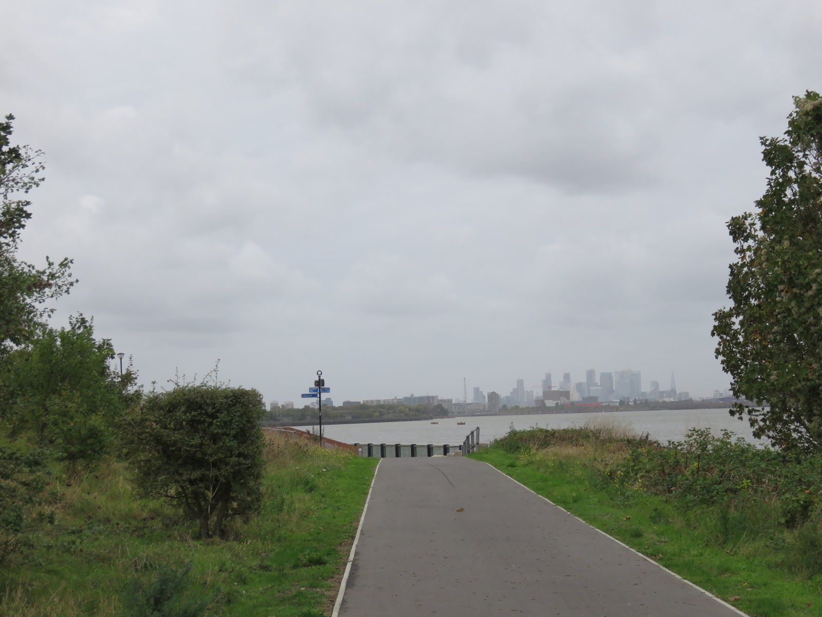
The
Barrier is also a psychological one: it could be said that to pass it is to
enter the city proper. Its skyscrapers loom unmissable ahead, and will no doubt
attempt to dominate the story. Yet for most of its history, the reaches ahead
lay also outside the city, as much the domain of the untamed marshes as the
stretch we have opened with today.
That
changed with industrialisation, which transformed them into a portal chamber to
locations all over the world. They were blue, rectangular portals. The Docks.
Through them flowed the riches of all the peoples a roaring colonial empire
could plunder; round them festered all the poverty it could inflict upon its
own people. Then it all fell apart, and cackling free-market hyper-zombies
mushroomed up on its corpse.


No comments:
Post a Comment