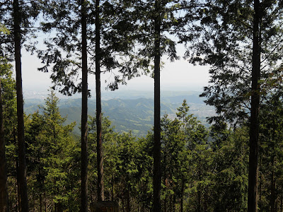
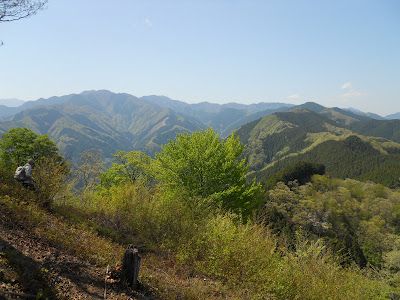
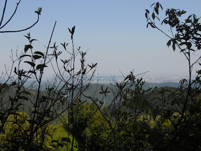
North across the Tama river from Mt. Mitake are the Three Mountains of Takamizu (Takamizu-Sanzan, 高水三山). Perched towards the top of the Ōme district amidst outlying suburbs, these peaks overlook lushly forested mountain slopes and rolling ridges, keeping the Tokyo sprawl at bay in the distance. At this time of year, walkers in these mountains are surrounded by thriving greenery, birdsong, and frequently colourful leaves and flowers, while the high points command broad views across surrounding peaks.
This is a moderate hike for
anyone of average fitness, in easy access of Tokyo. The climbs and
descents can be intense, but are reasonably paced, unsurprising, and
broken up by comfortable sections of easier going – a good place to
test your readiness for more challenging mountains. The route appears
quite popular, but not so much as to be overcrowded or
peace-shattering. Plenty of water, a light lunch, and good footwear
are advised.
Takamizu-sanzan
Length:
Approx.
9-10km
Hiking
Time: Approx.
4-5 hours
Height:
Begins
at Ikusabata station, 230m. Main ascent is the initial climb to
Takamizu-san, 759m. Some down then up to reach Iwatakeishi-yama
(793m, highest point), then Sōgaku-san
(756m). Sustained descent down to Mitake station at 245m.
Access (from central Tokyo):
Go
to Ikusabata
Station (軍畑駅)
(Chuo
Line or alternatives to Tachikawa Station, then JR
Ōme
Line to Ikusabata. Make sure your train is on the main line for
Oku-Tama, and not the branch-off to Musashi-Itsukaichi!) Depending on
where you start, this will take approx. 1h30-2hrs and cost approx.
800 yen (one-way).
Turn
left out of Ikusabata Station's only exit. There is a small shop
there where you can get basic provisions if needed. After a few paces
you will cross the railway line, and should follow the signs to
Takamizu-san
(高水山).
The first half-hour or so
consists of tarmac road, which progressively becomes narrower as you
turn off onto smaller lanes. There is enough safe space to walk, and
the signposting is generally good – there may also be a trickle of
hikers to follow. A pleasant stream runs along most of the way, and
you may see some locals fishing down there. Keep going, passing a
small temple across to the right, until you reach the start of a path
with an only slightly disturbing warning cartoon.
 |
| Turn right here. |
The
real ascent begins here. Go up the stairs past the top of the dam,
and suddenly the city is far behind. A good hour or so of climbing
gets you up through the woods, onto the ridge, and onto the approach
to Takamizu's peak. Already some impressively wide views will be
evident, though mostly of sugi
plantations.
Just before the Takamizu summit,
you'll find the Takamizu-san Jōfuku-in
Temple. Its grounds are worth a wander around, and there are toilets
here if needed. The summit proper is just five minutes further up the
path.
 |
| The view from Takamizu-san. |
You
now have an hour or so of a straightforward down-along-then-up to the
second peak, Iwatakeishi-yama
(岩茸
石山),
the highest point of the walk at 793m.
From Iwatakeishi you get a
marvellous 180-degree view to the north. On the right, a strip of
Tokyo sits on the horizon, with the skyscrapers of Shinjuku evident
through the smog. Across the middle, the rolling ridges mark the
boundary with Saitama Prefecture. And to the left, Kawanori-yama
(1364m) marks the rise of the land into Oku-Tama.
Forty
minutes further along is the third peak, Sōgaku-san
(惣岳山).
For the most part, this is a pleasant level path along the ridge,
with breaks in the plantations offering intermittent views over
neighbouring hills. That lasts until the final 0.1km, which gets
suddenly so steep that you may have to climb with your hands, though
the rocks and roots are sturdy and cooperative – potentially easier
in fact than the ascents on foot. Atop them is the clearing at the
peak, along with a small temple.
 |
| Deeper Oku-Tama beckons... |
Finally, the descent down to
Mitake Station is about one hour down a path that is oftentimes
steep, but gives you plenty of gentler level sections too. On account
of a hiking group of at least fifty people, this occasion granted a
very Japanese experience: queueing in the mountains.
Through
the final bamboo you come out at Mitake Station, which is also the set-off point for hiking on the eponymous mountain.
From here you can take the Ōme Line back to Tokyo, but if time and
energy remain, it takes only another hour to complete the circuit by
walking back to the start point at Ikusabata Station, two stops down.
Just follow the road east in the same direction of the railway.


Hello day, thank you for sharing the route and it is most informative. I know the blog entry is 2013 and I am planning to do this hike in last week of Sept 2019. Is there any changes to the route or transport (train or buses) that I need to take note of? I will be coming from Tokyo station. Thank you.
ReplyDeleteHello Sam Ng, I am no longer in Japan but assuming nothing has dramatically changed the route should still be the same - JR Chuo Line to Tachikawa, then JR Ome Line to Ikusabata. I hope you have an excellent time!
Delete