Today
is more or less this.
After
the
town at the centre of things, we come to an in-betweeny space where not
much seems to happen. There are fields. Ducks. Overhead cables. It’s quiet back
here.
 |
| Geese on the banks of Rivermead Park, West Reading. |
 |
| The river near Pangbourne. Railways, pylons and other infrastructure crisscross
this backstage space for Reading and its surrounding settlements. |
The
central Thames thus far has been a procession of castles and palaces, mansions
and monasteries, elite schools and sports facilities and sprawling land-grabs by the monied obscene. The Privilege Forts of
the English south line up along their valley of imagination: a furnace-belt of
willows and glistening water, insulated from its country’s sordid realities by
its fortress-walls of inherited wealth as it roars in the manufacture of narratives
of high-caste white Englishness.
As
we have seen, the hammering from these foundries is loud and relentless. Theirs
are the stories they want the whole nation to hear.
And
then, on the far side of Reading – they fade.
The
upper-middle Thames dispenses with the battlements, searchlights and
megaphones. In their place unfurl rolling lowlands, spread with farms and
dotted with small villages through which the river comes gliding. Some of these
settlements are historic, ancient even, while their surroundings continue to
supply the green-and-pleasant backdrop to the English national reverie. Yet now
the volume is dialled right down. These settlements merely speak their stories,
rather than shout them – except, of course, for one of the loftiest Privilege
Forts of all, which waits at the end of this sequence in a certain city known
as Oxford.
But
there is a more important transition beneath that. Literally.
Oxford
sits in a basin whose clay is geologically distinct from that of the
lower valley. To push north on this island is as to delve deeper in time. Where
London’s surface clay is young – that is, Cenozoic, about 50 million years old
– Oxford’s goes back some 100 million years further to the Late Jurassic period.
And through the space and time in between runs an outer arm of the great network
of Late Cretaceous chalk deposits (from c.65-95 million years ago) which
stretch across southern England and northwest Europe – and whose separation, of
course, is wholly imaginary.
 |
| One segment of that arm is well familiar by now. The chalk ridge of the
Chiltern Hills has overlooked the north bank all the way from Marlow. |
This
chalk has dramatically reshaped both the landscape itself and its imagery in
English culture, and among those effects have been significant changes to the river’s
course. There was a time the Thames pushed straight east into the North Sea. But finding its way blocked during the glaciations of the most recent ice age,
it cut a gap through the relatively permeable chalk and has since skewed down
through the London Basin instead.
It
is through this gap that we now pursue it, with a better look at this realest
of deep-history in the next section. For today the goal is the foot of that gap,
where the river emerges between the villages of Pangbourne and Whitchurch.
 |
| Thames Water HQ, with its sinister spiral stairs in transparent tubes, hulks
over the river at Reading Bridge where today’s progress begins. |
Start:
Reading Bridge (nearest station: Reading)
End:
Whitchurch Bridge (nearest station: Pangbourne)
Length:
11.2km/7 miles
Location:
Oxfordshire – South Oxfordshire; Berkshire – Borough of Reading, West Berkshire
District
Topics:
West Reading suburbs, Purley, Pangbourne – shifting satellite
settlements on the edge-of-centre
Reading outskirts
Our
main task today is to escape Reading. The town has an imprint on its surrounding
land to match its pivotal
historical position, and so most of this walk is spent shaking loose of the suburbs and infrastructure laid down in reference to it.
 |
| The view west from Reading Bridge. Despite carrying the town’s name, this is
the more recent of Reading’s two main river crossings. It was built only in
1923 to ease congestion, as part of the political arrangement by which Reading
absorbed the north bank village of Caversham as a suburb. |
 |
| A century later the same integrative strategy continues. Christchurch Bridge is
one of the river’s newest of all, opened in 2015 to further unify the
pedestrian and cyclist bloodstreams of Reading and Caversham. |
 |
| It’s called Christchurch Bridge for the Christchurch Meadows, visible here on
the Caversham side. Those in turn are named for the Christ Church College of
Oxford University, which used to own farmland in Reading and founded Reading
University in 1892 as an extension of itself. Already we begin to sense the tug
of Oxford’s gravitational field. |
Between
Reading’s principal bridges is an islet, seen here at left. Where it got its
name of Fry’s Island is not clear, but it comes with a political anecdote
that gives it its other name of De Montfort Island. It concerns
a public duel said to have taken place here in 1163 between two nobles from the
court of King Henry II – the first king of the Plantagenet dynasty from Anjou,
which is now in France but whose state, on his succession, also inherited
England. That arrangement was as much a mess as it sounds and resulted from the
violent upheaval that followed the death of his father’s uncle, the first
Henry, whose Reading
Abbey project was at last coming to fruition.
The
combat itself arose over an accusation of dishonourable conduct in battle, and
its outcome was that the accusing noble, Robert de Montfort, grievously wounded
the man he accused, the king’s standard-bearer Henry of Essex. Such a duel having
the equivalence of a judicial trial in that period, Henry of Essex was judged
guilty and stripped of his lands and titles. But the king had him brought to
Reading Abbey, where he was healed by the monks and supposedly joined them
afterwards.
Perhaps
that’s this incident’s broader significance. The duel took place here at all
because Henry II happened to be holding court at Reading Abbey. The monastery’s
prominence in this little tale attests that despite the disastrous ructions
that followed its founder’s death, despite even his Norman dynasty’s transition
to an Angevin one, his grand project at the crossroads had endured and was
ready to stand as a stable base of power.
 |
| The island, here at right, is known today for its lawn bowls club – the only
one in this country which must be reached by ferry. The main private house on
there still carries the name of Demontfort House. |
 |
| Fry’s Island also hosts this boatyard. Coincidentally or otherwise, the lion
seems to have been the primary motif in the heraldry of the De Montfort
family. |
Approaching
Reading’s main crossing of Caversham Bridge, it becomes apparent that this
settlement’s role as a centre ground also extends to the river’s bird life.
 |
| To live along here must come with the expectation that they’ll eat bits off
your house. |
 |
| Apartments overlook the river between Reading’s bridges. |
 |
| In this yard a group of elderly residents was engaged in some
socially-distanced morning exercise routine. These enormous swans stood in
the middle, looking faintly perplexed. |
 |
| It was evident from posters that the local people are actively
engaged in helping look after the cygnets here. |
Caversham
Bridge has long been Reading’s principal crossing. It originated not long
after the aforementioned duel, probably under the auspices of the Abbey to
improve its connection to Oxford. A sizeable manorial community seems to have
already existed on the north bank.
 |
| Caversham Bridge, with the obligatory war memorial at right. |
 |
| In spite of its heritage, the current bridge is a granite replacement from
1926. See the previous section on how it was badly
damaged in the civil war and languished for many generations. |
And
on the upstream side...
 |
| ...this. |
Have you ever seen so many swans in one place? A glance through local newspaper commentary suggests that contrary to
popular warnings about handing out food to water birds, Reading’s large swan
population has in fact grown reliant on humans feeding them to the point that
they have started to face starvation risks because of people withholding food
in reaction to said warnings. Evidently this is a relationship they are still working
out.
 |
| The swans here seem remarkably organised, even keeping to a single set of lanes
while conceding the outer lanes to ducks. |
 |
| From here Rivermead Park accompanies the river all the way out of Reading
proper. |
There
now follows a long fringe of parks, fields and farms, which together make up a
wedge of open land between the river and the Great Western Railway. How has
this slice of rurality survived the otherwise unstoppable appetite of suburban
sprawl? Does it hold extra-special significance for the local people, perhaps
in its role as the venue for the annual Reading Festival? Or has its
vulnerability to flooding kept the property speculators off it?
 |
| Rivermead Park seems a pleasant enough setting, with its large
willows, plentiful waterfowl and well-maintained lawns and paths. But further
inland come hints of decay: rusted information boards, smashed-up public
toilets, and a general atmosphere of faint desolation, of potentiality real but
unfulfilled. The park also holds a large leisure centre which is apparently
about to receive a massive refurbishment. |
 |
| On the opposite bank rise the residences of Caversham Heights. This appears to
be one of the main pockets of affluence in the Reading conurbation, whose
elevated estates flaunt their turrets, riverside gardens and posh boats at the
proletarians across the river. |
 |
| Like this. |
 |
| And this. |
 |
| And here we have a Middle-Finger Tree, which has no doubt grown up to support
those on the south side against such shows of ostentation. The ring of pennants
must indicate their alliance. |
As
with the stretch downstream of Reading, there is an after-the-apocalypse
solemnity in the air here. Even under this overcast sky the park is bright,
green and spacious; surely it should be full of people strolling, playing ball
games, napping, feeding the ducks or sitting around reading newspapers. But
aside from the odd passer-by it is close to deserted.
If
we might put this down to the isolating effects of COVID-19, it is worth
recalling that going for walks in spaces like this has been about the only safe
outdoor pastime available to people in the English urban centres. One can only
suspect that the true malady at issue here is the deeper one: the shipwrecked
modernity of abusive power structures and a toxic work culture that forces the
present-day English commoner to struggle all day just to put food on the table,
and to regard rest and recreation as unaffordable luxuries rather than a health
need and a natural human entitlement.
 |
| As the park stretches on, human activity on both banks steadily recedes. |
 |
| Soon the tarmac promenade returns to dirt towpath, and the managed parkland
gives way to open fields. |
 |
| This would appear to be a concealed English naval operation. Notice the assertive
hoisting of the English and United Kingdom flags side by side, as though to
express the regular assumption in this country that England is the UK. |
 |
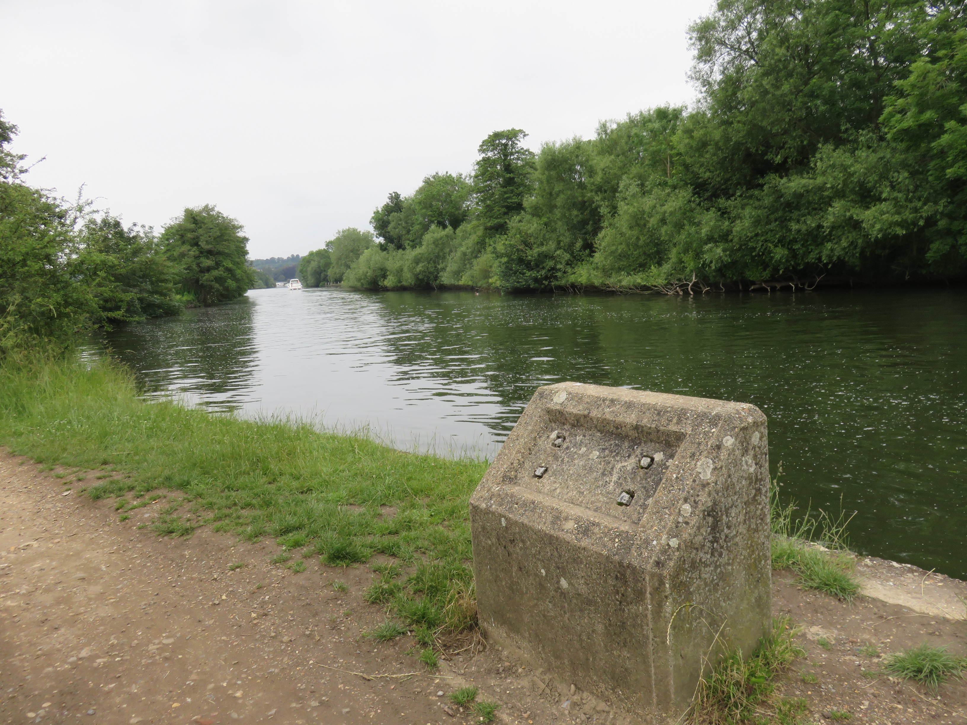
| This is the first of several of these strange stone structures that crop up
west of Reading. Were they markers? Did they display something? Or were they
part of the transport infrastructure when working barges were towed along
here? |
 |
| The pylons and cables of the busy Great Western Railway main line are
visible inland, with trains rattling through on a regular basis.
Amidst this greenery it is easy to forget that the suburbs of West Reading pack
the other side of the tracks. |
After
approximately two kilometres in this vein, a riverbend brings the Great Western
Railway right up beside the river, whereafter the two proceed in parallel for a
time. This track, the main connection between London and Bristol, runs some way
north up the river valley from here. This seems to have been a deliberate
decision by their engineer-hero Isambard Kingdom Brunel, who rather than run
his signature railway straight west, had it arc north beyond Reading to offer a
connection to Oxford along the way.
 |
| This large boatyard is one of the only human installations on the banks out
here. |
 |
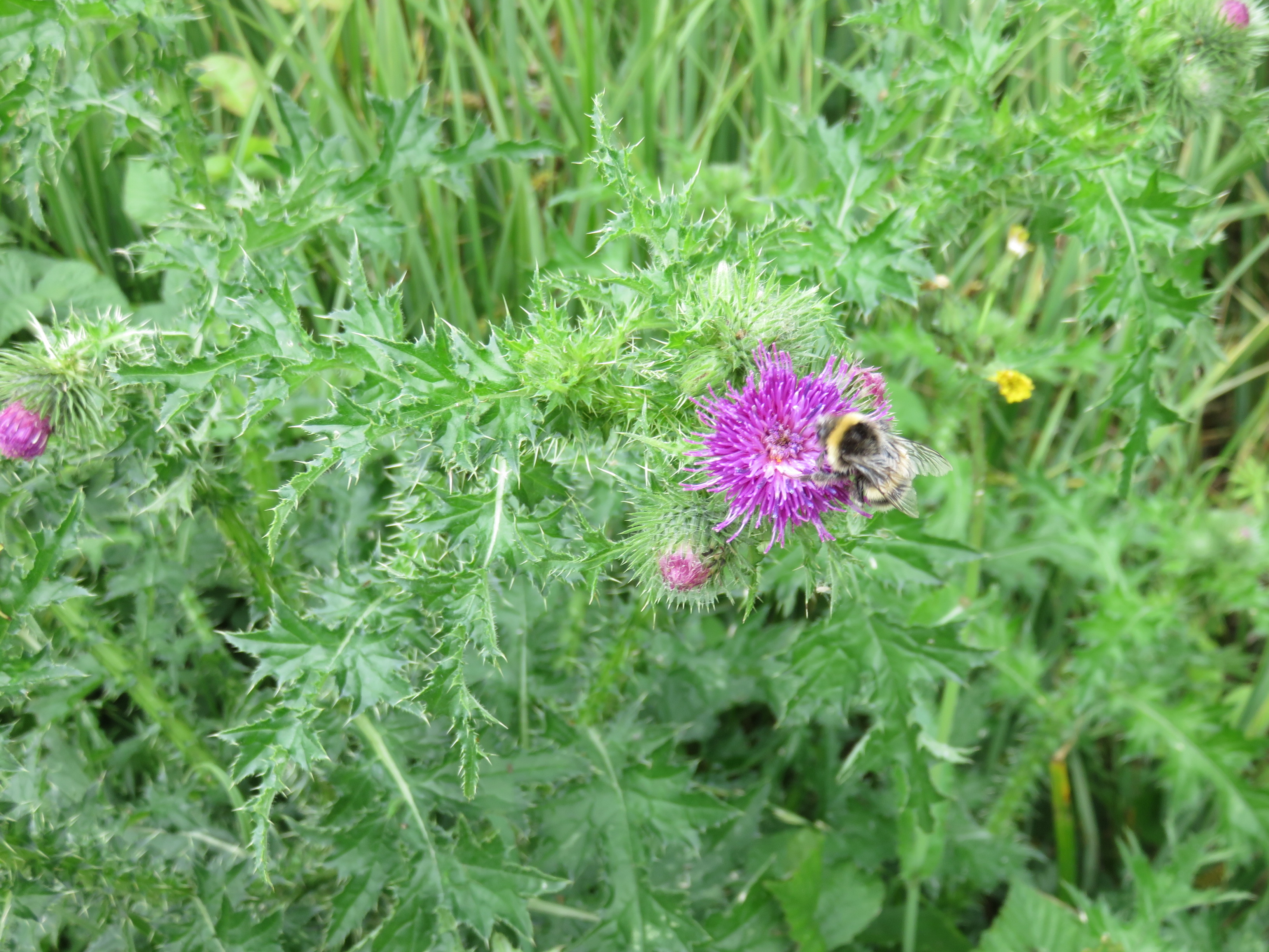
| The thistles here have grown plentifully this summer, no doubt as a further
warning to the natives that their behaviour is provoking Scottish
independence. |
 |
| And here the river and rails draw together. Across the railway is the suburb of
Tilehurst, but the walled rail embankment cuts it off from the riverside. |
Tilehurst
is a large suburb west of Reading on the Oxford road. It has its own railway
station here which cannot be reached from the towpath. Originally a hamlet
controlled by Reading Abbey, it was passed down a chain of manorial inheritance
after Henry VIII smashed the monastery. The railway was put through it in the
late nineteenth century, after which it was absorbed into Reading and
transformed into a residential suburb.
The
recentness of that absorption is notable. Suburbs do not simply exist by nature
but are rather a distinct historical phenomenon. Most English suburbs, like
Tilehurst, are creatures of nineteenth- and twentieth-century industrialisation,
because it was only with the spread of train and motor car infrastructure, and
the movements they enabled – the mass commute to urban factories and the middle-class escape from them – that suburbs
came to make conceptual sense.
Tilehurst’s
northern part retains the name of the original neighbouring manor of Kentwood.
Hence the name given to this isolated stretch of river, the Kentwood Deeps.
 |
| Trains go on one side, boats on the other, while those on foot tread this
narrow thread through the middle. |
 |
| Evidence of Reading’s secret socialist sympathies can be found painted on the
wall. |
 |
| And here must be the switch that turns the Great Western Railway on and off. |
Despite
the constrained character of the path here, it still offers hints as to these
people’s ways of life.
 |
| The river looks good when the English property culture isn’t grasping at it. |
 |
| A mysterious brick structure sits beneath the rail embankment, part-concealed
by the vegetation. An obsolete component of the railway system? Or something
more cryptic that wants you to think that’s what it is? There’s no sign of an
entrance. |
 |
| Another questionable arrangement. What does this tell us about the English of
the middle Thames valley? |
 |
| Spotted in the bushes: a pair of covert vessels flying the Welsh colours. No
doubt they’ve been parked here to spy on the naval facility downstream, ready
to pounce to neutralise it the moment the English government attempts violent
action against the Welsh independence movement. |
Eventually
the river bends once more, opening up another chunk of agrarian land. But at
this point, yet again, wayfarers are forced across a footbridge over the
railway so as not to inconvenience the property-dreams of those who dared think
to privatise the riverside. Like others we have passed on the way,
these landlords fiercely refused to allow the Thames Navigation Commission to install the
towpath across their land, which necessitates us, more than two centuries later, to take an inland detour through
the settlement of Purley.
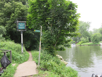 |
| The towpath is rudely cut off by a path to private property. Travellers might
nonetheless feel their hearts lift at the sign’s promise of ‘bar snacks and
meals’ at this seventeenth-century coaching inn on the Oxford road, with its
long tradition of refreshing passing boaters and anglers... |
 |
| ...but alas, this is England under market fundamentalism, and so it turns out
the venerable Roebuck was closed in 2010 and converted to private apartments. |
Purley
Purley-on-Thames
exists in flux. After some thousand years as an agricultural area split between
three manors – Purley Magna in the east, Purley Parva in the
northwest, and Purley La Hyde in the southwest (note the continental
inheritance in these names), the processes of so-called modernity have dragged
it messily in different directions.
 |
| Though part-suburbanised into a satellite of Reading, Purley represents our
first steps into West Berkshire. This is the hinterland of Berkshire province,
as large as all its eastern districts combined and almost all rural or wooded. |
 |
| Wooded enough to afford the river-seeker a brief escape from the Oxford
Road... |
 |
| ...though one should be careful not to disturb any beetles one happens to find
fornicating in the middle of the path. |
The
manor grounds of Purley Magna – this eastern part – were thoroughly transformed
by the railway and the motorisation of the Oxford Road, and have since been
absorbed into the Reading conurbation as its outermost riverside suburb.
Perhaps on account of its titled inheritance it appears to be another of Reading’s
chunks of relative wealth – hence the property-grab along the riverbend – but
makes up for this privilege with its susceptibility to devastating floods.
Purley
Parva and Purley La Hyde have likewise seen many of their manorial estates
redone into apartments, but their expanses of farm fields, north and south of
the rails respectively, remain largely intact. These account for the belt of
green between the Reading sprawl to the east and the valley of the River Pang
to the west. The best-known occupant of La Hyde’s manor house appears to have
been a certain Warren Hastings, the disgraced Governor-General of Bengal for
the East India Company, during his sensational impeachment trial in the 1790s.
 |
| A typical residential street in Purley. Most of its initial suburbanisation around
the 1920s ribboned along the Oxford Road. The housing closer to the river is
much more recent, dating mostly to within the last few decades and built with
flooding adaptations. |
 |
| The gates of the manor house of Purley Magna, now unaffordable flats. Its
private park still occupies the centre of the suburb. |
 |
| Along the suburb’s western rim, the old access road to Mapledurham Lock
offers a route back to the river. |
 |
| Whoever designed this poster is exactly right. |
 |
| I have been hesitant to offer food and drink recommendations on this journey
because so many of the traditional pubs and cafés have been taken over by big corporations
with no connection to the local communities. Purley however conceals a
refreshing surprise. Close to the river, hidden behind the houses on Wintringham
Way, the Mad Duck Café is a unique
and characterful rest stop run by local families which offers excellent lunches
and cakes for very generous prices. Seating is currently outdoors only due to
COVID-19. |
When
we rejoin the river, it is to face another large piece of inherited affluence. Like
Purley the north-bank Mapledurham estate goes back at least to the 1086
Domesday survey, but its country house was built in the Elizabethan 1580s. Blasted,
seized and sacked by the Parliamentary army during the civil war, it was later
recovered by the gentry and has since passed down a long chain of succession to
its present holders, the Eyston family.
Unusually,
these dwellers have sought to leverage Mapledurham’s picturesque heritage by opening up the house and grounds for
public tours, while diversifying its offerings with sustainable farming and
leisure initiatives. Its atmospheric setting has also drawn film crews, leading
it to feature in several decades’ worth of movies and TV series.
Regrettably
an assessment of these efforts in the context of the broader English problems
of land and class is beyond this expedition. Mapledurham is unreachable from
this side of the river, and the house, grounds, and tours have all closed this
year on account of COVID-19.
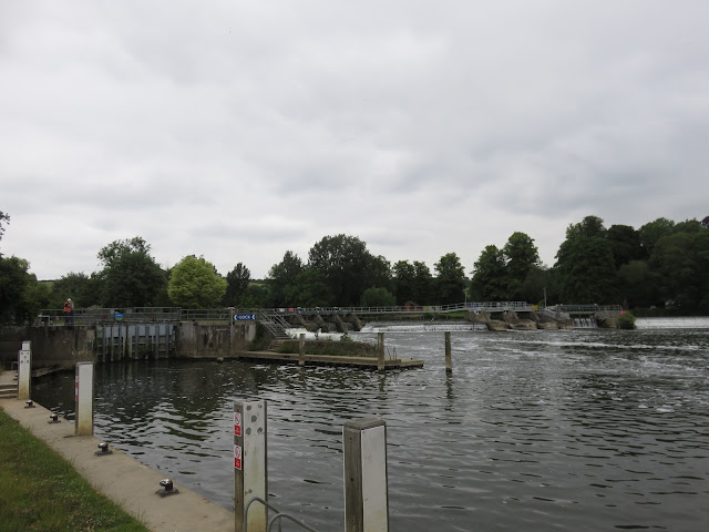 |
| Mapledurham Lock and Weir. The lock is a 1908 upgrade on a 1777 Thames
Navigation Commission creation, but the weir has been here for a millennium of
service to the adjoining watermill. Despite its name, the lock is here on the
Purley side and there is no means to cross the weir to Mapledurham. |
 |
| From the south side Mapledurham House can only be glimpsed through the summer
foliage. |
 |
| The banks facing Mapledurham are pleasant meadowland with sandy riverside
beaches, ideal for fluffy encounters like these. |
 |
| Those wishing not to be eaten by plants might be advised against sitting here. |
 |
| Mapledurham’s watermill had an advanced super-efficient screw turbine installed
in 2011 to generate hydro-electricity. But it continues to produce flour, making it
the only one of the Thames’s countless old mills that still functions
today. |
All
that remains for today is a brisk trek across the meadows of what was
presumably the territory of Purley Parva. This is still predominantly farmland,
centred around what was once the manor’s tiny village of Westbury, from where some
curious present-day inhabitants have come down to investigate passers-by.
 |
| The way beyond Mapledurham Lock. The low escarpment of the Chiltern Hills soars
close on the far side, anticipating its landing just a little further
upstream. |
 |
| And what is that concentration of biomass over there? |
 |
| Yes. |
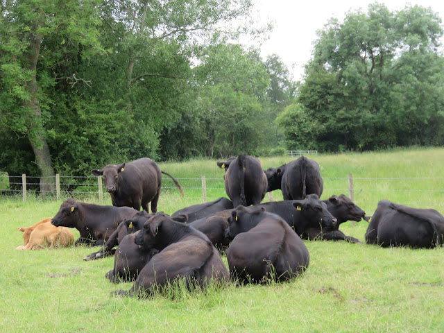 |
| Take care around these when you need to pass close. They are usually peaceful,
but statistically they are the
second-most dangerous large animal in England after humans and their occasional attacks can cause death or serious injury. One should always
pay respectful attention to their behaviour, refrain from antagonising them,
and take especial care with dogs. |
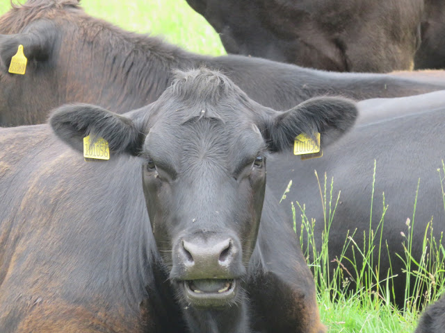 |
| Nuuo. |
The open grass of this final stretch offers some of today’s best scenery, with good views of the declining Chiltern slopes across the way.
 |
| Unlike the parkland close to Reading the riverbanks here seem largely left to
their own devices. |
 |
| Then appears the landscaped vista of Hardwick House, another Toad
Hall whose estate dominates the north bank here. |
Much
like neighbouring Mapledurham, Hardwick House anchors an ancient
Saxon-era estate whose house got upgraded into a big Tudor mansion in the late
sixteenth century. Its story mirrors its neighbour’s in the close
association of its resident Lybbe family with the ruling monarchy, which got it similarly ransacked by the Parliamentary army during the civil
war. The Lybbes got it back but eventually struggled financially and in 1909
they sold the estate to the Rose family, which lives there to this day. Like
the Eystons at Mapledurham they have attempted to branch out their land use, in this case into forestry and organic
farming.
 |
| How are we to assess this local trend of English aristocrats, apparently
transcending a long and deeply oppressive history – violent land enclosure,
links to colonialism and slavery and control of a toxic political system – to champion causes
urgent to and often critical of a problematic modernity? It’s a complex
question, and alas beyond this expedition’s investigative power. |
 |
| A number of interesting rural concerns dot the orbit of the Hardwick estate.
There’s an alpaca farm over there somewhere. |
The
approach to Pangbourne leads through its own meadow, a partial
nature reserve which the village manages alongside the National Trust.
 |
| As helpfully signposted. |
 |
| Natives fish on the banks of Pangbourne Meadow. |
 |
| Whitchurch Bridge connects the villages of Pangbourne (south) and Whitchurch
(north). Built in 1792 and replaced several times since – the present
steel-lattice structure is a 2014 refurbishment – it its privately-controlled
and charges a toll for crossing vehicles, one of only two traditional Thames
toll bridges still to do so. Inevitably, they still quarrel about the fee. It was doubled in 2009 and hiked further in 2015 to 60p for cars and £4 for
heavy vehicles. Walkers correctly cross for free. |
Pangbourne
Pangbourne,
along with its opposing village of Whitchurch, is a communications
junction: a minor outlying node of Reading where the
roads converge at a convenient river crossing at the mouth of the Pang.
The Pang is a lush chalk stream, and the bourne to which Pangbourne’s
name refers.
Accordingly
the settlement goes back a very long way. It was on the old road between the
Roman outposts of Silchester (south) and Dorchester (north); the
eighteenth-century railway-builders discovered a Roman cemetery nearby. Its
present name emerged after Anglo-Saxon immigration and is thought to refer to a
local chief called Pæga. It then occurs in writing as Peningaburnan
in 844 in a land grant to a certain Bertwulf, king of the central Saxon kingdom
of Mercia which the Vikings overwhelmed a few decades later.
 |
| The village sign depicts this Bertwulf, as well as a Viking longship. The book
in between is The Wind in the Willows, commemorating Pangbourne’s
connection to Kenneth Grahame. |
 |
| Pangbourne’s high street. It’s a small village, with its centre to the east of
the Pang and railway station to the west. |
 |
| The River Pang. This chalk tributary runs into the village through a relatively
isolated valley in the West Berkshire bush. It harbours rich wildlife habitats
and is popular with anglers, but historic over-extraction of drinking water has
damaged its course and prompted renewed conservation efforts. |
Pangbourne’s
later story unfolded in the dominant shadow of Reading
Abbey, to which it was given by Henry I at the latter’s foundation. Its
manor house (inland to the southwest) was supposedly a popular summer getaway
for the monastery’s abbots. More Englishly it was in its underground tunnels
that the last of those abbots, Hugh Faringdon, was dragged from hiding to be
butchered alive at the Abbey’s destruction in 1539. The violence of the civil
wars also left their mark: the road upriver rises up Shooters’ Hill, apparently
so named for its Royalist artillery fortifications whose cannonballs were dug
up when they built the railway.
 |
| As a river junction Pangbourne is significant in Thames literature.
Kenneth Grahame, author of The Wind in the Willows, spent the final
years of his life here in the 1920s; while Jerome K. Jerome and his party,
whose humorous voyage documented in his Three Men in a Boat (1889) is
perhaps the English’s best-known Thames expedition, brought their return
journey to an end at a still-extant pub here called The Swan. |
That’s
about it really. Pangbourne seems less a place where big things happen than a
place people pass through on their way to those places where they do. Fitting
perhaps for this margin of transitions, this quiet backstage connection-space
between the Reading and Oxford spheres of influence. You could say it has
transformed a great deal, and is still transforming. Or you could say it has in
fact changed very little, with the river sliding through as it has for as long
as there have been people here to witness it.
But
it wasn’t always here. And if this country’s failure at pandemic
governance doesn’t cause the latest wave of COVID-19 (that is, the
Modi/BJP variant) to go completely out of control in the next few days, the
next stage of this journey will cross the chalk to the time the river cut
through this way in the first place.


No comments:
Post a Comment